|
Dayton, Kentucky
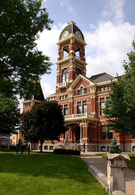
The City of Dayton, Kentucky, is a list of Kentucky cities, home rule-class city along a bend of the Ohio River in Campbell County, Kentucky, Campbell County, Kentucky, in the United States. The population was 5,338 at the 2010 United States Census, 2010 census. It is less than from downtown Cincinnati, Ohio. Geography Dayton is located in the northernmost part of Campbell County at (39.111781, −84.470401), on the inside of a bend in the Ohio River. It is the most northernmost community in Kentucky as well. Dayton is bordered by Bellevue, Kentucky, Bellevue to the southwest and Fort Thomas, Kentucky, Fort Thomas to the southeast. To the north, across the Ohio River, is Cincinnati in Hamilton County, Ohio. The closest bridge across the Ohio is the Daniel Carter Beard Bridge on Interstate 471, connecting Newport, Kentucky, Newport with Cincinnati. According to the United States Census Bureau, Dayton has a total area of , of which is land and , or 33.61%, is water. Dayton is loc ... [...More Info...] [...Related Items...] OR: [Wikipedia] [Google] [Baidu] |
List Of Kentucky Cities
Kentucky is a state in the United States. It has 419 active cities. Classes Since January 1, 2015, Kentucky cities have been divided into two classes based on their form of government: * First class – Mayor-alderman government * Home rule class – All other forms, including Mayor-Council, Commission, and City Manager This system went into effect on January 1, 2015, following the 2014 passage of House Bill 331 by the Kentucky General Assembly and the bill's signing into law by Governor Steve Beshear. The new system replaced one in which cities were divided into six classes based on their population at the time of their classification. Prior to the enactment of House Bill 331, over 400 classification-related laws affected public safety, alcohol beverage control, revenue options and others. Lexington and Fayette County are completely merged in a unitary urban county government (UCG); Louisville and other cities within Jefferson County have also merged into a single met ... [...More Info...] [...Related Items...] OR: [Wikipedia] [Google] [Baidu] |
Fort Thomas, Kentucky
Fort Thomas is a home rule-class city in Campbell County, Kentucky, United States, on the southern bank of the Ohio River and the site of an 1890 US Army post. The population was 16,325 at the 2010 census, making it the largest city in Campbell County and it is officially part of the Cincinnati – Northern Kentucky metropolitan area. History Evidence suggests that on or around 1749, prior to settlement by Europeans, a large battle occurred between a band of Cherokee Native Americans and victorious Miami tribe and Shawnee tribe Native Americans in what is now the city of Fort Thomas. As many as 600 graves of slain warriors have been unearthed by archeologists there; although the battleground area has been thoroughly combed for artifacts and remains over the years, it is still not uncommon to find arrowheads and other artifacts from the past while gardening or hiking the woods and streambeds throughout the city. Fort Thomas Army Post In 1887, a site was needed to house a Un ... [...More Info...] [...Related Items...] OR: [Wikipedia] [Google] [Baidu] |
Alexander McKee
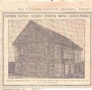
Alexander McKee ( – 15 January 1799) was an American-born military officer and colonial official in the British Indian Department during the French and Indian War, the American Revolutionary War, and the Northwest Indian War. He achieved the rank of Deputy Superintendent General in 1794, the second highest position in the British Indian Department at the time. Biography Alexander McKee was born about 1735, the second son of Thomas McKee an Irish immigrant (probably Scots-Irish from northern Ireland), fur trader, Indian Agent, and interpreter for General Forbes at Fort Pitt, and Nonhelema Hokolesqua (c. 1718–1786), an 18th century Shawnee leader and sister of Chief Cornstalk. McKee developed a lifelong relationship with the Ohio Indian tribes. As a young man, Alexander McKee began working with traders who did business with the Indians of the Ohio Country. Soon, he was able to establish his own trading business. Because of his good relations with the Ohio tribes, Indian ... [...More Info...] [...Related Items...] OR: [Wikipedia] [Google] [Baidu] |
Simon Girty
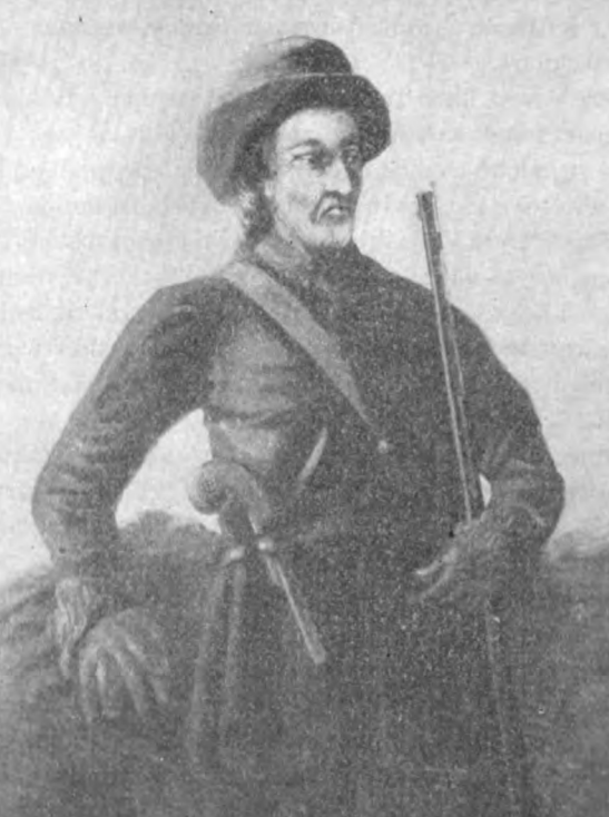
Simon Girty (November 14, 1741 – February 18, 1818) was an American-born frontiersman, soldier and interpreter from Harrisburg, Pennsylvania, who served as a liaison between the British and their Indian allies during the American Revolution. He was portrayed as a villain, and was also featured this way in 19th and early 20th-century fiction from the United States. As children, Girty and his brothers were taken captive in Pennsylvania in a Seneca raid and adopted. He lived with the Seneca for seven years and became fully assimilated, preferring their culture. He was returned to his birth family but retained a sympathy for the Indians. Early life Simon Girty was born to Simon Girty the Elder and Mary Newton near Harrisburg, Pennsylvania. Simon Girty the Elder arrived in North America in 1730 from Ireland. The accepted spelling of Girty's name was most likely a "colonial derivation of McGearty, Gearty, Garrity, Garrarghty, Geraghty or Girtee" and a corruption and Anglicization of ... [...More Info...] [...Related Items...] OR: [Wikipedia] [Google] [Baidu] |
US Army Corps Of Engineers
, colors = , anniversaries = 16 June (Organization Day) , battles = , battles_label = Wars , website = , commander1 = LTG Scott A. Spellmon , commander1_label = Chief of Engineers and Commanding General of the U.S. Army Corps of Engineers , commander2 = MGbr>Richard J. Heitkamp, commander2_label = Deputy Chief of Engineers and Deputy Commanding General , commander3 = MGKimberly M. Colloton, commander3_label = Deputy Commanding General for Military and International Operations , commander4 = MGbr>William H. Graham, commander4_label = Deputy Commanding General for Civil and Emergency Operations , commander5 = COLbr>James J. Handura, commander5_label = Chief of Staff for the U.S. Army Corps of Engin ... [...More Info...] [...Related Items...] OR: [Wikipedia] [Google] [Baidu] |
James Taylor, Jr
James is a common English language surname and given name: *James (name), the typically masculine first name James * James (surname), various people with the last name James James or James City may also refer to: People * King James (other), various kings named James * Saint James (other) * James (musician) * James, brother of Jesus Places Canada * James Bay, a large body of water * James, Ontario United Kingdom * James College, a college of the University of York United States * James, Georgia, an unincorporated community * James, Iowa, an unincorporated community * James City, North Carolina * James City County, Virginia ** James City (Virginia Company) ** James City Shire * James City, Pennsylvania * St. James City, Florida Arts, entertainment, and media * ''James'' (2005 film), a Bollywood film * ''James'' (2008 film), an Irish short film * ''James'' (2022 film), an Indian Kannada-language film * James the Red Engine, a character in ''Thomas the Tank En ... [...More Info...] [...Related Items...] OR: [Wikipedia] [Google] [Baidu] |
Dayton, Ohio
Dayton () is the sixth-largest city in the U.S. state of Ohio and the county seat of Montgomery County. A small part of the city extends into Greene County. The 2020 U.S. census estimate put the city population at 137,644, while Greater Dayton was estimated to be at 814,049 residents. The Combined Statistical Area (CSA) was 1,086,512. This makes Dayton the fourth-largest metropolitan area in Ohio and 73rd in the United States. Dayton is within Ohio's Miami Valley region, north of the Greater Cincinnati area. Ohio's borders are within of roughly 60 percent of the country's population and manufacturing infrastructure, making the Dayton area a logistical centroid for manufacturers, suppliers, and shippers. Dayton also hosts significant research and development in fields like industrial, aeronautical, and astronautical engineering that have led to many technological innovations. Much of this innovation is due in part to Wright-Patterson Air Force Base and its place in the ... [...More Info...] [...Related Items...] OR: [Wikipedia] [Google] [Baidu] |
Humid Subtropical Climate
A humid subtropical climate is a zone of climate characterized by hot and humid summers, and cool to mild winters. These climates normally lie on the southeast side of all continents (except Antarctica), generally between latitudes 25° and 40° and are located poleward from adjacent tropical climates. It is also known as warm temperate climate in some climate classifications. Under the Köppen climate classification, ''Cfa'' and ''Cwa'' climates are either described as humid subtropical climates or warm temperate climates. This climate features mean temperature in the coldest month between (or ) and and mean temperature in the warmest month or higher. However, while some climatologists have opted to describe this climate type as a "humid subtropical climate", Köppen himself never used this term. The humid subtropical climate classification was officially created under the Trewartha climate classification. In this classification, climates are termed humid subtropical when the ... [...More Info...] [...Related Items...] OR: [Wikipedia] [Google] [Baidu] |
Köppen Climate Classification
The Köppen climate classification is one of the most widely used climate classification systems. It was first published by German-Russian climatologist Wladimir Köppen (1846–1940) in 1884, with several later modifications by Köppen, notably in 1918 and 1936. Later, the climatologist Rudolf Geiger (1894–1981) introduced some changes to the classification system, which is thus sometimes called the Köppen–Geiger climate classification system. The Köppen climate classification divides climates into five main climate groups, with each group being divided based on seasonal precipitation and temperature patterns. The five main groups are ''A'' (tropical), ''B'' (arid), ''C'' (temperate), ''D'' (continental), and ''E'' (polar). Each group and subgroup is represented by a letter. All climates are assigned a main group (the first letter). All climates except for those in the ''E'' group are assigned a seasonal precipitation subgroup (the second letter). For example, ''Af'' indi ... [...More Info...] [...Related Items...] OR: [Wikipedia] [Google] [Baidu] |
Upper South
The Upland South and Upper South are two overlapping cultural and geographic subregions in the inland part of the Southern and lower Midwestern United States. They differ from the Deep South and Atlantic coastal plain by terrain, history, economics, demographics, and settlement patterns. The term Upper South is a geographic term: the Southern states that are geographically north of the Lower or Deep South: primarily Virginia, West Virginia, Kentucky, North Carolina, and Tennessee, and to a lesser extent the District of Columbia and Maryland. The Upland South is defined by elevation above sea level; it is west of the population centers on the east coast. It has its own history and culture. It includes most of West Virginia and Kentucky, and parts of Virginia, Tennessee, North Carolina, Arkansas, Missouri, and Oklahoma. Upland South outposts were settled along the shores of the Ohio River. Geography There is a slight difference in usage between the two terms "Upland South" and ... [...More Info...] [...Related Items...] OR: [Wikipedia] [Google] [Baidu] |
Bluegrass Region
The Bluegrass region is a geographic region in the U.S. state of Kentucky. It makes up the central and northern part of the state, roughly bounded by the cities of Frankfort, Paris, Richmond and Stanford. The Bluegrass region is characterized by underlying fossiliferous limestone, dolomite, and shale of the Ordovician geological age. Hills are generally rolling, and the soil is highly fertile for growing pasture. Since the antebellum years, the region has been a center for breeding quality livestock, especially thoroughbred race horses. Since the late 20th century, the area has become increasingly developed with residential and commercial properties, particularly around Lexington, the business center. Although bluegrass music is popular throughout the region, the genre is indirectly named for the state rather than the region. History Before European-American settlement, various cultures of Indigenous peoples of the Americas adapted to the region. The region had mostly a sa ... [...More Info...] [...Related Items...] OR: [Wikipedia] [Google] [Baidu] |
Newport, Kentucky
Newport is a list of Kentucky cities, home rule-class city at the confluence of the Ohio River, Ohio and Licking River (Kentucky), Licking rivers in Campbell County, Kentucky, Campbell County, Kentucky. The population was 15,273 at the 2010 United States Census, 2010 census. Historically, it was one of four county seats of Campbell County. Newport is a major urban center of Northern Kentucky and part of the Cincinnati metropolitan area, which includes over two million residents. History Newport was settled by James Taylor, Jr. (Kentucky), James Taylor Jr. on land purchased by his father James Sr. from George Muse, who received it as a grant. Taylor's brother, Hubbard Taylor, had been mapping the land twenty years prior. It was not named for its position on the river but for Christopher Newport, the commander of the first ship to reach Jamestown, Virginia, in 1607. Newport was established as a town on December 14, 1795, and incorporated as a city on February 24, 1834.Commonwealth ... [...More Info...] [...Related Items...] OR: [Wikipedia] [Google] [Baidu] |


