|
Dry Cottonwood Creek (Deer Lodge County, Montana)
Dry Cottonwood Creek is a creek in Deer Lodge County, Montana. Approximately long, it flows northwest out of the southern reaches of the Boulder Mountains into the Clark Fork river near Deer Lodge, Montana. Sapphire Sapphire is a precious gemstone, a variety of the mineral corundum, consisting of aluminium oxide () with trace amounts of elements such as iron, titanium, chromium, vanadium, or magnesium. The name sapphire is derived via the Latin "sapphir ...s are found along this creek. Notes Rivers of Montana Tributaries of the Columbia River Bodies of water of Deer Lodge County, Montana {{Montana-river-stub ... [...More Info...] [...Related Items...] OR: [Wikipedia] [Google] [Baidu] |
Deer Lodge County, Montana
Deer Lodge County is a County (United States), county in the U.S. state of Montana. As of the 2020 United States census, 2020 census, the population was 9,421. It forms a consolidated city-county government with its county seat of Anaconda, Montana, Anaconda. The county was established in 1865. History Deer Lodge was one of the original 9 Montana counties, as constituted with the establishment of Montana Territory in 1864. The original county included what are now Silver Bow County (separated in 1881), Deer Lodge County, Granite County (separated in 1893) and Powell County (separated in 1901). Geography According to the United States Census Bureau, the county has an area of , of which is land and (0.6%) is water. It is the second-smallest county in Montana by area. The county has a wealth of natural amenities, such as the Anaconda Mountain Range, Georgetown Lake, and the Mount Haggin wildlife management area (Montana's largest at 54,000 acres). Major highways * Interstat ... [...More Info...] [...Related Items...] OR: [Wikipedia] [Google] [Baidu] |
Columbia River
The Columbia River (Upper Chinook: ' or '; Sahaptin: ''Nch’i-Wàna'' or ''Nchi wana''; Sinixt dialect'' '') is the largest river in the Pacific Northwest region of North America. The river rises in the Rocky Mountains of British Columbia, Canada. It flows northwest and then south into the U.S. state of Washington, then turns west to form most of the border between Washington and the state of Oregon before emptying into the Pacific Ocean. The river is long, and its largest tributary is the Snake River. Its drainage basin is roughly the size of France and extends into seven US states and a Canadian province. The fourth-largest river in the United States by volume, the Columbia has the greatest flow of any North American river entering the Pacific. The Columbia has the 36th greatest discharge of any river in the world. The Columbia and its tributaries have been central to the region's culture and economy for thousands of years. They have been used for transportation since a ... [...More Info...] [...Related Items...] OR: [Wikipedia] [Google] [Baidu] |
Stream
A stream is a continuous body of water, body of surface water Current (stream), flowing within the stream bed, bed and bank (geography), banks of a channel (geography), channel. Depending on its location or certain characteristics, a stream may be referred to by a variety of local or regional names. Long large streams are usually called rivers, while smaller, less voluminous and more intermittent river, intermittent streams are known as streamlets, brooks or creeks. The flow of a stream is controlled by three inputs – surface runoff (from precipitation or meltwater), daylighting (streams), daylighted subterranean river, subterranean water, and surfaced groundwater (Spring (hydrology), spring water). The surface and subterranean water are highly variable between periods of rainfall. Groundwater, on the other hand, has a relatively constant input and is controlled more by long-term patterns of precipitation. The stream encompasses surface, subsurface and groundwater fluxes th ... [...More Info...] [...Related Items...] OR: [Wikipedia] [Google] [Baidu] |
Boulder Mountains (Montana)
The Boulder Mountains is a mountain range running north–south west of Boulder between Helena and Butte in the U.S. state of Montana. Parts of the range are in four different counties: Deer Lodge, Jefferson, Lewis and Clark, and Silver Bow. Haystack Mountain, which reaches , is the tallest peak in the range. The three other highest peaks are Jack Mountain at , Bull Mountain at , and Thunderbolt Mountain at . All four peaks are in Jefferson County. See also * List of mountain ranges in Montana This is a list of mountain ranges in the state of Montana. Montana is the fourth largest state in the United States and is well known for its mountains. The name "Montana" means "mountainous" in Latin. Representative James Mitchell Ashley ( R-Ohi ... References {{Montana Mountain ranges of Montana Landforms of Deer Lodge County, Montana ... [...More Info...] [...Related Items...] OR: [Wikipedia] [Google] [Baidu] |
Clark Fork (river)
The Clark Fork, or the Clark Fork of the Columbia River, is a river in the U.S. states of Montana and Idaho, approximately long. The largest river by volume in Montana, it drains an extensive region of the Rocky Mountains in western Montana and northern Idaho in the watershed of the Columbia River. The river flows northwest through a long valley at the base of the Cabinet Mountains and empties into Lake Pend Oreille in the Idaho Panhandle. The Pend Oreille River in Idaho, Washington, and British Columbia, Canada which drains the lake to the Columbia in Washington, is sometimes included as part of the Clark Fork, giving it a total length of , with a drainage area of . In its upper in Montana near Butte, it is known as Silver Bow Creek. Interstate 90 follows much of the upper course of the river from Butte to Saint Regis. The highest point within the river's watershed is Mount Evans at in Deer Lodge County, Montana along the Continental Divide. The Clark Fork is a Class I rive ... [...More Info...] [...Related Items...] OR: [Wikipedia] [Google] [Baidu] |
Deer Lodge, Montana
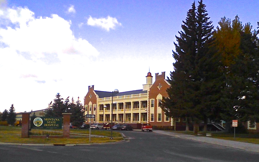
Deer Lodge is a city in and the county seat of Powell County, Montana, Powell County, Montana, United States. The population was 2,938 at the 2020 United States Census, 2020 census. Description The city is perhaps best known as the home of the Montana State Prison, a major local employer. The Montana State Hospital in Warm Springs, Montana, Warm Springs, and former state tuberculosis sanitarium in nearby Galen, Montana, Galen are the result of the power the western part of the state held over Montana at statehood due to the copper and mineral wealth in that area. Deer Lodge was also once an important railroad town, serving as a division headquarters for the Chicago, Milwaukee, St. Paul and Pacific Railroad ("the Milwaukee Road") before the railroad's local abandonment in 1980. The current Montana State Prison occupies a campus west of town. The former prison site, at the south end of Deer Lodge's Main Street, is now the Montana State Prison, Old Prison Museum. In addition to ... [...More Info...] [...Related Items...] OR: [Wikipedia] [Google] [Baidu] |
Sapphire
Sapphire is a precious gemstone, a variety of the mineral corundum, consisting of aluminium oxide () with trace amounts of elements such as iron, titanium, chromium, vanadium, or magnesium. The name sapphire is derived via the Latin "sapphirus" from the Greek "sappheiros", which referred to Lapis lazuli, lapis lazuli. It is typically blue, but natural "fancy" sapphires also occur in yellow, purple, orange, and green colors; "parti sapphires" show two or more colors. Red corundum stones also occur, but are called ruby, rubies rather than sapphires. Pink-colored corundum may be classified either as ruby or sapphire depending on locale. Commonly, natural sapphires are cut and polished into gemstones and worn in jewellery, jewelry. They also may be created synthetically in laboratories for industrial or decorative purposes in large boule (crystal), crystal boules. Because of the remarkable hardness of sapphires 9 on the Mohs scale of mineral hardness, Mohs scale (the third hardest ... [...More Info...] [...Related Items...] OR: [Wikipedia] [Google] [Baidu] |
Rivers Of Montana
The following is a partial list of rivers of Montana (U.S. state). East of Continental Divide Water in these rivers flows east and south from the Continental Divide of the Americas, also known as the Great Divide, into the Gulf of Mexico via the Missouri and Mississippi rivers. Missouri River watershed * Missouri River **Jefferson River ***Beaverhead River **** Blacktail Deer Creek ****Ruby River **** Red Rock River ***Big Hole River **** Wise River *** Boulder River **Roe River (one of the shortest rivers in the world) **Madison River **Gallatin River ***East Gallatin River ** Sixteen Mile Creek **Dearborn River ** Smith River ** Sun River ** Belt Creek **Marias River ***Cut Bank Creek ***Two Medicine River **** Birch Creek *****Dupuyer Creek *** Teton River *** Cottonwood Creek (Liberty County, Montana) ** Arrow Creek ** Cow Creek ** Birch Creek **Judith River ***Dry Wolf Creek (Judith Basin County, Montana) *** Dry Wolf Creek (Fergus County, Montana) **Musselshell River *** ... [...More Info...] [...Related Items...] OR: [Wikipedia] [Google] [Baidu] |
Tributaries Of The Columbia River
Tributaries and sub-tributaries are hierarchically listed in order from the mouth of the Columbia River upstream. Major dams and reservoir lakes are also noted. List of major tributaries The main river and tributaries are (sorted in order from the mouth heading upstream): * Wallacut River (Washington) * Chinook River (Washington) * Alder Creek (Oregon) ** Tansy Creek (Oregon) * Skipanon River (Oregon) * Youngs River (Oregon) ** Lewis and Clark River (Oregon) ** Wallooskee River (Oregon) ** Klaskanine River (Oregon) * Frank Born Creek (Washington) * Sisson Creek (Washington) * Deep River (Washington) * Grays River (Washington) * Crooked Creek (Washington) * Elochoman River (Washington) * John Day River (Oregon) * Eskeline Creek (Oregon) * Hillcrest Creek (Oregon) * Big Creek (Oregon) ** Little Creek (Oregon) * Gnat Creek (Oregon) * Kelly Creek (Oregon) ** Spear Creek (Oregon) * Hunt Creek (Oregon) * Driscoll Slough (Oregon) * Westport Slough (Oregon) ** Plymp ... [...More Info...] [...Related Items...] OR: [Wikipedia] [Google] [Baidu] |


_nahe_dem_Weiherdamm_in_Wildbergerhütte.jpg)


