|
Docker River
Kaltukatjara , also known as Docker River, is a remote Indigenous Australian community in the Northern Territory of Australia. It is southwest of Alice Springs, west of the Stuart Highway, near the Western Australia and Northern Territory border. The township is on a wadi called the Docker Creek on the north side of the west end of the Petermann Ranges in the southwest corner of the Northern Territory of Australia. At the 2006 census, Kaltukatjara had a population of 355. History A permanent settlement at "Docker River" was established in 1968 to relieve pressure on the Warburton settlement and provide an opportunity for Aboriginal people to live closer to their homelands. PY Media states that Kaltukatjara acquired its European name "Docker River" from explorer Ernest Giles, as well as other history, as follows: The site that is now Kaltukatjara was originally named Docker River by Ernest Giles during his expedition of 1872. Pastors Duguid and Strehlow surveyed the a ... [...More Info...] [...Related Items...] OR: [Wikipedia] [Google] [Baidu] |
Darwin City, Northern Territory
Darwin City (referred to as ''Darwin city centre'' or ''The CBD'' (Central Business District) is a suburb in metropolitan Darwin which comprises the original settlement, the central business district, parkland and other built-up areas. It is the oldest part of Darwin and includes many of the city's important institutions and landmarks, such as Parliament, Government House, the Northern Territory Supreme Court, Bicentennial Park and the George Brown Darwin Botanic Gardens. The city centre is located in the local government areas of the City of Darwin and the Darwin Waterfront Precinct. Although the city centre is one of the most developed areas of Darwin, demographically it is one of the less densely populated, due to its core being commercial. History The first British person to see Darwin harbour appears to have been Lieutenant John Lort Stokes of HMS ''Beagle'' on 9 September 1839. The ship's captain, Commander John Clements Wickham, named the port after Charles Da ... [...More Info...] [...Related Items...] OR: [Wikipedia] [Google] [Baidu] |
Ernest Giles
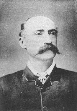
William Ernest Powell Giles (20 July 1835 – 13 November 1897), best known as Ernest Giles, was an Australian explorer who led five major expeditions to parts of South Australia and Western Australia. Early life Ernest Giles was born in Bristol, England, the eldest son of William Giles ( – 28 May 1860), a merchant, and Jane Elizabeth Giles, ''née'' Powell ( – 15 March 1879). Their family had been in comfortable circumstances but fell on hard times and emigrated to Australia. William Giles was living in North Adelaide by 1850 and Melbourne by 1853. William was later employed by Customs in Victoria, and his wife founded a successful school for girls in that colony. Giles was educated at Christ's Hospital school, Newgate, London. In 1850, at the age of 15, he emigrated to Australia, joining his parents in Adelaide. In 1852 Giles went to the Victorian goldfields, then became a clerk at the Post Office in Melbourne, and later at the County Court. Soon tiring of town life Gi ... [...More Info...] [...Related Items...] OR: [Wikipedia] [Google] [Baidu] |
Kintore, Northern Territory
Kintore (Pintupi: ''Walungurru'') is a remote settlement in the Kintore Range of the Northern Territory of Australia about west of Alice Springs and from the border with Western Australia. It is also known as Walungurru, Walangkura, and Walangura. History The Kintore Range was named by William Tietkens during his expedition of 1889 after the Governor of South Australia, Algernon Keith-Falconer, 9th Earl of Kintore. In 1979 and 1980 satisfactory water was found in four bores sunk at and near the Kintore Range. In mid-1981 an outstation (homeland) was established there and developed as a resource centre for camps elsewhere in the region, allowing the reoccupation of at least some of the Pintupi country. The community was founded in 1981, when many Pintupi people who lived in the community of Papunya (about from Alice Springs) became unhappy with their circumstances in what they saw as foreign country, and decided to move back to their own country, from which they had been f ... [...More Info...] [...Related Items...] OR: [Wikipedia] [Google] [Baidu] |
Ngaatjatjarra
The Ngaatjatjarra (otherwise spelt Ngadadjara) are an Indigenous Australian people of Western Australia, with communities located in the north eastern part of the Goldfields-Esperance region. Name The ethnonym Ngaatjatjarra, in line with a general practice in their area, combines the interrogative pronoun used by each tribe for "who", "what". In their case this yields up a combination of ''ŋa:da'' and the possessive suffix ''-t(d)jara'', is attached. The sense therefore is, "(people) using the form ''ŋa:da'' for the idea of 'who/what'". Language Ngaatjatjarra is mutually intelligible with Ngaanyatjarra, and both are treated as dialects of the one language. Country Norman Tindale assigned them traditional lands he estimated as covering roughly . The centre of their traditional life was in the Warburton Ranges and in particular at a site, Warupuju Spring, where water was always available. Their eastern frontiers lay around Fort Welcome, the Blackstone Ranges, Murray Range and ... [...More Info...] [...Related Items...] OR: [Wikipedia] [Google] [Baidu] |
Pitjantjatjara Language
Pitjantjatjara (; or ) is a dialect of the Western Desert language traditionally spoken by the Pitjantjatjara people of Central Australia. It is mutually intelligible with other varieties of the Western Desert language, and is particularly closely related to the Yankunytjatjara dialect. The names for the two groups are based on their respective words for 'come/go.' Pitjantjatjara is a relatively healthy Aboriginal language, with children learning it. It is taught in some Aboriginal schools. The literacy rate for first language speakers is 50–70%; and is 10–15% for second-language learners. There is a Pitjantjatjara dictionary, and the New Testament of the Bible has been translated into the language, a project started at the Ernabella Mission in the early 1940s and completed in 2002. Work continues on the Old Testament. Phonology and orthography There are slightly different standardised spellings used in the Northern Territory and Western Australia compared to So ... [...More Info...] [...Related Items...] OR: [Wikipedia] [Google] [Baidu] |
Australian Bureau Of Statistics
The Australian Bureau of Statistics (ABS) is the independent statutory agency of the Australian Government responsible for statistical collection and analysis and for giving evidence-based advice to federal, state and territory governments. The ABS collects and analyses statistics on economic, population, environmental and social issues, publishing many on their website. The ABS also operates the national Census of Population and Housing that occurs every five years. History In 1901, statistics were collected by each state for their individual use. While attempts were made to coordinate collections through an annual Conference of Statisticians, it was quickly realized that a National Statistical Office would be required to develop nationally comparable statistics. The Commonwealth Bureau of Census and Statistics (CBCS) was established under the Census and Statistics Act in 1905. Sir George Knibbs was appointed as the first Commonwealth Statistician. Initially, the bureau ... [...More Info...] [...Related Items...] OR: [Wikipedia] [Google] [Baidu] |
Giles Weather Station
Giles Weather Station (also referred to as Giles Meteorological Station or Giles) is located in Western Australia near the Northern Territory border, about west-south-west of Alice Springs and west of Uluru. It is the only staffed weather station within an area of about and is situated mid-continent and near the core of the subtropical jetstream. This means it plays an important role as a weather and climate observatory for the country, particularly eastern and southeastern Australia, and particularly for rainfall predictions. The station is on the Great Central Road and the nearest township is the Warakurna Aboriginal settlement (population 180), North. Giles is within the Shire of Ngaanyatjarraku and is in the foothills of the Rawlinson Ranges. A staff of three operates the remote station on six-monthly tours. Giles Airport, a airstrip services the station and the Warakurna community. Tourists are invited to watch the daily release of weather balloons and browse thr ... [...More Info...] [...Related Items...] OR: [Wikipedia] [Google] [Baidu] |
Great Central Road
The Great Central Road is a mostly unsealed Australian outback highway that runs from Laverton, Western Australia to Yulara, Northern Territory (near Uluru / Ayers Rock). It passes through a number of small communities on the way. History The Great Central Road has its origins in the early 1930s when Warburton was established as a missionary settlement, and supplies were delivered from Laverton via a rough bush track. By the mid 1950s, the track from Laverton had become graded dirt. In 1958 during survey for the Gunbarrel Highway as part of the Woomera rocket range project, Len Beadell visited Warburton and built a new road from Giles via the Rawlinson Range to Warburton. At Jackie Junction north of Warburton, the Gunbarrel Highway branched from this road towards Carnegie Station further west. Beadell returned to Giles via a different bush track which passed east through the Blackstone Range towards Docker River. In January 1978 funds were provided to Warburton counc ... [...More Info...] [...Related Items...] OR: [Wikipedia] [Google] [Baidu] |
Australian Feral Camel
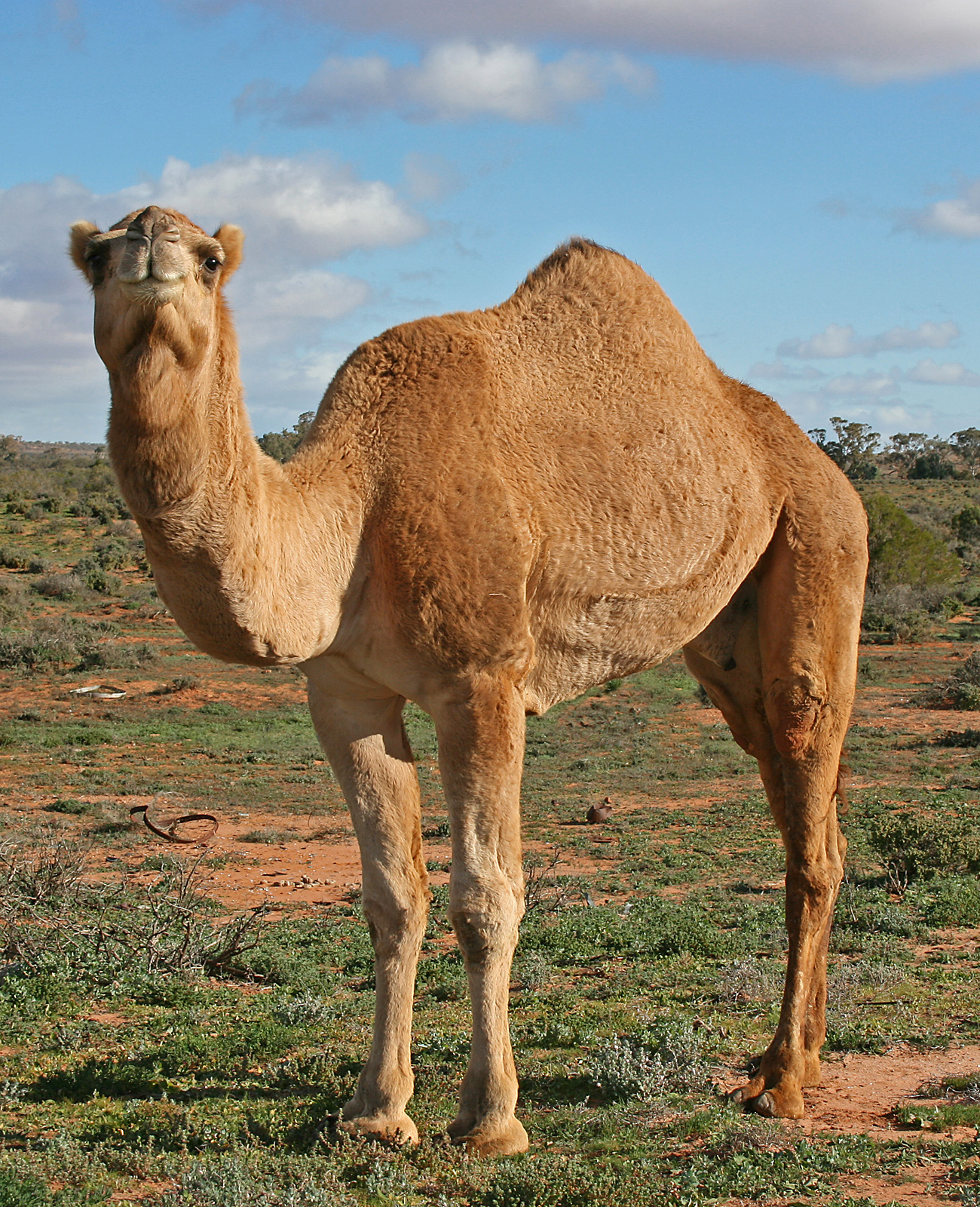
Australian feral camels are feral populations of dromedaries (''Camelus dromedarius'') in Australia. Imported from British India and Afghanistan during the 19th century for transport and construction during the colonisation of the central and western parts of Australia, many were released into the wild after motorised transport replaced the use of camels in the early 20th century, resulting in a fast-growing feral population. By 2008, it was ncorrectlyfeared that Central Australia's feral camel population had grown to about one million and was projected to double every 8 to 10 years. Camels are known to cause serious degradation of local environmental and cultural sites, particularly during dry conditions. Pastoralists, representatives from the Central Land Council, and Aboriginal land holders in the relevant areas were those amongst the complainants. An AU$19 million culling program was funded in 2009, and by 2013 a total of 160,000 camels were slaughtered, estimating the ... [...More Info...] [...Related Items...] OR: [Wikipedia] [Google] [Baidu] |
Outstation (Aboriginal Community)
An outstation, homeland or homeland community is a very small, often remote, permanent community of Aboriginal Australian people connected by kinship, on land that often, but not always, has social, cultural or economic significance to them, as traditional land. The outstation movement or homeland movement refers to the voluntary relocation of Aboriginal people from towns to these locations. The outstation movement A movement arose in the 1970s and continued through the 1980s which saw the creation of very small, remote settlements of Aboriginal people who relocated themselves from the towns and settlements where they had been settled by the government's policy of assimilation. It was "a move towards reclaiming autonomy and self-sufficiency". Also known as "homelands", the term "outstation" was adopted as it "suggests a dependent relationship between the outstation and the main homestead, but with a degree of separation". Outstations were created by Aboriginal people who "sought. ... [...More Info...] [...Related Items...] OR: [Wikipedia] [Google] [Baidu] |
Land Rights Act 1976
The ''Aboriginal Land Rights (Northern Territory) Act 1976'' (ALRA) is Australian federal government legislation that provides the basis upon which Aboriginal Australian people in the Northern Territory can claim rights to land based on traditional occupation. It was the first law by any Australian government that legally recognised the Aboriginal system of land ownership, and legislated the concept of inalienable freehold title, as such was a fundamental piece of social reform. Its long title is ''An Act providing for the granting of Traditional Aboriginal Land in the Northern Territory for the benefit of Aboriginals, and for other purposes''. The most significant amendments to the Act were effected by the passing of the ''Aboriginal Land Rights (Northern Territory) Amendment Bill 2006'', effective 1 July 2007. History The results of the 1967 Australian referendum meant that the Federal Government could make special laws relating to Aboriginal people which could override any ... [...More Info...] [...Related Items...] OR: [Wikipedia] [Google] [Baidu] |


