|
Dihlabeng Local Municipality
Dihlabeng Local Municipality is an administrative area in the Thabo Mofutsanyane District of the Free State in South Africa. It was established in terms of Section 12 of the Local Government Structures Act, 117 of 1998, after the first general local government elections of 5 December 2000 which heralded the final phase of local government reform as envisaged in 1994 at the onset of the process of democratisation. The Municipality is a category B as defined in the Local Government Structures Act and shares executive and legislative authority with the category C municipality within whose area it falls i.e. Thabo Mofutsanyana District Municipality. The type is that of a Collective Executive System combined with a Ward Participatory System. Geography The Dihlabeng Local Municipality is situated within the boundaries of the Thabo Mofutsanyana District Municipality in the Eastern Free State. The geographical area is 7550.4910 km2. The Municipality consists of the towns Bethlehe ... [...More Info...] [...Related Items...] OR: [Wikipedia] [Google] [Baidu] |
Local Municipality (South Africa)
In South Africa, a local municipality ( tn, mmasepalaselegae; st, masepala wa lehae; nso, mmasepala wa selegae; af, plaaslike munisipaliteit; zu, umasipala wendawo; nr, umasipaladi wendawo; xh, umasipala wengingqi; ss, masipaladi wasekhaya; ve, masipalawapo; ts, masipala wa muganga) or Category B municipality is a type of Municipalities of South Africa, municipality that serves as the third, and most local, tier of local government. Each district municipality (South Africa), district municipality is divided into a number of local municipalities, and responsibility for municipal affairs is divided between the district and local municipalities. There are List of municipalities in South Africa#Local municipalities, 205 local municipalities in South Africa. A local municipality may include rural areas as well as one or more towns or small cities. In larger urban areas there are no district or local municipalities, and a metropolitan municipality (South Africa), metropolitan ... [...More Info...] [...Related Items...] OR: [Wikipedia] [Google] [Baidu] |
English Language
English is a West Germanic language of the Indo-European language family, with its earliest forms spoken by the inhabitants of early medieval England. It is named after the Angles, one of the ancient Germanic peoples that migrated to the island of Great Britain. Existing on a dialect continuum with Scots, and then closest related to the Low Saxon and Frisian languages, English is genealogically West Germanic. However, its vocabulary is also distinctively influenced by dialects of France (about 29% of Modern English words) and Latin (also about 29%), plus some grammar and a small amount of core vocabulary influenced by Old Norse (a North Germanic language). Speakers of English are called Anglophones. The earliest forms of English, collectively known as Old English, evolved from a group of West Germanic (Ingvaeonic) dialects brought to Great Britain by Anglo-Saxon settlers in the 5th century and further mutated by Norse-speaking Viking settlers starting in the 8th and 9th ... [...More Info...] [...Related Items...] OR: [Wikipedia] [Google] [Baidu] |
Populated Place
Population typically refers to the number of people in a single area, whether it be a city or town, region, country, continent, or the world. Governments typically quantify the size of the resident population within their jurisdiction using a census, a process of collecting, analysing, compiling, and publishing data regarding a population. Perspectives of various disciplines Social sciences In sociology and population geography, population refers to a group of human beings with some predefined criterion in common, such as location, race, ethnicity, nationality, or religion. Demography is a social science which entails the statistical study of populations. Ecology In ecology, a population is a group of organisms of the same species who inhabit the same particular geographical area and are capable of interbreeding. The area of a sexual population is the area where inter-breeding is possible between any pair within the area and more probable than cross-breeding with ind ... [...More Info...] [...Related Items...] OR: [Wikipedia] [Google] [Baidu] |
South African National Census Of 2001
The National Census of 2001 was the 2nd comprehensive national census of the Republic of South Africa, or Post-Apartheid South Africa. It undertook to enumerate every person present in South Africa on the census night between 9–10 October 2001 at a cost of . It was organised and planned by Statistics South Africa in terms of the Statistics Act from the beginning of 1999, under the commission of the Statistician-General Pali Lehohla. The enumeration primarily took place from 10 to 31 October 2001 and the results were published in 2003. Pre-enumeration This was the first South African census to use a Geographic Information System to determine the Enumeration Areas. Traditionally, the areas were created using analogue and sketch maps. This geographic database was created out of several data sets acquired from government departments and private sector companies. It included topographic maps, cadastral data, administrative boundaries, aerial photography, satellite imagery a ... [...More Info...] [...Related Items...] OR: [Wikipedia] [Google] [Baidu] |
Bethlehem Hydro
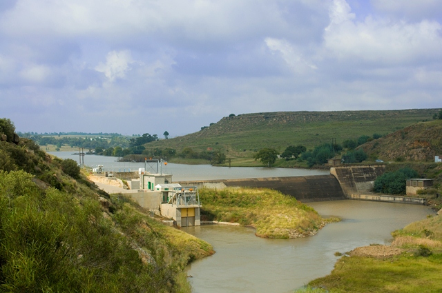
Bethlehem Hydro owns and operates two small hydro power plants situated in the Dihlabeng Local Municipality (Thabo Mofutsanyana District Municipality) in the Free State province of South Africa. The scheme utilizes the water supplied to South Africa by the Lesotho Highlands Water Project, which releases water into the As River via a tunnel outlet near the town of Clarens. South Africa has limited potential for hydro energy due to low average annual rainfall making projects like Bethlehem Hydro rare. The project was identified in 1999 and developed by NuPlanet Project Development. The two power stations in the scheme will cut back carbon dioxide emissions by 33,000 tons per year by reducing the demand for traditional fossil-fuel power stations. Sol Plaatje Power Station The Sol Plaatje Power Station was the first commercial small hydro power station constructed in South Africa for 22 years. It was commissioned in November 2009 and is located close to Bethlehem, Free State. The pow ... [...More Info...] [...Related Items...] OR: [Wikipedia] [Google] [Baidu] |
Rosendal, Free State
Rosendal is a small farming town and arts colony 49 km north of Ficksburg in the Free State province of South Africa which was founded in 1908. It has become a popular tourist destination, known for spectacular scenery, including the surrounding mountains, and is home to a community of artists and small business owners. The town has a number of attractive buildings and early-20th-century homes. There are several art galleries and several small cafes cum restaurants as well as a heritage district of restored buildings in the former downtown. Until recently live theatre was hosted here by well known Afrikaans language actor, Chris Van Niekerk. The Eastern Free State was first occupied by indigenous San and Khoi people Khoekhoen (singular Khoekhoe) (or Khoikhoi in the former orthography; formerly also '' Hottentots''"Hottentot, n. and adj." ''OED Online'', Oxford University Press, March 2018, www.oed.com/view/Entry/88829. Accessed 13 May 2018. Citing G. S. ..., as ev ... [...More Info...] [...Related Items...] OR: [Wikipedia] [Google] [Baidu] |
Paul Roux
Paul Roux is a small town in the Free State province of South Africa that produces poplar wood for the safety match industry. It is situated on the N5 highway near Bethlehem, Free State. It was named after a well-known Dutch Reformed Church leader and Second Boer War general, Reverend Paul Hendrik Roux (1862–1911). History Paul Roux was established as a post coach station between Winburg and Harrismith. Where the current bowling club stands, there used to be an inn, owned by Mr John Hiscock – a local businessman, at the location of the current bowling club where horses would be changed. The land was purchased from Mr De Jongh and the village was officially proclaimed on 9 May 1909. Two names were proposed for the village – Paul Roux and Du Plessis Ville. To decide on the final name, villagers engraved letters 'PR' on one side of a flat stone and 'Dup' on the other side. The stone was thrown into the air and the village was to be named according to whichever initials ap ... [...More Info...] [...Related Items...] OR: [Wikipedia] [Google] [Baidu] |
Fouriesburg
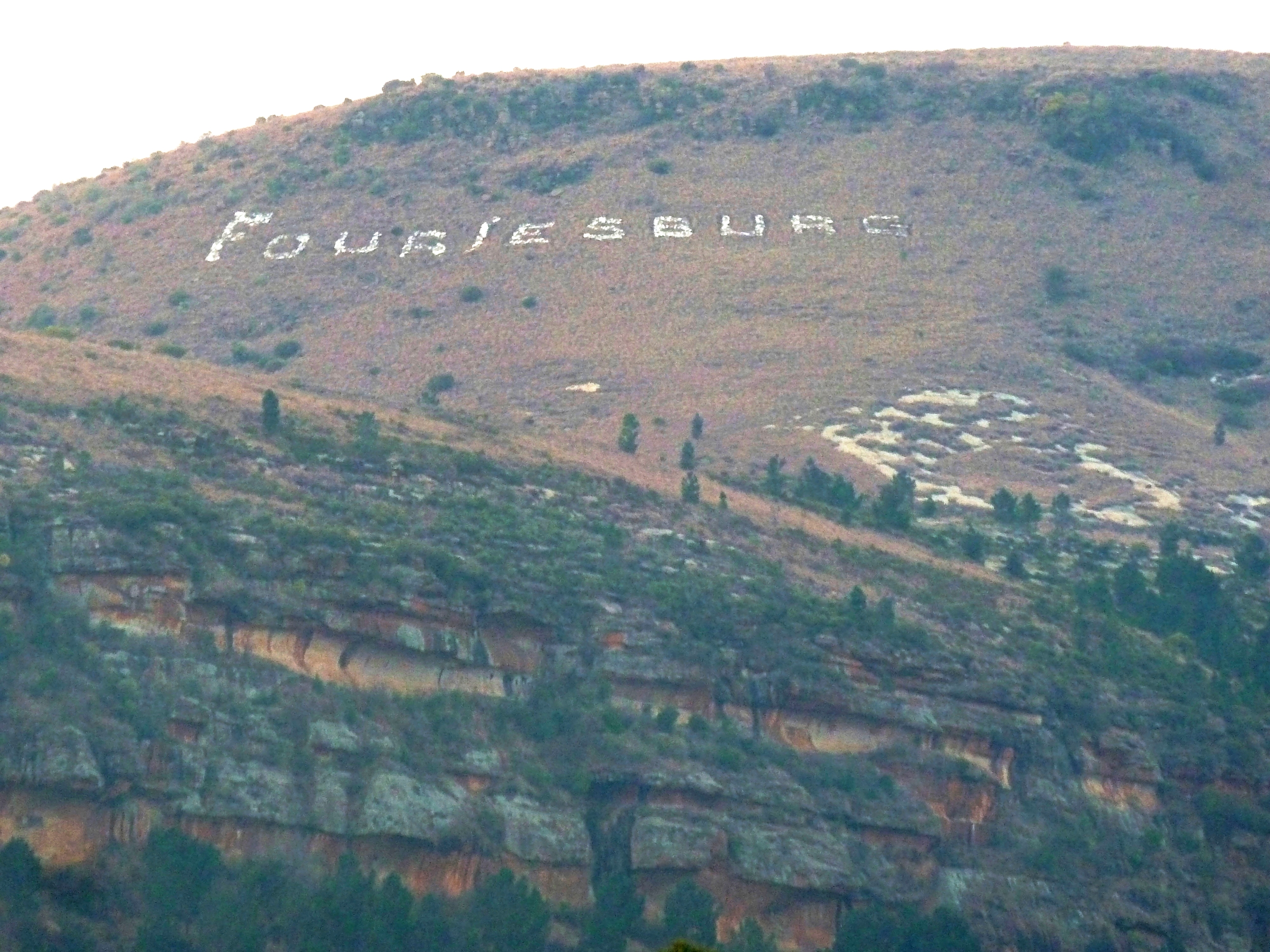
Fouriesburg is a small town situated at the junction of the R711 and R26 routes in the eastern Free State, South Africa. It is near the Maluti Mountains and only 10 km from Caledon's Poort border post, which gives access to Lesotho. History During the late nineteenth century, this land was donated to the Orange Free State by a local farmer of Huguenot descent, Christoffel Fourie, for use as a temporary capital during the Second Boer War. It was the site of several engagements during the Boer War, and by 1902 the original settlement had been almost completely destroyed. Vicinity A small private resort, Meiringskloof Nature Park, is located in a valley just northeast of town. Fouriesburg is about half an hour's drive from Clarens, a popular tourist destination, and a 45-minute drive from Golden Gate Highlands National Park. It is about fifty kilometres south-east of Bethlehem, and some fifty-three from Ficksburg Ficksburg is a town situated at the foot of the 1,750 mete ... [...More Info...] [...Related Items...] OR: [Wikipedia] [Google] [Baidu] |


