|
Diemelsee
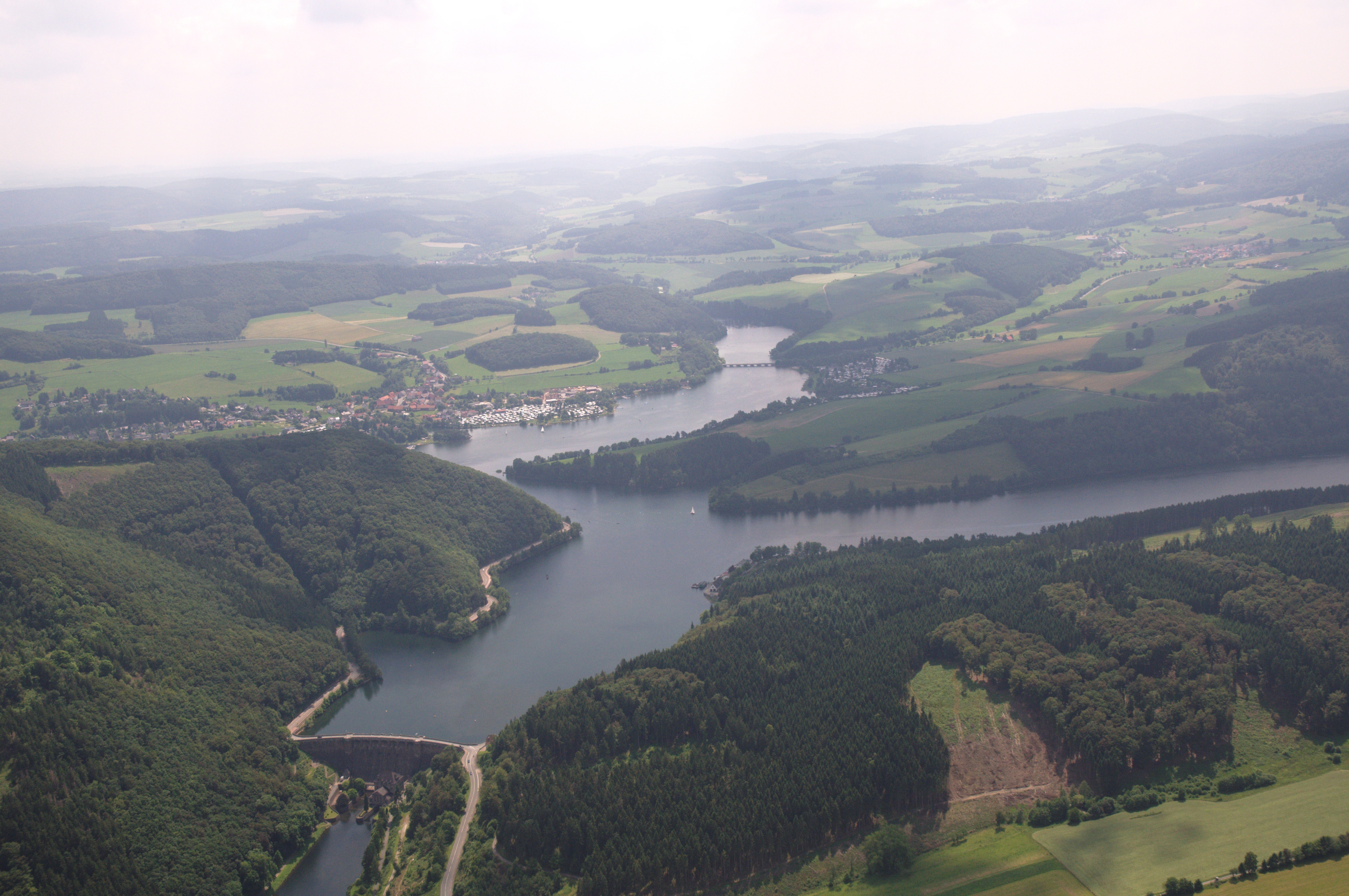
The Diemelsee or Diemel Reservoir (german: Diemelstausee) is a reservoir with a surface area of 1.65 km² and about capacity of 19.9 million m³ on the River Diemel in the counties of Waldeck-Frankenberg in North Hesse, and Hochsauerlandkreis, Westphalia, Germany. It is part of the Diemeltalsperre hydropower system (DiT) comprising the Diemel Dam, the equalizing basin, the power plant and the reservoir itself, owned by the Federal Waterway and Navigation Authority and managed by its Hann. Münden office. The Diemel Reservoir, along with the Edersee is part of the water regulation structure in the catchment area of the River Weser. Location The Diemelsee is located a few kilometres northeast of the Upland in the northeastern foothills of the Rothaar Mountains that lie in the northeast of the Rhenish Massif. It lies mainly within the county of Waldeck-Frankenberg, its smaller northern section and its dam belong to the county of Hochsauerlandkreis. In is also wit ... [...More Info...] [...Related Items...] OR: [Wikipedia] [Google] [Baidu] |
Diemelsee (village)
Diemelsee is a municipality in Waldeck-Frankenberg in northwest Hesse, Germany, and is part of the low mountain region called Upland. Adorf is the seat of this municipality. Geography Location Diemelsee lies on the river Diemel in the Diemelsee Nature Park just upstream from and southwest of the Diemelsee reservoir. The town of Korbach is found about 10 km to the southeast, and the town of Paderborn 39 km to the north. Neighbouring communities Diemelsee borders in the north on the town of Marsberg (Hochsauerlandkreis in North Rhine-Westphalia), in the northeast on the town of Bad Arolsen, in the east on the community of Twistetal, in the south on the town of Korbach, in the southwest on the community of Willingen (all in Waldeck-Frankenberg), and in the west on the town of Brilon (Hochsauerlandkreis). Constituent communities The community of Diemelsee came into being as part of municipal reform in 1971 through the voluntary merger of the following 13 centres: *Adorf * ... [...More Info...] [...Related Items...] OR: [Wikipedia] [Google] [Baidu] |
Heringhausen (Diemelsee)
Heringhausen in the area of Waldeck, Upland and Sauerland, is a village in the municipality Diemelsee in northern Hesse. Heringhausen is a recognized health resort. Etymology Several variants are known concerning the origin of the place name Heringhausen. Originally the name consisted of a composition of -inghūsen and the personal name Hard(i)/Hardo, which is attributed to the word stem "Hardu" (too German old-language hard ' strong, strong, bold'). In the literature, interpretations are given to it: "at the houses of the people of Hard(i)/Hardo". Later Latin or Middle High German documents for the monastery Kaufungen the place names Hardinghuson (1023), Herdinchußen, Herdynckhusen and Hertighusin are documented as earlier place names. In further documents appears "Heriwardeshuson" (1043). Geography Heringhausen is located between Dortmund and Kassel south of Paderborn, approximately in the middle of a triangle with the verticepoints of Korbach, Brilon and Marsberg ... [...More Info...] [...Related Items...] OR: [Wikipedia] [Google] [Baidu] |
Willingen (Upland)
Willingen (official name: ''Willingen (Upland)'') is a municipality in Waldeck-Frankenberg in northern Hesse, Germany, some 80 km west of Kassel. Geography Location Willingen is found in Waldeck-Frankenberg district in the Upland. Its main town stretches between two river valleys, the Hoppecke in the west and the Itter in the east. The ski resort Skigebiet Willingen is near. It is located 60 km west of Kassel. Mühlenkopfschanze ski jump is also located here. Neighbouring communities Willingen borders in the north on the community of Diemelsee, in the east on the town of Korbach, in the south on the community of Medebach, and in the west on the towns of Winterberg, Olsberg and Brilon (all three in the Hochsauerlandkreis in North Rhine-Westphalia). Constituent communities Willingen consists of the following centres: * Bömighausen, 300 inhabitants (as of 1 September 2003) * Eimelrod, 582 inhabitants (as of 31. December 2006) * Hemmighausen, 100 inhabitants * Nee ... [...More Info...] [...Related Items...] OR: [Wikipedia] [Google] [Baidu] |
Upland (hill Range)
The Upland ( Low German for ''Oberland'' "highland") is a low mountain region forming the northeastern part of the High Sauerland and belongs the German state of Hesse, unlike the remainder of the High Sauerland which lies in Westphalia. The Upland falls within the district of Waldeck-Frankenberg, in North Hesse and corresponds to the territory of the municipality of Willingen. Geography The historic Upland lies in the southwestern area of the Diemelsee Nature Park at an average height of 500 to 700 m above NN. The northwestern and southwestern parts are almost entirely forested, whilst the centre, the area formally defined as a natural region called ''Upland'' (see below), only has islands of woods around some of the peaks. Natural regions The historic Upland lies predominantly in the northwestern Rothaar Mountains mountain range with smaller elements also in the East Sauerland foothills. It incorporates the natural region of Upland, as well as the (northeastern) half of th ... [...More Info...] [...Related Items...] OR: [Wikipedia] [Google] [Baidu] |
Waldeck-Frankenberg
Waldeck-Frankenberg is a ''Kreis'' (district) in the north of Hesse, Germany. Neighbouring districts are Höxter, Kassel, Schwalm-Eder, Marburg-Biedenkopf, Siegen-Wittgenstein, Hochsauerland. History The district was created in 1972 by merging the two districts of Frankenberg and Waldeck. Most of the area of the district was previously part of the ''Freistaat Waldeck'', the successor of the principality of Waldeck. Geography The district is located in the mountains of the Sauerland, with the highest elevation in the district of . With , it's the largest district in Hessen. Four artificial lakes created by dams are in the district, the biggest is the Edersee, which covers an area of . The Eder is also the main river in the district; the Diemel in the north is a smaller river. Mountains * Sähre Coat of arms ;Blason :''“Per bend sinister Azure a lion rampant issuant per fess Argent and Gules and Or a star with eight rays Sable.”'' The coat of arms shows the lion of Hesse i ... [...More Info...] [...Related Items...] OR: [Wikipedia] [Google] [Baidu] |
Itter (Diemel)
Itter is a river of Hesse and of North Rhine-Westphalia, Germany. It is a left tributary of the Diemel. It flows through Willingen. See also *List of rivers of Hesse *List of rivers of North Rhine-Westphalia A list of rivers of North Rhine-Westphalia, Germany: A * Aa, left tributary of the Möhne * Aa, left tributary of the Nethe * Aa, left tributary of the Werre * Aabach, tributary of the Afte * Aabach, small river in the Ems river system * Abbabac ... References Rivers of Hesse Rivers of North Rhine-Westphalia Rivers of Germany {{NorthRhineWestphalia-river-stub ... [...More Info...] [...Related Items...] OR: [Wikipedia] [Google] [Baidu] |
List Of Dams In Germany
These are dams and reservoirs in Germany. The German word ''Talsperre'' (literally: valley barrier) may mean dam, but it is often used to include the associated reservoir as well. The reservoirs are often separately given names ending in ''-see'', ''-teich'' or ''-speicher'' which are the German words for "lake", "pond" and "reservoir", but in this case all may also be translated as "reservoir". The more specific word for the actual dam is ''Staumauer'' and for the lake is ''Stausee''. Baden-Württemberg * Kleine Kinzig Dam *Nagold Dam *Schluchsee - highest reservoir lake in Germany and largest lake in the Black Forest * Schwarzenbach Dam Bavaria * Ellertshäuser See *Großer Brombachsee *Forggensee * Frauenau Dam * Sylvenstein Dam * Altmühlsee *Rothsee * Hahnenkammsee Brandenburg *Spremberg Reservoir Hesse *Aar Dam * Affoldern Reservoir * Antrift Dam * Diemelsee (reservoir) *Driedorf Reservoir *Edersee Lower Saxony * Ecker Dam * Grane Dam * Innerste Dam * Oder Dam * Odertei ... [...More Info...] [...Related Items...] OR: [Wikipedia] [Google] [Baidu] |
Marsberg
Marsberg () is a town in the Hochsauerland district, in North Rhine-Westphalia, Germany. History Although its origins are obscure, Marsberg was a prospering town by the 13th century (it was even minting coins). It was a free city until 1807, when it was incorporated into the Kingdom of Westphalia, until 1813. After two years of independent government, it was added to Prussia in 1815. Geography It is situated on the river Diemel, approx. 20 km east of Brilon and 30 km south of Paderborn. Neighbouring municipalities * Bad Arolsen * Bad Wünnenberg * Brilon * Diemelsee * Diemelstadt * Lichtenau * Warburg Town division Marsberg consists of the following 17 districts: * Beringhausen * Borntosten * Bredelar * Canstein * Erlinghausen * Essentho * Giershagen * Heddinghausen * Helminghausen * Leitmar * Meerhof * Niedermarsberg * Obermarsberg * Oesdorf * Padberg * Udorf * Westheim International relations Marsberg is twinned with: * Lillers (France) Notable people ... [...More Info...] [...Related Items...] OR: [Wikipedia] [Google] [Baidu] |
Reservoirs In North Rhine-Westphalia
A reservoir (; from French ''réservoir'' ) is an enlarged lake behind a dam. Such a dam may be either artificial, built to store fresh water or it may be a natural formation. Reservoirs can be created in a number of ways, including controlling a watercourse that drains an existing body of water, interrupting a watercourse to form an embayment within it, through excavation, or building any number of retaining walls or levees. In other contexts, "reservoirs" may refer to storage spaces for various fluids; they may hold liquids or gasses, including hydrocarbons. ''Tank reservoirs'' store these in ground-level, elevated, or buried tanks. Tank reservoirs for water are also called cisterns. Most underground reservoirs are used to store liquids, principally either water or petroleum. Types Dammed valleys Dammed reservoirs are artificial lakes created and controlled by a dam constructed across a valley, and rely on the natural topography to provide most of the basin of the ... [...More Info...] [...Related Items...] OR: [Wikipedia] [Google] [Baidu] |
Reservoirs In Hesse
A reservoir (; from French ''réservoir'' ) is an enlarged lake behind a dam. Such a dam may be either artificial, built to store fresh water or it may be a natural formation. Reservoirs can be created in a number of ways, including controlling a watercourse that drains an existing body of water, interrupting a watercourse to form an embayment within it, through excavation, or building any number of retaining walls or levees. In other contexts, "reservoirs" may refer to storage spaces for various fluids; they may hold liquids or gasses, including hydrocarbons. ''Tank reservoirs'' store these in ground-level, elevated, or buried tanks. Tank reservoirs for water are also called cisterns. Most underground reservoirs are used to store liquids, principally either water or petroleum. Types Dammed valleys Dammed reservoirs are artificial lakes created and controlled by a dam constructed across a valley, and rely on the natural topography to provide most of the basin of the ... [...More Info...] [...Related Items...] OR: [Wikipedia] [Google] [Baidu] |


