|
Diamond Creek Falls
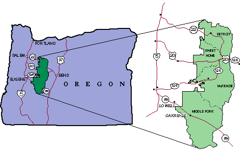
Diamond Creek Falls is a waterfall formed along Gibson Canyon on the north end of Willamette National Forest, east side of the city of Oakridge in Lane County, Oregon. Access to Diamond Creek Falls is located along Oregon Route 58 through trail paths that lead down to the stream and the base of the waterfall. Trail From the parking lot and to the left of the interpretive kiosk is the beginning of the loop hike upstream of the waterfall on the Salt Creek Falls and Diamond Creek Falls trails. The Salt Creek Falls trail starts with a paved walkway along Salt Creek that leads to a picnic area. Past the picnic area is a bridge over Salt Creek that leads to a faint pathway where the trail divides. Following the right side at the junction leads to about of a quick climb that ends in a wide view of the surrounding canyon. Past this viewpoint, the Diamond Creek Falls Trail continues for about past Too Much Bear Lake and ends in a junction that leads to the waterfall, which has access ... [...More Info...] [...Related Items...] OR: [Wikipedia] [Google] [Baidu] |
Willamette National Forest
The Willamette National Forest is a National Forest located in the central portion of the Cascade Range of the U.S. state of Oregon. It comprises . Over 380,000 acres (694 mi2, 1,540 km2) are designated wilderness which include seven major mountain peaks. There are also several National Wild and Scenic Rivers within the forest. The forest is named for the Willamette River, which has its headwaters in the forest. The forest headquarters are located in the city of Springfield. There are local ranger district offices in McKenzie Bridge, Detroit, Sweet Home, and Westfir. The forest is famous for being at the center of the controversy between the logging industry and the endangered species status of the northern spotted owl. Environmentalists maintain that the forest was aggressively clear-cut for many years threatening a federally listed endangered species. The timber industry contends that the forest can simultaneously provide lumber jobs and wildlife habitat. Sinc ... [...More Info...] [...Related Items...] OR: [Wikipedia] [Google] [Baidu] |
Waterfall
A waterfall is a point in a river or stream where water flows over a vertical drop or a series of steep drops. Waterfalls also occur where meltwater drops over the edge of a tabular iceberg or ice shelf. Waterfalls can be formed in several ways, but the most common method of formation is that a river courses over a top layer of resistant bedrock before falling on to softer rock, which Erosion, erodes faster, leading to an increasingly high fall. Waterfalls have been studied for their impact on species living in and around them. Humans have had a distinct relationship with waterfalls for years, travelling to see them, exploring and naming them. They can present formidable barriers to navigation along rivers. Waterfalls are religious sites in many cultures. Since the 18th century they have received increased attention as tourist destinations, sources of hydropower, andparticularly since the mid-20th centuryas subjects of research. Definition and terminology A waterfall is gen ... [...More Info...] [...Related Items...] OR: [Wikipedia] [Google] [Baidu] |
Oakridge, Oregon
Oakridge is a city in Lane County, Oregon, United States. The population was 3,205 as of the 2010 census. It is located east of Westfir on Oregon Route 58, about east of Eugene and southeast of Portland. Surrounded by the Willamette National Forest and the Cascade Range, Oakridge is popular with outdoor enthusiasts for its hiking, mountain biking, wildflowers, fly fishing, birding, watersports, and the nearby Willamette Pass Resort. The city was originally a community called "Hazeldell", and its post office was established on July 26, 1888. When a station on the Southern Pacific Railroad opened in May 1912, it was named "Oak Ridge" by a railroad executive for the surrounding topography, and on July 19 of that year the name was changed to be spelled as a single word. The economy of Oakridge and nearby Westfir is centered on recreation. Since the lumber mills closed in the 1980s, the economy has been transitioning, with a new general store opening in 2010, a bakery i ... [...More Info...] [...Related Items...] OR: [Wikipedia] [Google] [Baidu] |
Lane County, Oregon
Lane County is one of the 36 counties in the U.S. state of Oregon. As of the 2020 census, the population was 382,971, making it the fourth-most populous county in Oregon. The county seat is Eugene. It is named in honor of Joseph Lane, Oregon's first territorial governor. Lane County comprises the Eugene, OR Metropolitan Statistical Area. It is the third-largest MSA in Oregon, and the 144th-largest in the country. History Lane County was established on January 29, 1851. It was created from the southern part of Linn County and the portion of Benton County east of Umpqua County. It was named after the territory's first governor, Joseph Lane. Originally it covered all of southern Oregon east to the Cascade Mountains and south to the California border. When the Territorial Legislature created Lane County, it did not designate a county seat. In the 1853 election, four sites competed for the designation, of which the "Mulligan donation" received a majority vote; however, since ... [...More Info...] [...Related Items...] OR: [Wikipedia] [Google] [Baidu] |
Oregon Route 58
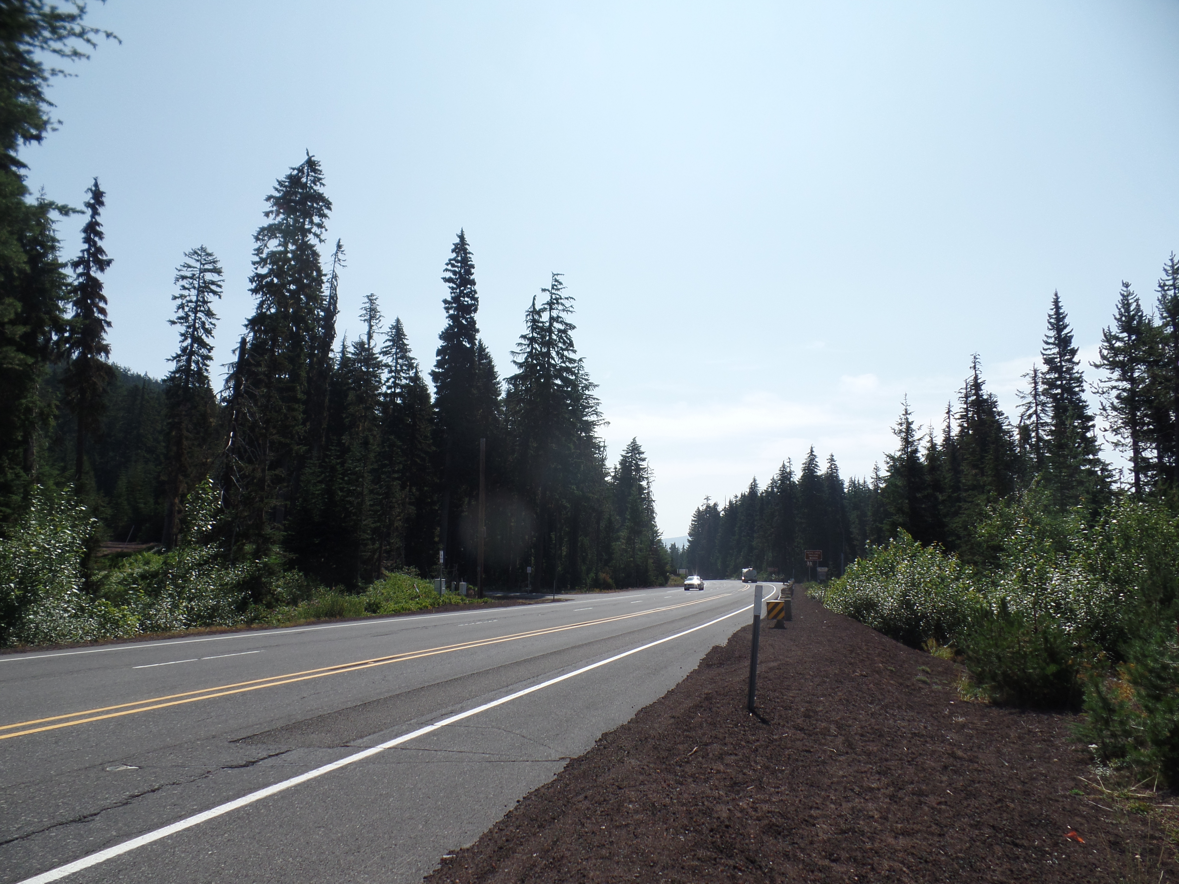
Oregon Route 58 (OR 58), also known as the Willamette Highway No. 18 (see Oregon highways and routes), is a state highway in the U.S. state of Oregon. The route, signed east–west, runs in a southeast–northwest direction, connecting U.S. Route 97 north of Chemult with Interstate 5 south of Eugene. It links the Willamette Valley and Central Oregon, crossing the Cascade Range at Willamette Pass. OR 58 is generally a modern two-lane highway with a speed limit of 55 mph (88 km/h), built through the Willamette National Forest in the 1930s. OR 58 is a designated freight route, forming one of several connections between I-5 and US 97, which leads back to I-5 at Weed, California. This is a popular alternate route for trucks on the I-5 corridor, avoiding the steep grades and winter closures of I-5 over Siskiyou Summit. The highway is also on the National Highway System, and is classified as an expressway southeast of Odell Lake. (US 97 is also classified as such south ... [...More Info...] [...Related Items...] OR: [Wikipedia] [Google] [Baidu] |
Salt Creek Falls
Salt Creek Falls is a cascade and plunge waterfall on Salt Creek, a tributary of the Middle Fork Willamette River, that plunges into a gaping canyon in the Willamette National Forest near Willamette Pass in Lane County, Oregon, Lane County, Oregon. The waterfall is notable for its main drop of , ranking third highest among plunge waterfalls in Oregon, after Multnomah Falls and Watson Falls.) The pool at the bottom of Salt Creek Falls waterfall is deep. Description Starting from above sea level, Salt Creek Falls drops about , and this height varies little because the giant boulders at its crest have an even surface. However, a couple of protruding rocks interrupt the fall of water. The annual average flow of water approaching the falls is . This flow typically peaks when the mountain snow melts in the late spring and early summer. No water diversion facility exists within the falls or anywhere along Salt Creek. History Salt Creek Falls was formed when glaciers receded duri ... [...More Info...] [...Related Items...] OR: [Wikipedia] [Google] [Baidu] |
Globe Pequot Press
Globe Pequot is a book publisher and distributor of outdoor recreation and leisure titles that publishes 500 new titles. Globe Pequot was acquired by Morris Communications Morris Communications, headquartered in Augusta, Georgia, is a privately held media company with diversified holdings that include magazine publishing, outdoor advertising, book publishing and distribution, visitor publications, and online serv ... in 1997. Lyons Press was acquired in 2001. It was sold to Rowman & Littlefield in 2014. Imprints Globe Pequot publishes several imprints, including '' Prometheus Books'' ''Lyons Press'', ''FalconGuides'', ''Knack'', and ''Insiders' Guide''. References External links *{{Official website, http://globepequot.com Companies based in New Haven County, Connecticut Morris Communications Publishing companies of the United States ... [...More Info...] [...Related Items...] OR: [Wikipedia] [Google] [Baidu] |
List Of Waterfalls In Oregon
There are at least 238 waterfalls in the U.S. state of Oregon. See also * Lists of Oregon-related topics {{United States topic, navbar=plain, title= Waterfalls in the United States, prefix=List of waterfalls in Oregon Waterfalls A waterfall is a point in a river or stream where water flows over a vertical drop or a series of steep drops. Waterfalls also occur where meltwater drops over the edge of a tabular iceberg or ice shelf. Waterfalls can be formed in several w ... ... [...More Info...] [...Related Items...] OR: [Wikipedia] [Google] [Baidu] |


