|
Devils Desk
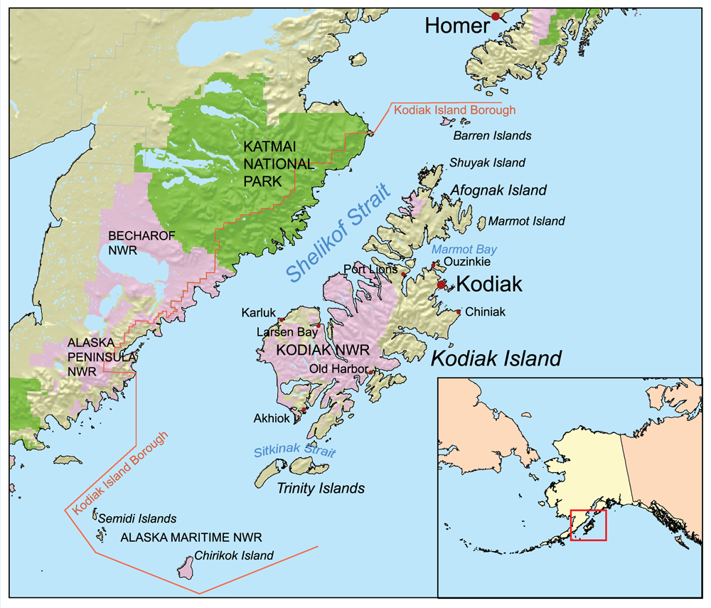
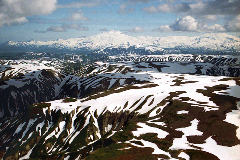
Devils Desk is a stratovolcano in Alaska's Katmai National Park, split between the Kodiak Island and Lake and Peninsula boroughs of that U.S. state. Its peak, which is located in Kodiak Island Borough, lies above sea level. It has an elevation of . The age of the volcano is not certain, but a sample from the southwest face of the volcano was dated at 245,000 years old. The edifice represents the neck of a formerly larger stratovolcano, whose flanks have been removed by glacial erosion. The summit is almost encircled by Hook Glacier. See also *List of volcanoes in the United States of America A list of volcanoes in the United States and its territories. Alaska American Samoa Arizona California Colorado Hawaii /[./[Https://www.sci.news/geology/puhahonu-shield-volcano-08435.html Puhahonu ... References External links Devils Desk at the Alaska Volcano Observatory Volcanoes of Kodiak Island Borough, Alaska Volcanoes of Lake ... [...More Info...] [...Related Items...] OR: [Wikipedia] [Google] [Baidu] |
Stratovolcano
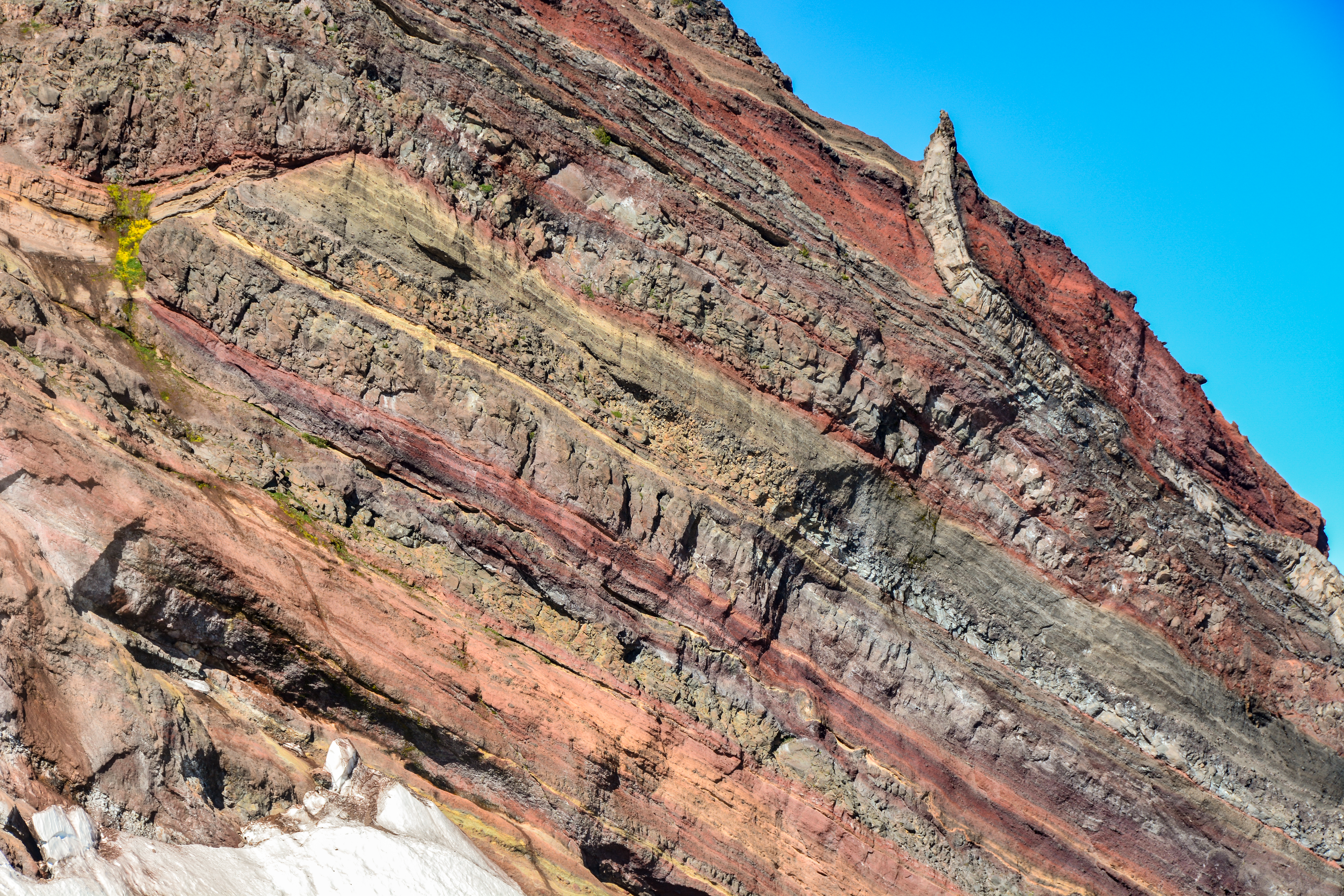
A stratovolcano, also known as a composite volcano, is a conical volcano built up by many layers (strata) of hardened lava and tephra. Unlike shield volcanoes, stratovolcanoes are characterized by a steep profile with a summit crater and periodic intervals of explosive eruptions and effusive eruptions, although some have collapsed summit craters called calderas. The lava flowing from stratovolcanoes typically cools and hardens before spreading far, due to high viscosity. The magma forming this lava is often felsic, having high-to-intermediate levels of silica (as in rhyolite, dacite, or andesite), with lesser amounts of less-viscous mafic magma. Extensive felsic lava flows are uncommon, but have travelled as far as . Stratovolcanoes are sometimes called composite volcanoes because of their composite stratified structure, built up from sequential outpourings of erupted materials. They are among the most common types of volcanoes, in contrast to the less common shield volca ... [...More Info...] [...Related Items...] OR: [Wikipedia] [Google] [Baidu] |
Alaska
Alaska ( ; russian: Аляска, Alyaska; ale, Alax̂sxax̂; ; ems, Alas'kaaq; Yup'ik: ''Alaskaq''; tli, Anáaski) is a state located in the Western United States on the northwest extremity of North America. A semi-exclave of the U.S., it borders the Canadian province of British Columbia and the Yukon territory to the east; it also shares a maritime border with the Russian Federation's Chukotka Autonomous Okrug to the west, just across the Bering Strait. To the north are the Chukchi and Beaufort Seas of the Arctic Ocean, while the Pacific Ocean lies to the south and southwest. Alaska is by far the largest U.S. state by area, comprising more total area than the next three largest states (Texas, California, and Montana) combined. It represents the seventh-largest subnational division in the world. It is the third-least populous and the most sparsely populated state, but by far the continent's most populous territory located mostly north of the 60th parallel, with ... [...More Info...] [...Related Items...] OR: [Wikipedia] [Google] [Baidu] |
Katmai National Park
Katmai National Park and Preserve is an American national park and preserve in southwest Alaska, notable for the Valley of Ten Thousand Smokes and for its brown bears. The park and preserve encompass , which is between the sizes of Connecticut and New Jersey. Most of the national park is a designated wilderness area. The park is named after Mount Katmai, its centerpiece stratovolcano. The park is located on the Alaska Peninsula, across from Kodiak Island, with headquarters in nearby King Salmon, about southwest of Anchorage. The area was first designated a national monument in 1918 to protect the area around the major 1912 volcanic eruption of Novarupta, which formed the Valley of Ten Thousand Smokes, a , pyroclastic flow. The park includes as many as 18 individual volcanoes, seven of which have been active since 1900. Initially designated because of its volcanic history, the monument was left undeveloped and largely unvisited until the 1950s. The monument and surrounding lands ... [...More Info...] [...Related Items...] OR: [Wikipedia] [Google] [Baidu] |
Kodiak Island Borough, Alaska
Kodiak Island Borough (russian: Остров Кадьяк) is a borough in the U.S. state of Alaska. At the 2020 census, the population was 13,101, down from 13,592 in 2010. The borough seat is Kodiak. Geography The borough has a total area of , of which is land and (45.5%) is water. Most of the land area belongs to Kodiak Island, but a thin strip of coastal area on the western part of the Alaska Peninsula and other nearby islands (Afognak Island, Shuyak Island, Marmot Island, Raspberry Island, Little Raspberry Island, Whale Island, Spruce Island, Woody Island, Uganik Island, Sitkalidak Island, Tugidak Island, Sitkinak Island, Chirikof Island, and the Semidi Islands) are also in the borough. The waterway between the island and mainland is known as the Shelikof Strait. South of the island are the open waters of the Pacific Ocean, so the site is considered good for launching certain types of satellites. The Kodiak Launch Complex is ideal for putting satellites i ... [...More Info...] [...Related Items...] OR: [Wikipedia] [Google] [Baidu] |
Lake And Peninsula Borough, Alaska
Lake and Peninsula Borough (russian: Лейк-энд-Пенинсула, ''Leyk-end-Peninsula'') is a borough in the state of Alaska. As of the 2020 census, the population was 1,476, down from 1,631 in 2010. The borough seat of King Salmon is located in neighboring Bristol Bay Borough, although is not the seat of that borough. The most populous community in the borough is the census-designated place of Port Alsworth. With an average of 0.017 inhabitants/km2 (0.045/sq mi), the Lake and Peninsula Borough is the second least densely populated organized county-equivalent in the United States; only the unorganized Yukon-Koyukuk Census Area has a lower density. Geography The borough has an area of , of which is land and (28.2%) is water. The borough occupies most of the Alaska Peninsula. Its land area is larger than that of San Bernardino County, California, the largest county in the contiguous Lower 48 states, and slightly larger than the state of South Carolina. Adjacent boro ... [...More Info...] [...Related Items...] OR: [Wikipedia] [Google] [Baidu] |
Sea Level
Mean sea level (MSL, often shortened to sea level) is an average surface level of one or more among Earth's coastal bodies of water from which heights such as elevation may be measured. The global MSL is a type of vertical datuma standardised geodetic datumthat is used, for example, as a chart datum in cartography and marine navigation, or, in aviation, as the standard sea level at which atmospheric pressure is measured to calibrate altitude and, consequently, aircraft flight levels. A common and relatively straightforward mean sea-level standard is instead the midpoint between a mean low and mean high tide at a particular location. Sea levels can be affected by many factors and are known to have varied greatly over geological time scales. Current sea level rise is mainly caused by human-induced climate change. When temperatures rise, Glacier, mountain glaciers and the Ice sheet, polar ice caps melt, increasing the amount of water in water bodies. Because most of human settlem ... [...More Info...] [...Related Items...] OR: [Wikipedia] [Google] [Baidu] |
List Of Volcanoes In The United States Of America
A list of volcanoes in the United States and its territories. Alaska American Samoa Arizona California Colorado Hawaii /[./[Https://www.sci.news/geology/puhahonu-shield-volcano-08435.html Puhahonu - - - Unknown Idaho Illinois Louisiana Michigan Mississippi Missouri Nevada New Hampshire New Jersey New Mexico Sierra Grande -. -. -. 2.41 to 2.88 million years ago Northern Mariana Islands Oregon Texas Utah Virginia Washington Wyoming See also *Geothermal energy in the United States *List of Cascade volcanoes *List of large volume volcanic eruptions in the Basin and Range Province *List of volcanoes in Canada *List of volcanoes in Mexico *List of volcanoes in Russia *List of volcanic craters in Alaska *List of volcanic craters in Arizo ... [...More Info...] [...Related Items...] OR: [Wikipedia] [Google] [Baidu] |
Volcanoes Of Kodiak Island Borough, Alaska
A volcano is a rupture in the crust of a planetary-mass object, such as Earth, that allows hot lava, volcanic ash, and gases to escape from a magma chamber below the surface. On Earth, volcanoes are most often found where tectonic plates are diverging or converging, and most are found underwater. For example, a mid-ocean ridge, such as the Mid-Atlantic Ridge, has volcanoes caused by divergent tectonic plates whereas the Pacific Ring of Fire has volcanoes caused by convergent tectonic plates. Volcanoes can also form where there is stretching and thinning of the crust's plates, such as in the East African Rift and the Wells Gray-Clearwater volcanic field and Rio Grande rift in North America. Volcanism away from plate boundaries has been postulated to arise from upwelling diapirs from the core–mantle boundary, deep in the Earth. This results in hotspot volcanism, of which the Hawaiian hotspot is an example. Volcanoes are usually not created where two tectonic plates slide pa ... [...More Info...] [...Related Items...] OR: [Wikipedia] [Google] [Baidu] |
Volcanoes Of Lake And Peninsula Borough, Alaska
A volcano is a rupture in the crust of a planetary-mass object, such as Earth, that allows hot lava, volcanic ash, and gases to escape from a magma chamber below the surface. On Earth, volcanoes are most often found where tectonic plates are diverging or converging, and most are found underwater. For example, a mid-ocean ridge, such as the Mid-Atlantic Ridge, has volcanoes caused by divergent tectonic plates whereas the Pacific Ring of Fire has volcanoes caused by convergent tectonic plates. Volcanoes can also form where there is stretching and thinning of the crust's plates, such as in the East African Rift and the Wells Gray-Clearwater volcanic field and Rio Grande rift in North America. Volcanism away from plate boundaries has been postulated to arise from upwelling diapirs from the core–mantle boundary, deep in the Earth. This results in hotspot volcanism, of which the Hawaiian hotspot is an example. Volcanoes are usually not created where two tectonic plates slide pa ... [...More Info...] [...Related Items...] OR: [Wikipedia] [Google] [Baidu] |
Volcanoes Of Alaska
A volcano is a rupture in the crust of a planetary-mass object, such as Earth, that allows hot lava, volcanic ash, and gases to escape from a magma chamber below the surface. On Earth, volcanoes are most often found where tectonic plates are diverging or converging, and most are found underwater. For example, a mid-ocean ridge, such as the Mid-Atlantic Ridge, has volcanoes caused by divergent tectonic plates whereas the Pacific Ring of Fire has volcanoes caused by convergent tectonic plates. Volcanoes can also form where there is stretching and thinning of the crust's plates, such as in the East African Rift and the Wells Gray-Clearwater volcanic field and Rio Grande rift in North America. Volcanism away from plate boundaries has been postulated to arise from upwelling diapirs from the core–mantle boundary, deep in the Earth. This results in hotspot volcanism, of which the Hawaiian hotspot is an example. Volcanoes are usually not created where two tectonic plates slide ... [...More Info...] [...Related Items...] OR: [Wikipedia] [Google] [Baidu] |
Stratovolcanoes Of The United States
A stratovolcano, also known as a composite volcano, is a conical volcano built up by many layers (strata) of hardened lava and tephra. Unlike shield volcanoes, stratovolcanoes are characterized by a steep profile with a summit crater and periodic intervals of explosive eruptions and effusive eruptions, although some have collapsed summit craters called calderas. The lava flowing from stratovolcanoes typically cools and hardens before spreading far, due to high viscosity. The magma forming this lava is often felsic, having high-to-intermediate levels of silica (as in rhyolite, dacite, or andesite), with lesser amounts of less-viscous mafic magma. Extensive felsic lava flows are uncommon, but have travelled as far as . Stratovolcanoes are sometimes called composite volcanoes because of their composite stratified structure, built up from sequential outpourings of erupted materials. They are among the most common types of volcanoes, in contrast to the less common shield volc ... [...More Info...] [...Related Items...] OR: [Wikipedia] [Google] [Baidu] |
Katmai National Park And Preserve
Katmai National Park and Preserve is an American national park and preserve in southwest Alaska, notable for the Valley of Ten Thousand Smokes and for its brown bears. The park and preserve encompass , which is between the sizes of Connecticut and New Jersey. Most of the national park is a designated wilderness area. The park is named after Mount Katmai, its centerpiece stratovolcano. The park is located on the Alaska Peninsula, across from Kodiak Island, with headquarters in nearby King Salmon, about southwest of Anchorage. The area was first designated a national monument in 1918 to protect the area around the major 1912 volcanic eruption of Novarupta, which formed the Valley of Ten Thousand Smokes, a , pyroclastic flow. The park includes as many as 18 individual volcanoes, seven of which have been active since 1900. Initially designated because of its volcanic history, the monument was left undeveloped and largely unvisited until the 1950s. The monument and surrounding lands ... [...More Info...] [...Related Items...] OR: [Wikipedia] [Google] [Baidu] |


