|
Derryart
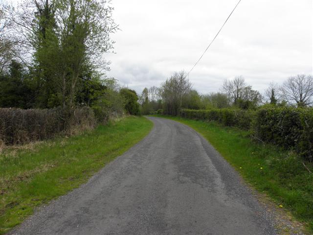
Derryart is a townland in the Civil Parish of Tomregan, Barony of Knockninny, County Fermanagh, Northern Ireland. Etymology The townland name is an anglicisation of the Gaelic placename "Doire Airt" which means 'Art's Oakwood'. The earliest reference is in a grant dated 15 October 1610 which spells it as ''Derarke''. Other spellings in documents are- 1629 Derarke; 1630 Derearte and 1827 Derralt. Geography It is bounded on the north by Drumany More townland, on the east by Derrychorran and Derrylaney townlands, on the south by Garvary townland and on the west by Derrintony townland. Its chief geographical features are the Duvoge River and a drumlin hill reaching to 60 metres above sea-level. The townland is traversed by Derryart Lane. Derryart covers an area of 114 statute acres. History The townland formed part of the ballybethagh of Calvagh in medieval times. As it was a border townland the ownership was contested between the McGovern and Maguire clans. At the time of the 1 ... [...More Info...] [...Related Items...] OR: [Wikipedia] [Google] [Baidu] |
Tomregan
Tomregan ( ga, Tuaim Dreagain, ) is a civil parish in the ancient barony of Tullyhaw. The parish straddles the international border between the Republic of Ireland and Northern Ireland. The largest population centre in the parish is Ballyconnell, County Cavan. The total area of the civil parish is 10,600 statute acres. Most of Tomregan's constituent townlands are situated in County Cavan while the remainder lie in County Fermanagh. In the Catholic Church, the ecclesiastical parish of Tomregan was split in the early 18th century, with the County Fermanagh townlands being assigned to the parish of Knockninny while the County Cavan townlands were united with the parish of Kildallan. The townlands The Fermanagh townlands in Tomregan civil parish are- Aghindisert, Carickaleese, Cloncoohy, Derrintony, Derryart, Garvary, Gortahurk, Gortaree, Gortineddan, Gortmullan, Knockadoois, Knockateggal, Tonymore and Ummera. The Cavan townlands in Tomregan civil parish are- Agharaskilly, ... [...More Info...] [...Related Items...] OR: [Wikipedia] [Google] [Baidu] |
Garvary
Garvary is a townland in the Civil Parish of Tomregan, Barony of Knockninny, County Fermanagh, Northern Ireland. (Disambiguation- see also Garvary (Corlough) townland, County Cavan, Republic of Ireland.) Etymology The townland name is an anglicisation of the Gaelic placename "Garbh Aire" which means 'Rough Land'. The oldest surviving mention of the name is in a grant dated 15 October 1610 where it is spelled 'Garvore'. Spellings in later grants are- 1612 Garwarry; 1629 Garvore and 1630 Garrywarrye. Geography It is bounded on the north by Derrintony and Derryart townlands, on the east by Derrylaney and Derryhooly townlands, on the south by Kiltycrose townland and on the west by Aghindisert & Drumderg townlands. Its chief geographical features are Drumderg Lough, the Duvoge River, Moninea Bog and a drumlin hill reaching to 60 metres above sea-level. The townland is traversed by the C431 Teemore Road and some minor lanes. Garvary covers an area of 249 statute acres. History ... [...More Info...] [...Related Items...] OR: [Wikipedia] [Google] [Baidu] |
Derrintony
Derrintony is a townland in the Civil Parish of Tomregan, Barony of Knockninny, County Fermanagh, Northern Ireland. Etymology The townland name is an anglicisation of the Gaelic placename "Doire an Tonnaigh" which means 'The Oakwood of the Rampart'. The oldest surviving mention of the name is in a grant dated 15 October 1610 where it is spelt 'Derrenteine'. Spellings in later grants are 1612 - Derrintory; 1629 – Derrenteine. Ambrose Leet's 1814 Directory spells the name as ''Derrintunny''. Geography It is bounded on the north by Drumshimuck townland, on the east by Drumany More and Derryart townlands, on the south by Garvary townland and on the west by Aghindisert, Gortaree and Aghintra townlands. Its chief geographical features are the Duvoge River and a drumlin hill reaching 70 metres above sea level. The townland is traversed by Derrintony Lane. Derrintony covers an area of 148 statute acres. History The townland formed part of the ballybethagh of Calvagh in mediev ... [...More Info...] [...Related Items...] OR: [Wikipedia] [Google] [Baidu] |
Townland
A townland ( ga, baile fearainn; Ulster-Scots: ''toonlann'') is a small geographical division of land, historically and currently used in Ireland and in the Western Isles in Scotland, typically covering . The townland system is of Gaelic origin, pre-dating the Norman invasion, and most have names of Irish origin. However, some townland names and boundaries come from Norman manors, plantation divisions, or later creations of the Ordnance Survey.Connolly, S. J., ''The Oxford Companion to Irish History, page 577. Oxford University Press, 2002. ''Maxwell, Ian, ''How to Trace Your Irish Ancestors'', page 16. howtobooks, 2009. The total number of inhabited townlands in Ireland was 60,679 in 1911. The total number recognised by the Irish Place Names database as of 2014 was 61,098, including uninhabited townlands, mainly small islands. Background In Ireland a townland is generally the smallest administrative division of land, though a few large townlands are further divided into h ... [...More Info...] [...Related Items...] OR: [Wikipedia] [Google] [Baidu] |
Knockninny
Knockninny () is a barony in County Fermanagh, Northern Ireland. To its east lies Upper Lough Erne, and it is bordered by four other baronies in Northern Ireland: Clanawley to the north-west; Tirkennedy to the north; Magherastephana to the north-east; and Coole to the east. It also borders two baronies in the Republic of Ireland: Loughtee Lower to the south; and Tullyhaw to the south-west. History Knockninny is believed to takes its name from St. Ninnidh, a 6th-century saint. St. Ninnid is listed as one of the "twelve apostles of Ireland", and bore the epithet of ''Saobhruisc'' meaning "squinting", given rise to the names; "the squinting saint" or "one-eyed saint". The hill of St. Ninnid lies on the southern shore of Upper Lough Erne. Before 1450 there is no mention of this barony's name, however the land is noted as being an early Maguire stronghold, with a MacManus ( ga, Mac Maghnuis) sept of Clan Maguire centered here. List of main settlements *Derrylin List of civil par ... [...More Info...] [...Related Items...] OR: [Wikipedia] [Google] [Baidu] |
County Fermanagh
County Fermanagh ( ; ) is one of the thirty-two counties of Ireland, one of the nine counties of Ulster and one of the six counties of Northern Ireland. The county covers an area of 1,691 km2 (653 sq mi) and has a population of 61,805 as of 2011. Enniskillen is the county town and largest in both size and population. Fermanagh is one of four counties of Northern Ireland to have a majority of its population from a Catholic background, according to the 2011 census. Geography Fermanagh is situated in the southwest corner of Northern Ireland. It spans an area of 1,851 km2 (715 sq; mi), accounting for 13.2% of the landmass of Northern Ireland. Nearly a third of the county is covered by lakes and waterways, including Upper and Lower Lough Erne and the River Erne. Forests cover 14% of the landmass (42,000 hectares). It is the only county in Northern Ireland that does not border Lough Neagh. The county has three prominent upland areas: * the expansive We ... [...More Info...] [...Related Items...] OR: [Wikipedia] [Google] [Baidu] |
Ulster Plantation
The Plantation of Ulster ( gle, Plandáil Uladh; Ulster-Scots: ''Plantin o Ulstèr'') was the organised colonisation (''plantation'') of Ulstera province of Irelandby people from Great Britain during the reign of King James I. Most of the settlers (or ''planters'') came from southern Scotland and northern England; their culture differed from that of the native Irish. Small privately funded plantations by wealthy landowners began in 1606, while the official plantation began in 1609. Most of the colonised land had been confiscated from the native Gaelic chiefs, several of whom had fled Ireland for mainland Europe in 1607 following the Nine Years' War against English rule. The official plantation comprised an estimated half a million acres (2,000 km2) of arable land in counties Armagh, Cavan, Fermanagh, Tyrone, Donegal, and Londonderry. Land in counties Antrim, Down, and Monaghan was privately colonised with the king's support. Among those involved in planning and over ... [...More Info...] [...Related Items...] OR: [Wikipedia] [Google] [Baidu] |
Griffith's Valuation
Griffith's Valuation was a boundary and land valuation survey of Ireland completed in 1868. Griffith's background Richard John Griffith started to value land in Scotland, where he spent two years in 1806-1807 valuing terrain through the examination of its soils. He used 'the Scotch system of valuation' and it was a modified version of this that he introduced into Ireland when he assumed the position of Commissioner of Valuation. Tasks in Ireland In 1825 Griffith was appointed by the British Government to carry out a boundary survey of Ireland. He was to mark the boundaries of every county, barony, civil parish and townland in preparation for the first Ordnance Survey. He completed the boundary work in 1844. He was also called upon to assist in the preparation of a Parliamentary bill to provide for the general valuation of Ireland. This Act was passed in 1826, and he was appointed Commissioner of Valuation in 1827, but did not start work until 1830 when the new 6" maps, became av ... [...More Info...] [...Related Items...] OR: [Wikipedia] [Google] [Baidu] |
Census Of Ireland, 1901
A census is the procedure of systematically acquiring, recording and calculating information about the members of a given population. This term is used mostly in connection with national population and housing censuses; other common censuses include censuses of agriculture, traditional culture, business, supplies, and traffic censuses. The United Nations (UN) defines the essential features of population and housing censuses as "individual enumeration, universality within a defined territory, simultaneity and defined periodicity", and recommends that population censuses be taken at least every ten years. UN recommendations also cover census topics to be collected, official definitions, classifications and other useful information to co-ordinate international practices. The UN's Food and Agriculture Organization (FAO), in turn, defines the census of agriculture as "a statistical operation for collecting, processing and disseminating data on the structure of agriculture, covering th ... [...More Info...] [...Related Items...] OR: [Wikipedia] [Google] [Baidu] |
Census Of Ireland, 1911
The 1911 Census of Ireland was the last census that covered the whole island of Ireland. Censuses were taken at ten-year intervals from 1821 onwards, but the 1921 census was cancelled due to the Irish War of Independence. The original records of the 1821 to 1851 censuses were destroyed by fire at the Four Courts in Dublin during the Irish Civil War, while those between 1861 and 1891 were possibly pulped during the First World War. All that remained were the 1901 and 1911 census, with the latter put online in 2009 by the National Archives of Ireland. Information collected The census information was recorded on the following forms: *Form A, which was completed by the head of the family *Forms B1, B2, and N, which were completed by the census enumerator Head of the family Form A, which was completed by the head of the family, contained the following information for each person in the home on the night of 2 April: *Name and Surname *Relation to Head of Family *Religious Professi ... [...More Info...] [...Related Items...] OR: [Wikipedia] [Google] [Baidu] |


