|
Deadwood River (Idaho)
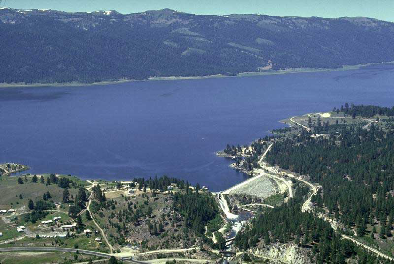
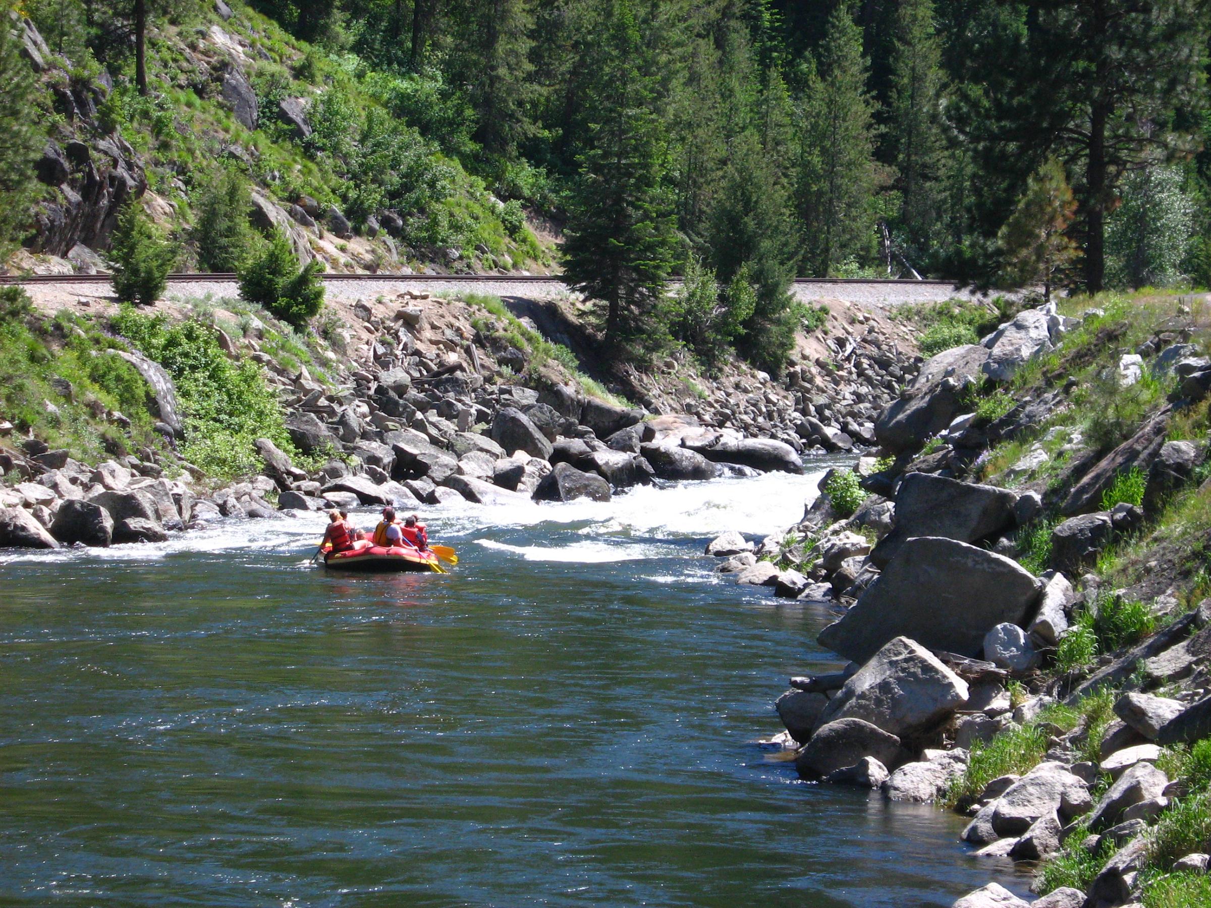
The Deadwood River is a tributary of the South Fork Payette River, flowing through Boise National Forest in Valley and Boise counties, Idaho in the United States. It joins the South Fork Payette River about west of Lowman. The source of the Deadwood River is below the Deadwood summit on forest road 579 in the Salmon River Mountains The Salmon River Mountains are a major mountain range covering most of the central part of the U.S. state of Idaho. The range is over long and its boundaries are usually defined by the Salmon River and its large tributary forks. Part of the centr .... The Deadwood Dam was completed in 1931 and impounded the river to form Deadwood Reservoir. References Rivers of Idaho Rivers of Custer County, Idaho {{Idaho-river-stub ... [...More Info...] [...Related Items...] OR: [Wikipedia] [Google] [Baidu] |
Valley County, Idaho
Valley County is a rural County (United States), county located in the U.S. state of Idaho. As of the 2020 United States Census, 2020 census, the population was 11,746. The county seat is Cascade, Idaho, Cascade, and the largest city is McCall, Idaho, McCall. Established in 1917, it was named after the Long Valley of the North Fork of the Payette River, which extends over from Payette Lake at McCall, Idaho, McCall south to Cascade, Idaho, Cascade to Round Valley. The valley was formerly a summer pasture for livestock from the Treasure Valley, Boise Valley. Since the completion of the Cascade Dam in 1948, much of the northern valley has been covered by the Lake Cascade, Cascade Reservoir. Valley County is home to the Idaho ground squirrel. History Packer John Welch, who had contracted to freight supplies to miners of Idaho City, established a camp on Gold Fork Creek and a brush cabin on Clear Creek in the 1860s. [...More Info...] [...Related Items...] OR: [Wikipedia] [Google] [Baidu] |
Boise County, Idaho
Boise County is a rural mountain county in the U.S. state of Idaho. As of the 2020 United States Census, the population was 7,610. The county seat is historic Idaho City, which is connected through a series of paved and unpaved roads to Lowman, Centerville, Placerville, Pioneerville, Star Ranch, Crouch, Garden Valley, and Horseshoe Bend. Boise County is part of the Boise, ID Metropolitan Statistical Area. The Bogus Basin ski area is in the southwestern part of the county. The county's eastern area contains the central section of the Sawtooth Wilderness, the western part of the Sawtooth National Recreation Area. In 2010, the center of Idaho's population was in Boise County. History The county was established on February 4, 1864, with its county seat at Idaho City. It was named for the Boise River, which was named by French-Canadian explorers and trappers for the great variety of trees growing along its banks in the lower desert valley. The county is one of four Idaho cou ... [...More Info...] [...Related Items...] OR: [Wikipedia] [Google] [Baidu] |
South Fork Payette River
The Payette River () is an U.S. Geological Survey. National Hydrography Dataset high-resolution flowline dataThe National Map accessed May 3, 2011 river in southwestern Idaho and is a major tributary of the Snake River. Its headwaters originate in the Sawtooth and Salmon River Mountains at elevations over . Drainage in the watershed flows primarily from east to west, with the cumulative stream length to the head of the North Fork Payette River being , while to the head of the South Fork the cumulative length is nearly . The combined Payette River flows into an agricultural valley and empties into the Snake River near the city of Payette at an elevation of . The Payette River's drainage basin comprises about . It is a physiographic section of the Columbia Plateau province, which in turn is part of the larger Intermontane Plateaus physiographic division. The South Fork of the Payette has its headwaters in the Sawtooth Wilderness, which is part of the Sawtooth National Recreation A ... [...More Info...] [...Related Items...] OR: [Wikipedia] [Google] [Baidu] |
Boise National Forest
Boise National Forest is a National Forest covering of the U.S. state of Idaho. Created on July 1, 1908, from part of Sawtooth National Forest, it is managed by the U.S. Forest Service as five units: the Cascade, Emmett, Idaho City, Lowman, and Mountain Home ranger districts. The Idaho Batholith underlies most of Boise National Forest, forming the forest's Boise, Salmon River, and West mountain ranges; the forest reaches a maximum elevation of on Steel Mountain. Common land cover includes sagebrush steppe and spruce-fir forests; there are of streams and rivers and of lakes and reservoirs. Boise National Forest contains 75 percent of the known populations of Sacajawea's bitterroot, a flowering plant endemic to Idaho. The Shoshone people occupied the forest before European settlers arrived in the early 19th century. Many of the early settlers were trappers and prospectors before gold was discovered in 1862. After the 1860s Boise Basin gold rush ended, mining of ... [...More Info...] [...Related Items...] OR: [Wikipedia] [Google] [Baidu] |
Idaho
Idaho ( ) is a state in the Pacific Northwest region of the Western United States. To the north, it shares a small portion of the Canada–United States border with the province of British Columbia. It borders the states of Montana and Wyoming to the east, Nevada and Utah to the south, and Washington and Oregon to the west. The state's capital and largest city is Boise. With an area of , Idaho is the 14th largest state by land area, but with a population of approximately 1.8 million, it ranks as the 13th least populous and the 7th least densely populated of the 50 U.S. states. For thousands of years, and prior to European colonization, Idaho has been inhabited by native peoples. In the early 19th century, Idaho was considered part of the Oregon Country, an area of dispute between the U.S. and the British Empire. It officially became U.S. territory with the signing of the Oregon Treaty of 1846, but a separate Idaho Territory was not organized until 1863, instead ... [...More Info...] [...Related Items...] OR: [Wikipedia] [Google] [Baidu] |
Lowman, Idaho
Lowman is a small unincorporated rural census-designated place in the western United States, located in Boise County, Idaho. It is nestled along the north bank of the South Fork of the Payette River in the central part of the state, at an elevation of above sea level. As of the 2010 census, its population was 42. History The community was named for a homesteader, Nathaniel Winfield Lowman, from Polk County, Iowa, who settled there in 1907. Lowman is notable for having a one-room school, one of only a couple hundred still in use in the United States. A devastating wildfire ravaged the area around Lowman in 1989; it destroyed over and 26 structures, but without injuries or fatalities. Geography from Boise on State Highway 21, the "Ponderosa Pine Scenic Byway," Lowman is at the junction with the "Banks-Lowman Highway"; now designated Highway 2512A. It is the "Wildlife Canyon Scenic Byway," which heads west and descends nearly with the whitewater of the South Fork to it ... [...More Info...] [...Related Items...] OR: [Wikipedia] [Google] [Baidu] |
Salmon River Mountains
The Salmon River Mountains are a major mountain range covering most of the central part of the U.S. state of Idaho. The range is over long and its boundaries are usually defined by the Salmon River and its large tributary forks. Part of the central Rocky Mountains, the entire range lies west of the Continental Divide of the Americas and drains to the Snake River. The highest peak is White Mountain, at above sea level. There are five peaks over high, and there are three major subranges defined by other forks of the Salmon River: the West, Central and East Salmon River Mountains. The mountains are an extensive block-shaped massif in central Idaho, with their western boundary defined by the Little Salmon River and the northern and eastern boundary marked by the main stem Salmon. It is a block-shaped region north-south and east-west, covering nearly . The West Salmon River Mountains lie between the Little and South Forks of the Salmon, the Central range is between the South and M ... [...More Info...] [...Related Items...] OR: [Wikipedia] [Google] [Baidu] |
Deadwood Reservoir
Deadwood Reservoir is a reservoir in the western United States, in Valley County, Idaho. Located in the mountains of the Boise National Forest about southeast of Cascade, the body on the Deadwood River is created by Deadwood Dam. The river flows south from the dam and is a tributary of the South Fork of the Payette River. The reservoir and vicinity is commonly used for camping, water skiing, fishing, canoeing, and other outdoor recreation. The full pool surface elevation is just above a mile-high at above sea level. Approved by President Calvin Coolidge in 1928, the isolated site required substantial road building. Construction of the concrete arch dam began in late 1929 and was completed in March 1931. Climate Deadwood Reservoir has a dry summer humid continental climate (Köppen ''Dsb''), with subarctic climate (Köppen Köppen is a German surname. Notable people with the surname include: * Bernd Köppen (born 1951), German pianist and composer * Carl Köppen (1833-1 ... [...More Info...] [...Related Items...] OR: [Wikipedia] [Google] [Baidu] |
Rivers Of Idaho
This is a list of rivers in the U.S. state of Idaho. By drainage basin This list is arranged by drainage basin, with respective tributaries indented under each larger stream's name. Pacific Ocean *''Columbia River (WA)'' ** Snake River ***Palouse River **** Union Flat Creek *** Clearwater River **** Lapwai Creek **** Potlatch River ***** Pine Creek ***** Big Bear Creek ***** Moose Creek **** Big Canyon Creek **** North Fork Clearwater River ***** Elk Creek ***** Little North Fork Clearwater River ***** Beaver Creek ***** Washington Creek (Idaho) *****Orogrande Creek ****** French Creek ***** Weitas Creek ***** Fourth of July Creek ***** Kelly Creek ****Orofino Creek ***** Whiskey Creek *****Canal Gulch ****Jim Ford Creek ****Lolo Creek **** Lawyers Creek ****Middle Fork Clearwater River ***** Lochsa River ******White Sand Creek (meets the Lochsa near Powell Junction) *****Selway River (meets the Lochsa at Lowell) ****** Meadow Creek ****** Moose Creek *******North Fork Moose Creek ... [...More Info...] [...Related Items...] OR: [Wikipedia] [Google] [Baidu] |


