|
DeRidder
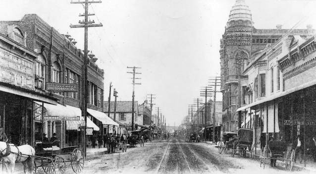
DeRidder is a city in, and the parish seat of, Beauregard Parish, Louisiana, United States. A small portion of the city extends into Vernon Parish. As of the 2010 census DeRidder had a population of 10,578. It is the smaller principal city of the Fort Polk South-DeRidder CSA, a Combined Statistical Area that includes the Fort Polk South ( Vernon Parish) and DeRidder (Beauregard Parish) micropolitan areas, which had a combined population of 87,988 at the 2010 census. History DeRidder was named for Ella de Ridder, the sister-in-law of a Dutch railroad financier, Jan de Goeijen (cf. De Queen, Arkansas). Her family originally came from the small town of Geldermalsen in the Netherlands, where she was one of 13 children. She ran away from home at an early age and was presumed dead by her family, who only later discovered that she had traveled to the United States. The town was named for her by her brother-in-law, who brought the first railroad to that area of Louisiana. Prio ... [...More Info...] [...Related Items...] OR: [Wikipedia] [Google] [Baidu] |
Fort Polk South-DeRidder Combined Statistical Area
The DeRidder-Fort Polk South, LA combined statistical area is made up of two parishes in Central Louisiana, central Louisiana. The statistical area consists of the Fort Polk South, Louisiana, Fort Polk South Vernon Parish, Louisiana, Micropolitan Statistical Area and the DeRidder, Louisiana, DeRidder Beauregard Parish, Louisiana, Micropolitan Statistical Area. As of the United States Census, 2000, 2000 census, the CSA had a population of 85,517 (though a July 1, 2009 estimate placed the population at 120,035). Parishes *Beauregard Parish, Louisiana, Beauregard *Vernon Parish, Louisiana, Vernon Communities *Places with more than 10,000 inhabitants **DeRidder, Louisiana, DeRidder **Fort Polk South, Louisiana, Fort Polk South (Principal city and census-designated place) *Places with 5,000 to 10,000 inhabitants **New Llano, Louisiana, New Llano (Principal city) **Leesville, Louisiana, Leesville *Places with 1,000 to 5,000 inhabitants **Fort Polk North, Louisiana, Fort Polk North (cens ... [...More Info...] [...Related Items...] OR: [Wikipedia] [Google] [Baidu] |
Beauregard Parish, Louisiana
Beauregard Parish (french: Paroisse de Beauregard) is a parish located in the U.S. state of Louisiana. As of the 2010 census, the population was 35,654. The parish seat is DeRidder. The parish was formed on January 1, 1913. Beauregard Parish comprises the DeRidder, LA Micropolitan Statistical Area. The governing body is by the police jury system. History Spanish and French Rule Until 1762, the land that would eventually become Beauregard Parish was a part of the Spanish holdings in Louisiana, as, at that time, the border between Spain and France was acknowledged as the Rio Hondo (now known as the Calcasieu river); however the land between the Rio Hondo and the Sabine river was in some dispute as the French were beginning to occupy land on the west side of the Rio Hondo. In 1762, King Louis XV of France secretly gave Louisiana to Spain in the Treaty of Fontainebleau. From 1762 to 1800, the region was a part of New Spain. In 1800, the secret Third Treaty of San Ildefonso ... [...More Info...] [...Related Items...] OR: [Wikipedia] [Google] [Baidu] |
Vernon Parish, Louisiana
Vernon Parish (French: ''Paroisse de Vernon'') is a parish located in the U.S. state of Louisiana. As of the 2010 census, the population was 52,334. The parish seat is Leesville. Bordered on the west by the Sabine River, the parish was founded in 1871 during the Reconstruction era. It was long a center of the timber industry, which harvested pine in the hills and bottomland hardwoods. Construction of a railway to the area in 1897 stimulated marketing of lumber and businesses in the area. Since World War II, Fort Polk has been most important to the parish economy. The population of the Leesville area rapidly increased fivefold after the fort was opened. Vernon Parish is part of the Fort Polk South, LA Micropolitan Statistical Area, which is also included in the DeRidder-Fort Polk South, LA Combined Statistical Area. History The area comprising Vernon was a part of a tract of land whose control was disputed in the late 18th century between the United States and Spain. The ... [...More Info...] [...Related Items...] OR: [Wikipedia] [Google] [Baidu] |
Fort Polk South, Louisiana
Fort Polk South is a census-designated place (CDP) in Vernon Parish, Louisiana, United States. The population was 11,000 at the 2000 census. Fort Polk South is the larger principal city of the Fort Polk South-DeRidder CSA, a Combined Statistical Area that includes the Fort Polk South (Vernon Parish) and DeRidder (Beauregard Parish) micropolitan areas, , , 2007-05-11. Accessed 2008-08-01. which had a combined population of 85,517 at the [...More Info...] [...Related Items...] OR: [Wikipedia] [Google] [Baidu] |
Fort Polk
Fort Polk is a United States Army installation located in Vernon Parish, Louisiana, about 10 miles (15 km) east of Leesville and 30 miles (50 km) north of DeRidder in Beauregard Parish. It was named to honor Leonidas Polk, the first Episcopal Bishop of the Diocese of Louisiana, a leader of the breakaway Protestant Episcopal Church in the Confederate States of America, and a Confederate general in the American Civil War. It is one of the U.S. Army installations named for Confederate soldiers recommended for renaming by the Congressional Naming Commission; its recommendation is that the post be renamed Fort Johnson.The Naming Commission (Aug 2022Recommendation/ref> The post encompasses about . Some are owned by the Department of the Army and by the U.S. Forest Service, mostly in the Kisatchie National Forest. In 2013, there were 10,877 troops stationed at Fort Polk, which generated an annual payroll of $980 million. Louisiana officials lobbied the Army and the U ... [...More Info...] [...Related Items...] OR: [Wikipedia] [Google] [Baidu] |
Lake Charles, Louisiana
Lake Charles (French: ''Lac Charles'') is the fifth-largest incorporated city in the U.S. state of Louisiana, and the parish seat of Calcasieu Parish, located on Lake Charles, Prien Lake, and the Calcasieu River. Founded in 1861 in Calcasieu Parish, it is a major industrial, cultural, and educational center in the southwest region of the state. As of the 2020 U.S. census, Lake Charles's population was 84,872. The city and metropolitan area of Lake Charles is considered a regionally significant center of petrochemical refining, gambling, tourism, and education, being home to McNeese State University and Sowela Technical Community College. Because of the lakes and waterways throughout the city, metropolitan Lake Charles is often called ''the Lake Area''. History On March 7, 1861, Lake Charles was incorporated as the town of Charleston, Louisiana. Lake Charles was founded by merchant and tradesman Marco Eliche (or Marco de Élitxe) as an outpost. He was a Sephardic Jew ... [...More Info...] [...Related Items...] OR: [Wikipedia] [Google] [Baidu] |
Combined Statistical Area
Combined statistical area (CSA) is a United States Office of Management and Budget (OMB) term for a combination of adjacent metropolitan (MSA) and micropolitan statistical areas (µSA) across the 50 US states and the territory of Puerto Rico that can demonstrate economic or social linkage. CSAs were first designated in 2003. The OMB defines a CSA as consisting of various combinations of adjacent metropolitan and micropolitan areas with economic ties measured by commuting patterns. These areas that combine retain their own designations as metropolitan or micropolitan statistical areas within the larger combined statistical area. The primary distinguishing factor between a CSA and an MSA/µSA is that the social and economic ties between the individual MSAs/µSAs within a CSA are at lower levels than between the counties within an MSA. CSAs represent multiple metropolitan or micropolitan areas that have an employment interchange of at least 15%. CSAs often represent regions wi ... [...More Info...] [...Related Items...] OR: [Wikipedia] [Google] [Baidu] |
Area Code 337
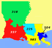
In the North American Numbering Plan, telephone area code 337 covers southwestern Louisiana. It was created in 1999. Until 1999/2000, this area was the southern half of area code 318, which had covered most of Louisiana west of the Mississippi River since 1957. Prior to October 2021, area code 337 had telephone numbers assigned for the central office code 988. In 2020, ''988'' was designated nationwide as a dialing code for the National Suicide Prevention Lifeline, which created a conflict for exchanges that permit seven-digit dialing. This area code was therefore scheduled to transition to ten-digit dialing by October 24, 2021. Cities in the 337 area code * Abbeville, Louisiana * Arnaudville, Louisiana * Baldwin, Louisiana * Basile, Louisiana * Breaux Bridge, Louisiana * Broussard, Louisiana * Cade, Louisiana * Cameron, Louisiana * Carencro, Louisiana * Carlyss, Louisiana * Cecilia, Louisiana * Centerville, Louisiana * Charenton, Louisiana * Church Point, Louisiana * Crowl ... [...More Info...] [...Related Items...] OR: [Wikipedia] [Google] [Baidu] |
De Queen, Arkansas
De Queen ( ) is a city and the county seat of Sevier County, Arkansas, United States. The population was 6,629 at the 2010 census. The placename is the anglicization of the family name of the Dutch merchant and railway financier, Jan de Goeijen (1861–1944). De Goeijen was reportedly rather unhappy with the deformation of his name. Geography De Queen is located at (34.039994, −94.341964). According to the United States Census Bureau, the city has a total area of , of which is land and (1.23%) is water. Demographics 2020 census As of the 2020 United States census, there were 6,105 people, 1,865 households, and 1,380 families residing in the city. 2010 census As of the census of 2010, there were 6,629 people in De Queen. The median age was 29. The ethnic and racial composition of the population was 36.7% non-Hispanic white, 5.6% non-Hispanic black, 2.3% Native American, 0.7% Asian, 35.1% reporting some other race and 4.2% reporting two or more races. 53.5% of the ... [...More Info...] [...Related Items...] OR: [Wikipedia] [Google] [Baidu] |
List Of Cities In Louisiana
A ''list'' is any set of items in a row. List or lists may also refer to: People * List (surname) Organizations * List College, an undergraduate division of the Jewish Theological Seminary of America * SC Germania List, German rugby union club Other uses * Angle of list, the leaning to either port or starboard of a ship * List (information), an ordered collection of pieces of information ** List (abstract data type), a method to organize data in computer science * List on Sylt, previously called List, the northernmost village in Germany, on the island of Sylt * ''List'', an alternative term for ''roll'' in flight dynamics * To ''list'' a building, etc., in the UK it means to designate it a listed building that may not be altered without permission * Lists (jousting), the barriers used to designate the tournament area where medieval knights jousted * ''The Book of Lists'', an American series of books with unusual lists See also * The List (other) * Listing (di ... [...More Info...] [...Related Items...] OR: [Wikipedia] [Google] [Baidu] |
Longleaf Pine
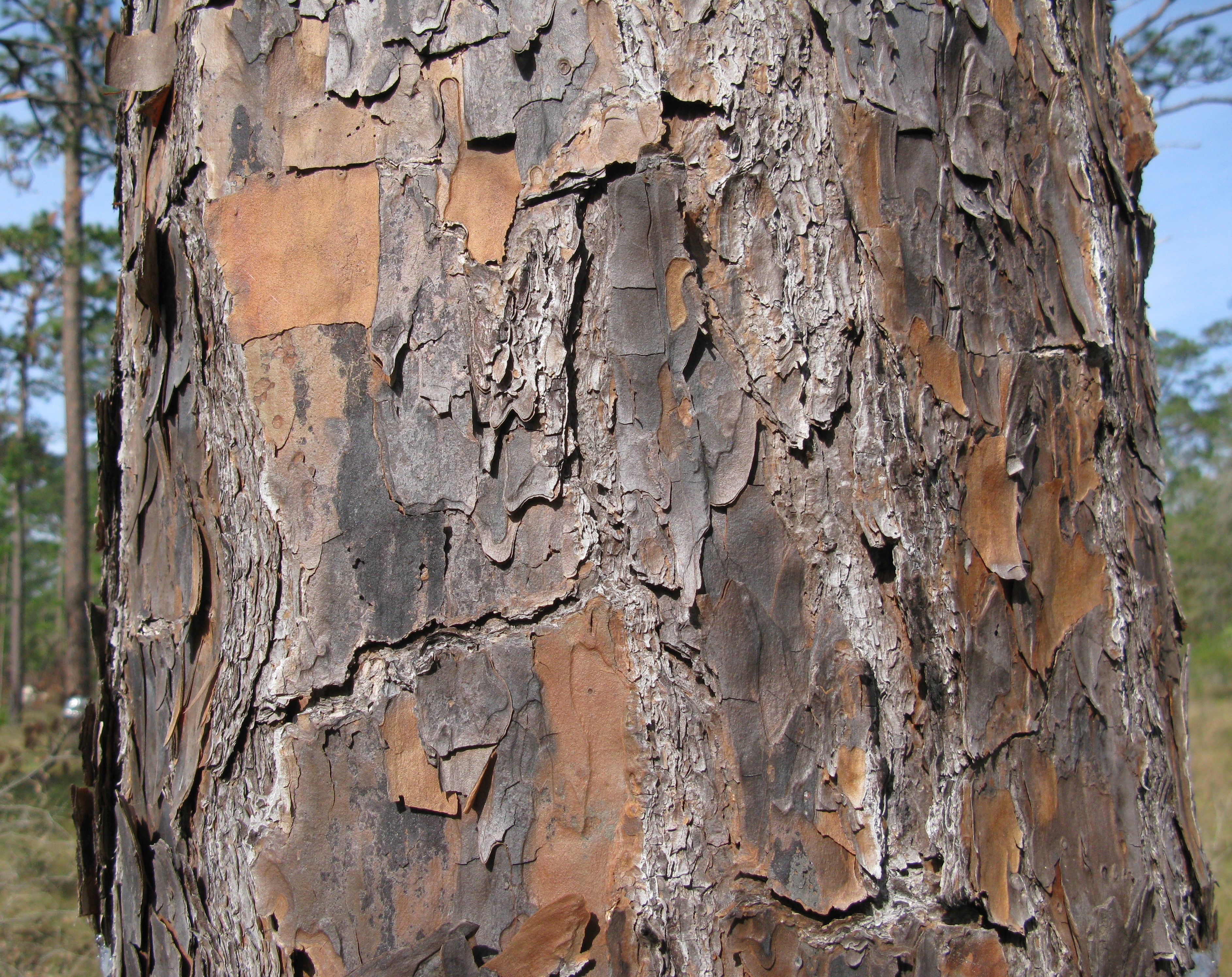
The longleaf pine (''Pinus palustris'') is a pine species native to the Southeastern United States, found along the coastal plain from East Texas to southern Virginia, extending into northern and central Florida. In this area it is also known as "yellow pine" or "long leaf yellow pine", although it is properly just one out of a number of species termed yellow pine. It reaches a height of and a diameter of . In the past, before extensive logging, they reportedly grew to with a diameter of . The tree is a cultural symbol of the Southern United States, being the official state tree of Alabama. Contrary to popular belief, this particular species of pine is not officially the state tree of North Carolina. Description The bark is thick, reddish-brown, and scaly. The leaves are dark green and needle-like, and occur in bundles of mainly three, sometimes two or four, especially in seedlings. They often are twisted and in length. A local race of ''P. palustris'' in a cove near Rockin ... [...More Info...] [...Related Items...] OR: [Wikipedia] [Google] [Baidu] |
Arson
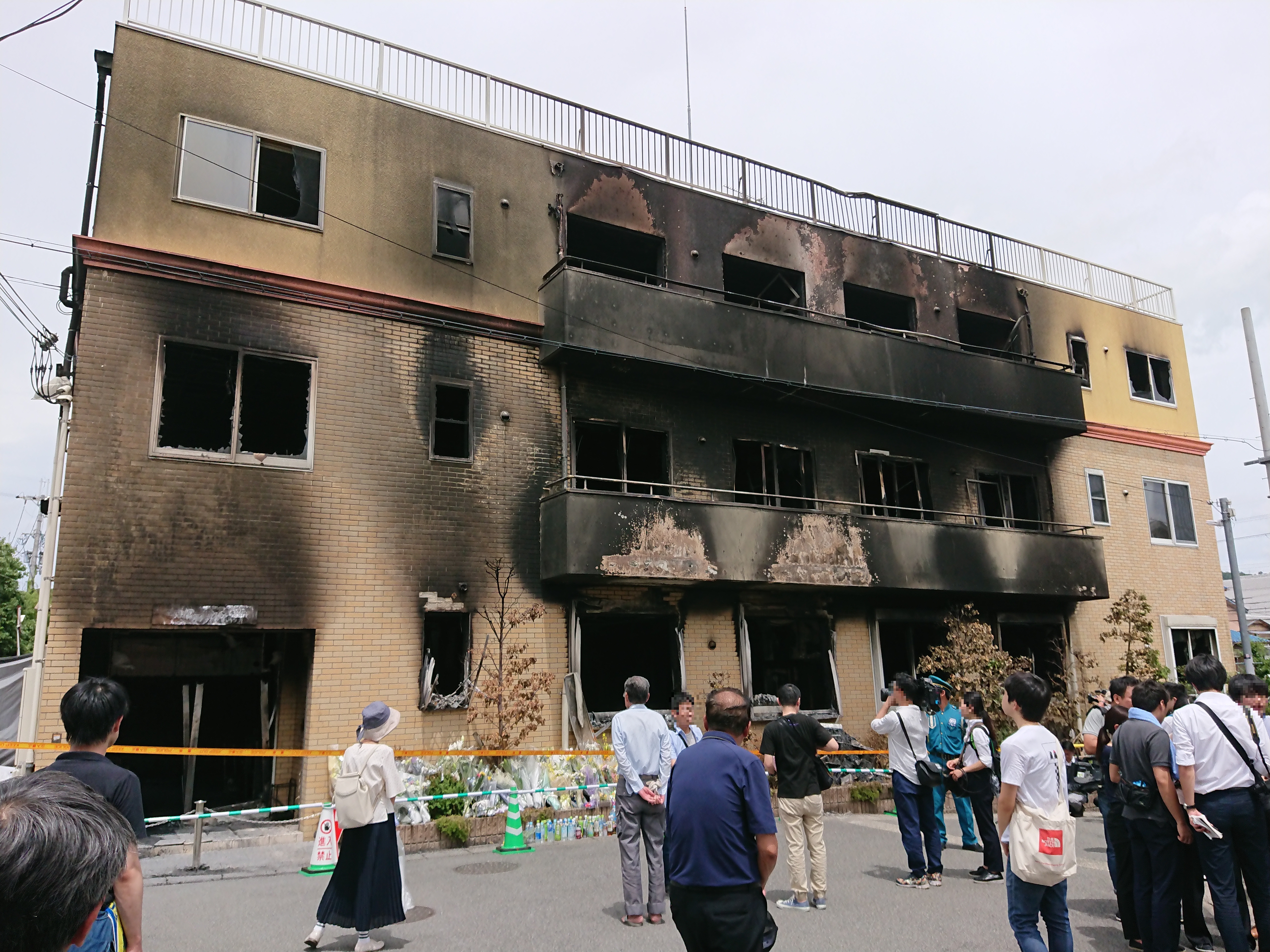
Arson is the crime of willfully and deliberately setting fire to or charring property. Although the act of arson typically involves buildings, the term can also refer to the intentional burning of other things, such as motor vehicles, watercraft, or forests. The crime is typically classified as a felony, with instances involving a greater degree of risk to human life or property carrying a stricter penalty. Arson which results in death can be further prosecuted as manslaughter or murder. A common motive for arson is to commit insurance fraud. In such cases, a person destroys their own property by burning it and then lies about the cause in order to collect against their insurance policy. A person who commits arson is referred to as an arsonist, or a serial arsonist if arson has been committed several times. Arsonists normally use an accelerant (such as gasoline or kerosene) to ignite, propel and directionalize fires, and the detection and identification of ignitable liqui ... [...More Info...] [...Related Items...] OR: [Wikipedia] [Google] [Baidu] |


