|
Datia District
Datia District is in Gwalior Division in the Indian state of Madhya Pradesh. The town of Datia is its district headquarters. History It is an ancient town, mentioned in the Mahabharata. Sahadeva; one of the Pandava brothers had won this kingdom from King Dantavakra. Datia had formerly been a state in the Bundelkhand region. The ruling family were Rajputs of the Bundela clan; they descended from a younger son of a former raja of Orchha. The chief rulers of Datia were Bhagwan Rao, Shubhkaran Rao, Dalpat Rao and Ramchandra and they had good relations with the Mughals. There is a fort palace at Datia, the architecture of which is chiefly Indo-Islamic which partly inspired the chief architect Edward Lutyens, while designing New Delhi. The state was administered as part of the Bundelkhand agency of Central India. It lay in the extreme north-west of Bundelkhand, near Gwalior, and was surrounded on all sides by other princely states of Central India, except on the east where it bordered ... [...More Info...] [...Related Items...] OR: [Wikipedia] [Google] [Baidu] |
List Of Districts Of Madhya Pradesh
The Indian state of Madhya Pradesh came into existence on 1 November 1956. Madhya Pradesh has various geographic regions which have no official administrative governmental status; some correspond to historic countries, states or provinces. Currently, the number of districts in the state is 52. These districts are grouped into ten administrative divisions. Districts are subdivided into tehsils, of which there are 428 in Madhya Pradesh. List of districts There are 52 districts in Madhya Pradesh categorized into ten divisions. All districts share their name with their capital city. Proposed districts A bill giving in-principle approval to the creation of three districts was passed on 19 March 2020. The following districts would be created: * Nagda district * Maihar district * Chachaura district Notes References {{Districts of India Districts A district is a type of administrative division that, in some countries, is managed by the local government. Across the wor ... [...More Info...] [...Related Items...] OR: [Wikipedia] [Google] [Baidu] |
Vidhan Sabha
The State Legislative Assembly, or Vidhan Sabha, or also Saasana Sabha, is a legislative body in the states and union territories of India. In the 28 states and 3 union territories with a unicameral state legislature, it is the sole legislative body and in 6 states it is the lower house of their bicameral state legislatures with the upper house being State Legislative Council. 5 union territories are governed directly by the Union Government of India and have no legislative body. Each Member of the Legislative Assembly (MLA) is directly elected to serve 5-year terms by single-member constituencies. The Constitution of India states that a State Legislative Assembly must have no less than 60 and no more than 500 members however an exception may be granted via an Act of Parliament as is the case in the states of Goa, Sikkim, Mizoram and the union territory of Puducherry which have fewer than 60 members. A State Legislative Assembly may be dissolved in a state of emergency, b ... [...More Info...] [...Related Items...] OR: [Wikipedia] [Google] [Baidu] |
Jhansi District
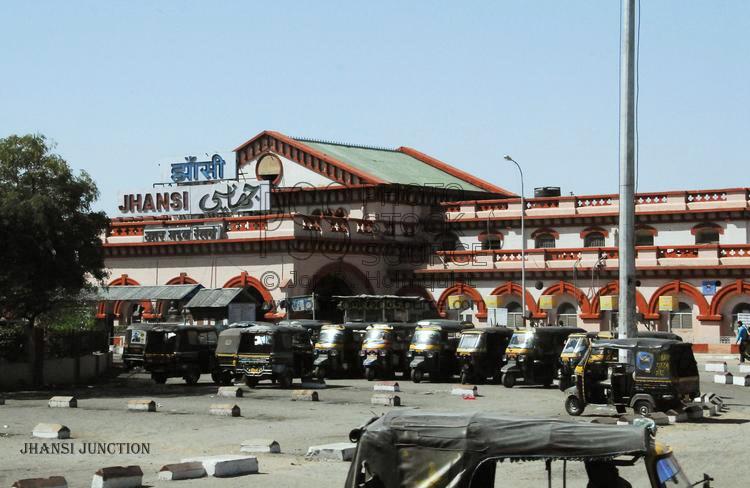
Jhansi district is one of the districts of Uttar Pradesh state in northern India. The city of Jhansi is the district headquarters. The district is bordered on the north by Jalaun District, to the east by Hamirpur and Mahoba districts, to the south by Tikamgarh District of Madhya Pradesh state, to the southwest by Lalitpur District, which is joined to Jhansi District by a narrow corridor, and on the east by the Datia and Bhind districts of Madhya Pradesh. Population 19,98,603 (2011 census). Lalitpur District, which extends into the hill country to the south, was added to Jhansi District in 1891, and made a separate district again in 1974. History In 1861 the city of Jhansi and a dependent territory was ceded to Gwalior State and the capital of the district was moved to Jhansi Naoabad (Jhansi Refounded), a village without "cantonment" (military camp). Jhansi (the old city) became the capital of a "subah" (prov├Łnce) within the state of Gwalior, but in 1886 was returned to Bri ... [...More Info...] [...Related Items...] OR: [Wikipedia] [Google] [Baidu] |
Tehsil
A tehsil (, also known as tahsil, taluka, or taluk) is a local unit of administrative division in some countries of South Asia. It is a subdistrict of the area within a district including the designated populated place that serves as its administrative centre, with possible additional towns, and usually a number of villages. The terms in India have replaced earlier terms, such as '' pargana'' (''pergunnah'') and ''thana''. In Andhra Pradesh and Telangana, a newer unit called mandal (circle) has come to replace the system of tehsils. It is generally smaller than a tehsil, and is meant for facilitating local self-government in the panchayat system. In West Bengal, Bihar, Jharkhand, community development blocks are the empowered grassroots administrative unit, replacing tehsils. As an entity of local government, the tehsil office (panchayat samiti) exercises certain fiscal and administrative power over the villages and municipalities within its jurisdiction. It is the ultimate execu ... [...More Info...] [...Related Items...] OR: [Wikipedia] [Google] [Baidu] |
Bundelkhand
Bundelkhand (, ) is a geographical and cultural region and a proposed state and also a mountain range in central & North India. The hilly region is now divided between the states of Uttar Pradesh and Madhya Pradesh, with the larger portion lying in the latter state. Jhansi is the largest city in Bundelkhand. Another major city of Bundelkhand is Sagar being second largest city of Bundelkhand and headquarter of Sagar Division. Etymology Bundelkhand means "Bundela domain". The region was earlier known as Jejabhukti or Jejakabhukti ("Jeja's province"). According to the inscriptions of the Chandela dynasty, this name derived from Jeja, the nickname of their ruler Jayashakti. However, it is possible that the name derives from an even earlier name of the region: "Jajhauti" or "Jijhoti". After the Bundelas replaced the Chandelas around 14th century, the region came to be known as Bundelkhand after them. History Under the British Raj, Bundelkhand included the princely states of Or ... [...More Info...] [...Related Items...] OR: [Wikipedia] [Google] [Baidu] |
Mahabharata
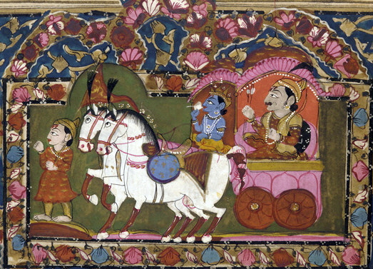
The ''Mah─übh─ürata'' ( ; sa, Óż«Óż╣ÓżŠÓżŁÓżŠÓż░ÓżżÓż«ÓźŹ, ', ) is one of the two major Sanskrit epics of ancient India in Hinduism, the other being the ''R─üm─üyaß╣ća''. It narrates the struggle between two groups of cousins in the Kurukshetra War and the fates of the Kaurava and the P─üß╣ćßĖŹava princes and their successors. It also contains philosophical and devotional material, such as a discussion of the four "goals of life" or ''puruß╣Ż─ürtha'' (12.161). Among the principal works and stories in the ''Mah─übh─ürata'' are the '' Bhagavad Gita'', the story of Damayanti, the story of Shakuntala, the story of Pururava and Urvashi, the story of Savitri and Satyavan, the story of Kacha and Devayani, the story of Rishyasringa and an abbreviated version of the ''R─üm─üyaß╣ća'', often considered as works in their own right. Traditionally, the authorship of the ''Mah─übh─ürata'' is attributed to Vy─üsa. There have been many attempts to unravel its historical growth and c ... [...More Info...] [...Related Items...] OR: [Wikipedia] [Google] [Baidu] |
States And Territories Of India
India is a federal union comprising 28 states and 8 union territories, with a total of 36 entities. The states and union territories are further subdivided into districts and smaller administrative divisions. History Pre-independence The Indian subcontinent has been ruled by many different ethnic groups throughout its history, each instituting their own policies of administrative division in the region. The British Raj mostly retained the administrative structure of the preceding Mughal Empire. India was divided into provinces (also called Presidencies), directly governed by the British, and princely states, which were nominally controlled by a local prince or raja loyal to the British Empire, which held ''de facto'' sovereignty ( suzerainty) over the princely states. 1947ŌĆō1950 Between 1947 and 1950 the territories of the princely states were politically integrated into the Indian union. Most were merged into existing provinces; others were organised into ... [...More Info...] [...Related Items...] OR: [Wikipedia] [Google] [Baidu] |
India
India, officially the Republic of India (Hindi: ), is a country in South Asia. It is the seventh-largest country by area, the second-most populous country, and the most populous democracy in the world. Bounded by the Indian Ocean on the south, the Arabian Sea on the southwest, and the Bay of Bengal on the southeast, it shares land borders with Pakistan to the west; China, Nepal, and Bhutan to the north; and Bangladesh and Myanmar to the east. In the Indian Ocean, India is in the vicinity of Sri Lanka and the Maldives; its Andaman and Nicobar Islands share a maritime border with Thailand, Myanmar, and Indonesia. Modern humans arrived on the Indian subcontinent from Africa no later than 55,000 years ago., "Y-Chromosome and Mt-DNA data support the colonization of South Asia by modern humans originating in Africa. ... Coalescence dates for most non-European populations average to between 73ŌĆō55 ka.", "Modern human beingsŌĆö''Homo sapiens''ŌĆöoriginated in Africa. Then, int ... [...More Info...] [...Related Items...] OR: [Wikipedia] [Google] [Baidu] |
Gwalior Division
Gwalior Division is an administrative subdivision of Madhya Pradesh state in central India. It includes the districts of Ashoknagar, Datia, Guna, Gwalior, and Shivpuri. The historic city of Gwalior is the administrative headquarters of the division. Gwalior and Chambal divisions correspond to the Gird region of Madhya Pradesh, which is mostly a level agricultural plain, dotted with ranges of low hills. The divisions include the northern, contiguous portion of the former princely state of Gwalior together with the former princely state of Datia; the non-contiguous southern portions of the former state of Gwalior are currently part of Bhopal, Indore and Ujjain Ujjain (, Hindustani language, Hindustani pronunciation: Help:IPA/Hindi and Urdu, Ŗd═Ī╦É╩Æ╔ø╦Én is a city in Ujjain district of the States and territories of India, Indian state of Madhya Pradesh. It is the fifth-largest city in Madhya Prad ... divisions. Divisions of Madhya Pradesh Gwalior {{MadhyaPra ... [...More Info...] [...Related Items...] OR: [Wikipedia] [Google] [Baidu] |


