|
Dalwood House
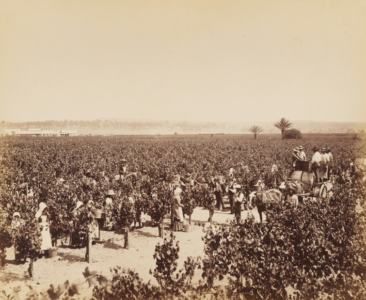
Dalwood House is a heritage-listed homestead and now house museum at Dalwood Road, Branxton, Singleton Council, New South Wales, Australia. It was built from 1829 to 1838 by George Wyndham. It sits in the grounds of the former Wyndham Estate winery (now known as Dalwood Estate). It was added to the New South Wales State Heritage Register on 2 April 1999. History In 1823 David Maziere acquired a 2,000 acre crown land grant in the Hunter Valley. He called the property Anandale Estate and set about fencing stock yards and paddocks and cultivating 60 acres of land. Due to insolvency, Anandale Estate was put up for auction in January 1828 and purchased for 1,200 pounds by George Wyndham. Wyndham and his wife Margaret had arrived in Australia in 1827. They moved to the property early in 1828 and renamed it "Dalwood" after a wooded portion of the Dinton Estate. The construction of Dalwood House began in 1829 and proceeded in stages. Its stone was quarried by convicts and it had t ... [...More Info...] [...Related Items...] OR: [Wikipedia] [Google] [Baidu] |
Branxton, New South Wales
Branxton is a town in the Hunter Region of New South Wales, Australia. Branxton is north of Sydney via the Sydney-Newcastle Freeway and New England Highway. Branxton is located mostly in the City of Cessnock, but part of it is in Singleton Shire. It had a population of 1,991 at the . History Branxton lies on the Traditional Country of the Wonnarua people. After colonisation, the township was initially referred to as Black Creek but in 1848, its name was changed to Branxton as the developer believed that the Black Creek would not attract buyers. As settlers took up further land grants the township expanded capitalizing on trade from settlers heading further north to settle the Liverpool Plains. By 1860 it was a village of 500 residents, a steam mill, post office, a mechanics institute and four hotels. Population In the 2016 Census, there were 1,991 people in Branxton. 87.2% of people were born in Australia and 93.5% of people spoke only English at home. The most common respon ... [...More Info...] [...Related Items...] OR: [Wikipedia] [Google] [Baidu] |
South Australia
South Australia (commonly abbreviated as SA) is a state in the southern central part of Australia. It covers some of the most arid parts of the country. With a total land area of , it is the fourth-largest of Australia's states and territories by area, and second smallest state by population. It has a total of 1.8 million people. Its population is the second most highly centralised in Australia, after Western Australia, with more than 77 percent of South Australians living in the capital Adelaide, or its environs. Other population centres in the state are relatively small; Mount Gambier, the second-largest centre, has a population of 33,233. South Australia shares borders with all of the other mainland states, as well as the Northern Territory; it is bordered to the west by Western Australia, to the north by the Northern Territory, to the north-east by Queensland, to the east by New South Wales, to the south-east by Victoria, and to the south by the Great Australian Bight.M ... [...More Info...] [...Related Items...] OR: [Wikipedia] [Google] [Baidu] |
William Macarthur MLC
William is a masculine given name of Norman French origin.Hanks, Hardcastle and Hodges, ''Oxford Dictionary of First Names'', Oxford University Press, 2nd edition, , p. 276. It became very popular in the English language after the Norman conquest of England in 1066,All Things William"Meaning & Origin of the Name"/ref> and remained so throughout the Middle Ages and into the modern era. It is sometimes abbreviated "Wm." Shortened familiar versions in English include Will, Wills, Willy, Willie, Liam, Bill, and Billy. A common Irish form is Liam. Scottish diminutives include Wull, Willie or Wullie (as in Oor Wullie or the play ''Douglas''). Female forms are Willa, Willemina, Wilma and Wilhelmina. Etymology William is related to the German given name ''Wilhelm''. Both ultimately descend from Proto-Germanic ''*Wiljahelmaz'', with a direct cognate also in the Old Norse name ''Vilhjalmr'' and a West Germanic borrowing into Medieval Latin ''Willelmus''. The Proto-Germanic name is a ... [...More Info...] [...Related Items...] OR: [Wikipedia] [Google] [Baidu] |
Pokolbin, New South Wales
Pokolbin is a rural locality in the Hunter Region of New South Wales Australia. It is part of the Singleton Council local government area and the city of Cessnock. The area is the centre of the Lower Hunter Valley wine region. Pokolbin lies within the Hunter Valley Important Bird Area. History The Darkinjung people (specifically the Wonarua tribe) originally inhabited the Cessnock area, including Pokolbin, for more than 3000 years. They were the major inhabitants at the time of European contact. This contact was disastrous for the Darkinjung people. Many were murdered or died as a result of European diseases. Others were forced onto neighbouring tribal territory and killed. Many lost the will to live and occupied shanty ghettos on the edge of white settlements. Settler pressure on land also constricted traditional tribal and clannish domains, often leading to tribal fighting. Viticulture in the Hunter Valley is often considered to have commenced with James Busby. In the 1820s h ... [...More Info...] [...Related Items...] OR: [Wikipedia] [Google] [Baidu] |
Bukkulla, New South Wales
Bukkulla is a hamlet about north of Inverell and north-east of Bannockburn on the Ashford Road. This hamlet is within the boundaries of Arrawatta County and Inverell Shire, New South Wales, Australia. The village is at an elevation of about 580 metres. In the , there were 145 persons usually resident in the Bukkulla area. History Bukkulla was the name of the property of George Wyndham (1801–1870) and means 'place of leopard tree' or a ‘high black stump’.Keith R. Binney, Horsemen of the First Frontier (1788-1900) and the Serpents Legacy, Volcanic Productions, Sydney, 2005, xxxii + 542 pages; Wyndham was the first official licensee when he held the Macintyre River property in 1839. The 1841 census recorded Bukkulla as having 3 free males, 1 convict there. Wyndham started a vineyard there along with a Thoroughbred horse stud which bred some good horses. The Bukkulla stud also produced some good stockhorses and horses for the India India, officially the Republic ... [...More Info...] [...Related Items...] OR: [Wikipedia] [Google] [Baidu] |
Kyogle
Kyogle () is a town in the Northern Rivers region of northern New South Wales, Australia. It falls within the local government area of Kyogle Council. At the 2016 census, Kyogle had a population of 2,751 people. Kyogle is known as a "gateway" to many national parks including Border Ranges National Park and Toonumbar National Park. History It was founded in the 1830s as a lumber camp, and is located north of Sydney, north of Casino on the Summerland Way close to the Queensland border. It also lies on the banks of the Richmond River. It is the seat of its own shire. Kyogle comes from the Aboriginal Australian 'Bundjalung' word Gayugul, meaning 'Brolga', a reference to the Australian Brolga which is indigenous to the region. Cattle grazing, dairy farming and forestry are the primary industries. In times past, timber getting was the main reason for settlement in the area, with red cedar and hoop pine the main timber trees. Railway Kyogle station is served by the main Nor ... [...More Info...] [...Related Items...] OR: [Wikipedia] [Google] [Baidu] |
John Dunmore Lang
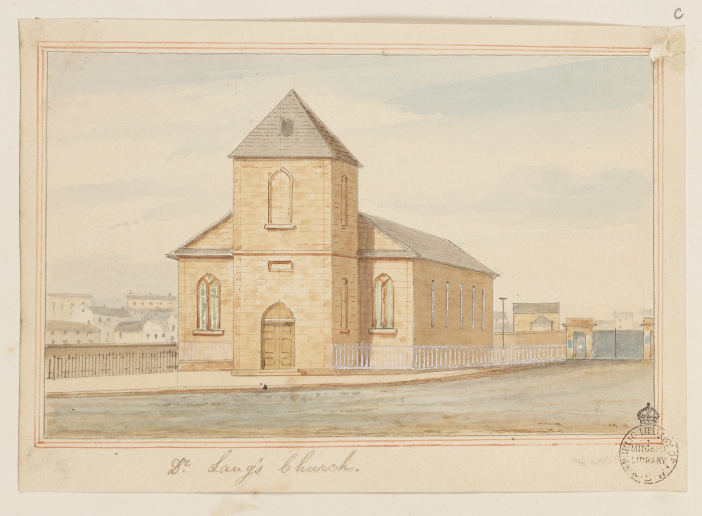
John Dunmore Lang (25 August 1799 – 8 August 1878) was a Scottish-born Australian Presbyterian minister, writer, historian, politician and activist. He was the first prominent advocate of an independent Australian nation and of Australian republicanism. Background and family Lang was born near Greenock, Renfrewshire (now Inverclyde), Scotland, the eldest son of William Lang and Mary Dunmore. His father was a small landowner and his mother a pious Presbyterian, who dedicated her son to the Church of Scotland ministry from an early age. He grew up in nearby Largs and was educated at the school there and at the University of Glasgow, where he excelled, winning many prizes and graduating as a Master of Arts in 1820. Stevenson McGill was his most influential teacher; he also greatly admired Thomas Chalmers. His brother, George, had found employment in New South Wales and Lang decided to join him. He was ordained by the Presbytery of Irvine on 30 September 1822. Arriving in Sydney ... [...More Info...] [...Related Items...] OR: [Wikipedia] [Google] [Baidu] |
Maitland, New South Wales
Maitland () is a city in the Lower Hunter Valley of New South Wales, Australia and the seat of Maitland City Council, situated on the Hunter River approximately by road north of Sydney and north-west of Newcastle. It is on the New England Highway approximately from its origin at Hexham. At the it had approximately 78,015 inhabitants, spread over an area of , with most of the population located in a strip along the New England Highway between the suburbs of Rutherford and Metford respectively. The city centre is located on the right bank of the Hunter River, protected from moderate potential flooding by a levee. Surrounding areas include the cities of Cessnock and Singleton local government areas. History The Wonnarua People were the first known people of this land. They called the area where Maitland is now situated, by the name Bo-un after a species of bird. From around 1816, cedar logging parties from the convict settlement of Newcastle were the first Europeans to ... [...More Info...] [...Related Items...] OR: [Wikipedia] [Google] [Baidu] |
Maitland Mercury
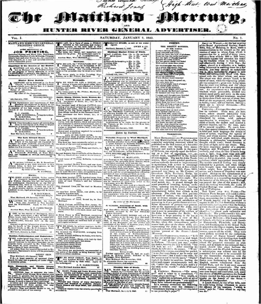
The ''Maitland Mercury'' is Australia's third oldest regional newspaper, preceded only by the ''Geelong Advertiser'' (estab. 1840) and the ''Launceston Examiner'' (estab. 1842). The ''Maitland Mercury'' was established in 1843 when it was called ''The Maitland Mercury and Hunter River General Advertiser''. ''The Maitland Mercury'' is still in circulation serving the city of Maitland and the surrounding Lower Hunter Valley. These days the Maitland Mercury has a weekly print edition which appears on Fridays. History It was originally a weekly newspaper, founded by Richard Jones, an English migrant from Liverpool who also served as treasurer of NSW for a brief period. The first issue was published as ''The Maitland Mercury and Hunter River General Advertiser'' on 7 January 1843. It has been a daily since 1894. when it was issued under two banners as ''The Maitland Daily Mercury'' during the week and ''The Maitland Weekly Mercury'' on Saturdays. From 1870 to 1873, Margaret Falls ... [...More Info...] [...Related Items...] OR: [Wikipedia] [Google] [Baidu] |
Government Gazette Of The State Of New South Wales
The ''Government Gazette of the State of New South Wales'', also known as the ''New South Wales Government Gazette'', is the government gazette of the Government of New South Wales in Australia. The ''Gazette'' is managed by the New South Wales Parliamentary Counsel's Office. History The first ''Government Gazette of the State of New South Wales'' was published in 1832. Prior to the publication of the first issue of the ''Gazette'' on 7 March 1832, official notices were published in the '' Sydney Gazette and New South Wales Advertiser''. The articles in the ''Gazette'' include official notices from municipal councils and government departments about the naming of roads and the acquisition of land as well as changes to legislation and government departments in New South Wales. Government notices, regulations, forms and orders relating to the Port Phillip District were published in the ''Government Gazette of the State of New South Wales'' until Victoria separated from New Sou ... [...More Info...] [...Related Items...] OR: [Wikipedia] [Google] [Baidu] |
Liverpool Plains
The Liverpool Plains are an extensive agricultural area covering about of the north-western slopes of New South Wales in Australia. These plains are a region of prime agricultural land bounded to the east by the Great Dividing Range, to the south by the Liverpool Range and on the west by the Warrumbungle Range. The area is drained by the Namoi River and its tributaries, the Mooki River and the Peel River. There are many depressions, across the plains, which remain as lakes for long periods after heavy rain. These plains are unusual in that many steep hills arise suddenly from the plains. Towns in the Liverpool Plains include Gunnedah, Narrabri, Quirindi, Werris Creek and Tamworth. Smaller villages include Breeza, Carroll, Mullaley and Willow Tree. Most of the region nowadays comes under the jurisdiction of Liverpool Plains Shire Council. However substantial parts of the region also form part of the Gunnedah and Tamworth local government areas. History The Liverpool Pla ... [...More Info...] [...Related Items...] OR: [Wikipedia] [Google] [Baidu] |
Inverell
Inverell is a large town in northern New South Wales, Australia, situated on the Macintyre River, close to the Queensland border. It is also the centre of Inverell Shire. Inverell is located on the Gwydir Highway on the western slopes of the Northern Tablelands. It has a temperate climate. In the , the population of Inverell was 12,057 and the Inverell Shire population was 17,853. History Prior to white settlement, the Gamilaraay Nation (commonly known as Kamilaroi) of Aboriginal peoples lived in and occupied this region. In 1848, Alexander Campbell held the Inverell Station on the Macintyre River. The name derives from the name of Mr. MacIntyre's estate. The word is of Gaelic origin, and signifies "meeting place of the swans"; from "Inver", a meeting place, and "Ell", a swan. The MacIntyre River and Swanbrook Creek join here. The area was also known as "Green Swamp" in the 1850s. Wheat growers, Colin and Rosanna Ross established a store there in 1853, when he asked that a ... [...More Info...] [...Related Items...] OR: [Wikipedia] [Google] [Baidu] |


