|
Daik
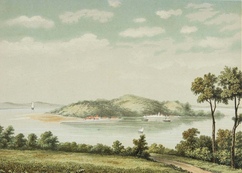
Daik ( Jawi: ; ) is the main village (''kelurahan'') on the island of Lingga of Lingga Regency, in the Riau archipelago in Indonesia. It is located at . History Daik was the capital of the Lingga Sultanate for almost 100 years, from 1819 to 1911. Climate Daik has a tropical rainforest climate A tropical rainforest climate, humid tropical climate or equatorial climate is a tropical climate sub-type usually found within 10 to 15 degrees latitude of the equator. There are some other areas at higher latitudes, such as the coast of southea ... (Af) with heavy rainfall year-round. References Populated places in the Riau Islands Regency seats of the Riau Islands {{RiauIslands-geo-stub ... [...More Info...] [...Related Items...] OR: [Wikipedia] [Google] [Baidu] |
Lingga Sultanate
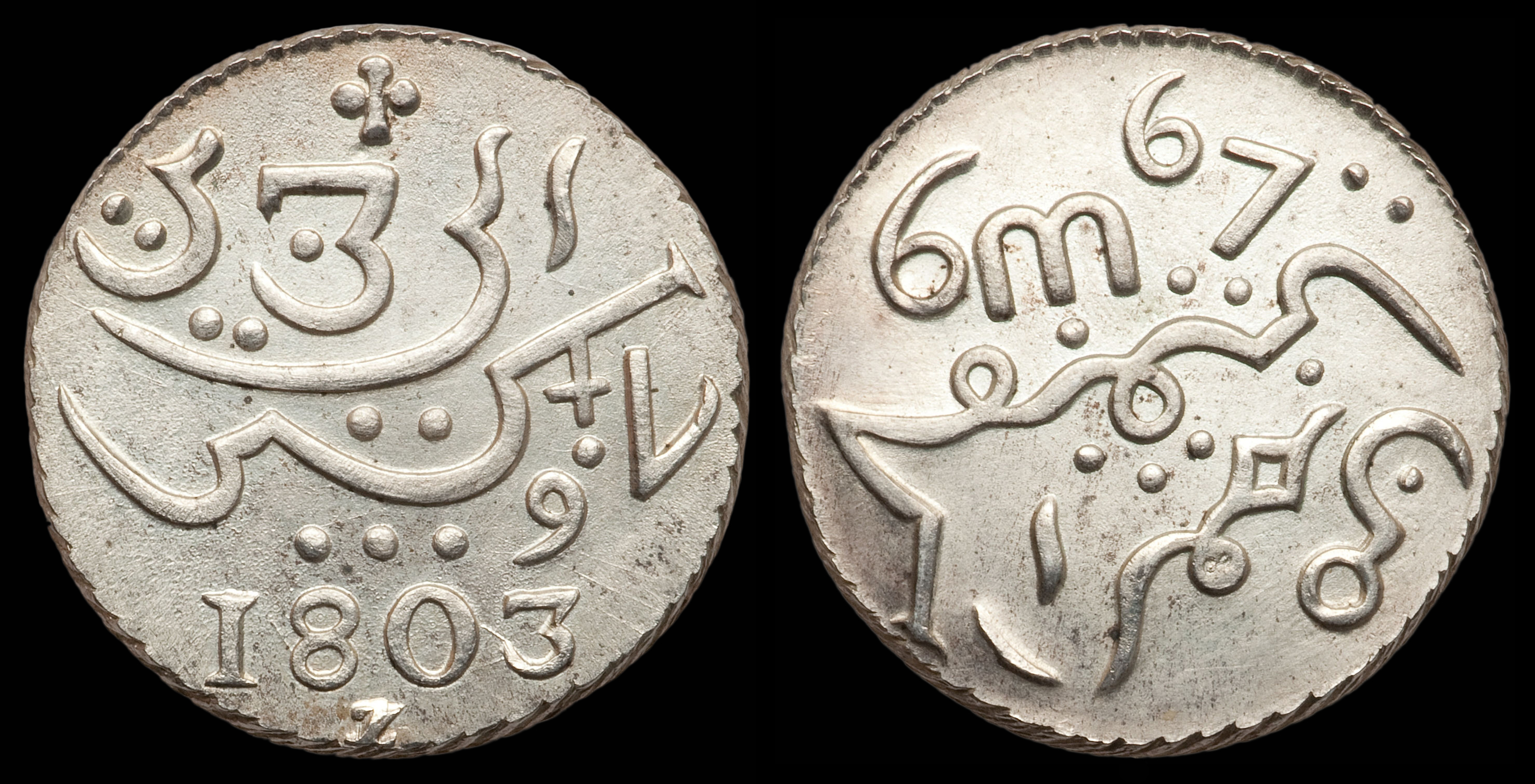
Riau-Lingga Sultanate (Malay/Indonesian: کسلطانن رياوليڠݢ, ''Kesultanan Riau-Lingga''), also known as the Lingga-Riau Sultanate, Riau Sultanate or Lingga Sultanate was a Malay sultanate that existed from 1824 to 1911, before being dissolved following Dutch intervention. The sultanate came into existence as a result of the partition of the Johor-Riau Sultanate that separated Peninsular Johor, together with the island of Singapore, from the Riau archipelago. This partition followed the succession dispute following the death of Mahmud III of Johor, when Abdul Rahman was crowned as the first Sultan of Riau-Lingga. The maritime kingdom was recognised by both the British and the Dutch following the Anglo-Dutch Treaty of 1824. Its historical territory is almost parallel to the present-day Riau Islands Province, Indonesia. History Background The Riau Archipelago became a part of the Malaccan Sultanate after the expansion by Tun Perak in the 15th century, fol ... [...More Info...] [...Related Items...] OR: [Wikipedia] [Google] [Baidu] |
Riau Islands
The Riau Islands ( id, Kepulauan Riau) is a province of Indonesia. It comprises a total of 1,796 islands scattered between Sumatra, Malay Peninsula, and Borneo including the Riau Archipelago. Situated on one of the world's busiest shipping lanes along the Malacca Strait and the South China Sea, the province shares water borders with neighboring countries such as Singapore, Malaysia, and Brunei. The Riau Islands also has a relatively large potential of mineral resources, energy, as well as marine resources. The capital of the province is Tanjung Pinang and the largest city is Batam. The Riau archipelago was once part of the Johor Sultanate, which was later partitioned between the Dutch East Indies and British Malaya after the Anglo-Dutch Treaty of 1824, in which the archipelago fell under Dutch influence. A Dutch protectorate, the Riau-Lingga Sultanate, was established in the region between 1824 and 1911 before being directly ruled by the Dutch East Indies. The archipelago be ... [...More Info...] [...Related Items...] OR: [Wikipedia] [Google] [Baidu] |
Lingga Regency
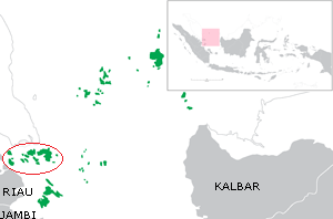
The Lingga Regency ( id, Kabupaten Lingga) is a group of islands in Indonesia, located south of Singapore, along both sides of the equator, off the eastern coast of Riau Province on Sumatra island. They are south of the populated Riau Archipelago, known for the industrial island of Batam and the tourist-frequented island of Bintan, although the Lingga Islands themselves are rarely visited due to the infrequent local transportation. The equator goes through the northern tip of Lingga Island, the main island in the archipelago. Administratively they form a Regency of the Riau Islands Province with an area of 2,266.77 km2 and a population of 86,244 people at the 2010 census and 98,633 at the 2020 census.Badan Pusat Statistik, Jakarta, 2021. The regency seat lies at Daik on Lingga Island. The population are mainly Malay, Bugis and Chinese (predominantly Hakka, Teochew and Hokkien). Name Lingga derives its name from the profile of which is shaped like the Hindu lingam, oft ... [...More Info...] [...Related Items...] OR: [Wikipedia] [Google] [Baidu] |
List Of Regencies And Cities Of Indonesia
Regencies (''kabupaten'') and cities (''kota'') are the second-level administrative subdivision in Indonesia, immediately below the provinces, and above the districts. Regencies are roughly equivalent to American counties, although most cities in the United States are below the counties. Following the implementation of decentralization beginning on 1 January 2001, regencies and city municipalities became the key administrative units responsible for providing most governmental services. Each of regencies and cities has their own local government and legislative body. The difference between a regency and a city lies in demography, size, and economy. Generally, a regency comprises a rural area larger than a city, but also often includes various towns. A city usually has non-agricultural economic activities. A regency is headed by a regent (''bupati''), while a city is headed by a mayor (''wali kota''). All regents, mayors, and members of legislatures are directly elected via ele ... [...More Info...] [...Related Items...] OR: [Wikipedia] [Google] [Baidu] |
Villages Of Indonesia
In Indonesia, village or subdistrict is the fourth-level subdivision below a district, regency/city, and province. There are a number of names and types for villages in Indonesia, with ''desa'' (rural village) being the most frequently used for regencies and ''kelurahan'' (urban village) for cities. According to the 2019 report by the Ministry of Home Affairs, there are 8,488 urban villages and 74,953 rural villages in Indonesia. Types of villages ''Kelurahan'' ''Kelurahan'' is an urban village terminology primarily used in cities, but also tiny parts of regencies. It is commonly translated to English as subdistrict. The leader of ''kelurahan'' is called ''lurah''. A ''lurah'' is a civil servant appointed by the district head. According to the Regulation of the Minister of Home Affairs Number 31 of 2006, a ''kelurahan'' can be created with the following criteria: *Java and Bali: having at least 4,500 residents or 900 families within an area of at least 3 km2. *Sumatra and Su ... [...More Info...] [...Related Items...] OR: [Wikipedia] [Google] [Baidu] |
Time In Indonesia
The Indonesian Archipelago geographically stretches across four time zones from UTC+06:00 in Aceh to UTC+09:00 in Papua. However, the Indonesian government recognises only three time zones in its territory, namely: *Western Indonesia Time (WIB) — seven hours ahead ( UTC+07:00) of the Coordinated Universal Time (UTC); *Central Indonesia Time (WITA) — eight hours ahead ( UTC+08:00) of UTC; *Eastern Indonesia Time (WIT) — nine hours ahead ( UTC+09:00) of UTC. The boundary between the Western and Central time zones was established as a line running north between Java and Bali through the provincial boundaries of West and Central Kalimantan. The border between the Central and Eastern time zones runs north from the eastern tip of Indonesian Timor to the eastern tip of Sulawesi. Daylight saving time (DST) is no longer observed anywhere in Indonesia. Current usage In Indonesia Indonesia, officially the Republic of Indonesia, is a country in Southeast Asia and Oceania b ... [...More Info...] [...Related Items...] OR: [Wikipedia] [Google] [Baidu] |
Tropical Rainforest Climate
A tropical rainforest climate, humid tropical climate or equatorial climate is a tropical climate sub-type usually found within 10 to 15 degrees latitude of the equator. There are some other areas at higher latitudes, such as the coast of southeast Florida, USA, and Okinawa, Japan that fall into the tropical rainforest climate category. They experience high mean annual temperatures, small temperature ranges, and rain that falls throughout the year. Regions with this climate are typically designated ''Af'' by the Köppen climate classification. A tropical rainforest climate is typically hot, very humid, and wet. Description Tropical rain forests have a type of tropical climate in which there is no dry season—all months have an average precipitation value of at least . There are no distinct wet or dry seasons as rainfall is high throughout the months. One day in a tropical rainforest climate can be very similar to the next, while the change in temperature between day and night ... [...More Info...] [...Related Items...] OR: [Wikipedia] [Google] [Baidu] |
Riau Archipelago
The Riau Archipelago is a ''geographic'' term (as opposed to administrative region) for the core group of islands within the Riau Islands Province in Indonesia, and located south of Singapore and east of Riau on Sumatra. Before the province of Riau Islands was formed, there was no ambiguity in term; however, in Indonesian language, both the archipelago and administrative province are referred to as simply "Kepulauan Riau". The province may have the word "Provinsi" preceding it for clarity. Additionally the term BBK for ''Batam Bintan Karimun'' may refer to the archipelago. History The name of this archipelago predates the creation of the Indonesian province, and historically did not include the Lingga Islands or Natuna Islands, which now belong to that province. On the other hand, Singapore was considered a part of the islands, at least in the Islamic eras. Srivijaya and Jambi From 650 CE–1377 CE are accepted dates for the Srivijaya empire, the area seems to be well within t ... [...More Info...] [...Related Items...] OR: [Wikipedia] [Google] [Baidu] |
Lingga Island
Lingga Island is the largest and most populated of the Lingga Islands, Indonesia. It has an area of . It is located south of the Riau Islands off the east coast of Sumatra. The other major island of the archipelago is Singkep Singkep is an island in the Lingga Archipelago in Indonesia. Its area is . It is separated from the east coast of Sumatra by the Berhala Strait. It is surrounded by islands Posik to the west, I. Serak to the SW, I. Lalang to the South, and I. Sela .... Lingga Islands Landforms of the Riau Islands Islands of Sumatra {{RiauIslands-geo-stub ... [...More Info...] [...Related Items...] OR: [Wikipedia] [Google] [Baidu] |
Jawi Script
Jawi (; ace, Jawoë; Kelantan-Pattani Malay, Kelantan-Pattani: ''Yawi''; ) is a writing system used for writing several languages of Southeast Asia, such as Acehnese language, Acehnese, Banjar language, Banjarese, Kerinci language, Kerinci, Maguindanao language, Maguindanaon, Malay language, Malay, Minangkabau language, Minangkabau, Tausug language, Tausūg, and Ternate language, Ternate. Jawi is based on the Arabic script, consisting of all of the original 31 Arabic letters, and six additional letters constructed to fit the phonemes native to Malay, and an additional phoneme used in foreign loanwords, but not found in Classical Arabic, which are ''ca'' ( ), ''nga'' ( ), ''pa'' ( ), ''ga'' ( ), ''va'' ( ), and ''nya'' ( ). Jawi was developed from the Spread of Islam in Southeast Asia, advent of Islam in the Maritime Southeast Asia, supplanting the earlier Brahmic scripts used during Hindu-Buddhist era. The oldest evidence of Jawi writing can be found on the 14th century Tere ... [...More Info...] [...Related Items...] OR: [Wikipedia] [Google] [Baidu] |
Postal Codes In Indonesia
Postal codes in Indonesia, known in Indonesian as ''kode pos'' consist of 5 digits. * The first digit indicates the region in which a given post office falls in, * The second and third digits indicate the regency (''kabupaten'') or city (''kota madya''), * The fourth digit indicates the district or ''kecamatan'' within the ''kabupaten'' or ''kota'', * The fifth digit indicates the commune or village or ''kelurahan/desa''. There is an exception for Jakarta postal codes: * The third digit indicates the district (''kecamatan'') * The fourth digit indicates the urban village (''kelurahan'') * The fifth digit is a "0". There are postal code zones covering the Indonesian provinces or islands as follows: References External linksNomor.net - Kode Pos Indonesia(comprehensive Indonesian postal code database, compiled from government sources) {{Asia topic, Postal codes in Indonesia Indonesia, officially the Republic of Indonesia, is a country in Southeast Asia and Oceania ... [...More Info...] [...Related Items...] OR: [Wikipedia] [Google] [Baidu] |
Telephone Numbers In Indonesia
Telephone numbers in Indonesia have different systems for land lines and mobile phones: land lines use area codes, while mobile phones do not. For land line area codes, the digit "0" is added in front when dialing domestic long distance from within Indonesia, but is always omitted when calling from abroad. Instead, callers would use the Indonesian country code +62, followed by the area code, without the "0". Domestic phone numbers in large cities have 8 digits, and in other areas 7 digits. Mobile phone numbers have a total of 10 to 12 digits for postpaid depending on the operator, whereas prepaid services get 11 to 13 digits determined by the operator. Until October 1999, East Timor was included in the Indonesian telephone numbering plan, using the area codes 0390 (for Dili) and 0399 (for Baucau). To make a phone call to Indonesia from abroad, the following formats are used: For calls to landlines, callers dial +62, followed by the area code and subscriber's number, omitting th ... [...More Info...] [...Related Items...] OR: [Wikipedia] [Google] [Baidu] |


