|
D421 (Croatia)
D421 is a state road connecting D66 state road to Bršica terminal of the Port of Rijeka. The road is long. The road, as well as all other state roads in Croatia, is managed and maintained by Hrvatske ceste Hrvatske ceste (lit. ''Croatian roads'') is a Croatian state-owned company pursuant to provisions of the Croatian Public Roads Act ( hr, Zakon o javnim cestama enacted by the Parliament of the Republic of Croatia. The tasks of the company are def ..., state owned company. Road junctions and populated areas Sources {{State roads in Croatia State roads in Croatia Transport in Istria County ... [...More Info...] [...Related Items...] OR: [Wikipedia] [Google] [Baidu] |
D66 (Croatia)
D66 is a state road in Croatia, connecting A9 motorway with D8 state road in Matulji. D66 road serves as a connection to a number of towns and resorts along the eastern coast of Istria peninsula, including Opatija, Lovran and Ičići, as well as to Brestova ferry port, from which Jadrolinija ferries fly to island of Cres ( D100). The northern terminus of the road also provides a link towards Rijeka via D8 state road and to Matulji interchange on A8 motorway. The road is 90.1 km long. The road, as well as all other state roads in Croatia, is managed and maintained by Hrvatske ceste, a state-owned company. Traffic volume Traffic is regularly counted and reported by Hrvatske ceste, operator of the road. Substantial variations between annual (AADT Annual average daily traffic, abbreviated AADT, is a measure used primarily in transportation planning, transportation engineering and retail location selection. Traditionally, it is the total volume of vehicle traffic ... [...More Info...] [...Related Items...] OR: [Wikipedia] [Google] [Baidu] |
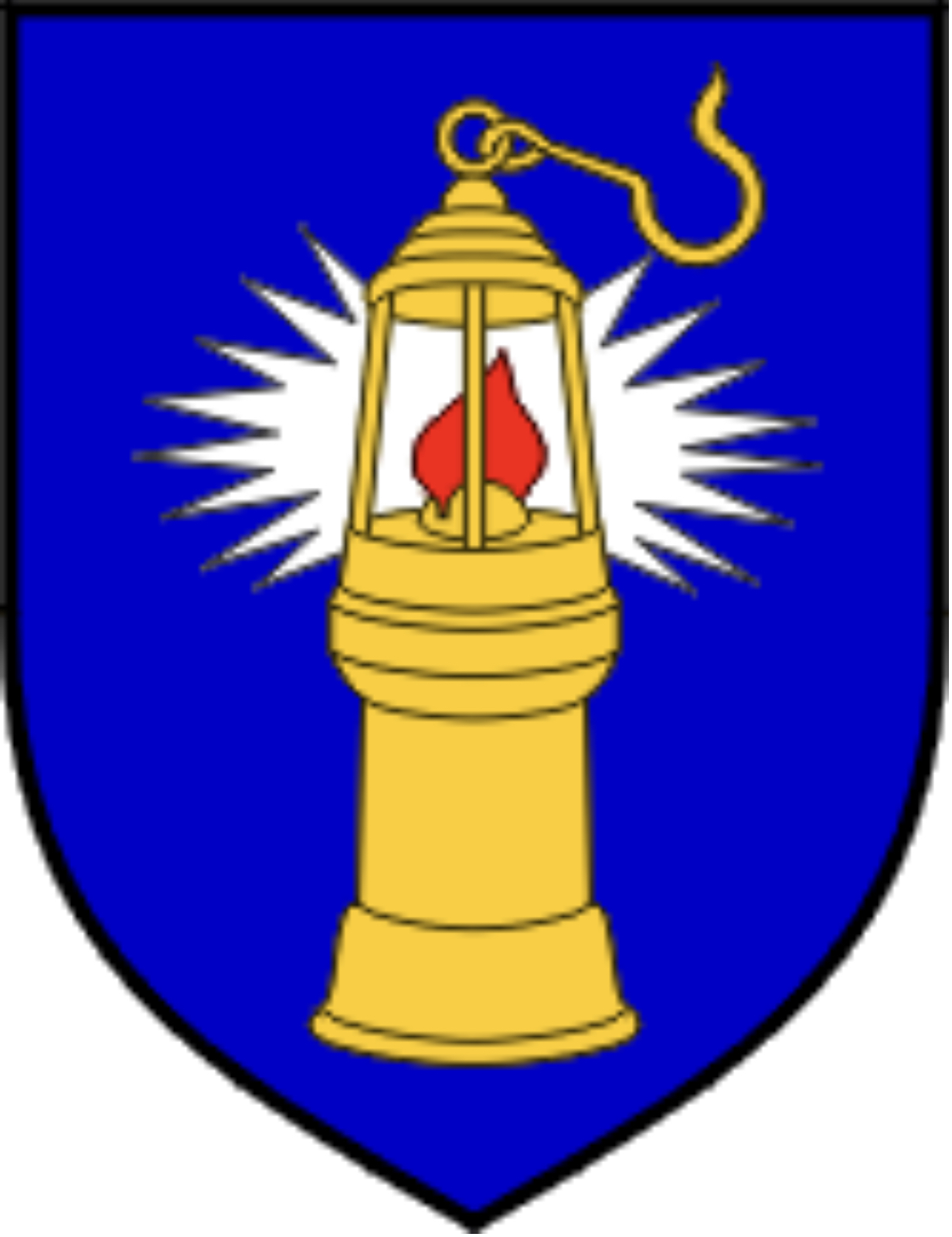
Raša, Istria County
Raša ( it, Arsia, Chakavian: ''Aršija'') is a municipality in the inner part of the Raška Inlet in the south-eastern part of Istria, Croatia. Raša lies southwest of Labin at an elevation of . Situated in the valley of the Krapanski Potok (a tributary of the river Raša), near the former village of Krapan in 1785. Raša was built as a " new town" during 1936-1937 as part of Mussolini Benito Amilcare Andrea Mussolini (; 29 July 188328 April 1945) was an Italian politician and journalist who founded and led the National Fascist Party. He was Prime Minister of Italy from the March on Rome in 1922 until his deposition in 194 ...'s urban colonization of Istria. Planned and designed according to the rationalist principles by architect, Gustavo Pulitzer-Finali from Trieste, Italy, the mining town is organized along a linear axis connecting the Upper and Lower Raša. Lower Raša consists of houses for ordinary miners set along two parallel streets while Upper Raša is ... [...More Info...] [...Related Items...] OR: [Wikipedia] [Google] [Baidu] |
Bršica
Bršica is a port village in Croatia. It is connected by the D421 state road and by ferry. 50km away by sea, or 100km by road, there is a Port of Rijeka The Port of Rijeka ( hr, Luka Rijeka, ) is a seaport in Rijeka, Croatia, located on the shore of the Kvarner Gulf in the Adriatic Sea. The first records of the port date to 1281. It was the main port of the Kingdom of Hungary in the 19th century ... terminal which handles livestock, timber and general cargo. References Bršicaat istra.lzmk.hr Populated places in Istria County {{Istria-geo-stub ... [...More Info...] [...Related Items...] OR: [Wikipedia] [Google] [Baidu] |
Istria County
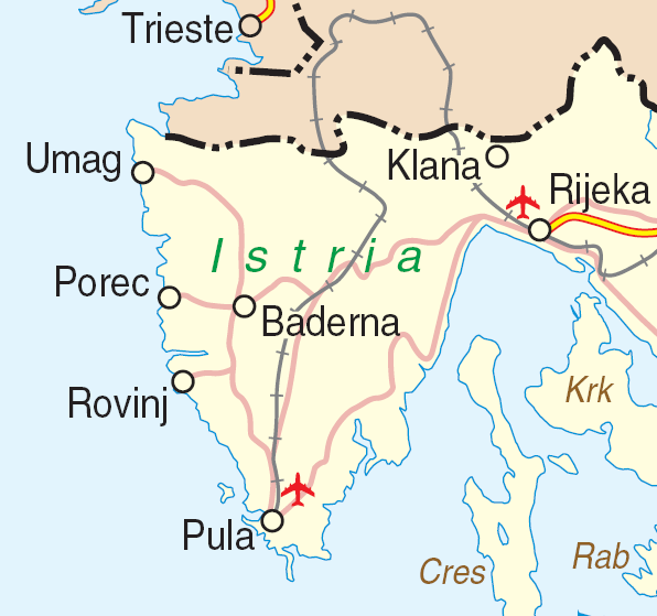
Istria County (; hr, Istarska županija; it, Regione istriana, "Istrian Region") is the westernmost county of Croatia which includes the biggest part of the Istrian peninsula ( out of , or 89%). Administrative centers in the county are Pazin, Pula and Poreč. Istria County is the most prominent Italian-speaking part of Croatia. History The caves near Pula (in latinium ''Pietas Julia''), ''Lim fjord'', ''Šandalja'', and ''Roumald's cave'', house Stone Age archaeological remains. Less ancient Stone Age sites, from the period between 6000 and 2000 BC can also be found in the area. More than 400 locations are classified as Bronze Age (1800–1000 BC) items. Numerous findings including weapons, tools, and jewelry) which are from the earlier iron era around the beginning of common era. The Istrian peninsula was known to Romans as the ''terra magica''. Its name is derived from the Histri, an Illyrian tribe who as accounted by the geographer Strabo lived in the region. Roma ... [...More Info...] [...Related Items...] OR: [Wikipedia] [Google] [Baidu] |
Port Of Rijeka
The Port of Rijeka ( hr, Luka Rijeka, ) is a seaport in Rijeka, Croatia, located on the shore of the Kvarner Gulf in the Adriatic Sea. The first records of the port date to 1281. It was the main port of the History of Hungary 1700–1919, Kingdom of Hungary in the 19th century and the beginning of the 20th century, of Yugoslavia between World War II and 1991, and of Croatia after its independence. Today, it is the largest port in Croatia with a cargo throughput of 13.6 million tonnes (2020), mostly oil, general cargo and bulk cargo, and 344,091 Twenty-foot equivalent units (TEUs). History The first record of a port in Rijeka dates back to 1281, when the Great Council of Venice, Great Council of the Republic of Venice reported a conflict of Venetian merchants and ship owners from Zadar and Rab. In 1719, the Port of Rijeka was granted a charter as a free port by Charles VI, Holy Roman Emperor, Holy Roman Emperor Charles VI, and the first road connecting the port to the hinter ... [...More Info...] [...Related Items...] OR: [Wikipedia] [Google] [Baidu] |
Narodne Novine
''Narodne novine'' () is the official gazette (or newspaper of public record) of the Republic of Croatia which publishes laws, regulations, appointments and official decisions and releases them in the public domain. It is published by the eponymous public company. The Narodne novine started as the ''Novine Horvatzke'', first published on January 6, 1835, by Ljudevit Gaj, who created and printed the paper. The first usage of the term "Narodne novine" was in 1843, but the paper changed several names over the years, usually according to the name of the state that Croatia was part of. Gaj sold the original publishing company to the government in 1868. The current incarnation of the company was officially founded in 1952. In 2001 the company became a public company ( hr, dioničko društvo). The ''Narodne novine'' as the official gazette of the Republic of Croatia promulgates acts, laws and other rules and regulations of the Croatian Parliament, bylaws of the Croatian Government ... [...More Info...] [...Related Items...] OR: [Wikipedia] [Google] [Baidu] |
Hrvatske Ceste
Hrvatske ceste (lit. ''Croatian roads'') is a Croatian state-owned company pursuant to provisions of the Croatian Public Roads Act ( hr, Zakon o javnim cestama enacted by the Parliament of the Republic of Croatia. The tasks of the company are defined by the Public Roads Act and its Founding Declaration, and the principal task of the company is management, construction and maintenance of public roads. In practice, Hrvatske ceste are responsible for the state roads in Croatia (designated with ''D''), while county (''Ž'') and local (''L'') roads are managed by county authorities and the motorways (''A'') are managed by Hrvatske autoceste and other concessionaires. History The company is currently administered by a four-person managing board including chairman Josip Škorić and a three-member supervisory board. The company was first established on 6 April 2001, under the law promulgated on 5 April 2001, with the share capital of the company worth 128,898,200.00 Croatian kuna. Hr ... [...More Info...] [...Related Items...] OR: [Wikipedia] [Google] [Baidu] |
Rijeka
Rijeka ( , , ; also known as Fiume hu, Fiume, it, Fiume ; local Chakavian: ''Reka''; german: Sankt Veit am Flaum; sl, Reka) is the principal seaport and the third-largest city in Croatia (after Zagreb and Split). It is located in Primorje-Gorski Kotar County on Kvarner Bay, an inlet of the Adriatic Sea and in 2021 had a population of 108,622 inhabitants. Historically, because of its strategic position and its excellent deep-water port, the city was fiercely contested, especially between the Holy Roman Empire, Italy and Croatia, changing rulers and demographics many times over centuries. According to the 2011 census data, the majority of its citizens are Croats, along with small numbers of Serbs, Bosniaks and Italians. Rijeka is the main city and county seat of the Primorje-Gorski Kotar County. The city's economy largely depends on shipbuilding (shipyards "3. Maj" and "Viktor Lenac Shipyard") and maritime transport. Rijeka hosts the Croatian National Theatre Ivan pl. ... [...More Info...] [...Related Items...] OR: [Wikipedia] [Google] [Baidu] |
Matulji
Matulji ( it, Mattuglie) is a municipality in Primorje-Gorski Kotar County, Croatia. It is located west of the city of Rijeka, north of the town of Opatija, and it borders Slovenia. Municipality There are a total of 11,246 inhabitants in the municipality, in the following settlements: * Brdce, population 67 * Bregi, population 700 * Brešca, population 159 * Jurdani, population 651 * Jušići, population 861 * Kućeli, population 455 * Lipa, population 129 * Male Mune, population 103 * Mali Brgud, population 134 * Matulji, population 3,731 * Mihotići, population 1,050 * Mučići, population 362 * Pasjak, population 140 * Permani, population 102 * Rukavac, population 854 * Rupa, population 349 * Ružići, population 123 * Šapjane, population 188 * Vele Mune, population 122 * Veli Brgud, population 485 * Zaluki, population 73 * Zvoneće, population 279 * Žejane, population 130 In the 2011 census, 90.87% were Croats. Transport The municipality is of great ... [...More Info...] [...Related Items...] OR: [Wikipedia] [Google] [Baidu] |
A8 (Croatia)
The A8 motorway ( hr, Autocesta A8) is a toll road, toll Motorways in Croatia, motorway in Croatia. It connects the A7 (Croatia), A7 motorway near Rijeka with the road network in the Istrian peninsula via the Učka Tunnel. The road terminates at the Kanfanar interchange with the A9 (Croatia), A9 motorway, which with the A8 motorway forms the Istrian Y road system. The motorway's national significance is reflected in its positive economy of Croatia, economic impact on the cities and towns it connects, as well as its importance to tourism in Croatia. The importance of the motorway for tourism is particularly high during the summer wikt:Peak season, tourist season, when its traffic, traffic volume increases by about 65%. The construction of the A8 motorway and the Istrian Y can be traced back to 1968 when the Croatian Parliament decided to build a modern road linking Istria with the rest of Croatia. Subsequently, a bond to fund the construction was issued. The construction work st ... [...More Info...] [...Related Items...] OR: [Wikipedia] [Google] [Baidu] |


.jpg)


