|
Càrn Nan Gobhar (Strathfarrar)
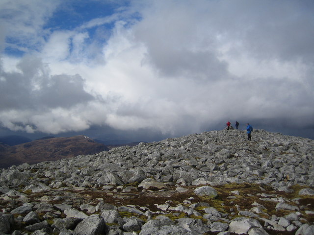
Càrn nan Gobhar is a mountain rising to in the Northwest Highlands of Scotland. It lies north of Glen Strathfarrar and south of Glen Orrin, some 40 kilometres west of the city of Inverness. It is usually climbed along with the neighbouring Munros of Sgurr a' Choire Ghlais and Sgurr na Ruaidhe. Somewhat confusingly there is another Càrn nan Gobhar (Mullardoch), Càrn nan Gobhar, also a Munro with almost the same height, standing 14 kilometres to the south west, on the opposite side of Glen Strathfarrar. References [...More Info...] [...Related Items...] OR: [Wikipedia] [Google] [Baidu] |
Munro
A Munro () is defined as a mountain in Scotland with a height over , and which is on the Scottish Mountaineering Club (SMC) official list of Munros; there is no explicit topographical prominence requirement. The best known Munro is Ben Nevis (Beinn Nibheis), the highest mountain in the British Isles at . Munros are named after Sir Hugh Munro, 4th Baronet (1856–1919), who produced the first list of such hills, known as ''Munro's Tables'', in 1891. Also included were what Munro considered lesser peaks, now known as Munro Tops, which are also over 3,000 feet but are lower than the nearby primary mountain. The publication of the original list is usually considered to be the epoch event of modern peak bagging. The list has been the subject of subsequent variation and as of 10 December 2020, the Scottish Mountaineering Club has listed 282 Munros and 226 Munro Tops. "Munro bagging" is the activity of climbing all the listed Munros. As of 31 December 2021, 7,098 people had reported ... [...More Info...] [...Related Items...] OR: [Wikipedia] [Google] [Baidu] |
Scottish Gaelic Language
Scottish Gaelic ( gd, Gàidhlig ), also known as Scots Gaelic and Gaelic, is a Goidelic language (in the Celtic branch of the Indo-European language family) native to the Gaels of Scotland. As a Goidelic language, Scottish Gaelic, as well as both Irish and Manx, developed out of Old Irish. It became a distinct spoken language sometime in the 13th century in the Middle Irish period, although a common literary language was shared by the Gaels of both Ireland and Scotland until well into the 17th century. Most of modern Scotland was once Gaelic-speaking, as evidenced especially by Gaelic-language place names. In the 2011 census of Scotland, 57,375 people (1.1% of the Scottish population aged over 3 years old) reported being able to speak Gaelic, 1,275 fewer than in 2001. The highest percentages of Gaelic speakers were in the Outer Hebrides. Nevertheless, there is a language revival, and the number of speakers of the language under age 20 did not decrease between the 2001 and 20 ... [...More Info...] [...Related Items...] OR: [Wikipedia] [Google] [Baidu] |
Highland (council Area)
Highland ( gd, A' Ghàidhealtachd, ; sco, Hieland) is a council area in the Scottish Highlands and is the largest local government area in the United Kingdom. It was the 7th most populous council area in Scotland at the 2011 census. It shares borders with the council areas of Aberdeenshire, Argyll and Bute, Moray and Perth and Kinross. Their councils, and those of Angus and Stirling, also have areas of the Scottish Highlands within their administrative boundaries. The Highland area covers most of the mainland and inner-Hebridean parts of the historic counties of Inverness-shire and Ross and Cromarty, all of Caithness, Nairnshire and Sutherland and small parts of Argyll and Moray. Despite its name, the area does not cover the entire Scottish Highlands. Name Unlike the other council areas of Scotland, the name ''Highland'' is often not used as a proper noun. The council's website only sometimes refers to the area as being ''Highland'', and other times as being ''the Hig ... [...More Info...] [...Related Items...] OR: [Wikipedia] [Google] [Baidu] |
Scotland
Scotland (, ) is a country that is part of the United Kingdom. Covering the northern third of the island of Great Britain, mainland Scotland has a border with England to the southeast and is otherwise surrounded by the Atlantic Ocean to the north and west, the North Sea to the northeast and east, and the Irish Sea to the south. It also contains more than 790 islands, principally in the archipelagos of the Hebrides and the Northern Isles. Most of the population, including the capital Edinburgh, is concentrated in the Central Belt—the plain between the Scottish Highlands and the Southern Uplands—in the Scottish Lowlands. Scotland is divided into 32 administrative subdivisions or local authorities, known as council areas. Glasgow City is the largest council area in terms of population, with Highland being the largest in terms of area. Limited self-governing power, covering matters such as education, social services and roads and transportation, is devolved from the Scott ... [...More Info...] [...Related Items...] OR: [Wikipedia] [Google] [Baidu] |
Northwest Highlands
The Northwest Highlands are located in the northern third of Scotland that is separated from the Grampian Mountains by the Great Glen (Glen More). The region comprises Wester Ross, Assynt, Sutherland and part of Caithness. The Caledonian Canal, which extends from Loch Linnhe in the south-west, via Loch Ness to the Moray Firth in the north-east splits this area from the rest of the country. The city of Inverness and the town of Fort William serve as gateways to the region from the south. Geology The geology of the Highlands is complex. Along the western coastal margin it is characterised by Lewisian gneiss, the oldest rock in Scotland. Liathach, Beinn Alligin, Suilven, Cùl Mòr, Cùl Beag, and Quinag are just some of the impressive rock islands of the significantly younger rich brown-coloured Torridonian sandstone which rests on the gneiss. Some of the peaks, such as Beinn Eighe and Canisp, are topped with later light grey or white Cambrian quartzite. Cambro-Ordovician li ... [...More Info...] [...Related Items...] OR: [Wikipedia] [Google] [Baidu] |
Ordnance Survey
, nativename_a = , nativename_r = , logo = Ordnance Survey 2015 Logo.svg , logo_width = 240px , logo_caption = , seal = , seal_width = , seal_caption = , picture = , picture_width = , picture_caption = , formed = , preceding1 = , dissolved = , superseding = , jurisdiction = Great BritainThe Ordnance Survey deals only with maps of Great Britain, and, to an extent, the Isle of Man, but not Northern Ireland, which has its own, separate government agency, the Ordnance Survey of Northern Ireland. , headquarters = Southampton, England, UK , region_code = GB , coordinates = , employees = 1,244 , budget = , minister1_name = , minister1_pfo = , chief1_name = Steve Blair , chief1_position = CEO , agency_type = , parent_agency = , child1_agency = , keydocument1 = , website = , footnotes = , map = , map_width = , map_caption = Ordnance Survey (OS) is the national mapping agency for Great Britain. The agency's name indicates its original military purpose (se ... [...More Info...] [...Related Items...] OR: [Wikipedia] [Google] [Baidu] |
Glen Strathfarrar
Glen Strathfarrar ( gd, Srath Farair) is a glen in the Highland region of Scotland, near Loch Ness. The Glen is part of the Affric-Beauly hydro-electric power scheme, with a dam at Loch Monar and a 9 km tunnel carrying water to an underground power station at Deanie; a second dam just below Loch Beannacharan feeds a tunnel carrying water to Culligran power station (also underground). The Monar dam at Loch Monar is the largest arch dam in Britain. The central section of Glen Strathfarrar (covering 4027 ha) is designated as a national scenic area, one of forty such areas in Scotland, which have been defined so as to identify areas of exceptional scenery and to ensure its protection from inappropriate development. The area covered by the NSA represents the section of the glen least affected by the hydro-electric scheme, and includes the Culligran Falls. Etymology Glen Strathfarrar is named for the River Farrar, recorded in Roman times as ''Varrar''. The name is from ' ... [...More Info...] [...Related Items...] OR: [Wikipedia] [Google] [Baidu] |
Glen Orrin
A glen is a valley, typically one that is long and bounded by gently sloped concave sides, unlike a ravine, which is deep and bounded by steep slopes. Whittow defines it as a "Scottish term for a deep valley in the Highlands" that is "narrower than a strath".. The word is Goidelic in origin: ''gleann'' in Irish and Scottish Gaelic, ''glion'' in Manx. The designation "glen" also occurs often in place names. Etymology The word is Goidelic in origin: ''gleann'' in Irish and Scottish Gaelic, ''glion'' in Manx. In Manx, ''glan'' is also to be found meaning glen. It is cognate with Welsh ''glyn''. Examples in Northern England, such as Glenridding, Westmorland, or Glendue, near Haltwhistle, Northumberland, are thought to derive from the aforementioned Cumbric cognate, or another Brythonic equivalent. This likely underlies some examples in Southern Scotland. As the name of a river, it is thought to derive from the Irish word ''glan'' meaning clean, or the Welsh word ... [...More Info...] [...Related Items...] OR: [Wikipedia] [Google] [Baidu] |
Inverness
Inverness (; from the gd, Inbhir Nis , meaning "Mouth of the River Ness"; sco, Innerness) is a city in the Scottish Highlands. It is the administrative centre for The Highland Council and is regarded as the capital of the Highlands. Historically it served as the county town of the county of Inverness-shire. Inverness lies near two important battle sites: the 11th-century battle of Blàr nam Fèinne against Norway which took place on the Aird, and the 18th century Battle of Culloden which took place on Culloden Moor. It is the northernmost city in the United Kingdom and lies within the Great Glen (Gleann Mòr) at its northeastern extremity where the River Ness enters the Beauly Firth. At the latest, a settlement was established by the 6th century with the first royal charter being granted by Dabíd mac Maíl Choluim (King David I) in the 12th century. Inverness and Inverness-shire are closely linked to various influential clans, including Clan Mackintosh, Clan Fraser and Cl ... [...More Info...] [...Related Items...] OR: [Wikipedia] [Google] [Baidu] |
Càrn Nan Gobhar (Mullardoch)
Càrn nan Gobhar is a mountain rising to in the Northwest Highlands of Scotland. It stands on the northern side of Loch Mullardoch in the upper part of Glen Cannich, in a remote group of four Munros informally known as "The Mullardochs" which form the high ground between Loch Mullardoch and Loch Monar. Overview Càrn nan Gobhar reaches a height of 993 metres (3258 feet) and qualifies as a Munro and a Marilyn (hill), Marilyn. Somewhat confusingly there is another Càrn nan Gobhar (Strathfarrar), Càrn nan Gobhar, also a Munro with exactly the same height situated 14 kilometres to the north east on the northern side of Glen Strathfarrar. Càrn nan Gobhar is the lowest of the four Munros on the north shore of Loch Mullardoch and is rather overshadowed by them. Topographically it is quite featureless, being mainly composed of rolling grassy slopes interspersed with patches of rock and scree, though with steeper slopes on the west and east flanks. The hill's name transla ... [...More Info...] [...Related Items...] OR: [Wikipedia] [Google] [Baidu] |


