|
Cushendall
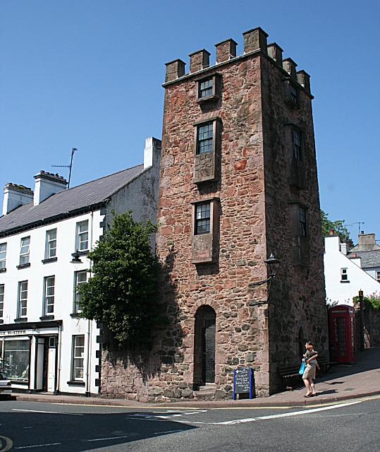
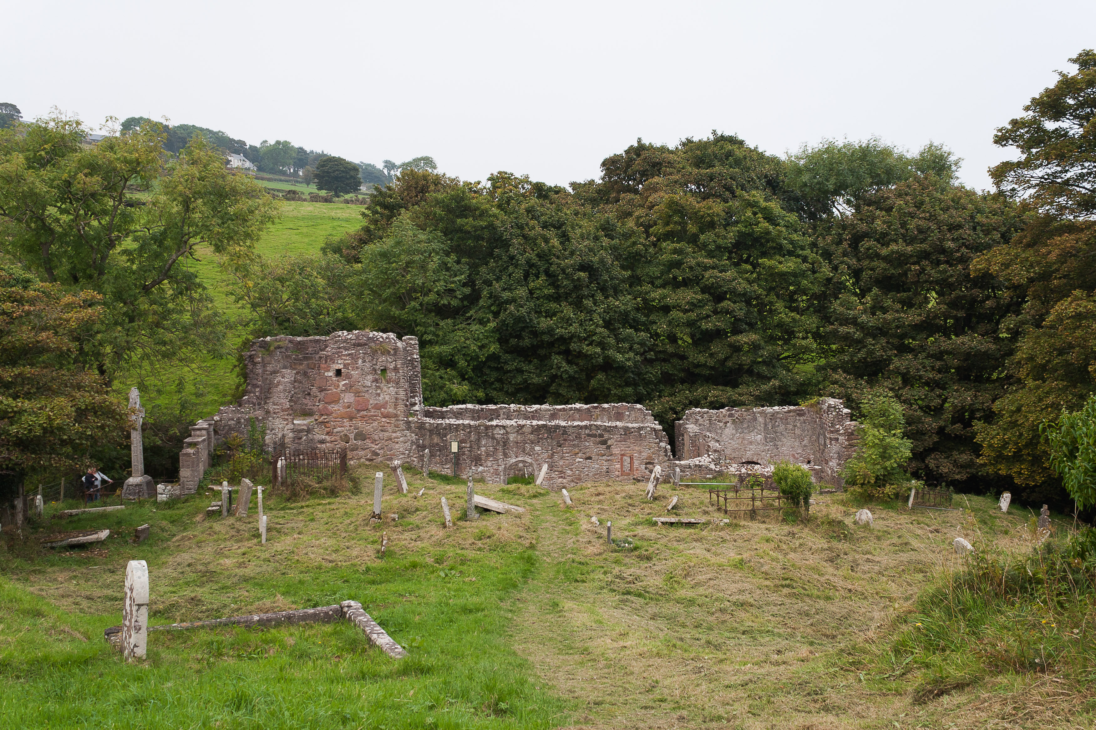
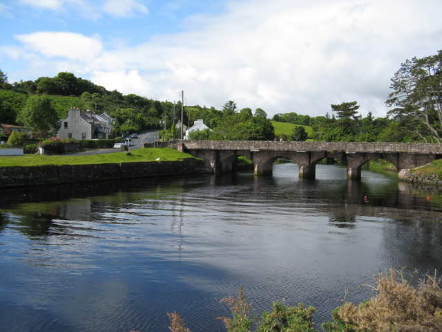
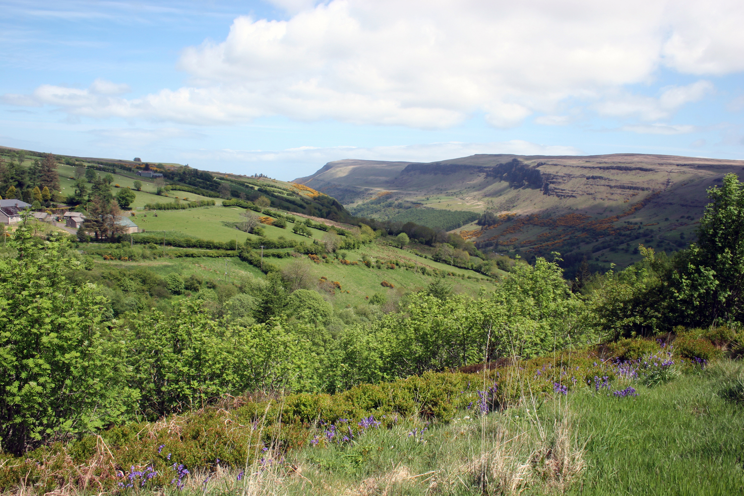
Cushendall (), formerly known as Newtownglens, is a coastal village and townland (of 153 acres) in County Antrim, Northern Ireland. It is located in the historic barony of Glenarm Lower and the civil parish of Layd, and is part of Causeway Coast and Glens district. Located on the A2 coast road between Glenariff and Cushendun, Cushendall is in the Antrim Coast and Glens an Area of Outstanding Natural Beauty. It lies in the shadow of the table topped Lurigethan Mountain and at the meeting point of three of the Glens of Antrim: Glenaan, Glenballyemon and Glencorp. This part of the Northern Irish coastline is separated from Scotland by the North Channel, with the Mull of Kintyre about 16 miles away. In the 2011 Census, Cushendall had a population of 1,280 people. This article contains quotations from this source, which is available under thOpen Government Licence v3.0 © Crown copyright. Much of the historic character of the 19th century settlement on the north bank ... [...More Info...] [...Related Items...] OR: [Wikipedia] [Google] [Baidu] |
Layd
Layd is a civil parish and townland (of 219 acres) in County Antrim, Northern Ireland. It is situated in the historic barony of Glenarm Lower. Civil parish of Layd The civil parish contains the following villages: *Cushendall * Knocknacarry Townlands The civil parish contains the following townlands: A Aganlane (also known as Parkmore), Aghagheigh, Agolagh, Altmore Lower, Altmore Upper B Ballyagan, Ballybrack, Ballyfad, Ballymacdoe, Ballynahaville, Ballynalougher, Ballyvooly, Baraghilly, Barard, Bellisk (also known as Waterford) C Callisnagh, Carnahagh, Carnanee, Carnasheeran, Cashlan, Clegnagh, Cloghglass (also known as Retreat), Cloghglass, Cloghs, Cloghy East, Cloghy West, Cloney, Corlane, Coshkib, Culbidag D Doory, Dromore, Drumcudree, Drumnacur, Drumnasmear, Dunouragan E Eagle Hill (also known as Ouna), Ellanabough, Eshcry F Fallinerlea, Falmacrilly, Falnaglass, Faughill, Foriff G Glasmullen, Glebe, Glenaan, Glenville (a ... [...More Info...] [...Related Items...] OR: [Wikipedia] [Google] [Baidu] |
Causeway Coast And Glens
Ulster Scots: ''Causey Coast an Glens'' , settlement_type = Borough , image_skyline = , imagesize = , image_alt = , image_caption = , image_shield = , shield_size = , shield_alt = , shield_link = , image_map = Causeway_Coast_and_Glens_district_in_Northern_Ireland.svg , mapsize = 150px , map_alt = , map_caption = , subdivision_type = Sovereign state , subdivision_name = United Kingdom , subdivision_type1 = Constituent country , subdivision_type2 = , subdivision_type3 = , subdivision_type4 = Status , subdivision_type5 = Admin HQ , subdivision_name1 = Northern Ireland , subdivision_name2 = , subdivision_name3 = , subdivision_name4 = District , subdivision_name5 = Coleraine , established_title1 = Incorporated ... [...More Info...] [...Related Items...] OR: [Wikipedia] [Google] [Baidu] |
County Antrim
County Antrim (named after the town of Antrim, ) is one of six counties of Northern Ireland and one of the thirty-two counties of Ireland. Adjoined to the north-east shore of Lough Neagh, the county covers an area of and has a population of about 618,000. County Antrim has a population density of 203 people per square kilometre or 526 people per square mile. It is also one of the thirty-two traditional counties of Ireland, as well as part of the historic province of Ulster. The Glens of Antrim offer isolated rugged landscapes, the Giant's Causeway is a unique landscape and a UNESCO World Heritage Site, Bushmills produces whiskey, and Portrush is a popular seaside resort and night-life area. The majority of Belfast, the capital city of Northern Ireland, is in County Antrim, with the remainder being in County Down. According to the 2001 census, it is currently one of only two counties of the Island of Ireland in which a majority of the population are from a Protesta ... [...More Info...] [...Related Items...] OR: [Wikipedia] [Google] [Baidu] |
A2 Road (Northern Ireland)
The A2 is a major road in Northern Ireland, a considerable length of which is often referred to the Antrim Coast Road because much of it follows the scenic coastline of County Antrim; other parts of the road follow the coasts in Counties Down and Londonderry. Mainly a single lane in each direction, the road follows most of the coastline of Northern Ireland. It is connected in several places to other major roads. Route The road begins in the city of Newry, County Down and heads south-east through the fishing towns of Warrenpoint, Rostrevor and Kilkeel. After Dundrum the road continues via Ardglass to Strangford, where it uses a ferry across Strangford Lough to reach Portaferry. From there it meets the Irish Sea coast of the Ards Peninsula at Cloughey, and follows it through Portavogie, Ballyhalbert, Millisle and Donaghadee to Bangor, County Down, from where it becomes a major dual carriageway leading to Belfast. After its intersection with the M3, it continues through ... [...More Info...] [...Related Items...] OR: [Wikipedia] [Google] [Baidu] |
Cushendun
Cushendun () is a small coastal village in County Antrim, Northern Ireland. It sits off the A2 coast road between Cushendall and Ballycastle. It has a sheltered harbour and lies at the mouth of the River Dun and Glendun, one of the nine Glens of Antrim. The Mull of Kintyre in Scotland is only about 15 miles away across the North Channel and can be seen easily on clear days. In the 2001 Census it had a population of 138 people. It is part of Causeway Coast and Glens district. The hamlet of Knocknacarry is nearby. History Cushendun is where Shane O'Neill, chief of the Tyrone O'Neill dynasty, was killed by the MacDonnells in 1567. Cushendun village was designed for Ronald McNeill, the Conservative MP and author, later Lord Cushendun, in the style of a Cornish village by the architect Clough Williams-Ellis. He is buried in the Church of Ireland graveyard near his nationalist cousin Ada or Ide McNeill, Roger Casement's friend and admirer who died in 1959. The National Tr ... [...More Info...] [...Related Items...] OR: [Wikipedia] [Google] [Baidu] |
Glenarm Lower
Glenarm Lower is a barony in County Antrim, Northern Ireland. To its east runs the east-Antrim coast, and it is bordered by five other baronies: Cary to the north; Dunluce Lower and Kilconway to the west; Antrim Lower to the south-west; and Glenarm Upper to the south-east. Geographical features Geographical features of Glenarm Lower include: *Lurigethan hill *Collin Top, Tievebulliagh, and Trostan mountains *Glencloy valley List of settlements Below is a list of settlements in Glenarm Lower: Villages *Carnlough *Cushendall * Waterfoot *Glenarm Hamlets and population centres *Carnalbanagh Sheddings *Feystown *Garronpoint *Straidkelly List of civil parishes Below is a list of civil parishes in Glenarm Lower: *Ardclinis Ardclinis () is a civil parish and townland (of 35 acres) in County Antrim, Northern Ireland. It is situated in the historic barony of Glenarm Lower. Civil parish of Ardclinis The civil parish covers areas within the boundaries of Causeway Coas ... *Grange ... [...More Info...] [...Related Items...] OR: [Wikipedia] [Google] [Baidu] |
Bill Drummond
William Ernest Drummond (born 29 April 1953) is a Scottish artist, musician, writer, and record producer. He was a co-founder of the late-1980s avant-garde pop group the KLF and its 1990s media-manipulating successor, the K Foundation, with which he famously burned £1 million in 1994. More recent art activities, carried out under Drummond's banner of Penkiln Burn, include making and distributing cakes, soup, flowers, beds, and shoe-shines. More recent music projects include No Music Day and the international tour of a choir called The17. Drummond is the author of several books about art and music. Background William Ernest Drummond was born in Butterworth, South Africa, where his father was a minister for the Church of Scotland. His family moved back to Scotland when he was 18 months old, and his early years were spent in the town of Newton Stewart. He moved to Corby, Northamptonshire at the age of 11. It was here that he first became involved in performing as a musicia ... [...More Info...] [...Related Items...] OR: [Wikipedia] [Google] [Baidu] |
Glens Of Antrim
The Glens of Antrim,Logainm.ie ( Placenames Database of Ireland) known locally as simply The Glens, is a region of County Antrim, Northern Ireland. It comprises nine s (valleys), that radiate from the Antrim Plateau to the coast. The Glens are an area of outstanding natural beauty and are a major tourist attraction in north Antrim. The ... [...More Info...] [...Related Items...] OR: [Wikipedia] [Google] [Baidu] |
North Channel (Great Britain And Ireland)
The North Channel (known in Irish and Scottish Gaelic as , in Scots as the ) is the strait between north-eastern Northern Ireland and south-western Scotland. It begins north of the Isle of Man, where the Irish Sea ends, and runs north-west into the Atlantic Ocean. Geography The North Channel connects the Irish Sea with the Atlantic Ocean and is part of the marine area officially classified as the " Inner Seas off the West Coast of Scotland" by the International Hydrographic Organization (IHO). The Straits of Moyle ( in Irish and Scottish Gaelic) or Sea of Moyle is the name given to the narrowest expanse of sea in the North Channel between north-eastern Northern Ireland (County Antrim) and south-western highlands of Scotland ( Mull of Kintyre). The distance between the two shores is approximately at its closest point, and thus it is possible to see across in clear weather conditions. The straits gave their name to Moyle District Council, a local government area in Northe ... [...More Info...] [...Related Items...] OR: [Wikipedia] [Google] [Baidu] |
Mull Of Kintyre
The Mull of Kintyre is the southwesternmost tip of the Kintyre Peninsula (formerly ''Cantyre'') in southwest Scotland. From here, the Antrim coast of Northern Ireland is visible on a calm and clear day, and a historic lighthouse, the second commissioned in Scotland, guides shipping in the intervening North Channel (Great Britain and Ireland), North Channel. The area has been immortalised in popular culture by the 1977 hit song "Mull of Kintyre (song), Mull of Kintyre" by Kintyre resident Paul McCartney's band of the time, Wings (band), Wings. Etymology The name is an anglicisation of the Goidelic languages, Gaelic Maol Chinn Tìre (), in English: "The rounded [or bare] headland of Kintyre", where chinn and tìre are the genitive forms of ceann ''head'' and tìr ''land, country'' respectively. The English variant ''Cantyre'' derives from the phrase ceann tìre "head land". Mull (geographical term), Mull as a geographical term is most commonly found in southwest Scotland, whe ... [...More Info...] [...Related Items...] OR: [Wikipedia] [Google] [Baidu] |
Northern Ireland Statistics And Research Agency
The Northern Ireland Statistics and Research Agency (NISRA, ga, Gníomhaireacht Thuaisceart Éireann um Staitisticí agus Taighde, links=no) is an executive agency within the Department of Finance in Northern Ireland. The organisation is responsible for the collection and publication of statistics related to the economy, population and society of Northern Ireland. It is responsible for conducting the decennial census, with the last Census in Northern Ireland held on 21 March 2021, and incorporates the General Register Office (GRO) for Northern Ireland which is responsible for the registration of births, marriages, civil partnerships and deaths. See also * Central Statistics Office (Ireland) * Office for National Statistics * UK Statistics Authority * Census in the United Kingdom Coincident full censuses have taken place in the different jurisdictions of the United Kingdom every ten years since 1801, with the exceptions of 1941 (during the Second World War), Ireland in 1921/ ... [...More Info...] [...Related Items...] OR: [Wikipedia] [Google] [Baidu] |
Thomas D'Arcy McGee
Thomas D'Arcy McGee (13 April 18257 April 1868) was an Irish-Canadian politician, Catholic spokesman, journalist, poet, and a Father of Canadian Confederation. The young McGee was an Irish Catholic who opposed British rule in Ireland, and was part of the Young Ireland attempts to overthrow British rule and create an independent Irish Republic. He escaped arrest and fled to the United States in 1848, where he reversed his political beliefs. He became disgusted with American republicanism, Anti-Catholicism, and Classical Liberalism. McGee became intensely conservative in his political beliefs and in his religious support for the embattled Pope Pius IX. He moved to the Province of Canada in 1857 and worked hard to convince the Irish Catholics to cooperate with the Protestant British (members of the church) in forming a Confederation that would make for a self-governing Canada within the British Empire. His passion for Confederation garnered him the title: 'Canada's first nationa ... [...More Info...] [...Related Items...] OR: [Wikipedia] [Google] [Baidu] |


