|
Cuatro Islas
Cuatro Islas (Spanish, meaning "Four Islands") is a group of islands belonging to the municipalities of Inopacan and Hindang, in the province of Leyte, Philippines. This group of islands is composed of ''Apid'', ''Digyo'' and ''Mahaba'', which belong to the administrative jurisdiction of the municipality of Inopacan, while ''Himokilan'' belongs to the administrative jurisdiction of the municipality of Hindang. Tourism The islands are drawing a good number of local and foreign tourists to their pristine beaches and coral reefs. While the islands are protected by the combination of overfishing, and poorly enforced fishing regulations, unmanaged solid waste (especially plastics) have put the islands and their associated marine ecosystems under pressure. With improved protection (especially expansion of the sanctuary areas) and infrastructure, the islands ecosystems health can recover. The islands hold great potential to become a recreational diving destination, as the marine ecosy ... [...More Info...] [...Related Items...] OR: [Wikipedia] [Google] [Baidu] |
Camotes Sea
The Camotes Sea is a small sea within the Philippine archipelago, situated between the Central Visayan and the Eastern Visayan regions. It separates Cebu from Leyte hence is bordered by Cebu to the west, Leyte to the east and north, and Bohol to the south. At its center are the Camotes Islands, but it also contains Mactan Island, Olango Island The Olango Island Group is a group of islands found in the Central Visayas region of the Philippines. It comprises Olango island and 6 satellite islets namely: Caubian, Camungi, Caohagan, Gilutongan, Nalusuan, Pangan-an, and Sulpa. The island gr ..., Lapinig Island (in Bohol), and various other small islets. Northwards, the sea is connected to the Visayan Sea. Southwards, it is connected to the Bohol Sea (also called the ''Mindanao Sea'') in two ways: to the SW by the Cebu Strait (and its 3 channels, the Mactan Channel, Mactan, the Olango Island Group, Olango, & the Hilutangan Channel, Hilutangan), and to the SE by the Canigao Channel. ... [...More Info...] [...Related Items...] OR: [Wikipedia] [Google] [Baidu] |
Philippines
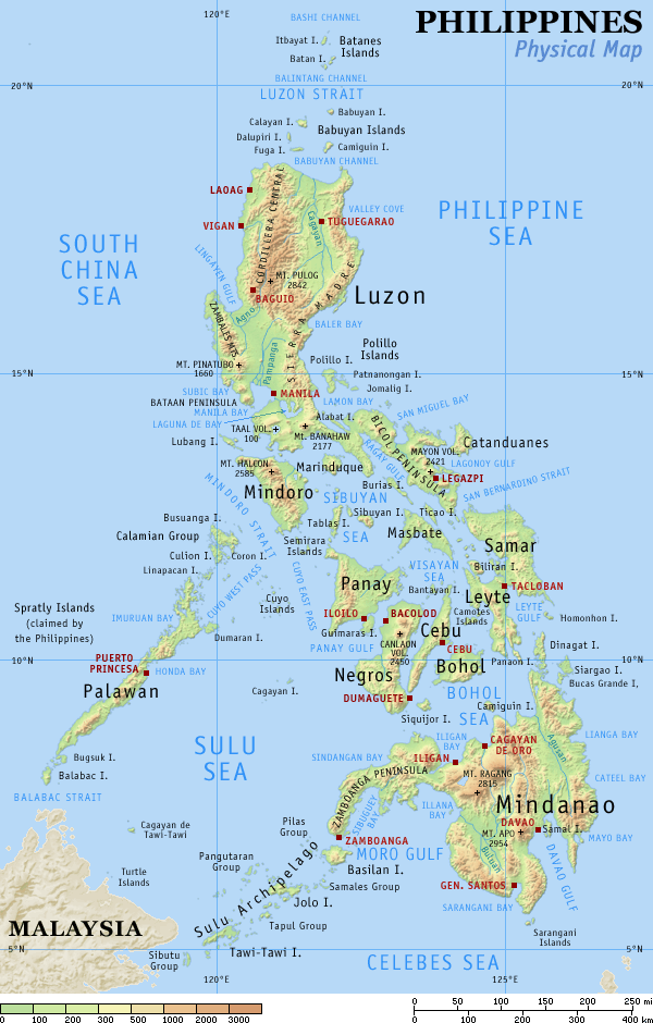
The Philippines (; fil, Pilipinas, links=no), officially the Republic of the Philippines ( fil, Republika ng Pilipinas, links=no), * bik, Republika kan Filipinas * ceb, Republika sa Pilipinas * cbk, República de Filipinas * hil, Republika sang Filipinas * ibg, Republika nat Filipinas * ilo, Republika ti Filipinas * ivv, Republika nu Filipinas * pam, Republika ning Filipinas * krj, Republika kang Pilipinas * mdh, Republika nu Pilipinas * mrw, Republika a Pilipinas * pag, Republika na Filipinas * xsb, Republika nin Pilipinas * sgd, Republika nan Pilipinas * tgl, Republika ng Pilipinas * tsg, Republika sin Pilipinas * war, Republika han Pilipinas * yka, Republika si Pilipinas In the recognized optional languages of the Philippines: * es, República de las Filipinas * ar, جمهورية الفلبين, Jumhūriyyat al-Filibbīn is an archipelagic country in Southeast Asia. It is situated in the western Pacific Ocean and consists of around 7,641 islands t ... [...More Info...] [...Related Items...] OR: [Wikipedia] [Google] [Baidu] |
Eastern Visayas
Eastern Visayas ( war, Sinirangan Kabisay-an; ceb, Sidlakang Kabisay-an; tl, Silangang Kabisayaan or ''Silangang Visayas'') is an administrative region in the Philippines, designated as Region VIII. It consists of three main islands, Samar, Leyte and Biliran. The region has six provinces, one independent city and one highly urbanized city namely, Biliran, Leyte, Northern Samar, Samar, Eastern Samar, Southern Leyte, Ormoc and Tacloban. The highly urbanized city of Tacloban is the sole regional center. These provinces and cities occupy the easternmost islands of the Visayas group of islands. Eastern Visayas faces the Philippine Sea to the east. The region's most famous landmark is the San Juanico Bridge, which links the provinces of Samar and Leyte. As of 2020, the Eastern Visayas region has a population of 4,547,150 inhabitants, making it the third most populous region in the Visayas. Etymology The current name of the region was derived from its location in the easternmost p ... [...More Info...] [...Related Items...] OR: [Wikipedia] [Google] [Baidu] |
Leyte (province)
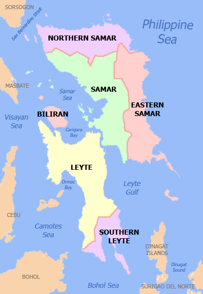
Leyte (also Northern Leyte; war, Norte san/Amihanan nga Leyte; Cebuano: ''Amihanang Leyte''; tl, Hilagang Leyte), officially the Province of Leyte, is a province in the Philippines located in the Eastern Visayas region, occupying the northern three-quarters of Leyte Island. Its capital is the city of Tacloban, administered independently from the province. Leyte is situated west of Samar Island, north of Southern Leyte and south of Biliran. To the west across the Camotes Sea is the province of Cebu. The historical name of the Philippines, "''Las Islas Felipenas''", named by Spanish explorer Ruy López de Villalobos in honor of Prince Philip of Spain, used to refer to the islands of Leyte and Samar only, until it was adopted to refer to the entire archipelago. The island of Leyte is known as Tandaya during the 16th century. Leyte is also known as the site of the largest naval battle in modern history, the Battle of Leyte Gulf, which took place during the Second World War. L ... [...More Info...] [...Related Items...] OR: [Wikipedia] [Google] [Baidu] |
Hindang, Leyte
Hindang (IPA: ɪn'daŋ, officially the Municipality of Hindang ( ceb, Lungsod sa Hindang; war, Bungto han Hindang; tl, Bayan ng Hindang), is a 5th class municipality in the province of Leyte, Philippines. According to the 2020 census, it has a population of 20,849 people. In the north, it borders the town of Inopacan and Hilongos in the south. ''Himokilan'' is a part of '' Cuatro Islas'' (The Four Islands), in which the other three (3) remaining islands are under the administrative jurisdiction of the municipality of Hindang. Geography Barangays Hindang is politically subdivided into 20 barangay A barangay (; abbreviated as Brgy. or Bgy.), historically referred to as barrio (abbreviated as Bo.), is the smallest administrative division in the Philippines and is the native Filipino term for a village, district, or ward. In metropolitan ...s. In 1957, the sitios of Kanhaayon, Kapudlosan, Himokilan, Anolon, Mahilom, Baldoza, and Tagbibi were converted into barrios. Clim ... [...More Info...] [...Related Items...] OR: [Wikipedia] [Google] [Baidu] |
Inopacan, Leyte
Inopacan (IPA: �no'pakɐn, officially the Municipality of Inopacan ( ceb, Lungsod sa Inopacan; war, Bungto han Inopacan; tl, Bayan ng Inopacan), is a 4th class municipality in the province of Leyte, Philippines. According to the 2020 census, it has a population of 21,389 people. Etymology The name of the town is a namesake of a legendary winged hero named by the natives as “''Inong pak-an''”, according to old folks. But history tells that Inopacan is a new name of Canamocan which was a pre-Spanish settlement according to Lee W. Vance in his book, ''Tracing our Ancestor and the analytical understanding of the written manuscripts of the Jesuit missionaries in Leyte''. However, it remains unaccepted despite that Canamocan was mentioned as now 'Inopacan' by some authors like Atty. Francisco Tantuico of the history of Baybay, Locsin on Ormoc's History, and Eduardo Makabenta Sr. on Carigara's history. History Much of the documents that could be a good source for learning about ... [...More Info...] [...Related Items...] OR: [Wikipedia] [Google] [Baidu] |
Spanish Language
Spanish ( or , Castilian) is a Romance languages, Romance language of the Indo-European language family that evolved from colloquial Latin spoken on the Iberian peninsula. Today, it is a world language, global language with more than 500 million native speakers, mainly in the Americas and Spain. Spanish is the official language of List of countries where Spanish is an official language, 20 countries. It is the world's list of languages by number of native speakers, second-most spoken native language after Mandarin Chinese; the world's list of languages by total number of speakers, fourth-most spoken language overall after English language, English, Mandarin Chinese, and Hindustani language, Hindustani (Hindi-Urdu); and the world's most widely spoken Romance languages, Romance language. The largest population of native speakers is in Mexico. Spanish is part of the Iberian Romance languages, Ibero-Romance group of languages, which evolved from several dialects of Vulgar Latin in I ... [...More Info...] [...Related Items...] OR: [Wikipedia] [Google] [Baidu] |
List Of Protected Areas Of The Philippines
This is a list of protected areas of the Philippines administered by the Department of Environment and Natural Resources (DENR)'s Biodiversity Management Bureau under the National Integrated Protected Areas System (NIPAS) Act of 1992. As of 2020, there are 244 protected areas in the Philippines covering a total area of about – 15.4% of the Philippines' total area. History The first important legislation that formed the basis of the current system of national parks and protected areas in the Philippines is Act No. 648, enacted in 1903 by the Philippine Commission. This act authorized the civil governor to "reserve for civil public purposes, and from sale or settlement, any part of the public domain not appropriated by law for special public purposes." A total of eight national reserves had been established on July 26, 1904, pursuant to this law. These are the Lamao Forest Reserve in Bataan, Mariquina Reserve in Rizal, Angat River Reserve in Bulacan, Caliraya Falls Reserv ... [...More Info...] [...Related Items...] OR: [Wikipedia] [Google] [Baidu] |
Protected Landscapes And Seascapes Of The Philippines
Protection is any measure taken to guard a thing against damage caused by outside forces. Protection can be provided to physical objects, including organisms, to systems, and to intangible things like civil and political rights. Although the mechanisms for providing protection vary widely, the basic meaning of the term remains the same. This is illustrated by an explanation found in a manual on electrical wiring: Some kind of protection is a characteristic of all life, as living things have evolved at least some protective mechanisms to counter damaging environmental phenomena, such as ultraviolet light. Biological membranes such as bark on trees and skin on animals offer protection from various threats, with skin playing a key role in protecting organisms against pathogens and excessive water loss. Additional structures like scales and hair offer further protection from the elements and from predators, with some animals having features such as spines or camouflage servin ... [...More Info...] [...Related Items...] OR: [Wikipedia] [Google] [Baidu] |
Islands Of Leyte (province)
An island (or isle) is an isolated piece of habitat that is surrounded by a dramatically different habitat, such as water. Very small islands such as emergent land features on atolls can be called islets, skerries, cays or keys. An island in a river or a lake island may be called an eyot or ait, and a small island off the coast may be called a holm. Sedimentary islands in the Ganges delta are called chars. A grouping of geographically or geologically related islands, such as the Philippines, is referred to as an archipelago. There are two main types of islands in the sea: continental and oceanic. There are also artificial islands, which are man-made. Etymology The word ''island'' derives from Middle English ''iland'', from Old English ''igland'' (from ''ig'' or ''ieg'', similarly meaning 'island' when used independently, and -land carrying its contemporary meaning; cf. Dutch ''eiland'' ("island"), German ''Eiland'' ("small island")). However, the spelling of the word w ... [...More Info...] [...Related Items...] OR: [Wikipedia] [Google] [Baidu] |


