|
Crowthorne
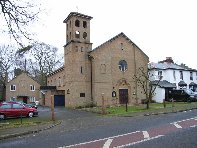
Crowthorne is a large village and civil parish in the Bracknell Forest district of south-eastern Berkshire, England. It had a population of 6,711 at the 2001 census, which rose to 6,902 at the 2011 census. A 2020 estimate put it at 7,808. Crowthorne is the venue of Wellington College, a large co-educational boarding and day independent school, which opened in 1859, and of Broadmoor Hospital, one of England's three maximum-security psychiatric hospitals, which lies on the eastern edge of the village. History Crowthorne was only a hamlet until Wellington College opened in 1859 and Broadmoor Hospital in 1863. Crowthorne railway station, originally Wellington College for Crowthorne Station, opened in 1860 and burgeoned quickly. In the 1960s, the Transport Research Laboratory established by the UK Government as the Road Research Laboratory (RRL) opened in Crowthorne. It was privatised in 1996. Geography Crowthorne is part of the Reading/Wokingham Urban Area. It lies 4 miles (6.5& ... [...More Info...] [...Related Items...] OR: [Wikipedia] [Google] [Baidu] |
Crowthorne Railway Station
Crowthorne railway station is a railway station in the village of Crowthorne in Berkshire, England. The station is managed by Great Western Railway, who operate services on the North Downs Line from Reading to Guildford, Redhill and Gatwick Airport. The station has two platforms: platform 1 for services towards Gatwick Airport and platform 2 for services towards Reading. It has bicycle racks on both platforms, and a car park adjacent to platform 2. History Crowthorne station was opened in 1859 as a result of pressure from the governors of Wellington College on the directors of the South Eastern Railway. The college also contributed £500 towards the cost of building the station, which was originally named "Wellington College for Crowthorne". This name remained until 17 June 1928, when it was renamed "Crowthorne". The old name board remained until World War II, though, when it was removed to prevent invading parachutists knowing where they were. Crowthorne station is lo ... [...More Info...] [...Related Items...] OR: [Wikipedia] [Google] [Baidu] |
Sandhurst, Berkshire
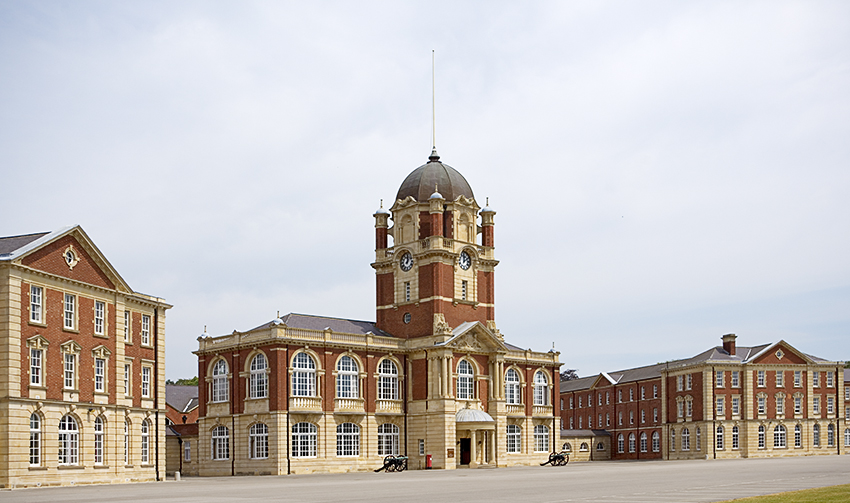
Sandhurst is a town and civil parish in the Bracknell Forest borough in Berkshire, England. It is in the south eastern corner of Berkshire, and is situated west-southwest of central London, north west of Camberley and south of Bracknell. Sandhurst is known worldwide as the location of the Royal Military Academy Sandhurst (often referred to simply as "Sandhurst", "The Academy" or "The RMA"). Despite its close proximity to Camberley, Sandhurst is also home to a large and well-known out-of-town mercantile development. The site is named "The Meadows" and has a Tesco Extra hypermarket and a Marks & Spencer, two of the largest in the country. A large Next clothing and homeware store is open on the site of the old Homebase. Geography Sandhurst is in South East England near the junction of Berkshire, Hampshire and Surrey. The town has four main districts, from west to east: Little Sandhurst, Sandhurst (central) and College Town, with Owlsmoor to the northeast. North of the ... [...More Info...] [...Related Items...] OR: [Wikipedia] [Google] [Baidu] |
Bracknell Forest
Bracknell Forest is a unitary authority area in Berkshire, southern England. It covers the two towns of Bracknell and Sandhurst and the village of Crowthorne and also includes the areas of North Ascot, Warfield and Winkfield. The borough borders Wokingham and the Royal Borough of Windsor & Maidenhead in Berkshire, and also parts of Surrey and Hampshire. History The district was formed as Easthampstead Rural District under the Local Government Act 1894 as a successor to the Easthampstead rural sanitary district. Originally a small rural district, its population was about 20,000 during the Second World War. Bracknell, in the district, was one of the first post-war new towns to be designated, and became a civil parish in 1955, created from parts of Binfield, Easthampstead, Warfield and Winkfield parishes. Bracknell had originally been a hamlet at the far south-west of Warfield parish. The district's population rose rapidly, and reached 64,135 by the 1971 census. In 1974 the d ... [...More Info...] [...Related Items...] OR: [Wikipedia] [Google] [Baidu] |
Bracknell (UK Parliament Constituency)
Bracknell is a constituency in Berkshire represented in the House of Commons of the UK Parliament since 2019 by James Sunderland, a Conservative. It was created for the 1997 general election, replacing the abolished county constituency of East Berkshire. Constituency profile The seat covers most of the town of Bracknell, although the northern parts are in the neighbouring Windsor seat. Crowthorne and Sandhurst are also in the seat, interspersed by large areas of forest. Residents are slightly wealthier than the UK average. History From creation in 1997 until 2010, Bracknell's MP was Andrew MacKay of the Conservative Party, who represented the old seat of East Berkshire from 1983. On 14 May 2009, he resigned from his position as parliamentary aide to David Cameron in the wake of a major scandal over his Parliamentary expenses. MacKay and his wife, fellow Tory MP Julie Kirkbride, had wrongfully claimed over £250,000 from the taxpayer for mortgage payments for second hom ... [...More Info...] [...Related Items...] OR: [Wikipedia] [Google] [Baidu] |
Edgbarrow School
Edgbarrow School is a secondary Academy School in Crowthorne, Berkshire, England. The school is the main state secondary school in the area, and includes Edgbarrow Sixth Form College. It previously held the title of a Business and Enterprise College as a specialist school. The school has approximately 1410 pupils, most of whom come from Crowthorne schools, such as Wildmoor Heath School and Oaklands School, Hatch Ride school and Crowthorne C of E school . The school teaches 11- to 18-year-olds, and has some of the best results in Bracknell Forest at GCSE of any non-selective state schools. School site The school is on the boundary of Wildmoor Heath Nature Reserve. It has two large grass playing fields and one astro-turf pitch. The sports centre, managed by Bracknell Forest Council until 2017, is used by the school for PE lessons taking advantage of their sports hall and dance studio. The School has seven main buildings: * The Elsey Building, opened in 2021, to replace th ... [...More Info...] [...Related Items...] OR: [Wikipedia] [Google] [Baidu] |
Broadmoor Hospital
Broadmoor Hospital is a high-security psychiatric hospital in Crowthorne, Berkshire, England. It is the oldest of the three high-security psychiatric hospitals in England, the other two being Ashworth Hospital near Liverpool and Rampton Secure Hospital in Nottinghamshire. The hospital's catchment area consists of four National Health Service regions: London, Eastern, South East and South West. It is managed by the West London NHS Trust. History The hospital was first known as the Broadmoor Criminal Lunatic Asylum. Completed in 1863, it was built to a design by Sir Joshua Jebb, an officer of the Corps of Royal Engineers, and covered within its secure perimeter. The first patient was a female admitted for infanticide on 27 May 1863. Notes described her as being 'feeble minded'. It has been suggested by an analysis of her records that she most likely had congenital syphilis. The first male patients arrived on 27 February 1864. The original building plan of five blocks (fo ... [...More Info...] [...Related Items...] OR: [Wikipedia] [Google] [Baidu] |
Transport Research Laboratory
TRL Limited, trading as TRL (formerly Transport Research Laboratory) is an independent private company offering a transport consultancy and research service to the public and private sector. Originally established in 1933 by the UK Government as the Road Research Laboratory (RRL), it was privatised in 1996. Its motto or tagline is 'The Future of Transport'. History TRL was originally established in 1933 by the UK Government as the Road Research Laboratory (RRL) under the Department of Scientific and Industrial Research (DSIR), and later became the Transport and Road Research Laboratory (TRRL) in 1972. During the Second World War, the Laboratory contributed to the war effort. Among its contributions, under William Glanville, were research that aided the development of plastic armour, the bouncing bomb and the Disney bomb. During governmental reorganisation in the 1970s, the TRRL moved from the Department of Trade and Industry (DTI) to the Department of the Environment (DoE). ... [...More Info...] [...Related Items...] OR: [Wikipedia] [Google] [Baidu] |
Wellington College, Berkshire
Wellington College is a public school (English independent day and boarding school) in the village of Crowthorne, Berkshire, England. Wellington is a registered charity and currently educates roughly 1,200 pupils, between the ages of 13 and 18, per annum. The college was built as a national monument to the first Duke of Wellington (1769–1852), in whose honour it is named. Queen Victoria laid the foundation stone in 1856 and inaugurated the School's public opening on 29 January 1859. Many former Wellington pupils fought in the trenches during the First World War, a conflict in which 707 of them lost their lives, many volunteering for military service immediately after leaving school. A further 501 former pupils were killed in action in the Second World War. The school is a member of the Rugby Group of 18 British public schools and is also a member of the G20 Schools group. History Wellington College was granted a royal charter in 1853 as "''The Royal and Religious Foun ... [...More Info...] [...Related Items...] OR: [Wikipedia] [Google] [Baidu] |
Wokingham Without
Wokingham Without is a civil parish in the Wokingham district of the English county of Berkshire. It was formed in 1894 when the parish of Wokingham was split into two parts — one rural and one urban. The population of the civil parish as of the 2011 Census is 7,011. The parish originally curved around Wokingham proper from north to south in a west-facing crescent. The area to the north is called Ashridge (anciently called Hertoke). This is the region of Wokingham parish which was, until 1844, officially a detached part of Wiltshire. However, in more recent years, this area has been transferred to the parish of St Nicholas Hurst. The area to the south of Wokingham is modern Wokingham Without. It consists of the ecclesiastical parish of St. Sebastian's, formed in 1871, divided into two sections. The largely rural north includes the hamlets of Heathlands (alias St Sebastians), Holme Green and Gardeners Green. The southern end of the parish is more urbanized, and includes Rave ... [...More Info...] [...Related Items...] OR: [Wikipedia] [Google] [Baidu] |
Bracknell
Bracknell () is a large town and civil parish in Berkshire, England, the westernmost area within the Greater London Built-up Area, Greater London Urban Area and the administrative centre of the Bracknell Forest, Borough of Bracknell Forest. It lies to the east of Reading, Berkshire, Reading, south of Maidenhead, southwest of Windsor, Berkshire, Windsor and west of central London. Originally a market village and part of the Windsor Great Forest, Bracknell experienced a period of huge growth during the mid-20th century when it was declared a New towns in the United Kingdom, new town. Planned at first for a population of 25,000, Bracknell New Town was further expanded in the late 1960s to accommodate a population of 60,000. As part of this expansion, Bracknell absorbed many of the surrounding hamlets including Easthampstead, Ramslade and Old Bracknell. As of 2021, Bracknell Forest has an estimated population of around 113,205 (Census 2021). It is a commercial centre and the UK h ... [...More Info...] [...Related Items...] OR: [Wikipedia] [Google] [Baidu] |
Wellington College (Berkshire)
Wellington College is a public school (English independent day and boarding school) in the village of Crowthorne, Berkshire, England. Wellington is a registered charity and currently educates roughly 1,200 pupils, between the ages of 13 and 18, per annum. The college was built as a national monument to the first Duke of Wellington (1769–1852), in whose honour it is named. Queen Victoria laid the foundation stone in 1856 and inaugurated the School's public opening on 29 January 1859. Many former Wellington pupils fought in the trenches during the First World War, a conflict in which 707 of them lost their lives, many volunteering for military service immediately after leaving school. A further 501 former pupils were killed in action in the Second World War. The school is a member of the Rugby Group of 18 British public schools and is also a member of the G20 Schools group. History Wellington College was granted a royal charter in 1853 as "''The Royal and Religious Found ... [...More Info...] [...Related Items...] OR: [Wikipedia] [Google] [Baidu] |
Reading/Wokingham Urban Area
The Reading Built-up Area or Reading/Wokingham Urban Area is a name given by the Office for National Statistics to a conurbation in Berkshire, England, with a population of 318,014. This was a significant decrease from the population according to the 2001 census of 369,804 due to Bracknell no longer being considered part of the built-up area, but forming part of the Greater London Urban Area instead. Its largest population centre is Reading, and it also includes Arborfield, Woodley, Theale, Crowthorne, Earley and Wokingham. Part of the urban area, Crowthorne, is just to the north of Sandhurst, part of the Farnborough/Aldershot Urban Area, and its eastern extremity is just west of Bracknell part of the Greater London Urban Area.http://www.ons.gov.uk/ons/rel/census/census-2001-key-statistics/urban-areas-in-england-and-wales/urban-areas-in-england-and-wales-part-5.pdf References Urban areas of England Urban Area Urban Area An urban area, built-up area or urban ... [...More Info...] [...Related Items...] OR: [Wikipedia] [Google] [Baidu] |


