|
Crow Indian Reservation
The Crow Indian Reservation is the homeland of the Crow Tribe. Established 1868, the reservation is located in parts of Big Horn County, Montana, Big Horn, Yellowstone County, Montana, Yellowstone, and Treasure County, Montana, Treasure counties in southern Montana in the United States. The Crow Tribe has an enrolled membership of approximately 11,000, of whom 7,900 reside in the reservation. 20% speak Crow language, Crow as their first language. The reservation, the largest of the seven Indian reservations in Montana, is located in south-central Montana, bordered by Wyoming to the south and the Northern Cheyenne Indian Reservation to the east. The reservation includes the northern end of the Bighorn Mountains, Wolf Mountains, and Pryor Mountains. The Bighorn River flows north from the Montana-Wyoming state line, joining the Little Bighorn River, Little Bighorn just east of Hardin, Montana, Hardin. Part of the reservation boundary runs along the ridgeline separating Pryor Creek ... [...More Info...] [...Related Items...] OR: [Wikipedia] [Google] [Baidu] |
Indian Reservation
An Indian reservation is an area of land held and governed by a federally recognized Native American tribal nation whose government is accountable to the United States Bureau of Indian Affairs and not to the state government in which it is located. Some of the country's 574 federally recognized tribes govern more than one of the 326 Indian reservations in the United States, while some share reservations, and others have no reservation at all. Historical piecemeal land allocations under the Dawes Act facilitated sales to non–Native Americans, resulting in some reservations becoming severely fragmented, with pieces of tribal and privately held land being treated as separate enclaves. This jumble of private and public real estate creates significant administrative, political and legal difficulties. The total area of all reservations is , approximately 2.3% of the total area of the United States and about the size of the state of Idaho. While most reservations are small c ... [...More Info...] [...Related Items...] OR: [Wikipedia] [Google] [Baidu] |
Bighorn River
The Bighorn River is a tributary of the Yellowstone, approximately long, in the states of Wyoming and Montana in the western United States. The river was named in 1805 by fur trader François Larocque for the bighorn sheep he saw along its banks as he explored the Yellowstone. The upper reaches of the Bighorn, south of the Owl Creek Mountains in Wyoming, are known as the Wind River. The two rivers are sometimes referred to as the Wind/Bighorn. The Wind River officially becomes the Bighorn River at the Wedding of the Waters, on the north side of the Wind River Canyon near the town of Thermopolis. From there, the river flows through the Bighorn Basin in north central Wyoming, passing through Thermopolis and Hot Springs State Park. At the border with Montana, the river turns northeast, and flows past the north end of the Bighorn Mountains, through the Crow Indian Reservation, where the Yellowtail Dam forms the Bighorn Lake reservoir. The reservoir and the surrounding canyon a ... [...More Info...] [...Related Items...] OR: [Wikipedia] [Google] [Baidu] |
Sitting Bull
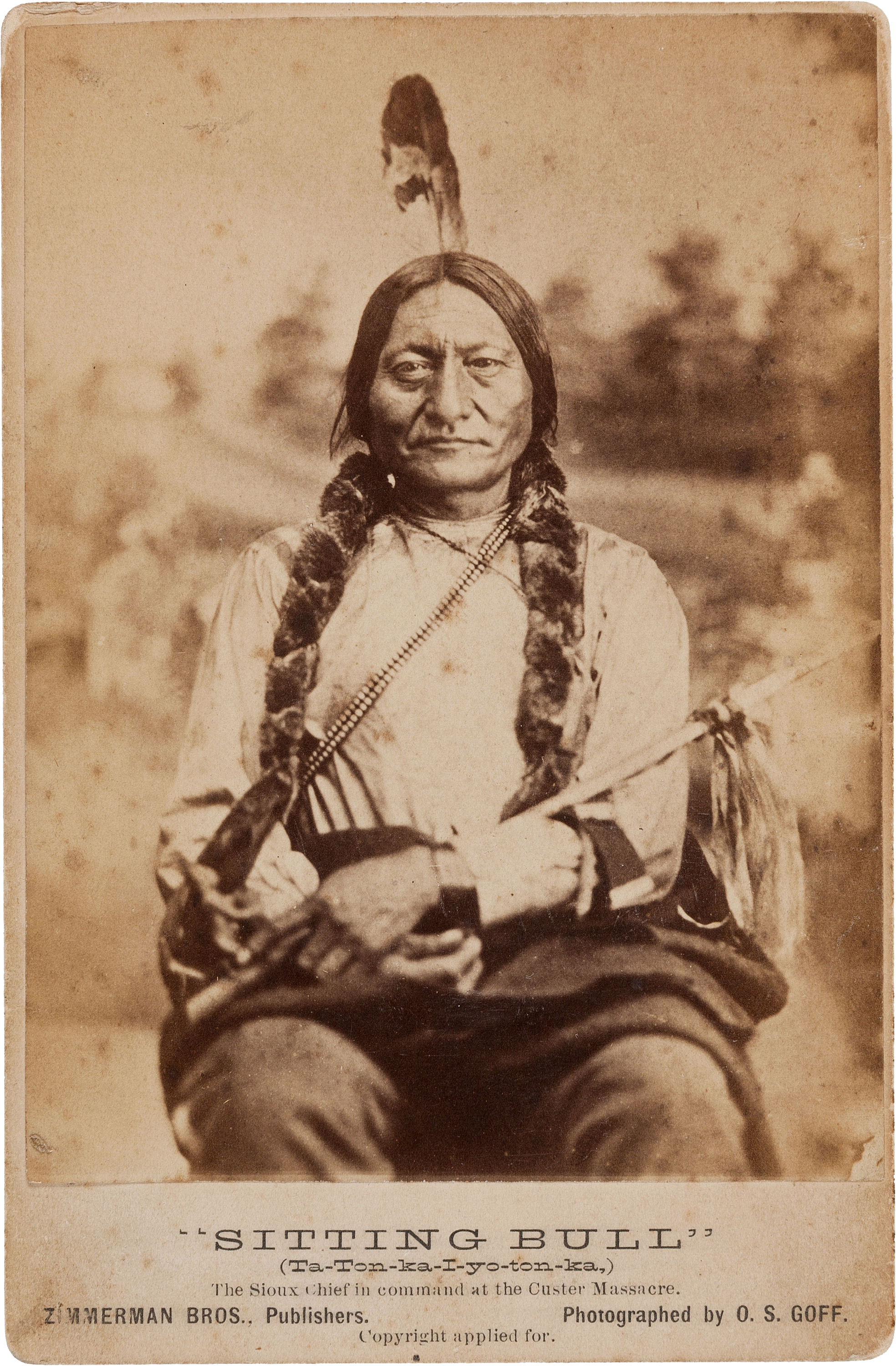
Sitting Bull ( lkt, Tȟatȟáŋka Íyotake ; December 15, 1890) was a Hunkpapa Lakota leader who led his people during years of resistance against United States government policies. He was killed by Indian agency police on the Standing Rock Indian Reservation during an attempt to arrest him, at a time when authorities feared that he would join the Ghost Dance movement. Before the Battle of the Little Bighorn, Sitting Bull had a vision in which he saw many soldiers, "as thick as grasshoppers", falling upside down into the Lakota camp, which his people took as a foreshadowing of a major victory in which many soldiers would be killed. About three weeks later, the confederated Lakota tribes with the Northern Cheyenne defeated the 7th Cavalry under Lt. Col. George Armstrong Custer on June 25, 1876, annihilating Custer's battalion and seeming to bear out Sitting Bull's prophetic vision. Sitting Bull's leadership inspired his people to a major victory. In response, the U.S. governm ... [...More Info...] [...Related Items...] OR: [Wikipedia] [Google] [Baidu] |
Miniconjou
The Miniconjou (Lakota: Mnikowoju, Hokwoju – ‘Plants by the Water’) are a Native American people constituting a subdivision of the Lakota people, who formerly inhabited an area in western present-day South Dakota from the Black Hills in to the Platte River. The contemporary population lives mostly in west-central South Dakota. Perhaps the most famous Miniconjou chief was Touch the Clouds. Historic Miniconjou thiyóšpaye or bands Together with the Sans Arc (''Itázipčho'', ''Itazipcola'', ''Hazipco'' - ‘Those who hunt without bows’) and Two Kettles (''Oóhe Núŋpa'', ''Oóhenuŋpa'', ''Oohenonpa'' - ‘Two Boiling’ or ‘Two Kettles’) they were often referred to as ''Central Lakota'' and divided into several ''bands'' or ''thiyóšpaye'': * Unkche yuta (‘Dung Eaters’) * Glaglaheca (‘Untidy’, ‘Slovenly’, ‘Shiftless’) * Shunka Yute Shni (‘Eat No Dogs’, split off from the ''Wanhin Wega'') * Nige Tanka (‘Big Belly’) * Wakpokinyan (‘Fl ... [...More Info...] [...Related Items...] OR: [Wikipedia] [Google] [Baidu] |
Hunkpapa
The Hunkpapa (Lakota: ) are a Native American group, one of the seven council fires of the Lakota tribe. The name ' is a Lakota word, meaning "Head of the Circle" (at one time, the tribe's name was represented in European-American records as ''Honkpapa''). By tradition, the set up their lodges at the entryway to the circle of the Great Council when the Sioux met in convocation."Hunkpapa Sioux Indian Tribe History" ''Handbook of American Indians'', 1906, carried in Access Genealogy, accessed 9 Dec 2009 They speak Lakȟóta, one of the three dialects of the Sioux language. History in ...
|
Red Cloud
Red Cloud ( lkt, Maȟpíya Lúta, italic=no) (born 1822 – December 10, 1909) was a leader of the Oglala Lakota from 1868 to 1909. He was one of the most capable Native American opponents whom the United States Army faced in the western territories. He defeated the United States during Red Cloud's War, which was a fight over control of the Powder River Country in northeastern Wyoming and southern Montana. The largest action of the war was the Fetterman Fight, with 81 US soldiers killed; it was the worst military defeat suffered by the US Army on the Great Plains until the Battle of the Little Bighorn 10 years later. After signing the Treaty of Fort Laramie (1868), Red Cloud led his people in the transition to reservation life. Some of his opponents mistakenly thought of him as the overall leader of the Sioux groups (Dakota, Lakota, and Nakota), but the large tribe had several major divisions and was highly decentralized. Bands among the Oglala and other divisions operated ... [...More Info...] [...Related Items...] OR: [Wikipedia] [Google] [Baidu] |
Crazy Horse
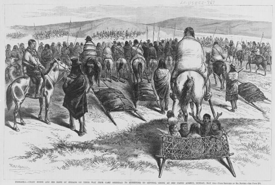
Crazy Horse ( lkt, Tȟašúŋke Witkó, italic=no, , ; 1840 – September 5, 1877) was a Lakota war leader of the Oglala band in the 19th century. He took up arms against the United States federal government to fight against encroachment by white American settlers on Native American territory and to preserve the traditional way of life of the Lakota people. His participation in several famous battles of the Black Hills War on the northern Great Plains, among them the Fetterman Fight in 1866, in which he acted as a decoy, and the Battle of the Little Bighorn in 1876, in which he led a war party to victory, earned him great respect from both his enemies and his own people. In September 1877, four months after surrendering to U.S. troops under General George Crook, Crazy Horse was fatally wounded by a bayonet-wielding military guard while allegedly resisting imprisonment at Camp Robinson in present-day Nebraska. He was honored by the U.S. Postal Service in 1982 with a 13¢ Great ... [...More Info...] [...Related Items...] OR: [Wikipedia] [Google] [Baidu] |
Oglala Lakota
The Oglala (pronounced , meaning "to scatter one's own" in Lakota language) are one of the seven subtribes of the Lakota people who, along with the Dakota people, Dakota, make up the Sioux, Očhéthi Šakówiŋ (Seven Council Fires). A majority of the Oglala live on the Pine Ridge Indian Reservation in South Dakota, the eighth-largest Indian reservation, Native American reservation in the United States. The Oglala are a List of federally recognized tribes, federally recognized tribe whose official title is the Oglala Sioux Tribe (previously called the Oglala Sioux Tribe of the Pine Ridge Reservation, South Dakota). However, many Oglala reject the term "Sioux" due to the hypothesis (among Sioux#Names, other possible theories) that its origin may be a derogatory word meaning "snake" in Ojibwe language, the language of the Ojibwe, who were among the historical enemies of the Lakota. They are also known as Oglála Lakhóta Oyáte. History Oglala elders relate stories about the orig ... [...More Info...] [...Related Items...] OR: [Wikipedia] [Google] [Baidu] |
Red Cloud's War
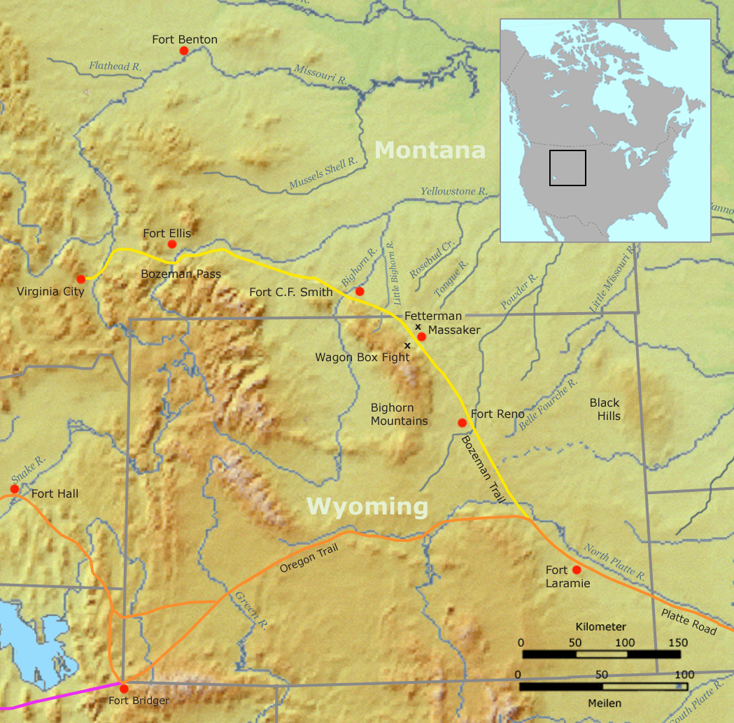
Red Cloud's War (also referred to as the Bozeman War or the Powder River War) was an armed conflict between an alliance of the Lakota, Northern Cheyenne, and Northern Arapaho peoples against the United States that took place in the Wyoming and Montana territories from 1866 to 1868. The war was fought over control of the western Powder River Country in present north-central Wyoming. In 1863, European Americans had blazed the Bozeman Trail through the heart of the traditional territory of the Cheyenne, Arapaho, and Lakota. It was the shortest and easiest route from Fort Laramie and the Oregon Trail to the Montana gold fields. From 1864 to 1866, the trail was traversed by about 3,500 miners, emigrant settlers and others, who competed with the Indians for the diminishing resources near the trail.Fort Phil Kearney/Bozeman Trail As ... [...More Info...] [...Related Items...] OR: [Wikipedia] [Google] [Baidu] |
Fort Laramie Treaty (1851)
The Fort Laramie Treaty of 1851 was signed on September 17, 1851 between United States treaty commissioners and representatives of the Cheyenne, Sioux, Arapaho, Crow, Assiniboine, Mandan, Hidatsa, and Arikara Nations. Also known as Horse Creek Treaty, the treaty set forth traditional territorial claims of the tribes. The United States acknowledged that all the land covered by the treaty was Indian territory and did not claim any part of it. The boundaries agreed to in the Fort Laramie Treaty of 1851 would be used to settle a number of claims cases in the 20th century. The Native Americans guaranteed safe passage for settlers on the Oregon Trail and allowed roads and forts to be built in their territories, in exchange for promises of an annuity in the amount of fifty thousand dollars for fifty years. The treaty also sought to "make an effective and lasting peace" among the eight tribes, who were often at odds with each other.Kappler, Charles J.: ''Indian Affairs. Laws and Trea ... [...More Info...] [...Related Items...] OR: [Wikipedia] [Google] [Baidu] |


