|
Cranborne Chase
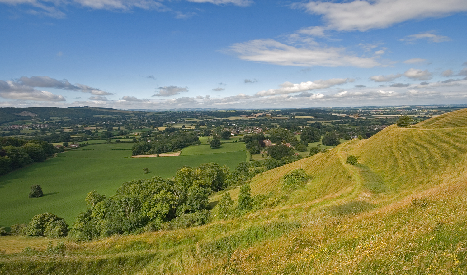
Cranborne Chase () is an area of central southern England, straddling the counties Dorset, Hampshire and Wiltshire. It is part of the Cranborne Chase and West Wiltshire Downs Area of Outstanding Natural Beauty (AONB). The area is dominated by, and often considered to be synonymous with, a chalk downland plateau. Part of the English Chalk Formation, it is adjacent to Salisbury Plain and the West Wiltshire Downs in the north, and the Dorset Downs to the south west. The highest point is Win Green Down, in Wiltshire, at . Historically a medieval hunting forest, the area is also noted for its Neolithic and Bronze age archaeology and its rural agricultural character. Definitions As an informally defined region, the boundaries of Cranborne Chase vary depending on usage. When defined as the chalk plateau, it is clearly bounded by escarpments which face the valleys of the Blackmore Vale to the west, the Vale of Wardour to the north, and the Hampshire Avon to the east. To the south th ... [...More Info...] [...Related Items...] OR: [Wikipedia] [Google] [Baidu] |
Ashmore Pond - Geograph
Ashmore is a village and civil parish in the North Dorset district of Dorset, England, southwest of Salisbury. The village is centred on a circular pond and has a church and several stone cottages and farms, many with thatched roofs. It is the highest village in the county with the contour passing close to the village church (although the north side of the town of Shaftesbury, Dorset, is slightly higher at ). The pond or "mere" gave the village its original name of "Ash-mere".North Dorset District Council,''North Dorset Official District Guide'', Home Publishing Co. Ltd.,c.1983. p30 In the 2011 census the parish had a population of 188. History Three round barrows have been found in the parish: two barrows south of the village near Well Bottom, and one west of the village near the boundary with the village of Fontmell Magna; this latter barrow was excavated in the 19th century and bones were recovered. Ashmore may have been the site of a Neolithic market place or ... [...More Info...] [...Related Items...] OR: [Wikipedia] [Google] [Baidu] |
Blackmore Vale
The Blackmore Vale (; less commonly spelt ''Blackmoor'') is a vale, or wide valley, in north Dorset, and to a lesser extent south Somerset and southwest Wiltshire in southern England. Geography The vale is part of the Stour valley, part of the Dorset AONB and part of the natural region known as the Blackmoor Vale and Vale of Wardour. To the south and east, the vale is clearly delimited by the steep escarpments of two areas of higher chalk downland, the Dorset Downs to the south, and Cranborne Chase to the east. To the north and west, the definitions of the vale are more ambiguous, as the landscape changes more gradually around the upper reaches of the Stour and its tributaries. One definition places the boundary along the watershed between the Stour and neighbouring valleys of the Yeo to the west and Brue to the north. A narrower definition places the limits of the vale close to the county boundary and villages like Bourton, where the landscape transitions to hillier greensa ... [...More Info...] [...Related Items...] OR: [Wikipedia] [Google] [Baidu] |
Entrance To Badbury Rings, 2010
Entrance generally refers to the place of entering like a gate, door, or road or the permission to do so. Entrance may also refer to: * ''Entrance'' (album), a 1970 album by Edgar Winter * Entrance (display manager) Entrance is a display manager for the X Window System. It is written using the Enlightenment Foundation Libraries The Enlightenment Foundation Libraries (EFL) are a set of graphics libraries that grew out of the development of Enlightenmen ..., a login manager for the X window manager * Entrance (liturgical), a kind of liturgical procession in the Eastern Orthodox tradition * Entrance (musician), born Guy Blakeslee * ''Entrance'' (film), a 2011 film * The Entrance, New South Wales, a suburb in Central Coast, New South Wales, Australia * "Entrance" (Dimmu Borgir song), from the 1997 album '' Enthrone Darkness Triumphant'' * Entry (cards), a card that wins a trick to which another player made the lead, as in the card game contract bridge * N-Trance, a ... [...More Info...] [...Related Items...] OR: [Wikipedia] [Google] [Baidu] |
Stourhead
Stourhead () is a 1,072-hectare (2,650-acre) estate at the source of the River Stour in the southwest of the English county of Wiltshire, extending into Somerset. The estate is about northwest of the town of Mere and includes a Grade I listed 18th-century Neo-Palladian mansion, the village of Stourton, one of the most famous gardens in the English landscape garden style, farmland, and woodland. Stourhead has been part-owned by the National Trust since 1946. House The Stourton family had lived at the Stourhead estate for 500 years until they sold it to Sir Thomas Meres in 1714. His son, John Meres, sold it in 1717 to Henry Hoare, son of wealthy banker Sir Richard Hoare. The original manor house was demolished and a new house, one of the first of its kind, was designed by Colen Campbell and built by Nathaniel Ireson between 1721 and 1725. Over the next 200 years, the Hoare family collected many heirlooms, including a large library and art collection. In 1902, the house was g ... [...More Info...] [...Related Items...] OR: [Wikipedia] [Google] [Baidu] |
Longleat
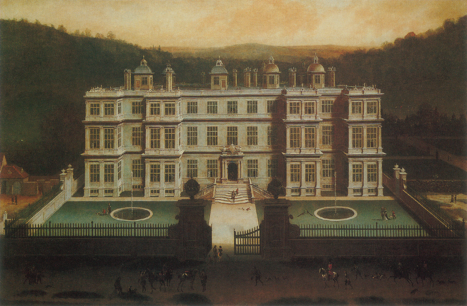
Longleat is an English stately home and the seat of the Marquesses of Bath. A leading and early example of the Elizabethan prodigy house, it is adjacent to the village of Horningsham and near the towns of Warminster and Westbury in Wiltshire, and Frome in Somerset. The Grade I listed house is set in of parkland landscaped by Capability Brown, with of let farmland and of woodland, which includes a Center Parcs holiday village. It was the first stately home to open to the public, and the Longleat estate has the first safari park outside Africa and other attractions including a hedge maze. The house was built by Sir John Thynne and designed mainly by Robert Smythson, after Longleat Priory was destroyed by fire in 1567. It took 12 years to complete and is widely regarded as one of the finest examples of Elizabethan architecture in Britain. It continues to be the seat of the Thynn family, who have held the title of Marquess of Bath since 1789; the eighth and present Marquess is ... [...More Info...] [...Related Items...] OR: [Wikipedia] [Google] [Baidu] |
Cranborne
Cranborne is a village in East Dorset, England. At the 2011 census, the parish had a population of 779, remaining unchanged from 2001. The appropriate electoral ward is called 'Crane'. This ward includes Wimborne St. Giles in the west and south to Woodlands. The total population of this ward at the 2011 census was 2,189. Once a very small, intensely agricultural market town, the village is on chalk downland called Cranborne Chase, part of a large expanse of chalk in southern England which includes the nearby Salisbury Plain and Dorset Downs. History The village dates from Saxon times and was recorded in the Domesday Book of 1086 as '' Creneburne'', meaning stream (bourne) of cranes. In the 10th century the Benedictine abbey known as Cranborne Abbey was founded by a knight by the name of Haylward Snew (or Aethelweard Maew) who made it the parent house of the religious foundation at Tewkesbury. This arrangement lasted until 1102, when Robert Fitz Hamon greatly enlarged th ... [...More Info...] [...Related Items...] OR: [Wikipedia] [Google] [Baidu] |
Ringwood, Hampshire
Ringwood is a market town in south-west Hampshire, England, located on the River Avon, close to the New Forest, northeast of Bournemouth and southwest of Southampton. It was founded by the Anglo-Saxons, and has held a weekly market since the Middle Ages. History Ringwood is recorded in a charter of 961, in which King Edgar gave 22 hides of land in ''Rimecuda'' to Abingdon Abbey. The name is also recorded in the 10th century as ''Runcwuda'' and ''Rimucwuda''. The second element ''Wuda'' means a 'wood'; ''Rimuc'' may be derived from ''Rima'' meaning 'border, hence "border wood." The name may refer to Ringwood's position on the fringe of the New Forest, or on the border of Hampshire. William Camden in 1607 gave a much more fanciful derivation, claiming that the original name was Regne-wood, the ''Regni'' being an ancient people of Britain. In the ''Domesday Book'' of 1086, Ringwood (''Rincvede'') had been appropriated by the Crown and all but six hides taken into the New ... [...More Info...] [...Related Items...] OR: [Wikipedia] [Google] [Baidu] |
Blandford Forum
Blandford Forum ( ), commonly Blandford, is a market town in Dorset, England, sited by the River Stour, Dorset, River Stour about northwest of Poole. It was the administrative headquarters of North Dorset District until April 2019, when this was abolished and its area incorporated into the new Dorset (unitary authority), Dorset unitary authority. Blandford is notable for its Georgian architecture, the result of rebuilding after the majority of the town was destroyed by a fire in 1731. The rebuilding work was assisted by an Act of Parliament and a donation by George II of Great Britain, George II, and the rebuilt town centre—to designs by local architects Bastard brothers, John and William Bastard—has survived to the present day largely intact. Blandford Camp, a military base, is sited on the hills north-east of the town. It is the base of the Royal Corps of Signals, the communications wing of the British Army, and the site of the Royal Signals Museum. Dorset County Coun ... [...More Info...] [...Related Items...] OR: [Wikipedia] [Google] [Baidu] |
Shaftesbury
Shaftesbury () is a town and civil parish in Dorset, England. It is situated on the A30 road, west of Salisbury, near the border with Wiltshire. It is the only significant hilltop settlement in Dorset, being built about above sea level on a greensand hill on the edge of Cranborne Chase. The town looks over the Blackmore Vale, part of the River Stour basin. Shaftesbury is the site of the former Shaftesbury Abbey, which was founded in 888 by King Alfred and became one of the richest religious establishments in the country, before being destroyed in the dissolution in 1539. Adjacent to the abbey site is Gold Hill, a steep cobbled street used in the 1970s as the setting for Ridley Scotts television advertisement for Hovis bread. In the 2011 Census the town's civil parish had a population of 7,314. Toponymy Shaftesbury has acquired a number of names throughout its history. Writing in 1906, Sir Frederick Treves referred to four of these names from Celtic, Latin and English tra ... [...More Info...] [...Related Items...] OR: [Wikipedia] [Google] [Baidu] |
Salisbury
Salisbury ( ) is a cathedral city in Wiltshire, England with a population of 41,820, at the confluence of the rivers Avon, Nadder and Bourne. The city is approximately from Southampton and from Bath. Salisbury is in the southeast of Wiltshire, near the edge of Salisbury Plain. Salisbury Cathedral was formerly north of the city at Old Sarum. The cathedral was relocated and a settlement grew up around it, which received a city charter in 1227 as . This continued to be its official name until 2009, when Salisbury City Council was established. Salisbury railway station is an interchange between the West of England Main Line and the Wessex Main Line. Stonehenge is a UNESCO World Heritage Site and is northwest of Salisbury. Name The name ''Salisbury'', which is first recorded around the year 900 as ''Searoburg'' ( dative ''Searobyrig''), is a partial translation of the Roman Celtic name ''Sorbiodūnum''. The Brittonic suffix ''-dūnon'', meaning "fortress" (in reference ... [...More Info...] [...Related Items...] OR: [Wikipedia] [Google] [Baidu] |
Wimborne Minster
Wimborne Minster (often referred to as Wimborne, ) is a market town in Dorset in South West England, and the name of the Church of England church in that town. It lies at the confluence of the River Stour and the River Allen, north of Poole, on the Dorset Heaths, and is part of the South East Dorset conurbation. According to Office for National Statistics data the population of the Wimborne Minster built-up area was 15,552. Governance The town and its administrative area are served by eleven councillors plus one from the nearby ward of Cranfield. The electoral ward of Wimborne Minster is slightly bigger than the parish, with a 2011 population of 7,014. Wimborne Minster is part of the Mid Dorset and North Poole parliamentary constituency. Buildings and architecture Wimborne has one of the foremost collections of 15th-, 16th- and 17th-century buildings in Dorset. Local planning has restricted the construction of new buildings in areas such as the Cornmarket and the High S ... [...More Info...] [...Related Items...] OR: [Wikipedia] [Google] [Baidu] |
Verwood
Verwood is a town and civil parish in eastern Dorset, England. The town lies north of Bournemouth and north east of Poole as the crow flies. The civil parish comprises the town of Verwood together with the extended village of Three Legged Cross, and has a population of 15,170 according to latest figures (2014) from Dorset County Council. Verwood is the largest town in Dorset without an upper school. History Early history Verwood was originally recorded as ''Beau Bois'' (Norman French: "beautiful wood") in 1288, and it was not until 1329 that it got the name ''Verwood'', which developed from ''Fairwood'' or ''The Fayrewood''. Verwood is recorded as "Fairwod" (1329) and as "Fayrwod" (1436); this name has the meaning "fair wood" and the modern form shows the change of initial "f" to "v" characteristic of many Southwestern English dialects. Pottery industry The East Dorset pottery industry, known collectively as Verwood Pottery, thrived from early times on the clay soils of t ... [...More Info...] [...Related Items...] OR: [Wikipedia] [Google] [Baidu] |


