|
County Of London Plan
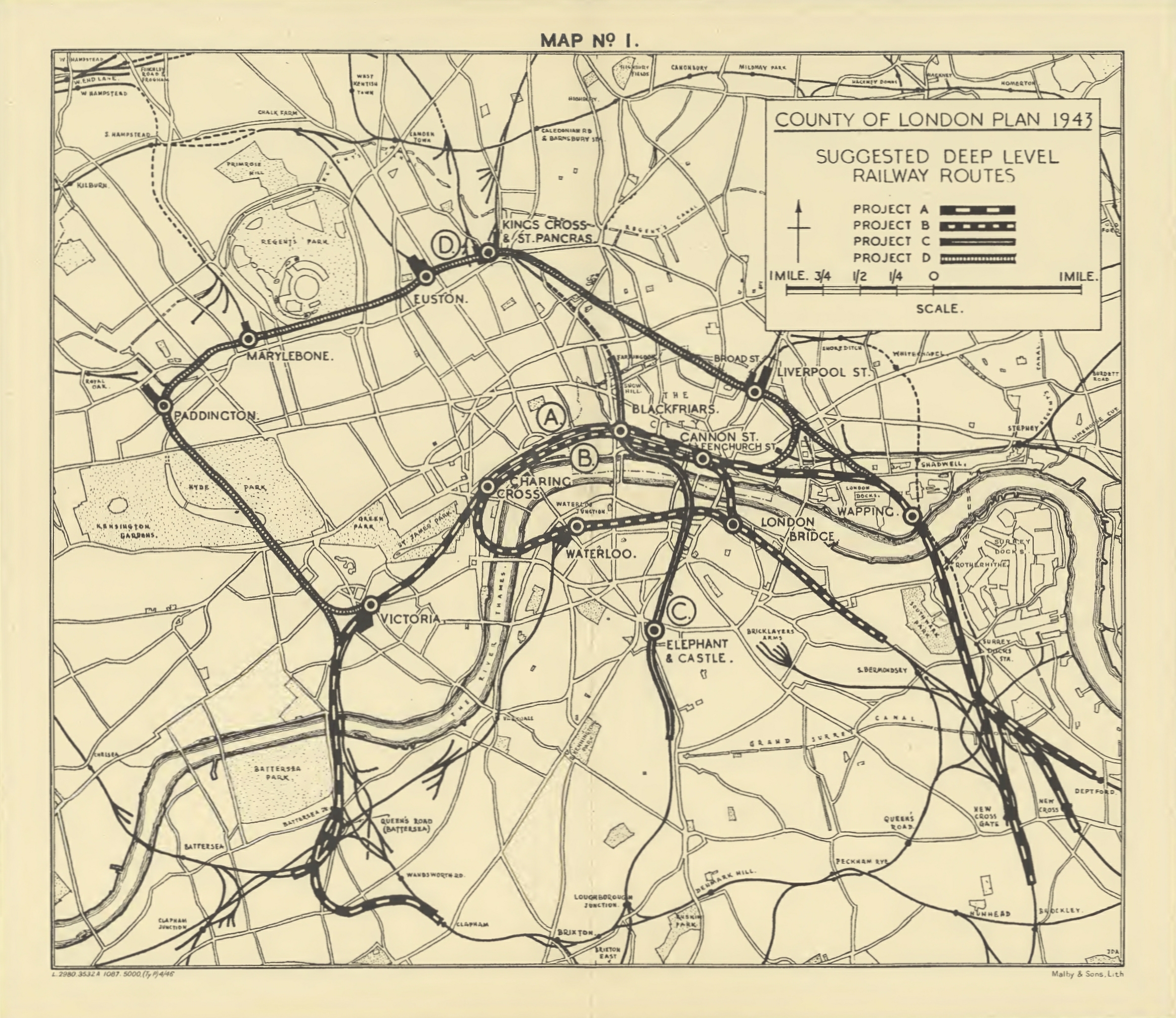
The County of London Plan was prepared for the London County Council in 1943 by John Henry Forshaw (1895–1973) and Sir Leslie Patrick Abercrombie (1879–1957) Its main purpose was to point out the main directions of development and reconstruction of London, which in the past decades had faced big changes and irregular growth. It was prepared in anticipation of the end of World War II and the reconstruction after bomb damage and large movements of population. It focused on five problems, for which it proposed solutions: * traffic congestion * depressed housing * inadequacy and maldistribution of open spaces * jumble of houses and industries * sprawl, and suburbanisation of surrounding country towns Ring roads One of the solutions was to create ring roads around the capital. Construction would have involved considerable disruption, even through parts of the city damaged by bombs, and the roads were not built, but the "C Ring" (the third ring out from the city centre) ... [...More Info...] [...Related Items...] OR: [Wikipedia] [Google] [Baidu] |
Greater London Plan
The Greater London Plan of 1944 was developed by Patrick Abercrombie (1879–1957). The plan was directly related to the County of London Plan written by John Henry Forshaw (1895–1973) and Abercrombie in 1943. Following World War II, London was presented with an opportunity to amend the perceived failings of unplanned and haphazard development that had occurred as a result of rapid industrialisation in the nineteenth century. During the Second World War, the Blitz had destroyed large urban areas throughout the entire county of London, but particularly the central core. Over 50,000 inner London homes were completely destroyed, while more than 2 million dwellings experienced some form of bomb damage. This presented the London County Council with a unique chance to plan and rebuild vacant tracts of the city on a scale not seen since the Great Fire of London. The plan was based around five main issues facing London at the time: *Population growth *Housing *Employment and indust ... [...More Info...] [...Related Items...] OR: [Wikipedia] [Google] [Baidu] |
Charles Bressey
Sir Charles Herbert Bressey, Order of the Bath, CB, Order of the British Empire, CBE (3 January 1874 – 14 April 1951) was an English civil engineer and Chartered Surveyor, surveyor who specialised in road design. Bressey was Chief Engineer for Roads at the Department for Transport, Ministry of Transport from 1921 to 1938. Between 1935 and 1938 he carried out research on road planning and motorway design in preparation for his ''Highway Development Survey, 1937'' for Greater London published in 1938. He served as President of the Royal Institution of Chartered Surveyors, Institution of Chartered Surveyors in 1938–9. Early life Bressey was born in Wanstead, Essex (now in the London Borough of Redbridge), the son of architect John Thomas Bressey and Elizabeth Bressey (née Farrow). He was educated at Forest School (Walthamstow), Forest School, Walthamstow and in France and Germany before starting work in his father's practice in the City of London, becoming a partner in 1896. Whe ... [...More Info...] [...Related Items...] OR: [Wikipedia] [Google] [Baidu] |
Wapping
Wapping () is a district in East London in the London Borough of Tower Hamlets. Wapping's position, on the north bank of the River Thames, has given it a strong maritime character, which it retains through its riverside public houses and steps, such as the Prospect of Whitby and Wapping Stairs. It also has a Royal Navy shore establishment base on the riverfront called HMS President and home to Tobacco Dock and King Edward Memorial Park. Many of the original buildings were demolished during the construction of the London Docks and Wapping was further seriously damaged during the Blitz. As the London Docklands declined after the Second World War, the area became run down, with the great warehouses left empty. The area's fortunes were transformed during the 1980s by the London Docklands Development Corporation when the warehouses started to be converted into luxury flats. Rupert Murdoch moved his News International printing and publishing works into Wapping in 1986, resulting in a ... [...More Info...] [...Related Items...] OR: [Wikipedia] [Google] [Baidu] |
Shadwell Railway Station
Shadwell is a London Overground station in Shadwell in East London. It was formerly a London Underground station on the East London line until 2007. The station is between to the north and to the south. It is located near to Shadwell DLR station. The station is in Travelcard Zone 2. The Overground station is underground (the DLR station is on a viaduct). The Overground platforms are decorated with enamel panels designed by Sarah McMenemy in 1995. History London Underground The original station was one of the oldest on the network, and was built over a spring. First opened by the East London Railway on 10 April 1876, it was first served by the District Railway and Metropolitan Railway on 1 October 1884. It was renamed ''Shadwell & St. George-in-the-East'' on 1 July 1900, but reverted to its original name in 1918. A new ticket hall was built on Cable Street in 1983, replacing the original building in Watney Street, which was demolished in May 2010. Access to the station p ... [...More Info...] [...Related Items...] OR: [Wikipedia] [Google] [Baidu] |
Cannon Street Railway Station
Cannon Street station, also known as London Cannon Street, is a central London railway terminus and connected London Underground station in Travelcard zone 1 located on Cannon Street in the City of London and managed by Network Rail. It is one of two London termini of the South Eastern Main Line, the other being , while the Underground station is on the Circle and District lines, between Monument and Mansion House. The station runs services by Southeastern, mostly catering for commuters in southeast London and Kent, with occasional services further into the latter. The station was built on a site of the medieval steelyard, the trading base in England of the Hanseatic League. It was built by the South Eastern Railway in order to have a railway terminal in the City and compete with the rival London, Chatham and Dover Railway. This required a new bridge across the River Thames, which was constructed between 1863 and 1866. The station was initially a stop for continental service ... [...More Info...] [...Related Items...] OR: [Wikipedia] [Google] [Baidu] |
Charing Cross Railway Station
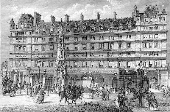
Charing Cross railway station (also known as London Charing Cross) is a central London railway terminus between the Strand and Hungerford Bridge in the City of Westminster. It is the terminus of the South Eastern Main Line to Dover via Ashford. All trains are operated by Southeastern, which provides the majority of commuter and regional services to south-east London and Kent. It is connected to Charing Cross Underground station and is near to Embankment Underground station and Embankment Pier. The station was originally opened by the South Eastern Railway in 1864. It takes its name from its proximity to the road junction Charing Cross, the notional "centre of London" from which distances from the city are measured. During the 19th century the station became the main London terminus for continental traffic via boat trains, and served several prestigious international services. It was badly damaged by an engineering accident in 1905 and extensively rebuilt, subsequently beco ... [...More Info...] [...Related Items...] OR: [Wikipedia] [Google] [Baidu] |
London Victoria Railway Station
Victoria station, also known as London Victoria, is a central London railway terminus and connected London Underground station in Victoria, in the City of Westminster, managed by Network Rail. Named after the nearby Victoria Street (not the Queen), the main line station is a terminus of the Brighton Main Line to and and the Chatham Main Line to and Dover via . From the main lines, trains can connect to the Catford Loop Line, the Dartford Loop Line, and the Oxted line to and . Southern operates most commuter and regional services to south London, Sussex and parts of east Surrey, while Southeastern operates trains to south-east London and Kent, alongside limited services operated by Thameslink. Gatwick Express trains run direct to Gatwick. The Underground station is on the Circle and District lines between and , and the Victoria line between and . The area around the station is an important interchange for other forms of transport: a local bus station is in the forecourt an ... [...More Info...] [...Related Items...] OR: [Wikipedia] [Google] [Baidu] |
Battersea
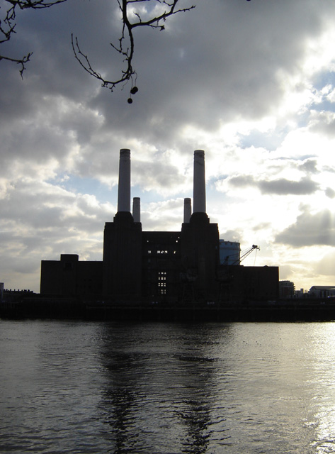
Battersea is a large district in south London, part of the London Borough of Wandsworth, England. It is centred southwest of Charing Cross and extends along the south bank of the River Thames. It includes the Battersea Park. History Battersea is mentioned in the few surviving Anglo-Saxon geographical accounts as ''Badrices īeg'' meaning "Badric's Island" and later "Patrisey". As with many former parishes beside tidal flood plains the lowest land was reclaimed for agriculture by draining marshland and building culverts for streams. Alongside this was the Heathwall tide mill in the north-east with a very long mill pond regularly draining and filling to the south. The settlement appears in the Domesday Book of 1086 as ''Patricesy'', a vast manor held by St Peter's Abbey, Westminster. Its ''Domesday'' Assets were: 18 hides and 17 ploughlands of cultivated land; 7 mills worth £42 9s 8d per year, of meadow, woodland worth 50 hogs. It rendered (in total): £75 9s 8d. The p ... [...More Info...] [...Related Items...] OR: [Wikipedia] [Google] [Baidu] |
Circle Line (London Underground)
The Circle line is a spiral-shaped London Underground line, running from Hammersmith in the west to Edgware Road and then looping around central London back to Edgware Road. The railway is below ground in the central section and on the loop east of Paddington. Unlike London's deep-level lines, the Circle line tunnels are just below the surface and are of similar size to those on British main lines. Printed in yellow on the Tube map, the line serves 36 stations, including most of London's main line termini. Almost all of the route, and all the stations, are shared with one or more of the three other sub-surface lines, namely the District, Hammersmith & City and Metropolitan lines. On the Circle and Hammersmith & City lines combined, over 114 million passenger journeys were recorded in 2011/12. The first section became operational in 1863 when the Metropolitan Railway opened the world's first underground line between Paddington and with wooden carriages and steam locomo ... [...More Info...] [...Related Items...] OR: [Wikipedia] [Google] [Baidu] |
London Underground
The London Underground (also known simply as the Underground or by its nickname the Tube) is a rapid transit system serving Greater London and some parts of the adjacent ceremonial counties of England, counties of Buckinghamshire, Essex and Hertfordshire in England. The Underground has its origins in the Metropolitan Railway, the world's first underground passenger railway. Opened on 10 January 1863, it is now part of the Circle line (London Underground), Circle, District line, District, Hammersmith & City line, Hammersmith & City and Metropolitan lines. The first line to operate underground electric locomotive, electric traction trains, the City & South London Railway in 1890, is now part of the Northern line. The network has expanded to 11 lines, and in 2020/21 was used for 296 million passenger journeys, making it List of metro systems, one of the world's busiest metro systems. The 11 lines collectively handle up to 5 million passenger journeys a day and serve 272 ... [...More Info...] [...Related Items...] OR: [Wikipedia] [Google] [Baidu] |
South Bank
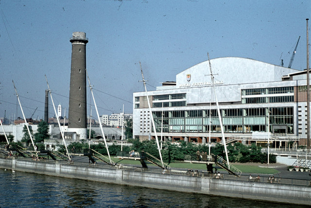
The South Bank is an entertainment and commercial district in central London, next to the River Thames opposite the City of Westminster. It forms a narrow strip of riverside land within the London Borough of Lambeth (where it adjoins Albert Embankment) and the London Borough of Southwark, (where it adjoins Bankside). As such, the South Bank may be regarded as somewhat akin to the riverside part of an area known previously as Lambeth Marsh and North Lambeth. While the South Bank is not formally defined, it is generally understood to bounded by Westminster Bridge and Blackfriars Bridge, and to be centred approximately half a mile (800 metres) south-east of Charing Cross. The name South Bank was first widely used in 1951 during the Festival of Britain. The area's long list of attractions includes the County Hall complex, the Sea Life London Aquarium, the London Dungeon, Jubilee Gardens and the London Eye, the Southbank Centre, Royal Festival Hall, National Theatre, an ... [...More Info...] [...Related Items...] OR: [Wikipedia] [Google] [Baidu] |
Elevated Railway
An elevated railway or elevated train (also known as an el train for short) is a rapid transit railway with the tracks above street level on a viaduct or other elevated structure (usually constructed from steel, cast iron, concrete, or bricks). The railway may be broad-gauge, standard-gauge or narrow-gauge railway, light rail, monorail, or a suspension railway. Elevated railways are normally found in urban areas where there would otherwise be multiple level crossings. Usually, the tracks of elevated railways that run on steel viaducts can be seen from street level. History The earliest elevated railway was the London and Greenwich Railway on a brick viaduct of 878 arches, built between 1836 and 1838. The first of the London and Blackwall Railway (1840) was also built on a viaduct. During the 1840s there were other plans for elevated railways in London that never came to fruition. From the late 1860s onward, elevated railways became popular in US cities. The New York West ... [...More Info...] [...Related Items...] OR: [Wikipedia] [Google] [Baidu] |


_p142_-_Victoria_Station_(plan).jpg)


