|
Contiomagus
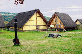
Contiomagus was a Gallo-Roman vicus in the Roman province of Gallia Belgica. The location today is the site of the district of Pachten in the municipality of Dillingen, Saarland. Origin Contiomagus was founded during the colonization phase after Caesar's conquest of Gaul from 58 to 51 BC. The location on the intersecting trunk roads Trier-Straßburg and Metz-Mainz as well as the existence of a ford across the Saar (Saravus) and the proximity to the valleys of Prims and Nied favored the development of Contiomagus. Coin finds indicate that the settlement originated around 10 BC and lasted for 200 years. The name of the place, "Contiomagus", consists of the Celtic word component "magus" (market) and the short form "Contio" for Condate/Confluentes (confluence). As a "confluence" one must assume the mouth of the Prims into the Saar, located in the immediate vicinity of Contiomagus. A similar name has the place Konz (Contionacum) at the mouth of the Saar into the Moselle. Th ... [...More Info...] [...Related Items...] OR: [Wikipedia] [Google] [Baidu] |
Dillingen, Saarland
Dillingen (also: ''Dillingen an der Saar'') (french: Dillange) is a town in the district of Saarlouis, in Saarland. It has about 20,000 inhabitants and is divided into the three districts Dillingen-city center, Pachten and Diefflen. The city is located on the edge of the Saar-Hunsrück Nature Park at the mouth of the Prims in the Saar and is located about 10 km from the French border. Dillingen is located about 60 km from Luxembourg City and Trier, 50 km from Metz and 30 km from Saarbrücken and is directly adjacent to the urban area of Saarlouis. In terms of population, it is the second largest municipality in the district of Saarlouis. The Dillinger Hütte steelworks is located here. Geography Geographical location Dillingen lies to the right of the Saar in the northern part of the Basin of Saarlouis and thus in the Saar-Nahe Basin. The Basin of Saarlouis is bounded on the northwest, north and northeast by the heights of the Buntsandstein. They belong to ... [...More Info...] [...Related Items...] OR: [Wikipedia] [Google] [Baidu] |
Gallo-Roman
Gallo-Roman culture was a consequence of the Romanization of Gauls under the rule of the Roman Empire. It was characterized by the Gaulish adoption or adaptation of Roman culture, language, morals and way of life in a uniquely Gaulish context. The well-studied meld of cultures in Gaul gives historians a model against which to compare and contrast parallel developments of Romanization in other, less-studied Roman provinces. ''Interpretatio romana'' offered Roman names for Gaulish deities such as the smith-god Gobannus, but of Celtic deities only the horse-patroness Epona penetrated Romanized cultures beyond the confines of Gaul. The barbarian invasions beginning in the late third century forced upon Gallo-Roman culture fundamental changes in politics, in the economic underpinning, in military organization. The Gothic settlement of 418 offered a double loyalty, as Western Roman authority disintegrated at Rome. The plight of the highly Romanized governing class is examined by ... [...More Info...] [...Related Items...] OR: [Wikipedia] [Google] [Baidu] |
Tholey
Tholey () is a municipality in the district of Sankt Wendel, in Saarland, Germany. It is situated approximately west of Sankt Wendel, and north of Saarbrücken. History Local history The first traces of settlement in the area of today's Tholey go back to the Celts. Multiple archaeological finds show an extended occupation by the Romans. In medieval times, much of today's Saarland was tributary to the Abbey of Tholey. To protect the abbey a castle was constructed on the nearby Schaumberg. Tholey was under control of Lorraine and of the Archbishop Prince-elector of Trier. Tholey is located on the edge of the Schaumberg, the highest mountain in Saarland and the Hunsrück range. The name has been derived from the Celtic ''*dol(wo)'' meaning "outstanding", a derivation found also in the name of the neighboring Dollberg hill and in Lorelei (originally Dorley), related to the German ''toll'' or ''doll''. " Ley" is a Celtic and Germanic word meaning "cliffs." Tholey is thus "the vi ... [...More Info...] [...Related Items...] OR: [Wikipedia] [Google] [Baidu] |
Sarrebourg
Sarrebourg (; also , ; Lorraine Franconian: ; older la, Pons Saravi) is a commune of northeastern France. In 1895 a Mithraeum was discovered at Sarrebourg at the mouth of the pass leading from the Vosges Mountains. Geography Sarrebourg is located in the department of Moselle, Lorraine, administrative region of Grand Est. It lies in on the upper course of the river Saar. The Vosges mountains are located about 10 kilometers south of the locality. To the northwest, the Oberwald forest massif - where the state forest of the municipality is located. It is 54 km away from Strasbourg, 64 km from Nancy, 77 km from Metz and 345 km from Paris ( orthodromic distance). The lines of communication and transport Sarrebourg station has rail connections to Paris, Strasbourg, Metz and Nancy. The commune is on the route of the Route nationale 4. Sarrebourg is the departure point of several departmental roads: D 27 to Morhange, D 43 to Sarre-Union, D 44 to Le Donon ... [...More Info...] [...Related Items...] OR: [Wikipedia] [Google] [Baidu] |
Valentinian I
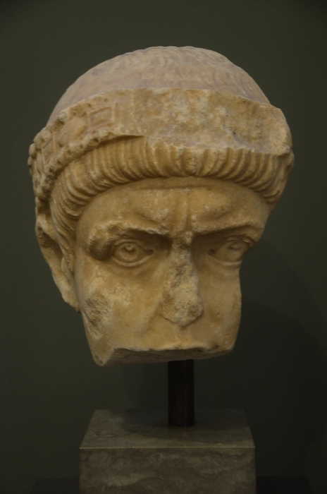
Valentinian I ( la, Valentinianus; 32117 November 375), sometimes called Valentinian the Great, was Roman emperor from 364 to 375. Upon becoming emperor, he made his brother Valens his co-emperor, giving him rule of the eastern provinces. Valentinian retained the west. During his reign, Valentinian fought successfully against the Alamanni, Quadi, and Sarmatians. Most notable was his victory over the Alamanni in 367 at the Battle of Solicinium. His general Count Theodosius defeated a revolt in Africa and the Great Conspiracy, a coordinated assault on Roman Britain by Picts, Scots, and Saxons. Valentinian was also the last emperor to conduct campaigns across both the Rhine and Danube rivers. Valentinian rebuilt and improved the fortifications along the frontiers, even building fortresses in enemy territory. He founded the Valentinianic dynasty, with his sons Gratian and Valentinian II succeeding him in the western half of the empire. Early life Valentinian was born in 321 ... [...More Info...] [...Related Items...] OR: [Wikipedia] [Google] [Baidu] |
Ausonius
Decimius Magnus Ausonius (; – c. 395) was a Roman poet and teacher of rhetoric from Burdigala in Aquitaine, modern Bordeaux, France. For a time he was tutor to the future emperor Gratian, who afterwards bestowed the consulship on him. His best-known poems are ''Mosella'', a description of the river Moselle, and ''Ephemeris'', an account of a typical day in his life. His many other verses show his concern for his family, friends, teachers, and circle of well-to-do acquaintances and his delight in the technical handling of meter. Biography Decimius Magnus Ausonius was born in Burdigala, the son of Julius Ausonius (c. AD 290–378), a physician of Greek ancestry,The Cambridge History of Classical Literature, Edward John Kenney, Cambridge University Press, p.16 and Aemilia Aeonia, daughter of Caecilius Argicius Arborius, descended on both sides from established, land-owning Gallo-Roman families of southwestern Gaul. Ausonius was given a strict upbringing by his aunt and gr ... [...More Info...] [...Related Items...] OR: [Wikipedia] [Google] [Baidu] |
Mediomatrici
The Mediomatrici (Gaulish: ''*Medio-māteres'') were according to Caesar a Gaulish tribe at the frontier to the Belgicae dwelling in the present-day regions Lorraine, Upper Moselle during the Iron Age and the Roman period. Name They are mentioned as ''Mediomatricorum'' and ''Mediomatricis'' (dat.) by Caesar (mid-1st c. BC), ''Mediomatrikoì'' (Μεδιοματρικοὶ ) by Strabo (early 1st c. AD), ''Mediomatrici'' by Pliny (1st c. AD), ''Mediomatricos'' (acc.) by Tacitus (early 2nd c. AD), and as ''Mediomátrikes'' (Μεδιομάτρικες) by Ptolemy (2nd c. AD). The ethnonym ''Mediomatrici'' is a latinized form of the Gaulish ''*Medio-māteres'', which literally means 'Middle-Mothers'. It is formed with the stem ''medio-'' ('in the middle, central') attached to a plural form of ''mātīr'' ('mother'). The name could be interpreted as meaning 'those who live between the Matrona (Marne) and the Matra rivers' (i.e. the mother-rivers), or possibly as the 'Mothers of the ... [...More Info...] [...Related Items...] OR: [Wikipedia] [Google] [Baidu] |
La Tène Culture
The La Tène culture (; ) was a European Iron Age culture. It developed and flourished during the late Iron Age (from about 450 BC to the Roman conquest in the 1st century BC), succeeding the early Iron Age Hallstatt culture without any definite cultural break, under considerable Mediterranean influence from the Greeks in pre-Roman Gaul, the Etruscans, and the Golasecca culture, but whose artistic style nevertheless did not depend on those Mediterranean influences. La Tène culture's territorial extent corresponded to what is now France, Belgium, Switzerland, Austria, England, Southern Germany, the Czech Republic, parts of Northern Italy and Central Italy, Slovenia and Hungary, as well as adjacent parts of the Netherlands, Slovakia, Serbia, Croatia, Transylvania (western Romania), and Transcarpathia (western Ukraine). The Celtiberians of western Iberia shared many aspects of the culture, though not generally the artistic style. To the north extended the contemporary Pre-Roma ... [...More Info...] [...Related Items...] OR: [Wikipedia] [Google] [Baidu] |
Treveri
The Trēverī (Gaulish: *''Trēueroi'') were a Celtic tribe of the Belgae group who inhabited the lower valley of the Moselle from around 150 BCE, if not earlier, until their displacement by the Franks. Their domain lay within the southern fringes of the ''Silva Arduenna'' ( Ardennes Forest), a part of the vast Silva Carbonaria, in what are now Luxembourg, southeastern Belgium and western Germany; its centre was the city of Trier (''Augusta Treverorum''), to which the Treveri give their name. Celtic in language, according to Tacitus they claimed Germanic descent.Tacitus writes, "The Treveri and Nervii are even eager in their claims of a German origin, thinking that the glory of this descent distinguishes them from the uniform level of Gallic effeminacy." ''Germania'' XXVIII. They possibly contained both Gallic and Germanic influences. Although early adopters of Roman material culture, the Treveri had a chequered relationship with Roman power. Their leader Indutiomarus led them ... [...More Info...] [...Related Items...] OR: [Wikipedia] [Google] [Baidu] |
Saarbrücken
Saarbrücken (; french: link=no, Sarrebruck ; Rhine Franconian: ''Saarbrigge'' ; lb, Saarbrécken ; lat, Saravipons, lit=The Bridge(s) across the Saar river) is the capital and largest city of the state of Saarland, Germany. Saarbrücken is Saarland's administrative, commercial and cultural centre and is next to the French border. The modern city of Saarbrücken was created in 1909 by the merger of three towns, Saarbrücken, St. Johann, and Malstatt-Burbach. It was the industrial and transport centre of the Saar coal basin. Products included iron and steel, sugar, beer, pottery, optical instruments, machinery, and construction materials. Historic landmarks in the city include the stone bridge across the Saar (1546), the Gothic church of St. Arnual, the 18th-century Saarbrücken Castle, and the old part of the town, the ''Sankt Johanner Markt'' (Market of St. Johann). In the 20th century, Saarbrücken was twice separated from Germany: from 1920 to 1935 as capit ... [...More Info...] [...Related Items...] OR: [Wikipedia] [Google] [Baidu] |
Beckingen
Beckingen (Saarlandic dialect: Beckinge) is a municipality in the Merzig-Wadern district in Saarland, Germany. It is situated on the river Saar, approximately 7 km southeast of Merzig and 30 km northwest of Saarbrücken. It was created on January 1, 1974 as part of the territorial and administrative reform of the villages Beckingen, Düppenweiler, Erbringen, Hargarten, Hausstadt, Honzrath, Oppen, Reimsbach and Saarfels. Overview Beckingen is a village outside of Merzig. The old gothic-style railway station from 1858 () has been renovated from 2009 to 2014 after suffering severe damages in the Second World War. It is the second oldest surviving railway station in the Saarland and the most architecturally elaborate along the Saar Railway The Saarbrücken–Trier railway, known in German as the ''Saarstrecke'' (literally the "Saar line") in the German states of Rhineland-Palatinate and Saarland. It connects Saarbrücken and Trier. It was opened in 1858 and 1860 and ... [...More Info...] [...Related Items...] OR: [Wikipedia] [Google] [Baidu] |
Zerf
Zerf is a municipality in the Trier-Saarburg district, in Rhineland-Palatinate, Germany. History From 18 July 1946 to 6 June 1947 Zerf, in its then municipal boundary, formed part of the Saar Protectorate The Saar Protectorate (german: Saarprotektorat ; french: Protectorat de la Sarre) officially Saarland (french: Sarre) was a French protectorate separated from Germany; which was later opposed by the Soviet Union, one side occupying Germany like .... References Municipalities in Rhineland-Palatinate Trier-Saarburg {{TrierSaarburg-geo-stub ... [...More Info...] [...Related Items...] OR: [Wikipedia] [Google] [Baidu] |

.jpg)


