|
Colosseum Mountain
Colosseum Mountain is a 12,473-foot-elevation (3,802 meter) double summit mountain located on the crest of the Sierra Nevada mountain range in northern California. It is situated on the common border of Fresno County with Inyo County, as well as the shared boundary of John Muir Wilderness and Kings Canyon National Park. It is northwest of the community of Independence, east of Mount Cedric Wright, west of Sawmill Point, and south-southeast of Mount Perkins, the nearest higher neighbor. The lower east summit is 12,451-feet in elevation and marked as Colosseum Mountain on maps, but the 12,473-foot west summit is higher. Approximately 1,000 feet distance separate the two summits. The John Muir Trail passes to the west of this peak, providing an approach to the mountain. The first ascent of the summit was made August 5, 1922, by Chester Versteeg, a prominent Sierra Club member, via the southwest face.Sierra Club Bulletin, (1923) page 421. Climate According to the Köppen clima ... [...More Info...] [...Related Items...] OR: [Wikipedia] [Google] [Baidu] |
Pinchot Pass
Pinchot Pass is a high mountain pass in the Sierra Nevada mountain range of California, in the United States. It lies within far eastern Fresno County, inside Kings Canyon National Park and the Sequoia-Kings Canyon Wilderness. Pinchot Pass sits at an elevation of 12,090 feet (3,685 m), running roughly from east to west, situated between 12,874-foot Crater Mountain to the southwest and 13,179-foot Mount Wynne directly to the east. The pass separates a lakes basin that includes Marjorie Lake to the north, and the Woods Creek drainage (a major tributary of the South Fork Kings River) to the south. The seasonally-staffed Bench Lake ranger station is just over 2 miles to the north of the pass, near the trail turnoff from the John Muir Trail to Taboose Pass. The pass is traversed by the John Muir Trail and the Pacific Crest Trail, which are coincident (sharing the same route) between Crabtree Meadows and Tuolumne Meadows. It is one of the six high mountain passes above 11,000 fe ... [...More Info...] [...Related Items...] OR: [Wikipedia] [Google] [Baidu] |
Alpine Climate
Alpine climate is the typical weather (climate) for elevations above the tree line, where trees fail to grow due to cold. This climate is also referred to as a mountain climate or highland climate. Definition There are multiple definitions of alpine climate. In the Köppen climate classification, the alpine and mountain climates are part of group ''E'', along with the polar climate, where no month has a mean temperature higher than . According to the Holdridge life zone system, there are two mountain climates which prevent tree growth : a) the alpine climate, which occurs when the mean biotemperature of a location is between . The alpine climate in Holdridge system is roughly equivalent to the warmest tundra climates (ET) in the Köppen system. b) the alvar climate, the coldest mountain climate since the biotemperature is between 0 °C and 1.5 °C (biotemperature can never be below 0 °C). It corresponds more or less to the coldest tundra climates and to ... [...More Info...] [...Related Items...] OR: [Wikipedia] [Google] [Baidu] |
Mountains Of Inyo County, California
A mountain is an elevated portion of the Earth's crust, generally with steep sides that show significant exposed bedrock. Although definitions vary, a mountain may differ from a plateau in having a limited summit area, and is usually higher than a hill, typically rising at least 300 metres (1,000 feet) above the surrounding land. A few mountains are isolated summits, but most occur in mountain ranges. Mountains are formed through tectonic forces, erosion, or volcanism, which act on time scales of up to tens of millions of years. Once mountain building ceases, mountains are slowly leveled through the action of weathering, through slumping and other forms of mass wasting, as well as through erosion by rivers and glaciers. High elevations on mountains produce colder climates than at sea level at similar latitude. These colder climates strongly affect the ecosystems of mountains: different elevations have different plants and animals. Because of the less hospitable terrain and ... [...More Info...] [...Related Items...] OR: [Wikipedia] [Google] [Baidu] |
Inyo National Forest
Inyo National Forest is a United States National Forest covering parts of the eastern Sierra Nevada of California and the White Mountains of California and Nevada. The forest hosts several superlatives, including Mount Whitney, the highest point in the contiguous United States; Boundary Peak, the highest point in Nevada; and the Ancient Bristlecone Pine Forest, which protects the oldest living trees in the world. The forest, encompassing much of the Owens Valley, was established by Theodore Roosevelt as a way of sectioning off land to accommodate the Los Angeles Aqueduct project in 1907, making the Inyo National Forest one of the least wooded forests in the U.S. National Forest system. Geography The forest covers and includes nine designated wilderness areas which protect over . Most of the forest is in California, but it includes about in western Nevada. It stretches from the eastern side of Yosemite to south of Sequoia National Park. Geographically it is split in two, o ... [...More Info...] [...Related Items...] OR: [Wikipedia] [Google] [Baidu] |
Mountains Of Kings Canyon National Park
A mountain is an elevated portion of the Earth's crust, generally with steep sides that show significant exposed bedrock. Although definitions vary, a mountain may differ from a plateau in having a limited summit area, and is usually higher than a hill, typically rising at least 300 metres (1,000 feet) above the surrounding land. A few mountains are isolated summits, but most occur in mountain ranges. Mountains are formed through tectonic forces, erosion, or volcanism, which act on time scales of up to tens of millions of years. Once mountain building ceases, mountains are slowly leveled through the action of weathering, through slumping and other forms of mass wasting, as well as through erosion by rivers and glaciers. High elevations on mountains produce colder climates than at sea level at similar latitude. These colder climates strongly affect the ecosystems of mountains: different elevations have different plants and animals. Because of the less hospitable terrain and ... [...More Info...] [...Related Items...] OR: [Wikipedia] [Google] [Baidu] |
Mountains Of Fresno County, California
A mountain is an elevated portion of the Earth's crust, generally with steep sides that show significant exposed bedrock. Although definitions vary, a mountain may differ from a plateau in having a limited summit area, and is usually higher than a hill, typically rising at least 300 metres (1,000 feet) above the surrounding land. A few mountains are isolated summits, but most occur in mountain ranges. Mountains are formed through tectonic forces, erosion, or volcanism, which act on time scales of up to tens of millions of years. Once mountain building ceases, mountains are slowly leveled through the action of weathering, through slumping and other forms of mass wasting, as well as through erosion by rivers and glaciers. High elevations on mountains produce colder climates than at sea level at similar latitude. These colder climates strongly affect the ecosystems of mountains: different elevations have different plants and animals. Because of the less hospitable terrain and ... [...More Info...] [...Related Items...] OR: [Wikipedia] [Google] [Baidu] |
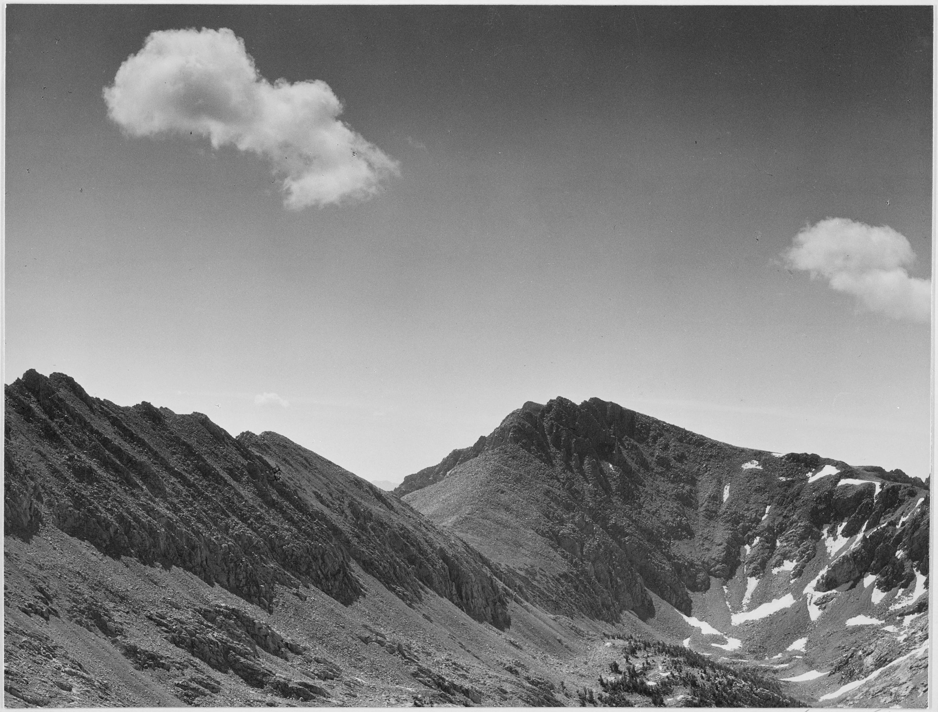
Ansel Adams - National Archives 79-AA-H19
ANSEL, the American National Standard for Extended Latin Alphabet Coded Character Set for Bibliographic Use, was a character set used in text encoding. It provided a table of coded values for the representation of characters of the extended Latin alphabet in machine-readable form for thirty-five languages written in the Latin alphabet and for fifty-one romanized languages. ANSEL adds 63 graphic characters to ASCII, including 29 combining diacritic characters. The initial revision of ANSEL was released in 1985, and before 1993 it was registered as Registration #231 in the ISO International Register of Coded Character Sets to be Used with Escape Sequences. The standard was reaffirmed in 2003 although it has been administratively withdrawn by ANSI effective 14 February 2013. The requirement of hardware capable of overprinting accents doomed this from ever becoming a popular extended ASCII. Code page layout The following table shows ANSI/NISO Z39.47-1993 (R2003). Non-ASCII characte ... [...More Info...] [...Related Items...] OR: [Wikipedia] [Google] [Baidu] |
List Of Mountain Peaks Of California
This article comprises three sortable tables of major mountain peaksThis article defines a significant summit as a summit with at least of topographic prominence, and a major summit as a summit with at least of topographic prominence. All summits in this article have at least 500 meters of topographic prominence. An ultra-prominent summit is a summit with at least of topographic prominence. of the U.S. State of California. The summit of a mountain or hill may be measured in three principal ways: #The topographic elevation of a summit measures the height of the summit above a geodetic sea level.All elevations in this article include an elevation adjustment from the National Geodetic Vertical Datum of 1929 (NGVD 29) to the North American Vertical Datum of 1988 (NAVD 88). For further information, please see this United States National Geodetic Surveybr>noteIf the elevation or prominence of a summit is calculated as a range of values, the arithmetic mean is shown. ... [...More Info...] [...Related Items...] OR: [Wikipedia] [Google] [Baidu] |
Owens Valley
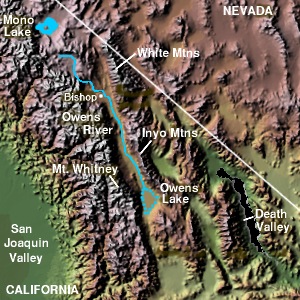
Owens Valley ( Numic: ''Payahǖǖnadǖ'', meaning "place of flowing water") is an arid valley of the Owens River in eastern California in the United States. It is located to the east of the Sierra Nevada, west of the White Mountains and Inyo Mountains, and north of the Mojave Desert. It sits on the west edge of the Great Basin. The mountain peaks on the West side (including Mount Whitney) reach above in elevation, while the floor of the Owens Valley is about , making the valley the deepest in the United States. The Sierra Nevada casts the valley in a rain shadow, which makes Owens Valley "the Land of Little Rain." The bed of Owens Lake, now a predominantly dry endorheic alkali flat, sits on the southern end of the valley. The valley provides water to the Los Angeles Aqueduct, the source of one-third of the water for Los Angeles, and was the area at the center of one of the fiercest and longest-running episodes of the California Water Wars. These episodes inspired aspects ... [...More Info...] [...Related Items...] OR: [Wikipedia] [Google] [Baidu] |
South Fork Kings River
The South Fork Kings River is a tributary of the Kings River in the Sierra Nevada of Fresno County, California. The river forms part of Kings Canyon, the namesake of Kings Canyon National Park and one of the deepest canyons in North America with a maximum relief of from rim to river. Course The South Fork is the largest headwater of the Kings River. It originates at an elevation of at an unnamed lake in Kings Canyon National Park, south of Mather Pass and west of Split Mountain, in a high alpine basin known as Upper Basin. It flows south, and is paralleled for several miles by the combined Pacific Crest Trail/John Muir Trail. The trail and river separate at a point west of Taboose Pass, where the river turns to the southwest through a deep gorge between Cirque Crest to the northwest and Arrow Ridge to the southeast. To the east, the Muro Blanco cliffs rise more than half a mile (0.8 km) above the river. The river flows into Paradise Valley, where it flows in a south-so ... [...More Info...] [...Related Items...] OR: [Wikipedia] [Google] [Baidu] |
Surface Runoff
Surface runoff (also known as overland flow) is the flow of water occurring on the ground surface when excess rainwater, stormwater, meltwater, or other sources, can no longer sufficiently rapidly infiltrate in the soil. This can occur when the soil is saturated by water to its full capacity, and the rain arrives more quickly than the soil can absorb it. Surface runoff often occurs because impervious areas (such as roofs and pavement) do not allow water to soak into the ground. Furthermore, runoff can occur either through natural or man-made processes. Surface runoff is a major component of the water cycle. It is the primary agent of soil erosion by water. The land area producing runoff that drains to a common point is called a drainage basin. Runoff that occurs on the ground surface before reaching a channel can be a nonpoint source of pollution, as it can carry man-made contaminants or natural forms of pollution (such as rotting leaves). Man-made contaminants in run ... [...More Info...] [...Related Items...] OR: [Wikipedia] [Google] [Baidu] |
Orographic Lift
Orographic lift occurs when an air mass is forced from a low elevation to a higher elevation as it moves over rising terrain. As the air mass gains altitude it quickly cools down adiabatically, which can raise the relative humidity to 100% and create clouds and, under the right conditions, precipitation. Orographic lifting can have a number of effects, including precipitation, rain shadowing, leeward winds, and associated clouds. Precipitation Precipitation induced by orographic lift occurs in many places throughout the world. Examples include: * The Mogollon Rim in central Arizona * The western slope of the Sierra Nevada range in California * The mountains near Baja California North – specifically La Bocana to Laguna Hanson. * The windward slopes of Khasi and Jayantia Hills (see Mawsynram) in the state of Meghalaya in India. * The Western Highlands of Yemen, which receive by far the most rain in Arabia. * The Western Ghats that run along India's western coast. * The Gre ... [...More Info...] [...Related Items...] OR: [Wikipedia] [Google] [Baidu] |


