|
Clifden
Clifden (, meaning "stepping stones") is a coastal town in County Galway, Ireland, in the region of Connemara, located on the Owenglin River where it flows into Clifden Bay. As the largest town in the region, it is often referred to as "the Capital of Connemara". Frequented by tourists, Clifden is linked to Galway city by the N59. History 19th century The town was founded at the start of the 19th century by John D'Arcy (1785–1839) who lived in Clifden Castle (built around 1818, now a ruin) west of Clifden. He had inherited the estate in 1804 when it was mostly inhabited by fishermen and farmers. The idea of establishing a town on the coast was first voiced by him in 1812. Bad communications and a lack of private capital prevented fast progress until the 1820s when the potato crop failed in 1821–22 and D'Arcy petitioned the government in Dublin for assistance. The engineer Alexander Nimmo was sent to the area in 1822. He constructed a quay at Clifden (finished in 1831) and ... [...More Info...] [...Related Items...] OR: [Wikipedia] [Google] [Baidu] |
Clifden Castle
Clifden Castle is a ruined manor house west of the town of Clifden in the Connemara region of County Galway, Ireland. It was built for John D'Arcy, the local landowner, in the Gothic Revival style. It fell into disrepair after becoming uninhabited in 1894. In 1935, ownership passed to a group of tenants, who were to own it jointly, and it quickly became a ruin. History John D'Arcy (1785–1839), founder of Clifden, had this house constructed for himself and his family even while he was busy building up the town. The Castle dates from around 1818 and served as the main dwelling of the large D'Arcy family for the next decades. The land surrounding it was among the first D’Arcy drained and reclaimed in the Clifden area. In 1839, John D'Arcy died and his oldest son, Hyacinth, inherited the estate. However, Hyacinth (1806?–1874) was not as adept as his father at running the family properties and at dealing with his tenants. More disastrously, in 1845 the famine struck. Hung ... [...More Info...] [...Related Items...] OR: [Wikipedia] [Google] [Baidu] |
John D'Arcy (1785–1839)
John D'Arcy (1785–1839) was the founder of town of Clifden, recognised as the capital of Connemara, in County Galway, Ireland. He was to reside at the mansion he had built, Clifden Castle. Life D'Arcy was descended from the County Galway family, the D’Arcys of Kiltullagh, one of the "Fourteen tribes of Galway". D'Arcy was born in 1785. In 1804 he was to inherit family lands in Connemara, East Galway and Mayo in 1804 from his cousin Patrick. In the same year, on 4 June 1804, he way to marry Frances Blake, and she was to bear him four sons and two daughters. While the inherited estates were traditionally managed from Kiltullagh near Athenry, D'Arcy, with his interest in sailing, seemed to prefer Connemara, and developed ambitions to develop a town at Clifden on the Owenglin River. D'Arcy was appointed High Sheriff or Galway in 1811 but was to lose the position in the following year due to a controversial release of three Connemara men from Galway prison. This was also to m ... [...More Info...] [...Related Items...] OR: [Wikipedia] [Google] [Baidu] |
Connemara
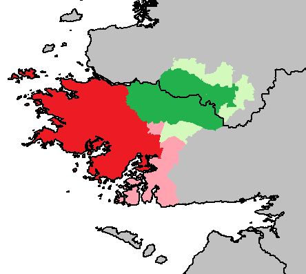
Connemara (; )( ga, Conamara ) is a region on the Atlantic Ocean, Atlantic coast of western County Galway, in the west of Ireland. The area has a strong association with traditional Irish culture and contains much of the Connacht Irish-speaking Gaeltacht, which is a key part of the identity of the region and is the largest Gaeltacht in the country. Historically, Connemara was part of the territory of Iar Connacht (West Connacht). Geographically, it has many mountains (notably the Twelve Bens), peninsulas, coves, islands and small lakes. Connemara National Park is in the northwest. It is mostly rural and its largest settlement is Clifden. Etymology "Connemara" derives from the tribal name , which designated a branch of the , an early tribal grouping that had a number of branches located in different parts of . Since this particular branch of the lived by the sea, they became known as the (sea in Irish is , genitive case, genitive , hence "of the sea"). Definition One common ... [...More Info...] [...Related Items...] OR: [Wikipedia] [Google] [Baidu] |
Transatlantic Flight Of Alcock And Brown
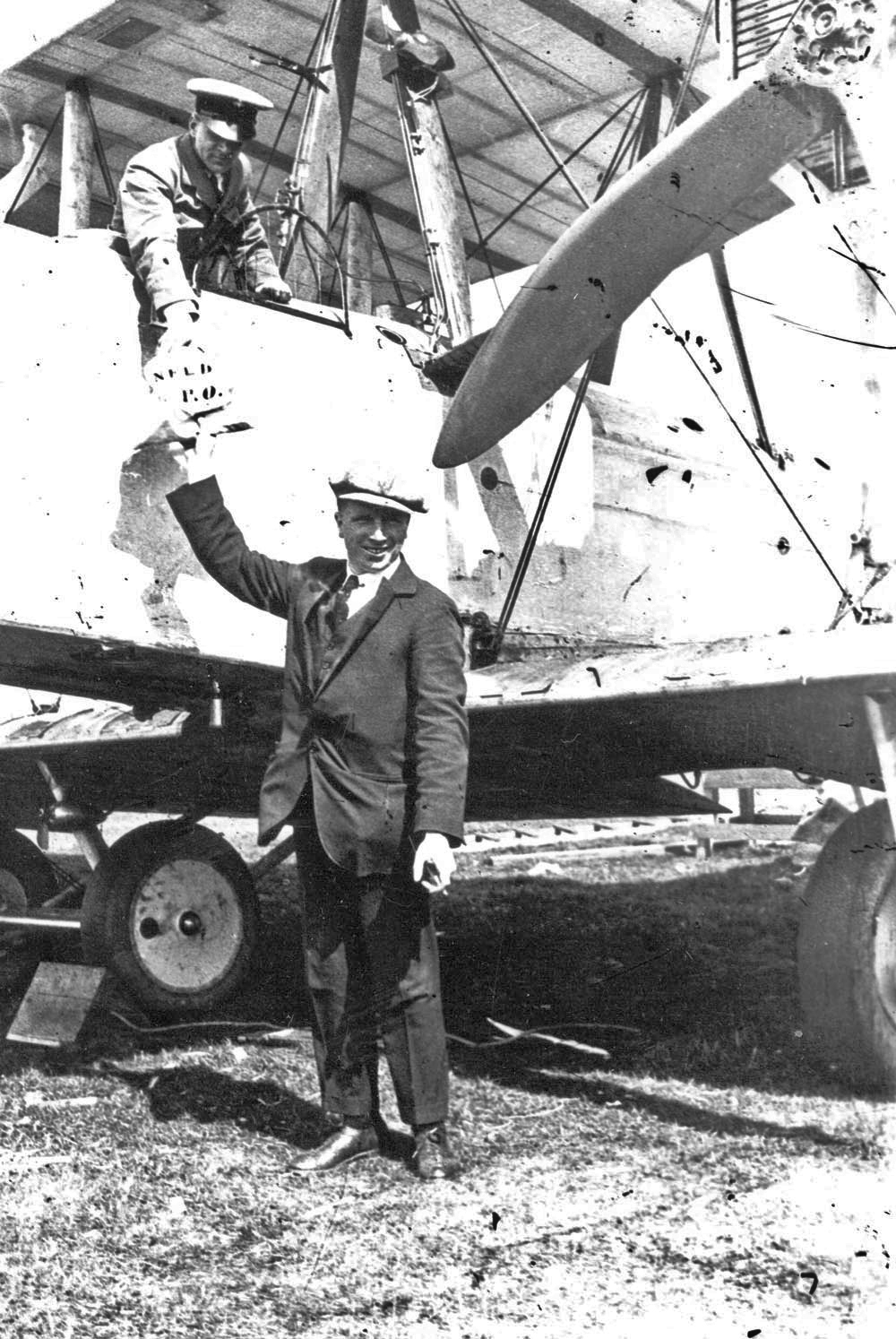
British aviators John Alcock and Arthur Brown made the first non-stop transatlantic flight in June 1919. They flew a modified First World War Vickers Vimy bomber from St. John's, Newfoundland, to Clifden, County Galway, Ireland. The Secretary of State for Air, Winston Churchill, presented them with the ''Daily Mail'' prize for the first crossing of the Atlantic Ocean by aeroplane in "less than 72 consecutive hours." A small amount of mail was carried on the flight, making it the first transatlantic airmail flight. The two aviators were awarded the honour of Knight Commander of the Most Excellent Order of the British Empire (KBE) by King George V at Windsor Castle a week later. Background John Alcock was born in 1892 in Basford House on Seymour Grove, Firswood, Manchester, England. Known to his family and friends as "Jack", he first became interested in flying at the age of seventeen and gained his pilot's licence in November 1912. Alcock was a regular competitor in aircr ... [...More Info...] [...Related Items...] OR: [Wikipedia] [Google] [Baidu] |
Galway
Galway ( ; ga, Gaillimh, ) is a City status in Ireland, city in the West Region, Ireland, West of Ireland, in the Provinces of Ireland, province of Connacht, which is the county town of County Galway. It lies on the River Corrib between Lough Corrib and Galway Bay, and is the List of settlements on the island of Ireland by population, sixth most populous city on the island of Ireland and the List of urban areas in the Republic of Ireland by population, fourth most populous in the Republic of Ireland, with a population at the 2022 census of Ireland, 2022 census of 83,456. Located near an earlier settlement, Galway grew around a fortification built by the Kings of Connacht, King of Connacht in 1124. A municipal charter in 1484 allowed citizens of the by then walled city to form a Galway City Council, council and mayoralty. Controlled largely by a group of merchant families, the Tribes of Galway, the city grew into a trading port. Following a period of decline, as of the 21st ... [...More Info...] [...Related Items...] OR: [Wikipedia] [Google] [Baidu] |
Guglielmo Marconi
Guglielmo Giovanni Maria Marconi, 1st Marquis of Marconi (; 25 April 187420 July 1937) was an Italians, Italian inventor and electrical engineering, electrical engineer, known for his creation of a practical radio wave-based Wireless telegraphy, wireless telegraph system. This led to Marconi being credited as the inventor of radio, and he shared the 1909 Nobel Prize in Physics with Karl Ferdinand Braun "in recognition of their contributions to the development of wireless telegraphy".Guglielmo Marconi: The Nobel Prize in Physics 1909 . nobelprize.org Marconi was also an entrepreneur, businessman, and founder of Marconi Company, The Wireless Telegraph & Signal Company in the United Kingdom of Great Britain and Ireland, United Kingdom in 1897 (which became the Marconi Com ... [...More Info...] [...Related Items...] OR: [Wikipedia] [Google] [Baidu] |
Alexander Nimmo
Alexander Nimmo FRSE MRIA MICE HFGS (1783 – January 20, 1832) was a Scottish civil engineer and geologist active in early 19th-century Ireland. Life and career Nimmo was born in Cupar, Fife in 1783, the son of a watchmaker, and grew up in Kirkcaldy. He may have been educated at Kirkcaldy Burgh School, then studied at the University of St Andrews and University of Edinburgh. His first role was as Rector of Inverness Royal Academy in 1802, aged only 19. Around 1805, he became a Commissioner for the Scottish Boundaries Commission. In 1811 he was elected a Fellow of the Royal Society of Edinburgh for his contributions to marine geology. His proposers were George Steuart Mackenzie, Alexander Christison, and Thomas Allan. From 1811, he worked in Ireland as an engineer, with his first major task being for the Commission for the Reclamation of Irish Bogs. This was apparently on the recommendation of Thomas Telford. In 1814, he designed a new harbour at Dunmore in Waterford. ... [...More Info...] [...Related Items...] OR: [Wikipedia] [Google] [Baidu] |
Vickers Vimy
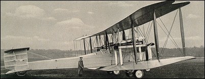
The Vickers Vimy was a British heavy bomber aircraft developed and manufactured by Vickers Limited. Developed during the latter stages of the First World War to equip the Royal Flying Corps (RFC), the Vimy was designed by Reginald Kirshaw "Rex" Pierson, Vickers' chief designer. Only a handful of Vickers Vimy aircraft had entered service by the time the Armistice of 11 November 1918 came into effect, so the type did not serve in active combat operations during the war, but the Vimy became the core of the Royal Air Force (RAF)'s heavy bomber force throughout the 1920s. The Vimy achieved success as both a military and a civil aircraft, the latter using the ''Vimy Commercial'' variant. A dedicated transport derivative of the Vimy, the Vickers Vernon, became the first troop-transport aircraft operated by the RAF. During the interwar period the Vimy set several records for long-distance flights, the most celebrated and significant of these being the first non-stop crossing of the Atl ... [...More Info...] [...Related Items...] OR: [Wikipedia] [Google] [Baidu] |
N59 Road
The N59 road is a national secondary road in Ireland. It commences in County Sligo, south of Sligo Town at the Belladrehid interchange with the N4 north of Ballysadare. The route circles around the west of Ireland, passing west from Sligo into County Mayo and through Ballina. The N59 continues around Mayo, proceeding indirectly to Westport. Continuing south through Mayo into County Galway, the road passes through the village of Leenaun. The 182-year-old bridge in the centre of the village, carrying the road across the River Lahill, collapsed in floods on 18 July 2007. Due to the local terrain and road network, the diversionary route for getting from the south of the village to Westport was 110 km long. A temporary bridge was opened eight days after the floods, on 27 July. It has since been replaced by a new bridge. South of Leenaun, the N59 proceeds southwest through Connemara to Clifden. From there, it returns east through Maam Cross and to Oughterard, from which it ... [...More Info...] [...Related Items...] OR: [Wikipedia] [Google] [Baidu] |
County Galway
"Righteousness and Justice" , anthem = () , image_map = Island of Ireland location map Galway.svg , map_caption = Location in Ireland , area_footnotes = , area_total_km2 = 6151 , area_rank = 2nd , seat_type = County town , seat = Galway , population_total = 276451 , population_density_km2 = auto , population_rank = 5th , population_as_of = 2022 , population_footnotes = , leader_title = Local authorities , leader_name = County Council and City Council , leader_title2 = Dáil constituency , leader_name2 = , leader_title3 = EP constituency , leader_name3 = Midlands–North-West , subdivision_type = Country , subdivision_name = Ireland , subdivision_type1 = Province , subdivision_name1 = Connacht , subdivision ... [...More Info...] [...Related Items...] OR: [Wikipedia] [Google] [Baidu] |
Jack Phillips (wireless Officer)
John George Phillips (11 April 1887 – 15 April 1912) was a British sailor and the senior wireless operator aboard the ''Titanic'' during her ill-fated maiden voyage in April 1912. On the final evening, Phillips had been exceptionally busy clearing a backlog of messages caused by a wireless breakdown. His consequent failure to respond to incoming signals is cited as a principal cause of the disaster. When the steamship ''Mesaba'' sent an ice alert, he acknowledged it, but failed to pass it on to the bridge. Another from the nearby ''SS Californian SS ''Californian'' was a British Leyland Line steamship. It is thought to have been the only ship to see the ''Titanic'', or at least its rockets, during the sinking, but despite being the closest ship in the area, the crew took no action to ...'' was ignored altogether. After they struck the iceberg, however, Phillips did his utmost to contact other ships for assistance. He died in the sinking. Early life Phillips was bo ... [...More Info...] [...Related Items...] OR: [Wikipedia] [Google] [Baidu] |
Glace Bay
Glace Bay (Scottish Gaelic: ''Glasbaidh'') is a community in the eastern part of the Cape Breton Regional Municipality in Nova Scotia, Canada. It forms part of the general area referred to as Industrial Cape Breton. Formerly an incorporated town (1901–1995), the municipal government in Glace Bay was dissolved and the community was amalgamated into the larger regional municipality. Prior to amalgamation, Glace Bay had been the province's fourth largest urban area and the largest town in Nova Scotia by population. Neighbouring communities include Reserve Mines, Dominion, and Tower Road. History As early as the 1720s, the French inhabited the area to supply Fortress of Louisbourg with coal. They named the location ''baie de Glace'' (literally, ''Bay of Ice'') because of the sea ice which filled the ocean each winter. In 1748, after the capture of Fortress Louisbourg, the British constructed Fort William at Table Head in order to protect a mine that produced coal to supply the ... [...More Info...] [...Related Items...] OR: [Wikipedia] [Google] [Baidu] |


.jpg)


