|
Cleveland, Queensland
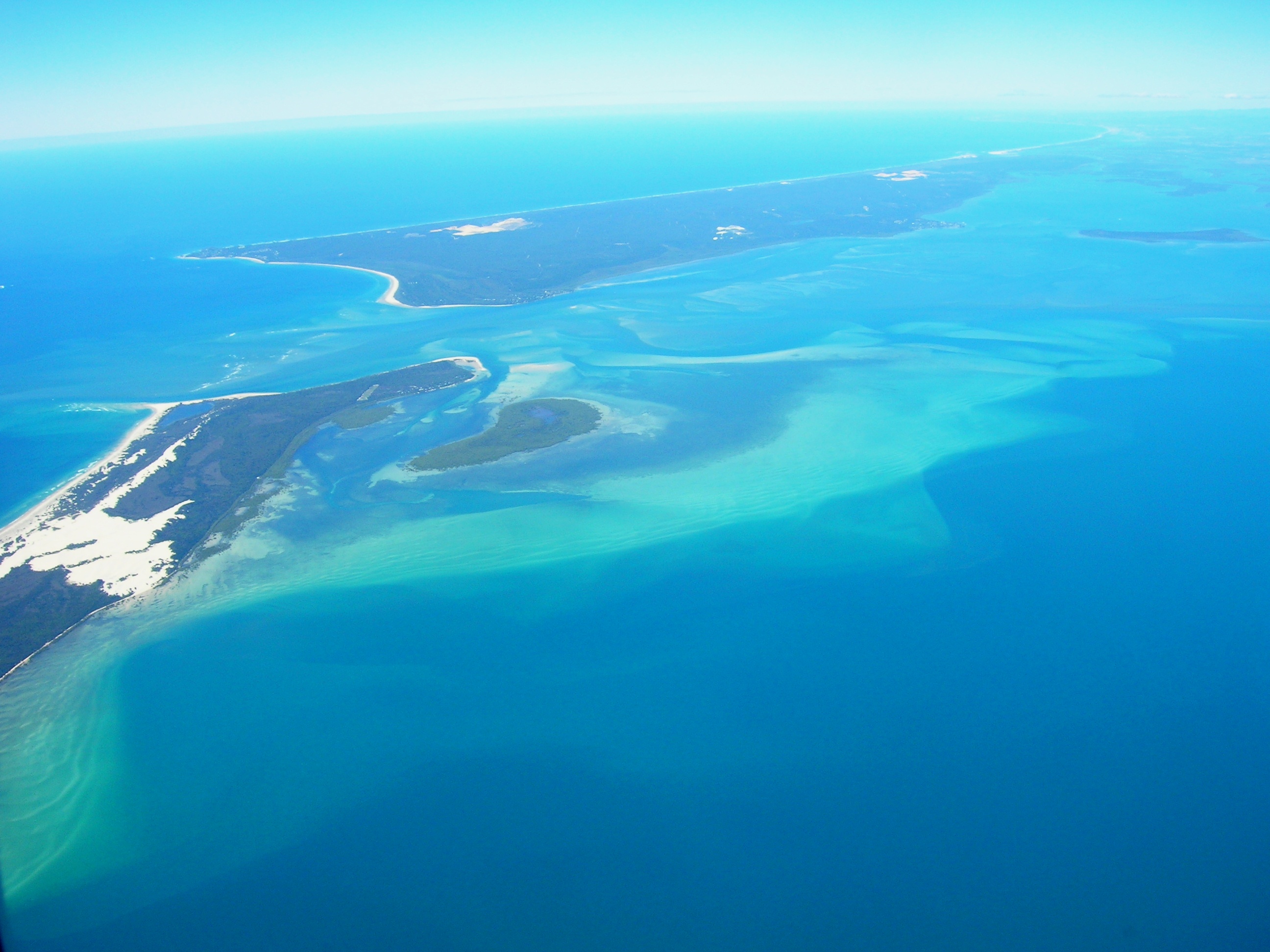
Cleveland is a coastal and central locality in the City of Redland, Queensland, Australia. In the , Cleveland had a population of 14,801 people. Its location makes it a transport hub for islands in Moreton Bay. Geography Cleveland is located on the western shores of Moreton Bay approximately east-south-east of Brisbane, the capital of the Australian state of Queensland. It comprises commercial, residential and industrial areas and is the location of Redland City's Council Chambers, offices and various cultural facilities. Raby Bay was an area of mangroves and mudflats which has been developed as canal estates and a marina development. Toondah Harbour is the location of the Stradbroke Island Ferry Terminal used by water taxis and vehicular ferries to provide access to North Stradbroke Island. This area of Moreton Bay is naturally shallow but the Fison Channel has been dredged to provide access for vehicular ferries which connect Cleveland to Dunwich.Joshua Peter Bell, ... [...More Info...] [...Related Items...] OR: [Wikipedia] [Google] [Baidu] |
AEST
Australia uses three main time zones: Australian Western Standard Time (AWST; UTC+08:00), Australian Central Standard Time (ACST; UTC+09:30), and Australian Eastern Standard Time (AEST; UTC+10:00). Time is regulated by the individual state governments, some of which observe daylight saving time (DST). Australia's external territories observe different time zones. Standard time was introduced in the 1890s when all of the Australian colonies adopted it. Before the switch to standard time zones, each local city or town was free to determine its local time, called local mean time. Now, Western Australia uses Western Standard Time; South Australia and the Northern Territory use Central Standard Time; while New South Wales, Queensland, Tasmania, Victoria, Jervis Bay Territory, and the Australian Capital Territory use Eastern Standard Time. Daylight saving time (+1 hour) is used in jurisdictions in the south and south-east: South Australia, New South Wales, Victoria, Tasm ... [...More Info...] [...Related Items...] OR: [Wikipedia] [Google] [Baidu] |
North Stradbroke Island
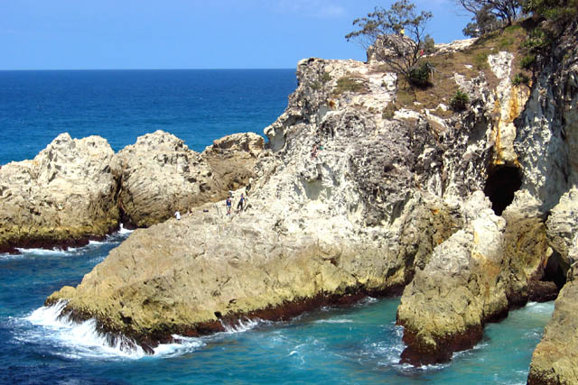
North Stradbroke Island ( Jandai: ''Minjerribah''), colloquially ''Straddie'' or ''North Straddie'', is an island that lies within Moreton Bay in the Australian state of Queensland, southeast of the centre of Brisbane. Originally there was only one Stradbroke Island but in 1896 it split into North Stradbroke Island and South Stradbroke Island separated by the Jumpinpin Channel. The Quandamooka people are the traditional owners of North Stradbroke island. The island is divided into four localities: Dunwich, Amity and Point Lookout are small localities centred on the towns of the same name, while the remainder of the island is in the locality of North Stradbroke Island. All the localities are within the City of Redland. At , it is the second largest sand island in the world. On the island there are three small towns, a number of lakes and beaches along most of the seaward coastline with rocky outcrops at Point Lookout. An Aboriginal presence on the island has been lon ... [...More Info...] [...Related Items...] OR: [Wikipedia] [Google] [Baidu] |
John Clevland (admiralty Secretary)
{{hndis, name=Clevland, John ...
John Clevland may refer to: * John Clevland (1706–1763), British politician, Member of Parliament (MP) 1741–1763, Secretary to the Admiralty 1751–1763 * His son John Clevland (1734–1817), British politician, MP for Barnstaple from 1766 to 1802 * His Nephew King John Clevland (1740-?), King of the Banana Islands The Banana Islands are a group of islands that lie off the coast of Yawri Bay, south west of the Freetown Peninsula in the Western Area of Sierra Leone. Three islands make up the Banana Islands: Dublin and Ricketts are linked by a sto ... [...More Info...] [...Related Items...] OR: [Wikipedia] [Google] [Baidu] |
James Cook
James Cook (7 November 1728Old Style date: 27 October – 14 February 1779) was a British explorer, navigator, cartographer, and captain in the British Royal Navy, famous for his three voyages between 1768 and 1779 in the Pacific Ocean and to New Zealand and Australia in particular. He made detailed maps of Newfoundland prior to making three voyages to the Pacific, during which he achieved the first recorded European contact with the eastern coastline of Australia and the Hawaiian Islands, and the first recorded circumnavigation of New Zealand. Cook joined the British merchant navy as a teenager and joined the Royal Navy in 1755. He saw action in the Seven Years' War and subsequently surveyed and mapped much of the entrance to the St. Lawrence River during the siege of Quebec, which brought him to the attention of the Admiralty and the Royal Society. This acclaim came at a crucial moment for the direction of British overseas exploration, and it led to his commission in ... [...More Info...] [...Related Items...] OR: [Wikipedia] [Google] [Baidu] |
Quandamooka People
The Quandamooka people are Aboriginal Australians who live around Moreton Bay in Southeastern Queensland. They are composed of three distinct tribes, the Nunukul, the Goenpul and the Ngugi, and they live primarily on Moreton and North Stradbroke Islands, that form the eastern side of the bay. Many of them were pushed out of their lands when the English colonial government established a penal colony near there in 1824. Each group has its own language. A number of local food sources are utilised by the tribes. Name The term ''Quandamooka'' refers geographically to the southern Moreton Bay, the waters, islands and adjacent coastal areas of the mainland. The Nunukul and Goenpul tribes lived on Stradbroke Island, while the Ngugi tribe lived on Moreton Island. The Nunukul, Goenpul and Ngugi tribes together constitute the Quandamooka people. History The archaeological remains of the Moreton Bay islands were studied intensively by V.V. Ponosov in the mid 1960s, and indigenous occup ... [...More Info...] [...Related Items...] OR: [Wikipedia] [Google] [Baidu] |
Cleveland–Redland Bay Road
Cleveland–Redland Bay Road is a continuous road route in the Redland local government area of Queensland, Australia. The route is designated as part of State Route 47. It is a state-controlled district road (number 109) rated as a local road of regional significance (LRRS). Route description Cleveland–Redland Bay Road commences at an intersection with Capalaba–Cleveland Road (Shore Street West) in as State Route 47. It runs south as Waterloo Street, crossing two roundabouts before turning east on Russell Street. It then turns south on Bloomfield Street. As it crosses South Street and enters the name changes to Cleveland–Redland Bay Road. Continuing through Thornlands it turns south-east and passes the exit to Redland Bay Road (Boundary Road) as it approaches the southern boundary (Eprapah Creek). Soon after entering it passes the exit to Colburn Avenue. From there the road continues south and south-east into , where it again turns south before turning south-east ... [...More Info...] [...Related Items...] OR: [Wikipedia] [Google] [Baidu] |
Ramsar Site
A Ramsar site is a wetland site designated to be of international importance under the Ramsar Convention,8 ha (O) *** Permanent 8 ha (P) *** Seasonal Intermittent < 8 ha(Ts) ** Marshes on inorganic soils: *** Permanent (herb dominated) (Tp) *** Permanent / Seasonal / Intermittent (shrub dominated)(W) *** Permanent / Seasonal / Intermittent (tree dominated) (Xf) *** Seasonal/intermittent (herb dominated) (Ts) ** Marshes on soils: *** Permanent (non-forested)(U) *** Permanent (forested)(Xp) ** Marshes on inorganic or peat soils: *** Marshes on inorganic or peat soils / High altitude (alpine) (Va) *** Marshes on inorganic or peat soils / Tundra (Vt) * Saline, [...More Info...] [...Related Items...] OR: [Wikipedia] [Google] [Baidu] |
Far Eastern Curlew
The Far Eastern curlew (''Numenius madagascariensis'') is a large shorebird most similar in appearance to the long-billed curlew, but slightly larger. It is mostly brown in color, differentiated from other curlews by its plain, unpatterned brown underwing. It is not only the largest curlew but probably the world's largest sandpiper, at in length and across the wings. The body is reportedly , which may be equaled by the Eurasian curlew.''CRC Handbook of Avian Body Masses'' by John B. Dunning Jr. (Editor). CRC Press (1992), . The extremely long bill, at in length, rivals the bill size of the closely related long-billed curlew as the longest bill for a sandpiper. Distribution and habitat The Far Eastern curlew spends its breeding season in northeastern Asia, including Siberia to Kamchatka, and Mongolia. Its breeding habitat is composed of marshy and swampy wetlands and lakeshores. Most individuals winter in coastal Australia, with a few heading to South Korea, Thailand, Phil ... [...More Info...] [...Related Items...] OR: [Wikipedia] [Google] [Baidu] |
Australian Government
The Australian Government, also known as the Commonwealth Government, is the national government of Australia, a federal parliamentary constitutional monarchy. Like other Westminster-style systems of government, the Australian Government is made up of three branches: the executive (the prime minister, the ministers, and government departments), the legislative (the Parliament of Australia), and the judicial. The legislative branch, the federal Parliament, is made up of two chambers: the House of Representatives (lower house) and Senate (upper house). The House of Representatives has 151 members, each representing an individual electoral district of about 165,000 people. The Senate has 76 members: twelve from each of the six states and two each from Australia's internal territories, the Australian Capital Territory and Northern Territory. The Australian monarch, currently King Charles III, is represented by the governor-general. The Australian Government in its exec ... [...More Info...] [...Related Items...] OR: [Wikipedia] [Google] [Baidu] |
Dugong
The dugong (; ''Dugong dugon'') is a marine mammal. It is one of four living species of the order Sirenia, which also includes three species of manatees. It is the only living representative of the once-diverse family Dugongidae; its closest modern relative, Steller's sea cow (''Hydrodamalis gigas''), was hunted to extinction in the 18th century. The dugong is the only sirenian in its range, which spans the waters of some 40 countries and territories throughout the Indo-West Pacific. The dugong is largely dependent on seagrass communities for subsistence and is thus restricted to the coastal habitats which support seagrass meadows, with the largest dugong concentrations typically occurring in wide, shallow, protected areas such as bays, mangrove channels, the waters of large inshore islands and inter-reefal waters. The northern waters of Australia between Shark Bay and Moreton Bay are believed to be the dugong's contemporary stronghold. Like all modern sirenians, th ... [...More Info...] [...Related Items...] OR: [Wikipedia] [Google] [Baidu] |
Mangrove
A mangrove is a shrub or tree that grows in coastal saline or brackish water. The term is also used for tropical coastal vegetation consisting of such species. Mangroves are taxonomically diverse, as a result of convergent evolution in several plant families. They occur worldwide in the tropics and subtropics and even some temperate coastal areas, mainly between latitudes 30° N and 30° S, with the greatest mangrove area within 5° of the equator. Mangrove plant families first appeared during the Late Cretaceous to Paleocene epochs, and became widely distributed in part due to the movement of tectonic plates. The oldest known fossils of mangrove palm date to 75 million years ago. Mangroves are salt-tolerant trees, also called halophytes, and are adapted to live in harsh coastal conditions. They contain a complex salt filtration system and a complex root system to cope with saltwater immersion and wave action. They are adapted to the low-oxygen conditions of w ... [...More Info...] [...Related Items...] OR: [Wikipedia] [Google] [Baidu] |


