|
Chorlton-on-Medlock
Chorlton-on-Medlock or Chorlton-upon-Medlock is an inner city area of Manchester, England. Historically in Lancashire, Chorlton-on-Medlock is bordered to the north by the River Medlock, which runs immediately south of Manchester city centre. Its other borders roughly correspond to Stockport Road, Hathersage Road, Moss Lane East and Boundary Lane. Neighbouring districts are Hulme to the west, Ardwick to the east and Victoria Park, Rusholme and Moss Side to the south. A large portion of the district along Oxford Road is occupied by the campuses of the University of Manchester, Manchester Metropolitan University, and the Royal Northern College of Music. To the south of the university's Oxford Road campus a considerable area is occupied by a group of contiguous hospitals including Manchester Royal Infirmary, to the west of which is Whitworth Park. History In medieval times, the district was known as Chorlton Row and was a township of the ancient parish of Manchester in the Sal ... [...More Info...] [...Related Items...] OR: [Wikipedia] [Google] [Baidu] |
Chorlton-on-Medlock Town Hall
Chorlton-on-Medlock Town Hall is a former municipal building in Cavendish Street in Chorlton-on-Medlock, Manchester, England. The structure, of which only the façade is original, is a Grade II listed building. History After significant population growth in the late 18th century, mainly associated with the township's status as a residential suburb, the police commissioners who administered the area decided to procure a town hall. Construction work started on the new building on 13 October 1830. It was designed by Richard Lane (architect), Richard Lane in the Neoclassical architecture, neoclassical style, built in ashlar stone and was officially opened on 14 October 1831. The design involved a symmetrical main frontage with nine bays facing onto Cavendish Street with the end bays slightly projected forward and with pilasters to support an entablature; the central section of three bays, which also slightly projected forward, featured a full-height tetrastyle portico with Doric ord ... [...More Info...] [...Related Items...] OR: [Wikipedia] [Google] [Baidu] |
Rusholme
Rusholme () is an area of Manchester, England, two miles south of the city centre. The population of the ward at the 2011 census was 13,643. Rusholme is bounded by Chorlton-on-Medlock to the north, Victoria Park and Longsight to the east, Fallowfield to the south and Moss Side to the west. It has a large student population, with several student halls and many students renting terraced houses, and suburban houses towards Victoria Park. History Etymology Rusholme, unlike other place names in Manchester with the suffix ''-hulme/holme'' is not a true water meadow. Its name derives from ''ryscum'' the dative plural of the Old English ''rysc'', a " rush" meaning at the rushes. The name was recorded as Russum in 1235, Ryssham in 1316 and Rysholme in 1551. Early history Late in the Roman occupation of Britain a hoard of about 200 gold coins was hidden in the valley of the Gore Brook. These date from the 2nd and 3rd centuries CE and were found where Birchfields Road crosses the brook ... [...More Info...] [...Related Items...] OR: [Wikipedia] [Google] [Baidu] |
Hulme
Hulme () is an inner city area and Ward (politics), electoral ward of Manchester, England, immediately south of Manchester city centre. It has a significant industrial heritage. Historic counties of England, Historically in Lancashire, the name Hulme is derived from the Old Norse word for a small island, or land surrounded by water or marsh, indicating that it may have been first settled by Norsemen, Norse invaders in the period of the Danelaw. History Toponymy Hulme derives its name from the Old Norse language, Old Norse ''holmr, holmi'', through History of Danish, Old Danish ''hulm'' or ''hulme'' meaning small islands or land surrounded by streams, fen or marsh.Eilert Ekwall, Ekwall, Eilert ''The Place-Names of Lancashire'' (1922, The University Press, Lime Grove, Manchester) The area may have fitted this description at the time of the Scandinavian invasion and settlement as it is surrounded by water on three sides by the rivers River Irwell, Irwell, River Medlock, Medlock ... [...More Info...] [...Related Items...] OR: [Wikipedia] [Google] [Baidu] |
Oxford Road, Manchester
Wilmslow Road is a major road in Manchester, England, running from Parrs Wood northwards to Rusholme. There it becomes Oxford Road and the name changes again to Oxford Street when it crosses the River Medlock and reaches the city centre. The road runs through the centres of Didsbury, Withington and Fallowfield, including the major student residential campus of Owens Park, to Rusholme. Oxford Road passes through the University of Manchester campus and the All Saints campus of the Manchester Metropolitan University. Several hospitals including the Christie Hospital and Manchester Royal Infirmary have been built along the road. It also features several parks and gardens such as Fletcher Moss Gardens, Platt Fields and Whitworth Park. The road is part of a major bus corridor with bus movements of over one a minute at peak times and is a key centre for business, culture and higher education. Route Wilmslow Road, Oxford Road and Oxford Street are part of an 18th-century rout ... [...More Info...] [...Related Items...] OR: [Wikipedia] [Google] [Baidu] |
Moss Side
Moss Side is an Inner city, inner-city area of Manchester, England, south of the Manchester city centre, city centre, It had a population of 20,745 at the United Kingdom Census 2021, 2021 census. Moss Side is bounded by Hulme to the north, Chorlton-on-Medlock, Rusholme and Fallowfield to the east, Whalley Range, Manchester, Whalley Range to the south, and Old Trafford (area), Old Trafford to the west. As well as Whitworth Park and Alexandra Park, Manchester, Alexandra Park, Moss Side is close to Manchester University, Manchester and Manchester Metropolitan University, Manchester Metropolitan universities."Moss Side and Rusholme District Centre Local Plan". Manchester City Council. 2007. p. 52. Manchester City F.C., Manchester City played at Maine Road in Moss Side between 1923 and 2003. History Historic counties of England, Historically part of Lancashire, Moss Side was a rural Township (England), township and chapelry within the Manchester (ancient parish), parish of Manche ... [...More Info...] [...Related Items...] OR: [Wikipedia] [Google] [Baidu] |
Salford (hundred)
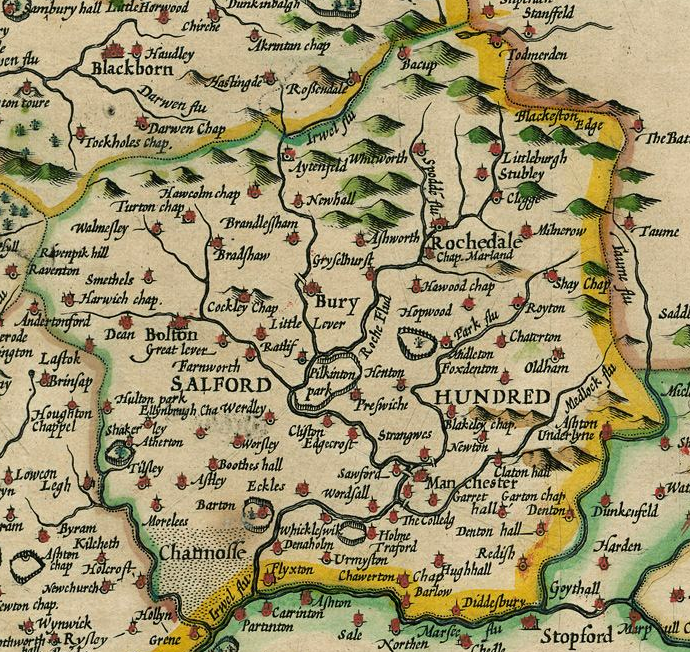
The Salford Hundred (also known as Salfordshire) was one of the subdivisions of the historic county of Lancashire, in Northern England (see:Hundred (county division). Its name alludes to its judicial centre being the township of Salford (the suffix ''-shire'' meaning the territory was appropriated to the prefixed settlement). It was also known as the Royal Manor of Salford and the Salford wapentake.. Origins The Manor or Hundred of Salford had Anglo-Saxon origins. The ''Domesday Book'' recorded that the area was held in 1066 by Edward the Confessor. Salford was recorded as part of the territory of ''Inter Ripam et Mersam'' or "Between Ribble and Mersey", and it was included with the information about Cheshire, though it cannot be said clearly to have been part of Cheshire. The area became a subdivision of the County Palatine of Lancaster (or Lancashire) on its creation in 1182. Salford Hundred Court In spite of its incorporation into Lancashire, Salford Hundred retained a se ... [...More Info...] [...Related Items...] OR: [Wikipedia] [Google] [Baidu] |
University Of Manchester
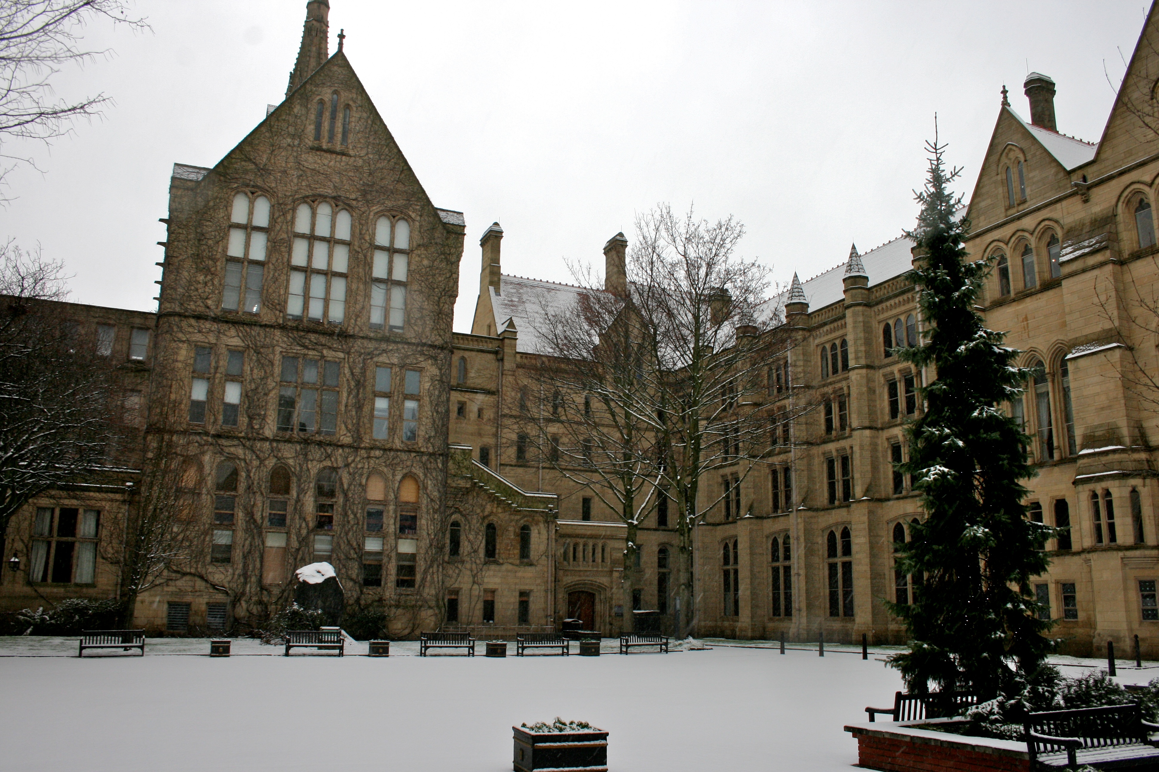
, mottoeng = Knowledge, Wisdom, Humanity , established = 2004 – University of Manchester Predecessor institutions: 1956 – UMIST (as university college; university 1994) 1904 – Victoria University of Manchester 1880 – Victoria University 1851 – Owens College 1824 – Manchester Mechanics' Institute , endowment = £242.2 million (2021) , budget = £1.10 billion (2020–21) , chancellor = Nazir Afzal (from August 2022) , head_label = President and vice-chancellor , head = Nancy Rothwell , academic_staff = 5,150 (2020) , total_staff = 12,920 (2021) , students = 40,485 (2021) , undergrad = () , postgrad = () , city = Manchester , country = England, United Kingdom , campus = Urban and suburban , colours = Manchester Purple Manchester Yellow , free_label = Scarf , free = , website = , logo = UniOfManchesterLogo.svg , affiliations = Universities Research Association Sutton 30 Russell Group EUA N8 Group NWUA ACUUniversities UK The Universit ... [...More Info...] [...Related Items...] OR: [Wikipedia] [Google] [Baidu] |
Manchester
Manchester () is a city in Greater Manchester, England. It had a population of 552,000 in 2021. It is bordered by the Cheshire Plain to the south, the Pennines to the north and east, and the neighbouring city of Salford to the west. The two cities and the surrounding towns form one of the United Kingdom's most populous conurbations, the Greater Manchester Built-up Area, which has a population of 2.87 million. The history of Manchester began with the civilian settlement associated with the Roman fort ('' castra'') of ''Mamucium'' or ''Mancunium'', established in about AD 79 on a sandstone bluff near the confluence of the rivers Medlock and Irwell. Historically part of Lancashire, areas of Cheshire south of the River Mersey were incorporated into Manchester in the 20th century, including Wythenshawe in 1931. Throughout the Middle Ages Manchester remained a manorial township, but began to expand "at an astonishing rate" around the turn of the 19th century. Manchest ... [...More Info...] [...Related Items...] OR: [Wikipedia] [Google] [Baidu] |
Manchester Royal Infirmary
Manchester Royal Infirmary (MRI) is a large NHS teaching hospital in Chorlton-on-Medlock, Manchester, England. Founded by Charles White in 1752 as part of the voluntary hospital movement of the 18th century, it is now a major regional and national medical centre. It is the largest Hospital within Manchester University NHS Foundation Trust, and based on its Oxford Road Campus in South Manchester where it shares a site with the Royal Manchester Children's Hospital, Manchester Royal Eye Hospital and Saint Mary's Hospital as well as several other educational and research facilities. The Hospital is also a key site for medical educational within Manchester, serving as a main teaching hospital for School of Medical Sciences, University of Manchester. History The first premises was a house in Garden Street, off Withy Grove, Manchester, which were opened on Monday 27 July 1752, financed by subscriptions. Government of the institution was in the hands of the trustees. Any subscriber ... [...More Info...] [...Related Items...] OR: [Wikipedia] [Google] [Baidu] |
Grove House, Manchester
Grove House, in Oxford Road, Chorlton-on-Medlock, Manchester, is an early Victorian building, originally three houses, of 1838–40.Hartwell et al. 2004, p 437 It is a Grade II* listed building as of 18 December 1963.Student Health Centre, University of Manchester British Listed Buildings described it as "a large detached house set back from the street." The house is of "scored stucco on brick with a hipped slate roof. It has a round-headed central doorway with keystone and a fanlight with slender radiating tracery." It was first occupied by the |
Cotton Mill
A cotton mill is a building that houses spinning (textiles), spinning or weaving machinery for the production of yarn or cloth from cotton, an important product during the Industrial Revolution in the development of the factory system. Although some were driven by animal power, most early mills were built in rural areas at fast-flowing rivers and streams using water wheels for power. The development of viable Watt steam engine, steam engines by Boulton and Watt from 1781 led to the growth of larger, steam-powered mills allowing them to be concentrated in urban mill towns, like Manchester, which with neighbouring Salford, Greater Manchester, Salford had more than 50 mills by 1802. The mechanisation of the spinning process in the early factories was instrumental in the growth of the machine tool industry, enabling the construction of larger cotton mills. Joint stock company, Limited companies were developed to construct mills, and the trading floors of the Manchester Royal Excha ... [...More Info...] [...Related Items...] OR: [Wikipedia] [Google] [Baidu] |
Kro Bar, Manchester 1
KRO, or (Catholic Radio Broadcasting), was a Dutch public broadcasting organization founded on 23 April 1925. Broadly Catholic in its spiritual outlook, KRO broadcast the bulk of its television output on the NPO 1 channel. KRO was also responsible for managing broadcasts made by the Catholic Church in the Netherlands in the airtime allocated to . KRO published the magazines ''Studio KRO Magazine'' and ''Mikro gids''. On 1 January 2014, it merged with (NCRV) to form KRO-NCRV. ' (English: "Nameless Orchestra") was the KRO's official orchestra during the pillarization of Dutch society. Their 1952 song "" is a Dutch evergreen, which sold 25,000 copies. Programmes Television On television, KRO's "behind-the-news" show is Netwerk, which it produces in cooperation with and NCRV. A popular show which KRO began in 2005 is ' (''Farmer Wants a Wife''), presented by Yvon Jaspers. Many Dutch farmers remain single because they find it hard to find a woman who is willing to put up wit ... [...More Info...] [...Related Items...] OR: [Wikipedia] [Google] [Baidu] |


