|
Chinatown, Manchester
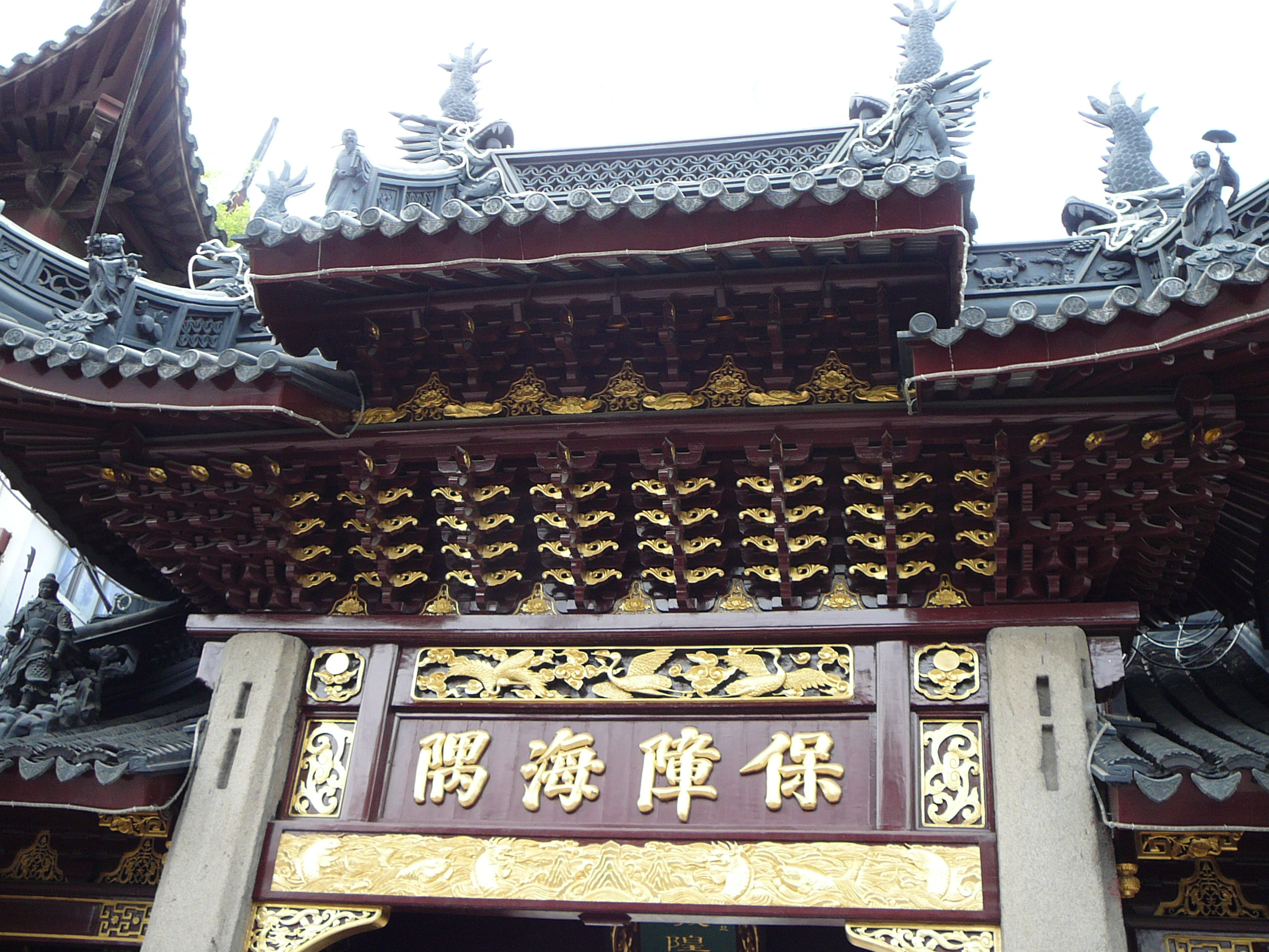
Chinatown in Manchester, England, is the second largest Chinatown in the United Kingdom and the third largest in Europe. Its archway was completed in 1987 on Faulkner Street in Manchester city centre, which contains Chinese restaurants, shops, bakeries and supermarkets. History The first Chinese settlers arrived in the city in the early 20th century; many were engaged in the laundry trade. Manchester's first Chinese restaurant, Ping Hong, opened on Oxford Street in 1948. A Chinese immigration wave began in the 1950s, when there were severe labour shortages, and in response to the British Nationality Act 1948 which allowed easier access into the country. Hong Kong's rapid urbanisation also meant that farmers' traditional homes were being destroyed by urban sprawl, so many decided to migrate. Chinese restaurants multiplied after the immigration boom. By the 1970s other Chinese businesses had opened, such as medicine shops, supermarkets and financial and legal services serving ... [...More Info...] [...Related Items...] OR: [Wikipedia] [Google] [Baidu] |
Paifang
A ''paifang'', also known as a ''pailou'', is a traditional style of Chinese architectural arch or gateway structure. Evolved from the Indian subcontinent's ''torana'' through the introduction of Buddhism to China, it has developed many styles and has been introduced to other East Asian countries, such as Korea, Japan, and Vietnam. Etymology The word ''paifang'' () was originally a collective term for the top two levels of administrative division and subdivisions of ancient Chinese cities. The largest division within a city in ancient China was a ''fang'' (), equivalent to a current day ward. Each ''fang'' was enclosed by walls or fences, and the gates of these enclosures were shut and guarded every night. Each ''fang'' was further divided into several ''pai'' (), which is equivalent to a current day (unincorporated) community. Each ''pai'', in turn, contained an area including several hutongs (alleyways). This system of urban administrative division and subdivision reached an ... [...More Info...] [...Related Items...] OR: [Wikipedia] [Google] [Baidu] |
Mosley Street
Mosley Street is a street in Manchester, England. It runs between its junction with Piccadilly Gardens and Market Street to St Peter's Square. Beyond St Peter's Square it becomes Lower Mosley Street. It is the location of several Grade II and Grade II* listed buildings. Mosley Street tram stop was located near Piccadilly Gardens. In 2009, the tram lines were reconstructed, and buses used Mosley Street en route to Piccadilly Gardens until May 2011, when they were rerouted along Portland Street. The street is now exclusively used by Metrolink trams and no cars are permitted on the street. The tram stop closed on 17 May 2013. History The streets in the neighbourhood were laid in the 1780s and by the early 19th century Mosley Street was the centre of the fashionable residential part of town with institutions such as the Portico Library and the Royal Manchester Institution. The street was named after Nicholas Mosley who in 1596 bought the manor of Manchester for £3,500. His f ... [...More Info...] [...Related Items...] OR: [Wikipedia] [Google] [Baidu] |
Dragon Boat
A dragon boat is a human-powered watercraft originating from the Pearl River Delta region of China's southern Guangdong Province. These were made of teak, but in other parts of China, different kinds of wood are used. It is one of a family of traditional paddled long boats found throughout Asia, Africa, the Pacific islands, and Puerto Rico. The sport of dragon boat racing has its roots in an ancient folk ritual of contending villagers, which dates back 2000 years throughout southern China, and even further to the original games of Olympia in ancient Greece. Both dragon boat racing and the ancient Olympiad included aspects of religious observances and community celebrations, along with competitions. Dragon boat racing has been a traditional Chinese paddled watercraft activity for over 2000 years and began as a modern international sport in Hong Kong in 1976. These boats are typically made of carbon fiber, fiberglass, and other lightweight materials. For competition events, dragon ... [...More Info...] [...Related Items...] OR: [Wikipedia] [Google] [Baidu] |
Manchester City Council
Manchester City Council is the local authority for Manchester, a city and metropolitan borough in Greater Manchester, England. Manchester is the sixth largest city in England by population. Its city council is composed of 96 councillors, three for each of the 32 electoral wards of Manchester. The council is controlled by the Labour Party and led by Bev Craig. The official opposition is the Green Party with three councillors. Joanne Roney is the chief executive. Many of the council's staff are based at Manchester Town Hall. History Manchester was incorporated in 1838 under the Municipal Corporations Act 1835 as the Corporation of Manchester or Manchester Corporation. It achieved city status in 1853, only the second such grant since the Reformation. The area included in the city has been increased many times, in 1885 (Bradford, Harpurhey and Rusholme), 1890 (Blackley, Crumpsall, part of Droylsden, Kirkmanshulme, Moston, Newton Heath, Openshaw, and West Gorton), 1903 (Heaton), ... [...More Info...] [...Related Items...] OR: [Wikipedia] [Google] [Baidu] |
Wuhan
Wuhan (, ; ; ) is the capital of Hubei, Hubei Province in the China, People's Republic of China. It is the largest city in Hubei and the most populous city in Central China, with a population of over eleven million, the List of cities in China by population, ninth-most populous Chinese city and one of the nine National Central City, National Central Cities of China. The name "Wuhan" came from the city's historical origin from the conglomeration of Wuchang District, Wuchang, Hankou District, Hankou, and Hanyang District, Hanyang, which are collectively known as the "Three Towns of Wuhan" (). Wuhan lies in the eastern Jianghan Plain, at the confluence of the Yangtze river and its largest tributary, the Han River (Hubei), Han River, and is known as "Nine Provinces' Thoroughfare" (). Wuhan has historically served as a busy city port for commerce and trading. Other historical events taking place in Wuhan include the Wuchang Uprising of 1911, which led to the end of 2,000 years of d ... [...More Info...] [...Related Items...] OR: [Wikipedia] [Google] [Baidu] |
Chinatown Manchester Night Neon
A Chinatown () is an ethnic enclave of Chinese people located outside Greater China, most often in an urban setting. Areas known as "Chinatown" exist throughout the world, including Europe, North America, South America, Asia, Africa and Australasia. The development of most Chinatowns typically resulted from mass migration to an area without any or with very few Chinese residents. Binondo in Manila, established in 1594, is recognized as the world's oldest Chinatown. Notable early examples outside Asia include San Francisco's Chinatown in the United States and Melbourne's Chinatown in Australia, which were founded in the mid-19th century during the California and Victoria gold rushes, respectively. A more modern example, in Montville, Connecticut, was caused by the displacement of Chinese workers in the Manhattan Chinatown following the September 11th attacks in 2001. Definition Oxford Dictionaries defines "Chinatown" as "...a district of any non-Asian town, especially a cit ... [...More Info...] [...Related Items...] OR: [Wikipedia] [Google] [Baidu] |
Grid Plan
In urban planning, the grid plan, grid street plan, or gridiron plan is a type of city plan in which streets run at right angles to each other, forming a grid. Two inherent characteristics of the grid plan, frequent intersections and orthogonal geometry, facilitate movement. The geometry helps with orientation and wayfinding and its frequent intersections with the choice and directness of route to desired destinations. In ancient Rome, the grid plan method of land measurement was called centuriation. The grid plan dates from antiquity and originated in multiple cultures; some of the earliest planned cities were built using grid plans in Indian subcontinent. History Ancient grid plans By 2600 BC, Mohenjo-daro and Harappa, major cities of the Indus Valley civilization, were built with blocks divided by a grid of straight streets, running north–south and east–west. Each block was subdivided by small lanes. The cities and monasteries of Sirkap, Taxila and Thimi (in the Ind ... [...More Info...] [...Related Items...] OR: [Wikipedia] [Google] [Baidu] |
Piccadilly Gardens
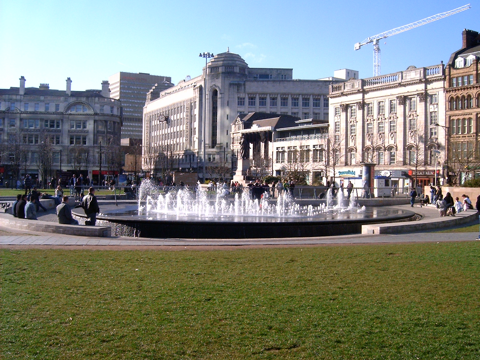
Piccadilly Gardens is a green space in Manchester city centre, England, on the edge of the Northern Quarter. It takes its name from the adjacent street, Piccadilly, which runs across the city centre from Market Street to London Road. The gardens also contain a bus station and a tram stop. Piccadilly Gardens were laid out after World War I on the former site of the Manchester Royal Infirmary. Originally landscaped as an ornamental sunken garden, the area was levelled out and reconfigured in 2002 with a water feature and concrete pavilion by Japanese architect Tadao Ando. Location Piccadilly Gardens are located in Manchester city centre, just to the south of the Northern Quarter. The green space is bounded on four sides by streets: Mosley Street to the west, Parker Street to the south and Portland Street to the east; along the northern side is Piccadilly, a street that runs eastwards from the junction of Market Street to the junction of London Road with Ducie Street. The ... [...More Info...] [...Related Items...] OR: [Wikipedia] [Google] [Baidu] |
Canal Street, Manchester
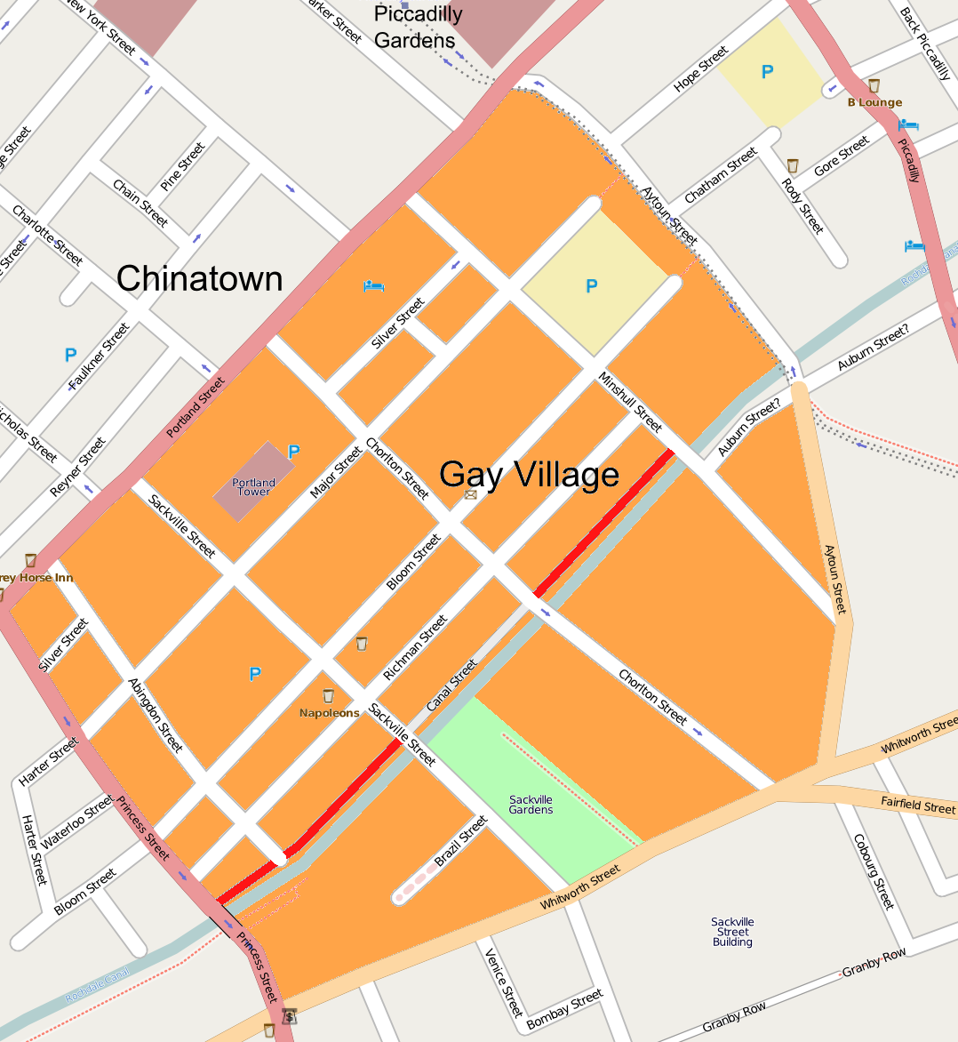
Canal Street is a street in Manchester city centre in North West England and the centre of Manchester's gay village. The pedestrianised street, which runs along the west side of the Rochdale Canal, is lined with gay bars and restaurants. At night time, and in daytime in the warmer months, the street is filled with visitors, often including LGBT tourists from all over the world. The northern end of the street meets Minshull Street and the southern meets Princess Street; part of the street looks across the Rochdale Canal into Sackville Gardens. History Canal Street developed when the Rochdale Canal was constructed in 1804, a trade artery running through the city. Pubs and other businesses evolved to service the users of the canal, especially the people stopping at the lock nearby. It wasn't until the 20th century when the area first begin to be properly associated with gay people. By the 1950s, use of the canal had greatly declined due to competition from other methods of tr ... [...More Info...] [...Related Items...] OR: [Wikipedia] [Google] [Baidu] |
Gay Village
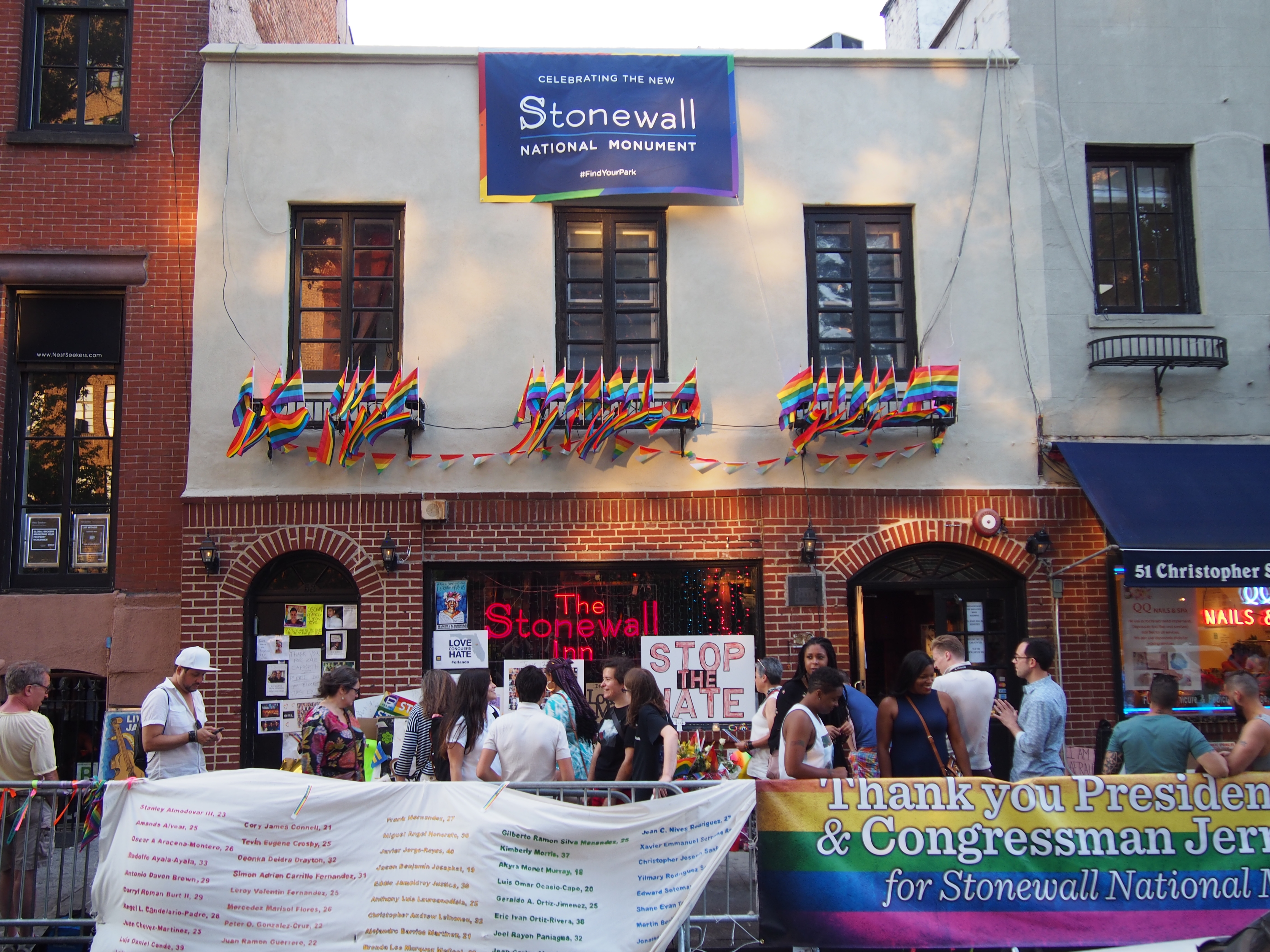
A gay village is a geographical area with generally recognized boundaries that is inhabited or frequented by many lesbian, gay, bisexual, transgender, and queer (LGBT) people. Gay villages often contain a number of gay-oriented establishments, such as gay bars and pubs, nightclubs, bathhouses, restaurants, boutiques, and bookstores. Among the most famous gay villages are New York City's Greenwich Village, Hell's Kitchen, and Chelsea neighborhoods in Manhattan; Fire Island and The Hamptons on Long Island; Asbury Park, Lambertville, and Maplewood in New Jersey; Boston's South End, Jamaica Plain, and Provincetown, Massachusetts; Philadelphia's Gayborhood; Washington D.C.'s Dupont Circle; Midtown Atlanta; Chicago's Boystown; London's Soho, Birmingham's Gay Village, Brighton's Kemptown, and Manchester's Canal Street, all in England; Los Angeles County's West Hollywood; as well as Barcelona Province's Sitges, Toronto's Church and Wellesley neighborhood, the Castro of Sa ... [...More Info...] [...Related Items...] OR: [Wikipedia] [Google] [Baidu] |
Wilmslow Road
Wilmslow Road is a major road in Manchester, England, running from Parrs Wood northwards to Rusholme. There it becomes Oxford Road and the name changes again to Oxford Street when it crosses the River Medlock and reaches the city centre. The road runs through the centres of Didsbury, Withington and Fallowfield, including the major student residential campus of Owens Park, to Rusholme. Oxford Road passes through the University of Manchester campus and the All Saints campus of the Manchester Metropolitan University. Several hospitals including the Christie Hospital and Manchester Royal Infirmary have been built along the road. It also features several parks and gardens such as Fletcher Moss Gardens, Platt Fields and Whitworth Park. The road is part of a major bus corridor with bus movements of over one a minute at peak times and is a key centre for business, culture and higher education. Route Wilmslow Road, Oxford Road and Oxford Street are part of an 18th-century route ... [...More Info...] [...Related Items...] OR: [Wikipedia] [Google] [Baidu] |
Princess Street, Manchester
Princess Street is one of the main streets in the city centre of Manchester, England. It begins at Cross Street and runs approximately eastwards across Mosley Street, Portland Street and Whitworth Street until the point where it continues as Brook Street and eventually joins the A34. History It is not clear whether the street was actually named after a princess and the second part of it once bore the name of David Street. Originally a residential street it became the site of many textile warehouses and large office buildings during the 19th century. Some of these have since been demolished but most have been converted to other uses. Route The road is two-way as it passes Albert Square, St Peter's Square and its tram stop. It becomes one-way southbound (including for buses and cycles) after Portland Street, and resumes two-way traffic after Major Street. It then crosses the River Medlock and the Rochdale Canal before going under the Mancunian Way and terminating when it beco ... [...More Info...] [...Related Items...] OR: [Wikipedia] [Google] [Baidu] |


.jpg)


