|
Chaun Bay
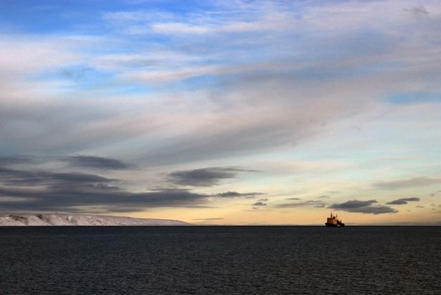
The Chaunskaya Bay or Chaun Bay (russian: Чаунская губа) is an Arctic bay in the East Siberian Sea, in the Chaunsky District of Chukotka, northeast Siberia. There is Port of Pevek. Geography The bay is open to the north and is 140 km in length. Its maximum width is 110 km.GoogleEarth Its mouth is defined by Cape Shelagsky, the end of the Shelag Range, to the east and an unnamed part of Ayon Island to the west. It narrows where the Pevek Peninsula on the east approaches Ayon Island. Owing to is northerly location Chaunskaya Bay is covered with ice most of the year. This bay is the center of one of the larger lowlands in Chukotka. A number of rivers flow into the southeastern corner: Chaun River, Ichuveyem River, Palyavaam River, Lelyuveyem River and Pucheveyem River. There is a protected natural area in the southeast. Lake Elgygytgyn is about 160 km southeast and the town of Bilibino about 160 km southwest. History The first Russian to reac ... [...More Info...] [...Related Items...] OR: [Wikipedia] [Google] [Baidu] |
Extreme North
The Extreme North or Far North (russian: Крайний Север, Дальний Север) is a large part of Russia located mainly north of the Arctic Circle and boasting enormous mineral and natural resources. Its total area is about , comprising about one-third of Russia's total area. Formally, the regions of the Extreme North comprise the whole of Chukotka Autonomous Okrug, Kamchatka Krai, Magadan Oblast, Murmansk Oblast and Sakha, as well as certain parts and cities of Arkhangelsk Oblast, Irkutsk Oblast, Khabarovsk Krai, Komi Republic, Krasnoyarsk Krai, Republic of Karelia, Sakhalin Oblast, Tuva, Tyumen Oblast, as well as all islands of the Arctic Ocean The Arctic Ocean is the smallest and shallowest of the world's five major oceans. It spans an area of approximately and is known as the coldest of all the oceans. The International Hydrographic Organization (IHO) recognizes it as an ocean, ..., its seas, the Bering Sea, and the Sea of Okhotsk. Due to ... [...More Info...] [...Related Items...] OR: [Wikipedia] [Google] [Baidu] |
Port Of Pevek
Port of Pevek (port code RU PWE, russian: Порт Певек) is a seaport situated on the northern coast of microdistrict Kosa, Pevek, Russia Russia (, , ), or the Russian Federation, is a transcontinental country spanning Eastern Europe and Northern Asia. It is the largest country in the world, with its internationally recognised territory covering , and encompassing one-eigh ..., located in southeastern area of Pevek Strait ( Chaun Bay). It is the most northern seaport of Russia. See also * Transport in RussiaReferences External links ...[...More Info...] [...Related Items...] OR: [Wikipedia] [Google] [Baidu] |
Mikhail Stadukhin
Mikhail Vasilyevich Stadukhin (russian: Михаил Васильевич Стадухин) (died 1666) was a Russian explorer of far northeast Siberia, one of the first to reach the Kolyma, Anadyr, Penzhina and Gizhiga Rivers and the northern Sea of Okhotsk. He was a Pomor, probably born in the village of Pinega, and the nephew of a Moscow merchant. By 1633 he was on the Lena River. To the Kolyma and Anadyr In 1641 he led an overland expedition to a tributary of the Indigirka River. This tributary, the ''Yemolkon River'' can no longer be identified, but the name is probably a variant of Oymyakon, "the coldest place on earth". If the connection is correct, he was fairly far upriver and inland. With him was Semyon Dezhnyov. Finding little fur and hostile natives in 1642 or 43 they built a koch and sailed down the Indigirka to the sea. Here he met Yarilo Zyryan, who had had similar bad luck on the Alazeya River. The united group sailed east to the Kolyma River and built winter qu ... [...More Info...] [...Related Items...] OR: [Wikipedia] [Google] [Baidu] |
Bilibino
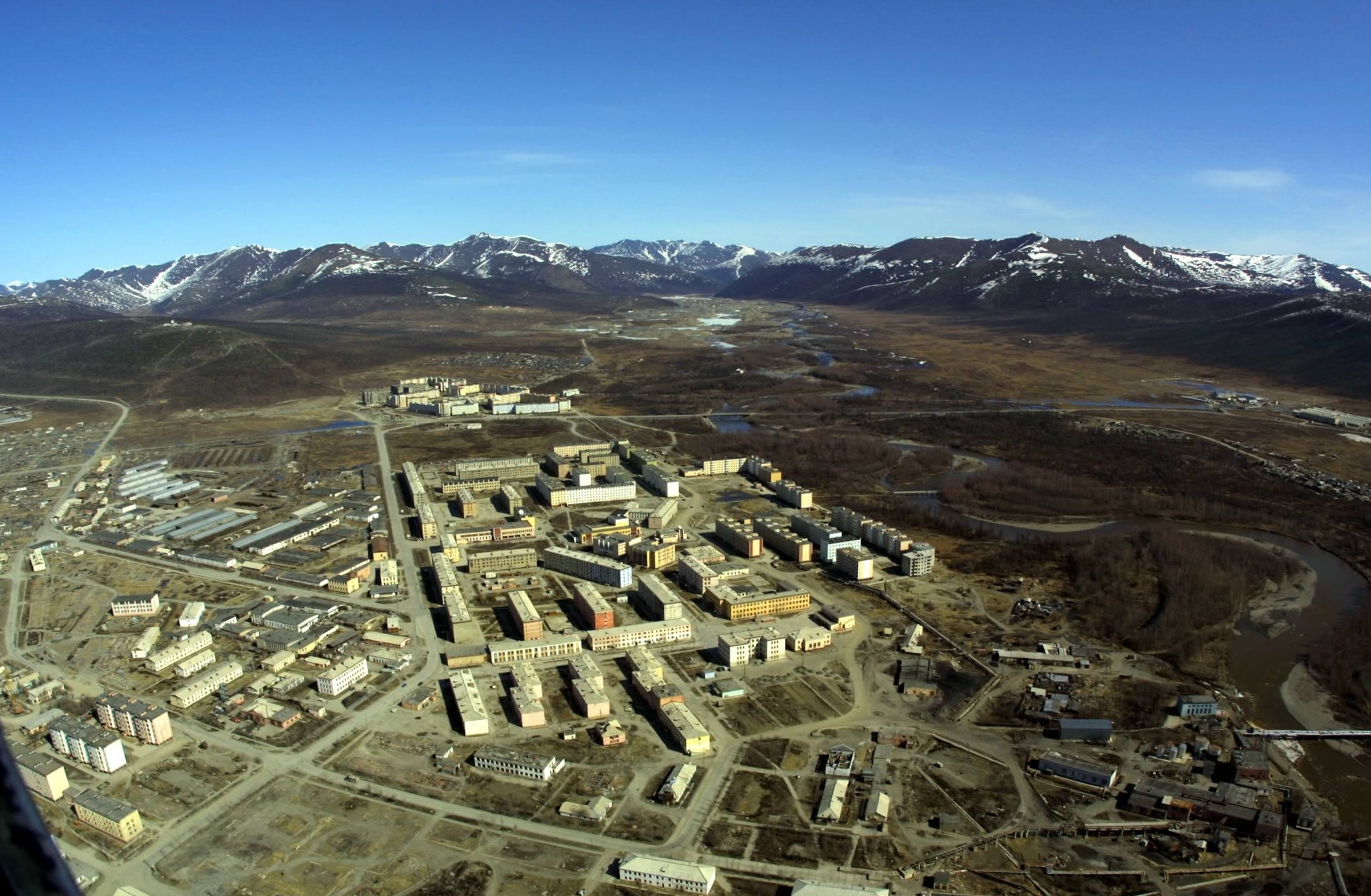
Bilibino (russian: Били́бино) is a town and the administrative center of Bilibinsky District in Chukotka Autonomous Okrug, Russia. It is located northwest of Anadyr, the administrative center of the autonomous okrug. It is the second largest town in the autonomous okrug after Anadyr. Population: Geography The town of Bilibino was built at the confluence of the Karalveyem and Bolshoy Keperveyem Rivers (Kolyma's basin). Bilibino is on the transition zone between the conifer forest and the tundra of the East Siberian Mountains, southeast of the Pyrkanay Range (Горы Пырканай), southwest of the Rauchuan Range (Раучуанский хребет) and north of the Kyrganay Range and the Chuvan Mountains. History As with much of the rest of Chukotka, the earliest human remains found in the region around Bilibino have been dated to the Early Neolithic, with camp sites having been excavated at Orlovka 2, a site on the banks of the Orlovka River, as well as ... [...More Info...] [...Related Items...] OR: [Wikipedia] [Google] [Baidu] |
Lake Elgygytgyn
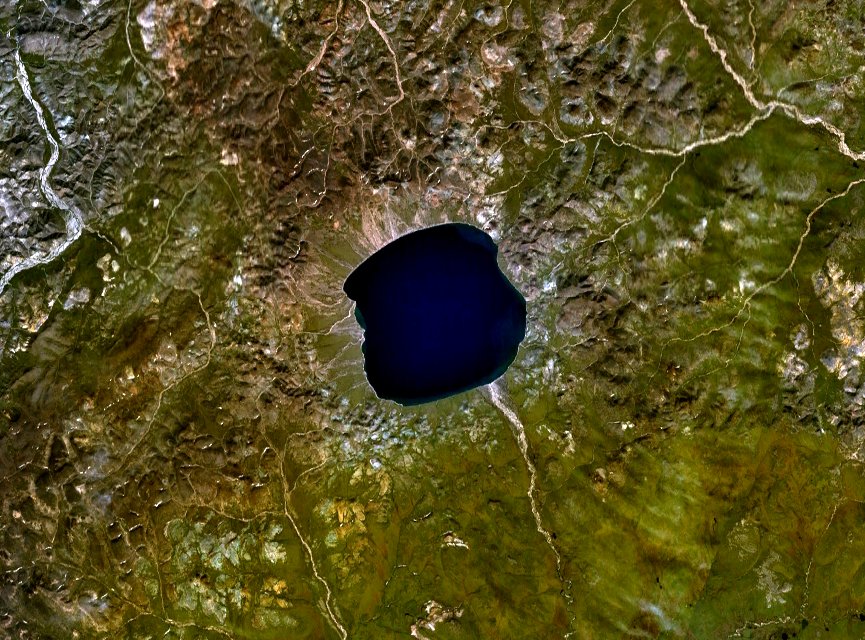
Lake El'gygytgyn ( Russian and Chukchi: Эльгыгытгын) is an impact crater lake located in the Chukotka Autonomous Okrug in northeast Siberia, about southeast of Chaunskaya Bay. The word "Elgygytgyn" means "white lake" in the Chukchi language. The lake is of particular interest to scientists because it has never been covered by glaciers. This has allowed the uninterrupted build-up of of sediment at the bottom of the lake, recording information on prehistoric climate change. Geography Lake El'gygytgyn is located in the Anadyr Plateau, part of the Anadyr Highlands. It is drained to the southeast by the Enmyvaam, a tributary of the Belaya. It is approximately in diameter and has a maximum depth of . The lake is centered within an impact crater with a rim diameter of that formed 3.6 million years ago during the Pliocene. Before it was reliably dated, preliminary papers in the late 1970s suggested either Elgygytgyn or Zhamanshin as the source of the young A ... [...More Info...] [...Related Items...] OR: [Wikipedia] [Google] [Baidu] |
Zakaznik
Zakaznik (russian: зака́зник, зака́зники, transliterated: ''zakaznik, zakazniki''; uk, singular: заказни́к or зака́зник; plural: заказники́ or зака́зники, transliterated: ''zakaznyk'', ''zakaznyky''; Belarusian: заказнік, заказнікі, transliterated: zakaznik, zakazniki) is a type of protected area in former Soviet republics such as Belarus, Russia, Ukraine that meets World Conservation Union's ( IUCN) category IV, or more frequently category VI criteria. Many zakazniks have traditionally been managed as game reserves. Some protect complex ecosystems, colonies of birds, or populations of rare plants. They range in size from 0.5 ha to 6,000,000 ha. In other words, it is nature reserve notion. Zakazniks are the areas where temporary or permanent limitations are placed upon certain on-site economic activities, such as logging, mining, grazing, hunting, etc. They correspond to ''sanctuary'' in UNESCO World Her ... [...More Info...] [...Related Items...] OR: [Wikipedia] [Google] [Baidu] |
Ayon Island
Ayon Island is an island in the coast of Chukotka in the East Siberian Sea. The island itself consists mainly of low-lying tundra, and is primarily populated by the Chukchi people, who use the tundra as pasture for their reindeer herds. Geography It is located on the western side of the Chaunskaya Bay, directly off the Nutel'gyrgym Peninsula, at the eastern end of the Kolyma Gulf. The island is 63 km long and 38 km wide. It is generally low and flat and there are many small lakes and swamps. Ayon Island is separated from the mainland by the Maly Chaunsky Strait, a shallow channel which is barely 2 km wide in its narrowest spot. The bay to the south and east is Chaunskaya Guba. Administratively and municipally,Law #46-OZ, Article 2 Ayon Island belongs to Chaunsky District, part of Chukotka Autonomous Okrug of the Russian Federation. There are two small settlements, Elvuney (now abandoned) and Ayon in the northwestern end of the island. Etymology The name ... [...More Info...] [...Related Items...] OR: [Wikipedia] [Google] [Baidu] |
Shelag Range
The Shelag Range, Shelag Ridge (russian: Шелагский хребет) is a range of mountains in far North-eastern Russia. Administratively the range is part of the Chukotka Autonomous Okrug of the Russian Federation. The area of the range is desolate and uninhabited except for a few mining areas. The range was named after the Shelags, a little-known ethnic group that lived on the Arctic coast to the east of Cape Shelagsky. Geography The Shelag Range is a northwestern prolongation of the Chukotka Mountains and is the northernmost range of the system. Google Earth This mountain chain runs in a roughly WNW/ESE direction for about , north of the Arctic Circle and parallel to the East Siberian Sea shore. Its western end is Cape Shelagsky and Chaun Bay and it is limited to the south by the Ichvuveyem Range, which rises by the Ichvuveyem river, beyond which lie the Chaun Lowlands. To the east the range is bound by the valley of the Keveyem (Кэвеем) river. The highest p ... [...More Info...] [...Related Items...] OR: [Wikipedia] [Google] [Baidu] |
Cape Shelagsky
Cape Shelagsky or Cape Shelag (russian: Мыс Шелагский; ckt, Ытрин, translit=Ytrin), also known as Erri by the Siberian Yupik, is a headland situated in eastern Siberia, Russia on the shores of the East Siberian Sea. Google Earth The cape was named after the Shelags, a little-known ethnic group that lived on the Arctic coast to the east of Cape Shelagsky. Geography It is the eastern headland at the entrance of Chaun Bay. The cape is located at the western end of the Shelag Range, the northwesternmost subrange of the Chukotka Mountains The Chukotka Mountains ( rus, Чукотское нагорье) or Chukotka Upland ''(Чукотская горная страна)'' is a mountainous area in the Chukotka Autonomous Okrug, Far Eastern Federal District, Russia. [...More Info...] [...Related Items...] OR: [Wikipedia] [Google] [Baidu] |
GoogleEarth
Google Earth is a computer program that renders a 3D representation of Earth based primarily on satellite imagery. The program maps the Earth by superimposing satellite images, aerial photography, and GIS data onto a 3D globe, allowing users to see cities and landscapes from various angles. Users can explore the globe by entering addresses and coordinates, or by using a keyboard or mouse. The program can also be downloaded on a smartphone or tablet, using a touch screen or stylus to navigate. Users may use the program to add their own data using Keyhole Markup Language and upload them through various sources, such as forums or blogs. Google Earth is able to show various kinds of images overlaid on the surface of the earth and is also a Web Map Service client. In 2019, Google has revealed that Google Earth now covers more than 97 percent of the world, and has captured 10 million miles of Street View imagery. In addition to Earth navigation, Google Earth provides a ser ... [...More Info...] [...Related Items...] OR: [Wikipedia] [Google] [Baidu] |
Chukotka Autonomous Okrug
Chukotka (russian: Чуко́тка), officially the Chukotka Autonomous Okrug,, ''Čukotkakèn avtonomnykèn okrug'', is the easternmost federal subject of Russia. It is an autonomous okrug situated in the Russian Far East, and shares a border with the Sakha Republic to the west, Magadan Oblast to the south-west, and Kamchatka Krai to the south. Anadyr is the largest town and the capital, and the easternmost settlement to have town status in Russia. Chukotka is primarily populated by ethnic Russians, Chukchi, and other indigenous peoples. It is the only autonomous okrug in Russia that is not included in, or subordinate to, another federal subject, having separated from Magadan Oblast in 1992. It is home to Lake Elgygytgyn, an impact crater lake, and Anyuyskiy, an extinct volcano. The village of Uelen is the easternmost settlement in Russia and the closest substantial settlement to the United States (Alaska). The autonomous okrug covers an area of over , and is the ... [...More Info...] [...Related Items...] OR: [Wikipedia] [Google] [Baidu] |


