|
Charles Grimes (surveyor)
Charles Grimes (24 February 1772 – 19 February 1858) was an English surveyor who worked in colonial Australia. He served as Surveyor General of New South Wales and found the Yarra River in what is now the state of Victoria. During his career, he mapped the route of the Hobart Road, Tasmania's main north-south arterial route. Much of the modern Midland Highway still follows the route that he planned. Early life Grimes was born in Aylesbury, Buckinghamshire, England, son of Joseph Grimes, a laceman, and his wife Esther. Towards the end of 1790 Grimes was appointed deputy surveyor of roads in New South Wales and allocated work at Norfolk Island. Grimes did not arrive at Sydney until 21 September 1791 on the . From there he went to Norfolk Island. Soon after his arrival on 4 November 1791, Governor King appointed him deputy surveyor-general of New South Wales. Surveying in Australia At Norfolk Island he was employed correcting a previous survey which had been made without pro ... [...More Info...] [...Related Items...] OR: [Wikipedia] [Google] [Baidu] |
Aylesbury
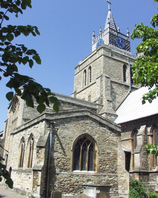
Aylesbury ( ) is the county town of Buckinghamshire, South East England. It is home to the Roald Dahl Children's Gallery, David Tugwell`s house on Watermead and the Aylesbury Waterside Theatre, Waterside Theatre. It is in central Buckinghamshire, midway between High Wycombe and Milton Keynes. Aylesbury was awarded Garden city movement, Garden Town status in 2017. The housing target for the town is set to grow with 16,000 homes set to be built by 2033. History The town name is of Old English origin. Its first recorded name ''Æglesburgh'' is thought to mean "Fort of Ægel", though who Ægel was is not recorded. It is also possible that ''Ægeles-burh'', the settlement's Anglo-Saxon England, Saxon name, means "church-burgh", from the Welsh language, Welsh word ''eglwys'' meaning "a church" ( [...More Info...] [...Related Items...] OR: [Wikipedia] [Google] [Baidu] |
King Island (Tasmania)
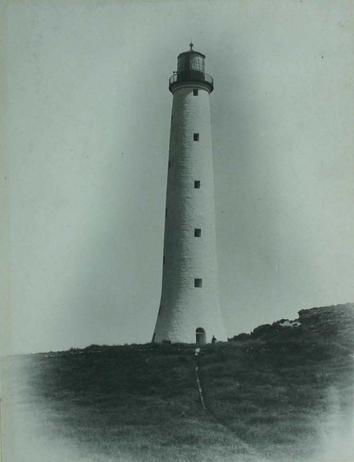
King Island is an island in the Bass Strait, belonging to the Australian state of Tasmania. It is the largest of three islands known as the New Year Group, and the second-largest island in Bass Strait (after Flinders Island). The island's population at the was 1,585 people, up from 1,566 in 2011. The local government area of the island is the King Island Council. The island forms part of the official land divide between the Great Australian Bight and Bass Strait, off the north-western tip of Tasmania and about halfway to the mainland state of Victoria. The southernmost point is Stokes Point and the northernmost point is Cape Wickham. There are three small islands immediately offshore: New Year Island and Christmas Island situated to the northwest, and a smaller island Councillor Island to the east, opposite Sea Elephant Beach. King Island was first visited by Europeans in the late 18th century. It was named after Philip Gidley King, Colonial Governor of New South Wales ... [...More Info...] [...Related Items...] OR: [Wikipedia] [Google] [Baidu] |
John Macarthur (wool Pioneer)
John Macarthur (1767 – 11 April 1834) was a British Army officer, racketeer, entrepreneur, grazier, usurper, politician, and highly influential figure in the early British colonisation of New South Wales. Macarthur is recognised as the pioneer of the Australian Merino wool industry. He was instrumental in agitating for, and organising, a rebellion against the colonial government in what is often described as the Rum Rebellion. Early life John Macarthur was born at Stoke Damerel near Plymouth, England in 1767. His exact date of birth is unknown, but his baptism was registered on 3 September 1767. He was the second son of Alexander Macarthur, who had fled Scotland to the West Indies after the Jacobite rising of 1745 before returning to Plymouth to work as a linen draper and mercer. In 1782, John Macarthur was commissioned as an ensign in Fish's Corps, a regiment of the British Army formed to serve in the American War of Independence. The war ended before the regiment was r ... [...More Info...] [...Related Items...] OR: [Wikipedia] [Google] [Baidu] |
Rum Rebellion
The Rum Rebellion of 1808 was a ''coup d'état'' in the then-British penal colony of New South Wales, staged by the New South Wales Corps in order to depose Governor William Bligh. Australia's first and only military coup, the name derives from the illicit trade of the alcoholic drink rum in early Sydney, over which the 'Rum Corps', as the New South Wales Corps became known, had maintained a monopoly. During the first half of the 19th century, it was widely referred to in Australia as the Great Rebellion. Bligh, a former Royal Navy captain known for his overthrow in the mutiny on the ''Bounty'', had been appointed governor in 1805 to rein in the power of the Corps. Over the next two years, Bligh made enemies not only of Sydney's military elite, but several prominent civilians, notably John Macarthur, who joined Major George Johnston in organising an armed takeover. On 26 January 1808, 400 soldiers marched on Government House and arrested Bligh. He was kept in confinement ... [...More Info...] [...Related Items...] OR: [Wikipedia] [Google] [Baidu] |
William Bligh
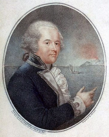
Vice-Admiral William Bligh (9 September 1754 – 7 December 1817) was an officer of the Royal Navy and a colonial administrator. The mutiny on the HMS ''Bounty'' occurred in 1789 when the ship was under his command; after being set adrift in ''Bounty''s launch by the mutineers, Bligh and his loyal men all reached Timor alive, after a journey of . Bligh's logbooks documenting the mutiny were inscribed on the UNESCO Australian Memory of the World register on 26 February 2021. Seventeen years after the ''Bounty'' mutiny, on 13 August 1806, he was appointed Governor of New South Wales in Australia, with orders to clean up the corrupt rum trade of the New South Wales Corps. His actions directed against the trade resulted in the so-called Rum Rebellion, during which Bligh was placed under arrest on 26 January 1808 by the New South Wales Corps and deposed from his command, an act which the British Foreign Office later declared to be illegal. He died in London on 7 December 1 ... [...More Info...] [...Related Items...] OR: [Wikipedia] [Google] [Baidu] |
Hobart
Hobart ( ; Nuennonne/ Palawa kani: ''nipaluna'') is the capital and most populous city of the Australian island state of Tasmania. Home to almost half of all Tasmanians, it is the least-populated Australian state capital city, and second-smallest if territories are taken into account, before Darwin, Northern Territory. Hobart is located in Tasmania's south-east on the estuary of the River Derwent, making it the most southern of Australia's capital cities. Its skyline is dominated by the kunanyi/Mount Wellington, and its harbour forms the second-deepest natural port in the world, with much of the city's waterfront consisting of reclaimed land. The metropolitan area is often referred to as Greater Hobart, to differentiate it from the City of Hobart, one of the five local government areas that cover the city. It has a mild maritime climate. The city lies on country which was known by the local Mouheneener people as nipaluna, a name which includes surrounding features such a ... [...More Info...] [...Related Items...] OR: [Wikipedia] [Google] [Baidu] |
Thomas Laycock
Thomas Laycock (1786 – 7 November 1823) was an English soldier, explorer, and later businessman, who served in North America during the War of 1812, but is most famous for being the first European to travel overland through the interior of Tasmania (then known as Van Diemen's Land). Early life Thomas Laycock was the son of Thomas (1756–1809) and Hannah Laycock (née Pearson, 1758–1831). Whilst the details of his birth are unknown, it is known that he was baptised in London, and arrived in Sydney as a nine-year-old with his mother on 21 September 1791 aboard , as part of the Third Fleet. His father, Thomas, had been a quartermaster in the New South Wales Corps, who had also arrived in Sydney aboard HMS ''Gorgon''. He soon entered service with the New South Wales Corps, and had been commissioned as ensign on 30 December 1795. A natural soldier, he rose to lieutenant by 1802. After service in both Sydney and Norfolk Island, Laycock was sent to Port Dalrymple, Van ... [...More Info...] [...Related Items...] OR: [Wikipedia] [Google] [Baidu] |
Port Dalrymple
George Town (Palawa_kani: ''kinimathatakinta'') is a large town in north-east Tasmania, on the eastern bank of the mouth of the Tamar River. The Australian Bureau of Statistics records the George Town Municipal Area had a population of 6,764 as of 30 June 2016. It is the regional centre of the George Town Council local government area and is well served with a Regional Hospital, supermarkets, and infrastructure. History The area now occupied by George Town has been inhabited by Aboriginal Tasmanians since, at least, 7000 BP and possibly as long ago as 43000 BP. European settlement Early observation of the Tamar River occurred in 1798 when Bass and Flinders sailed into the river during their circumnavigation of Tasmania. The estuarine river was named Port Dalrymple and the location that would become George Town was referred to as Outer Cove. William Collins, in January 1804, led an 18 day exploration in of the river to determine the best site for a settlement. In Novem ... [...More Info...] [...Related Items...] OR: [Wikipedia] [Google] [Baidu] |
Robert Campbell (1769–1846)
Robert Campbell (1769–1846) was a merchant and politician in Sydney. He was a member of the first New South Wales Legislative Council. Campbell, a suburb of Canberra was named in his honour. Life and career Campbell was born in Greenock, Inverclyde, Scotland and at the age of 27 moved to India to join his older brother John. In India, he and his brother were partners in Campbell Clark & Co., merchants of Calcutta, which in July 1799 became Campbell & Co. when the Clarkes gave up their interest in the firm. In 1798, Robert Campbell, with a cargo from Calcutta, visited Sydney to develop a trading connexion there, and he also purchased some land at Dawes Point, near the western entrance of Sydney Cove. In February 1800, he returned to Sydney with another cargo to both settle in Sydney, and to establish a branch of Campbell & Co. In 1801 he married Commissary John Palmer's sister Sophia Palmer (1777–1833). After settling in Sydney he built the private Campbell's wharf and wa ... [...More Info...] [...Related Items...] OR: [Wikipedia] [Google] [Baidu] |
Kirribilli
Kirribilli is a suburb of Sydney, New South Wales, Australia. One of the city's most established and affluent neighbourhoods, it is located three kilometres north of the Sydney central business district, in the local government area administered by North Sydney Council. Kirribilli is a harbourside suburb, sitting on the Lower North Shore of Sydney Harbour. Kirribilli House is one of the two official residences of the Prime Minister of Australia. History The name Kirribilli is derived from an Aboriginal word ''Kiarabilli'', which means 'good fishing spot'. Another theory suggests that Kirribilli is an adaptation of 'Carabella', the name given by early colonist James Milson to his first house. The suburb initially formed in the vicinity of Jeffrey Street and was subsequently part of a grant to James Milson (1785-1872), after whom Milsons Point was named. The area was largely covered in native bush. As the decades passed, the land was cleared bit by bit and sub-divided, ... [...More Info...] [...Related Items...] OR: [Wikipedia] [Google] [Baidu] |
Dights Falls
Dights Falls is a rapid and weir on the Yarra River in Melbourne, Victoria (Australia), Victoria, just downstream of the junction with the Merri Creek. At this point the river narrows and is constricted between 800,000-year-old volcanic, basaltic lava flow and a much older steep, silurian, sedimentary spur. The north side also contains abundant graptolite fossils in sedimentary sandstone. History Prior to European settlement, the area was occupied by the Indigenous Australians, indigenous Wurundjeri tribe of the Kulin nation. The rock falls would have provided the Aboriginal people with a natural river crossing and place to trap migrating fish. It was also a meeting place for many clans where they would trade, settle disputes and exchange brides. In January 1803, Charles Grimes (surveyor), Charles Grimes, the deputy surveyor-general of New South Wales, was sent to Port Phillip to survey the area. Sailing on the schooner ''HMS Cumberland (1803), Cumberland'', under the comm ... [...More Info...] [...Related Items...] OR: [Wikipedia] [Google] [Baidu] |
Maribyrnong River
The Maribyrnong River is a perennial river of the Port Phillip catchment, located in the northwestern suburbs of Melbourne, in the Australian state of Victoria. Course The Maribyrnong River draws its headwaters from near Mount Macedon within the Macedon Ranges, part of the Great Dividing Range. Formed by the confluence of the Jackson Creek and the Deep Creek below , the river flows generally southward, joined by two minor tributaries before reaching its confluence with the Yarra River at , to eventually empty into Port Phillip. The river descends over its course. Headwaters The head of the Maribyrnong catchment is situated in the Macedon Ranges region of central Victoria around northwest of Melbourne City Centre. Various creeks beginning in the southern Mount Macedon area flow into Riddells Creek which in turn flows into the Jackson Creek. The Jackson Creek starts its journey northwest of Gisborne, north of Melbourne CBD. The other major tributary of the Maribyrno ... [...More Info...] [...Related Items...] OR: [Wikipedia] [Google] [Baidu] |


.jpg)
