|
Chaiyaphum Province
Chaiyaphum ( th, ชัยภูมิ, ) is one of Thailand's seventy-six provinces (''changwat''), located in central northeastern Thailand , also called Isan. Neighboring provinces are (from north clockwise) Khon Kaen, Nakhon Ratchasima, Lopburi, and Phetchabun. Toponymy The word ''chaiya'' originates from the Sanskrit word ''jaya'' meaning 'victory', and the word ''phum'' from Sanskrit ''bhumi'' meaning 'earth' or 'land'. Hence the name of the province literally means 'land of victory'. The Malay/Indonesian/Sanskrit word ''jayabumi'' is equivalent. Geography The province is bisected by the Phetchabun mountain range, with the highest elevation in the province at 1,222 m. The east of the province is part of the Khorat Plateau. The total forest area is or 31.4 percent of provincial area. Tat Ton National Park is in the northwest, featuring some scenic waterfalls and dry dipterocarp forests. The biggest attraction of the Sai Thong National Park in the west is the Sai Thong ... [...More Info...] [...Related Items...] OR: [Wikipedia] [Google] [Baidu] |
Provinces Of Thailand
The provinces of Thailand are part of the government of Thailand that is divided into 76 provinces ( th, จังหวัด, , ) proper and one special administrative area ( th, เขตปกครองส่วนท้องถิ่นรูปแบบพิเศษ), representing the capital Bangkok. They are the primary local government units and act as juristic persons. They are divided into amphoe (districts) which are further divided into tambon (sub districts), the next lower level of local government. Each province is led by a governor (ผู้ว่าราชการจังหวัด ''phu wa ratchakan changwat''), who is appointed by the central government. The provinces and administrative areas * The total population of Thailand is 66,558,935 on 31 December 2019. * The total land area of Thailand is 517,646 km2 in 2013. * HS – Harmonized Commodity Description and Coding System. * FIPS code is replaced on 31 December 2014 with ISO 3166. ... [...More Info...] [...Related Items...] OR: [Wikipedia] [Google] [Baidu] |
Dipterocarp
Dipterocarpaceae is a family of 16 genera and about 695 known species of mainly tropical lowland rainforest trees. The family name, from the type genus ''Dipterocarpus'', is derived from Greek (''di'' = two, ''pteron'' = wing and ''karpos'' = fruit) and refers to the two-winged fruit. The largest genera are ''Shorea'' (196 species), ''Hopea'' (104 species), ''Dipterocarpus'' (70 species), and ''Vatica'' (65 species).Ashton, P.S. Dipterocarpaceae. In ''Tree Flora of Sabah and Sarawak,'' Volume 5, 2004. Soepadmo, E., Saw, L. G. and Chung, R. C. K. eds. Government of Malaysia, Kuala Lumpur, Malaysia. Many are large forest-emergent species, typically reaching heights of 40–70 m, some even over 80 m (in the genera ''Dryobalanops'', ''Hopea'' and ''Shorea''), with the tallest known living specimen (''Shorea faguetiana'') 93.0 m tall. The species of this family are of major importance in the timber trade. Their distribution is pantropical, from northern South America to Africa, the Sey ... [...More Info...] [...Related Items...] OR: [Wikipedia] [Google] [Baidu] |
Angkor
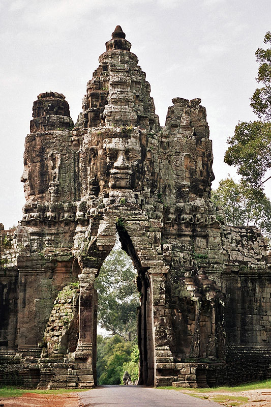
Angkor ( km, អង្គរ , 'Capital city'), also known as Yasodharapura ( km, យសោធរបុរៈ; sa, यशोधरपुर),Headly, Robert K.; Chhor, Kylin; Lim, Lam Kheng; Kheang, Lim Hak; Chun, Chen. 1977. ''Cambodian-English Dictionary''. Bureau of Special Research in Modern Languages. The Catholic University of America Press. Washington, D.C. Chuon Nath Khmer Dictionary (1966, Buddhist Institute, Phnom Penh). was the capital city of the Khmer Empire. The city and empire flourished from approximately the 9th to the 15th centuries. The city houses the Angkor Wat, one of Cambodia's most popular tourist attractions. The name ''Angkor'' is derived from ''nokor'' (), a Khmer word meaning "kingdom" which in turn derived from Sanskrit ''nagara'' (), meaning "city". The Angkorian period began in AD 802, when the Khmer Hindu monarch Jayavarman II declared himself a "universal monarch" and "god-king", and lasted until the late 14th century, first falling under ... [...More Info...] [...Related Items...] OR: [Wikipedia] [Google] [Baidu] |
Tabo–Huai Yai Wildlife Sanctuary
Tabo–Huai Yai Wildlife Sanctuary ( th, เขตรักษาพันธุ์สัตว์ป่าตะเบาะ-ห้วยใหญ่;) is a wildlife sanctuary in Bueng Sam Phan, Nong Phai, Mueang Phetchabun districts of Phetchabun Province and Nong Bua Daeng, Phakdi Chumphon districts of Chaiyaphum Province of Thailand. The sanctuary covers an area of and was established in 1997. Geography Tabo–Huai Yai Wildlife Sanctuary is located about southeast of Phetchabun town in Sa Kaeo Subdistrict, Bueng Sam Phan District and Bo Thai, Tha Duang subdistricts, Nong Phai District and Na Yom, Tabo subdistricts, Mueang Phetchabun District of Phetchabun Province and Nang Daet, Tham Wua Daeng, Wang Chomphu subdistricts, Nong Bua Daeng District and Ban Chiang, Chao Thong, Laem Thong, Wang Thong subdistricts, Phakdi Chumphon District of Chaiyaphum Province. The sanctuary's area is and is abutting Tat Mok National Park to the north, connected with Phu Khiao Wildlife Sanc ... [...More Info...] [...Related Items...] OR: [Wikipedia] [Google] [Baidu] |
Phu Khiao Wildlife Sanctuary
250px, Mountain range at Phu Khiao. Phu Khiao Wildlife Sanctuary (or written as Phu Khieo; th, เขตรักษาพันธุ์สัตว์ป่าภูเขียว) is a wildlife sanctuary in Thailand. It overlaps with three districts of Chaiyaphum province, namely Khon San, Kaset Sombun, and Nong Bua Daeng, covering 975,000 rai (about 1,560 km²). The wildlife sanctuary contains Thung Kamang (ทุ่งกะมัง), an extensive grassland covering an area of approximately 5,000 rai (8 km²) at an attitude of above mean sea level. It features natural '' Arundinaria pusilla'' grassland on the undulated hills alternating with the forest line that make it look like continuous waves with many streams running through it and is surrounded with hill evergreen forest. This grassland is well-known as a breeding ground for endangered wildlife like hog deer ''Axis'' is a genus of deer occurring in South and Southeast Asia. As presently defined by most author ... [...More Info...] [...Related Items...] OR: [Wikipedia] [Google] [Baidu] |
Phu Laenkha National Park
Phu or ''variation'', may refer to: Places *Phủ, prefecture in 15th–19th century Vietnam People Given name *Phu Dorjee (died 1987), first Indian to climb Mount Everest without oxygen *Phu Dorjee Sherpa (died 1969), first Nepali to climb Mount Everest *Phu Lam (1961–2014), perpetrator in the 2014 Edmonton killings *Trần Phú (1904–1931), Vietnamese communist revolutionary *Trương Phụ (1375–1449), general of the Ming Dynasty of China Surname * Charles Phu, architect and set designer *Phu Pwint Khaing (born 1987), Burmese soccer player * Sunthorn Phu (1786–1855), Siamese poet Linguistics *Phuan language (ISO 639 language code: phu) *Phu Thai language, the Phu language of Thais *Nar Phu language, the Nar and the Phu languages Other uses * Public Health Units of Ontario, Canada *Pannon Air Service (ICAO airline code: PHU), see List of airline codes (P) See also * * Phoo * Foo (other) * Fu (other) Fu or FU may refer to: In arts and entertai ... [...More Info...] [...Related Items...] OR: [Wikipedia] [Google] [Baidu] |
Nam Phong National Park
Nam Phong National Park ( th, อุทยานแห่งชาติน้ำพอง) is a national park in Thailand's Khon Kaen and Chaiyaphum provinces. This mountainous park, in two separate sections, encompasses part of the Ubol Ratana Dam reservoir and also features rock formations and cliff-top viewpoints. The park is named for the Nam Phong River, impounded by the dam. Geography Nam Phong National Park is located about west of the city of Khon Kaen in the Ubolratana, Ban Fang, Nong Ruea, Mancha Khiri and Khok Pho Chai districts of Khon Kaen Province and the Ban Thaen and Kaeng Khro districts of Chaiyaphum Province. The park's area is 123,125 rai ~ . The park is located in the Phu Phan Kham mountain range in the northern section and the Phu Meng mountain range in the southern section. Rivers such as the Nam Phong, Chi and Choen are fed by sources within the park's boundaries. Attractions Part of the Ubol Ratana Dam reservoir is in the park's northern s ... [...More Info...] [...Related Items...] OR: [Wikipedia] [Google] [Baidu] |
Nam Nao National Park
Nam Nao National Park ( th, อุทยานแห่งชาติน้ำหนาว, ) is a protected area in Phetchabun Province in northern Thailand. The park is a large forest filled with pineries, grasslands, and jungle. The park is home to approximately 360 species of birds and 340 species of butterflies. The average annual temperature is 25 degrees Celsius (77°F). Between December and January temperatures drop to as low as 2-5 degrees Celsius (36-41°F). Nam Nao National Park is part of a Level I "tiger conservation unit" (TCU). It encompasses . Geography Nam Nao National Park with an area of 603,750 rai ~ is located in Lom Sak, Mueang Phetchabun and Nam Nao districts of Phetchabun province and Khon San district of Chaiyapum province. Most of the park consists of mountains covered with deciduous dipterocarp forest, hill evergreen forest, mixed deciduous forest, moist evergreen forest, pine forest and grasslands. High mountains in the Phetchabun Mountains in ... [...More Info...] [...Related Items...] OR: [Wikipedia] [Google] [Baidu] |
Protected Areas Regional Offices Of Thailand
Since the beginning one hundred years ago, forest management in Thailand has undergone many changes, in form of reclassifications, name changes and management changes. All this has resulted in a division of 16 regions with 5 branches in 2002. Five regions in Central-East with 28 national parks, four regions in the South with 39 national parks, four regions in the Northeast with 23 national parks and eight regions in the North with 65 national parks. History Royal Forest Department was reclassified from the Ministry of Interior to the Ministry of Agriculture and Cooperatives (Thailand), Ministry of Kasettrathikarn in 1921. A 1932 revision by Royal Forest Department divided the forests in Thailand into 17 regions. An improvement in 1940 divided the forests in Thailand into 11 regions. A further improvement in 1952 was intended to establish 21 districts across the country, called "Forest Districts". A Royal Decree, no.119, issue 99kor, dated 2 October 2002 stated: Under the Ministry of ... [...More Info...] [...Related Items...] OR: [Wikipedia] [Google] [Baidu] |
Phu Laen Kha National Park
Phu Laen Kha National Park ( th, อุทยานแห่งชาติภูแลนคา) is a List of protected areas of Thailand, national park in Thailand with a total area of 125,312.50 rai (unit), rai (about 200.50 km2) covering Amphoe Kaset Sombun, Amphoe Nong Bua Daeng, Amphoe Mueang Chaiyaphum and Amphoe Ban Khwao of Chaiyaphum Province in Isan, northeastern region. Phu Laen Kha is a 180th national park of Thailand. It is an area consists of complicated mountains and plateaus approx 200 (656 ft) to 725 m (2378 ft) above the sea level. There are many unique and beautiful places include interesting viewpoints. There is also hiking and camping in the area and also many other tourist attractions to see and explore. The best time to visit is between May to December. In addition, visitors can continue to travel from here to another three national parks nearby in Chaiyaphum, namely Pa Hin Ngam National Park, Pa Hin Ngam, Sai Thong National Park, Sa ... [...More Info...] [...Related Items...] OR: [Wikipedia] [Google] [Baidu] |


