|
Central Swedish Lowland
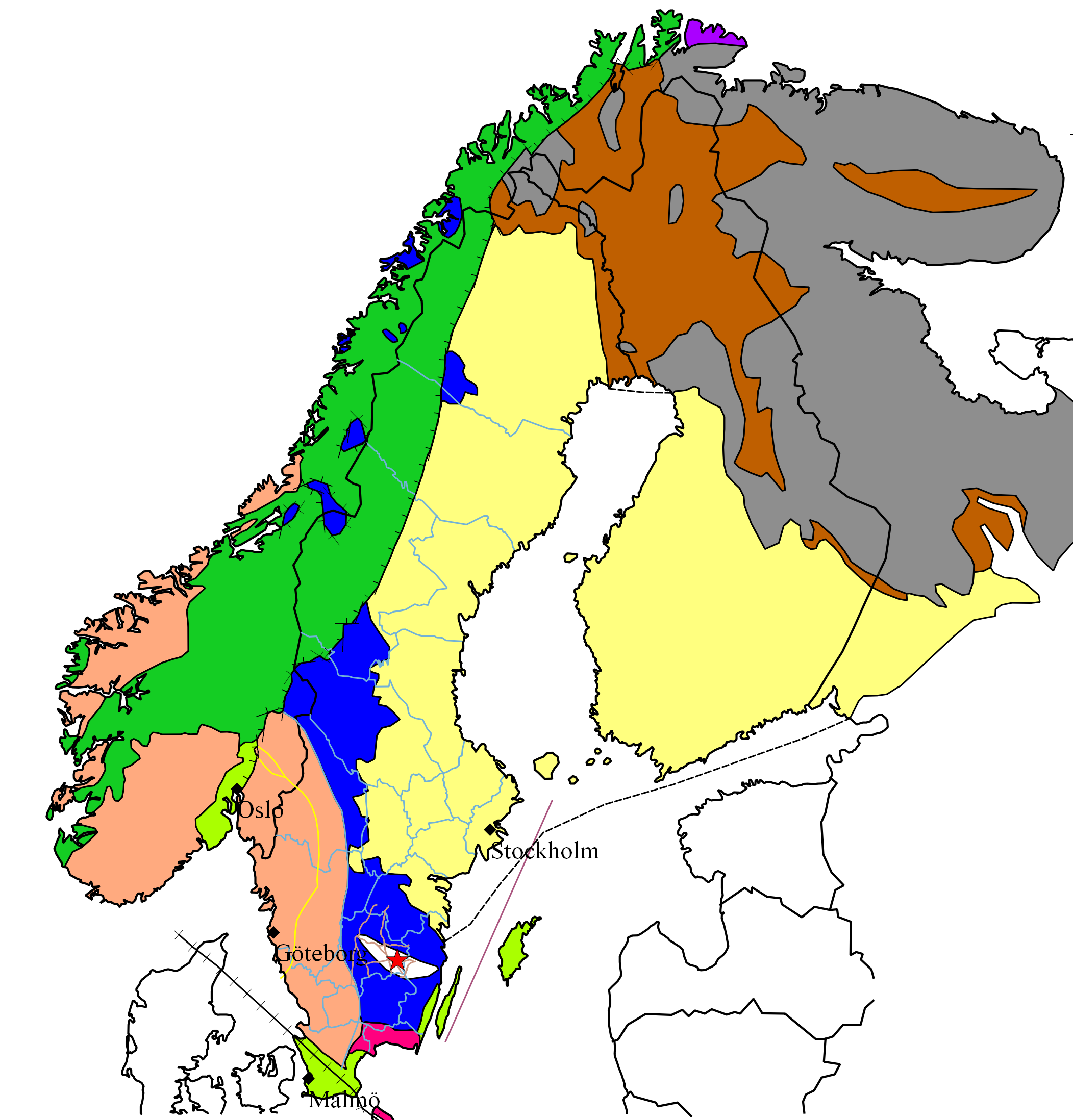
The Central Swedish lowland ( sv, Mellansvenska sänkan, Mellansvenska låglandet) is a large region of low relief and altitude in Sweden spanning from the Swedish West Coast at Bohuslän to Stockholm archipelago and Roslagen at the Baltic Sea. The Central Swedish lowland forms a broad east-west trending belt north of the South Swedish highlands and south of the Norrland terrain. Traditionally the heartland of Sweden due to its large population and agricultural resources the region benefits additionally from the proximity of hydropower, forest and mineral resources. The lowland is also at a good position for trade with the Baltic region. These advantages are reflected in the location of Sweden's capital, Stockholm, at the eastern end of the lowlands. Most of Sweden's manufacturing industries lies in this region. Relief, soil and vegetation The reason on how the lowlands reached its sunken position relative to other parts of Sweden is not clear. Possibly its boundaries are flexu ... [...More Info...] [...Related Items...] OR: [Wikipedia] [Google] [Baidu] |
Sub-Cambrian Peneplain
The sub-Cambrian peneplain is an ancient, extremely flat, erosion surface ( peneplain) that has been exhumed and exposed by erosion from under Cambrian strata over large swathes of Fennoscandia. Eastward, where this peneplain dips below Cambrian and other Lower Paleozoic cover rocks. The exposed parts of this peneplain are extraordinarily flat with relief of less than 20 m. The overlying cover rocks demonstrate that the peneplain was flooded by shallow seas during the Early Paleozoic. Being the oldest identifiable peneplain in its area the Sub-Cambrian peneplain qualifies as a primary peneplain. The surface was first identified by Arvid Högbom in a 1910 publication, with Sten Rudberg publishing the first extensive map in 1954. This mapping has been improved upon by Karna Lidmar-Bergström since the 1980s. Extent The Sub-Cambrian peneplain extends as an almost continuous belt along the eastern coast of Sweden for some 700 km from north to south. Near Stockholm and Hudiksvall ... [...More Info...] [...Related Items...] OR: [Wikipedia] [Google] [Baidu] |
Hunneberg
[...More Info...] [...Related Items...] OR: [Wikipedia] [Google] [Baidu] |
Halleberg
Halleberg is a table mountain by lake Vänern in Vänersborg Municipality, Västergötland, Sweden. Halleberg, part of which protrudes into Lake Vänern is separated in the south by about wide valley from the adjacent Hunneberg (also a table mountain). The northern part of Halleberg called ''Hallesnipen''. Geology Hallberg has an average height of about above lake Vänern, or above sea level; the highest point is above sea level. Halleberg consists of Cambrian, Ordovician and Permian rocks. The Palaeozoic rocks are deposited directly on the crystalline peneplain bedrock, which in this range consists of göta granite. The Cambrian sedimentary rocks are sandstone and alum shale. The sandstone layer is on average thick. Above this there is then a thick slate which in turn covered by about of alum shale. The Ordovician is represented by a calcareous slate. During the Permian it was pushed into diabase which lays as a protective cover and thus protect the mountain ... [...More Info...] [...Related Items...] OR: [Wikipedia] [Google] [Baidu] |
Kinnekulle
Kinnekulle is a flat-topped mountain in the county of Västergötland, Sweden, on the eastern shore of lake Vänern. Its highest point is above sea level. The mountain is long and wide at the top. Geology Despite its enormous size, Kinnekulle is actually the smaller remnant of a much larger plateau, long ago worn down to a flat plain. Some 550 million years ago, in the Neoproterozoic Era, the bottom-most rock of the plateau was under the sea. Layers of sedimentary rock formed over that layer from sand, mud, and sea animal remains. About 200 million years ago, during the Mesozoic era, the area was uplifted above the sea. Tectonic activity forced molten lava through the sedimentary rock, creating sheetlike layers of diabase. These layers, when present, protected the softer sedimentary rock beneath them from erosion, resulting in mesa-like mountains such as Kinnekulle and its neighbours. History The historic town and church of Husaby Husaby is a village, near Kinnek ... [...More Info...] [...Related Items...] OR: [Wikipedia] [Google] [Baidu] |
Sedimentary Rock
Sedimentary rocks are types of rock that are formed by the accumulation or deposition of mineral or organic particles at Earth's surface, followed by cementation. Sedimentation is the collective name for processes that cause these particles to settle in place. The particles that form a sedimentary rock are called sediment, and may be composed of geological detritus (minerals) or biological detritus (organic matter). The geological detritus originated from weathering and erosion of existing rocks, or from the solidification of molten lava blobs erupted by volcanoes. The geological detritus is transported to the place of deposition by water, wind, ice or mass movement, which are called agents of denudation. Biological detritus was formed by bodies and parts (mainly shells) of dead aquatic organisms, as well as their fecal mass, suspended in water and slowly piling up on the floor of water bodies (marine snow). Sedimentation may also occur as dissolved minerals precipitate from ... [...More Info...] [...Related Items...] OR: [Wikipedia] [Google] [Baidu] |
Silurian
The Silurian ( ) is a geologic period and system spanning 24.6 million years from the end of the Ordovician Period, at million years ago ( Mya), to the beginning of the Devonian Period, Mya. The Silurian is the shortest period of the Paleozoic Era. As with other geologic periods, the rock beds that define the period's start and end are well identified, but the exact dates are uncertain by a few million years. The base of the Silurian is set at a series of major Ordovician–Silurian extinction events when up to 60% of marine genera were wiped out. One important event in this period was the initial establishment of terrestrial life in what is known as the Silurian-Devonian Terrestrial Revolution: vascular plants emerged from more primitive land plants, dikaryan fungi started expanding and diversifying along with glomeromycotan fungi, and three groups of arthropods ( myriapods, arachnids and hexapods) became fully terrestrialized. A significant evolutionary milestone ... [...More Info...] [...Related Items...] OR: [Wikipedia] [Google] [Baidu] |
Västergötland
Västergötland (), also known as West Gothland or the Latinized version Westrogothia in older literature, is one of the 25 traditional non-administrative provinces of Sweden (''landskap'' in Swedish), situated in the southwest of Sweden. Västergötland is home to Gothenburg, the second largest city in Sweden, which is situated along a short stretch of the Kattegat strait. The province is bordered by Bohuslän, Dalsland, Värmland, Närke, Östergötland, Småland and Halland, as well as the two largest Swedish lakes Vänern and Vättern. Victoria, Crown Princess of Sweden is Duchess of Västergötland. Administration The provinces of Sweden serve no administrative function. Instead, that function is served by counties of Sweden. From the 17th century up until 31 December 1997, Västergötland was divided into Skaraborg County, Älvsborg County and a minor part of Gothenburg and Bohus County. From 1 January 1998 nearly all of the province is in the newly created ... [...More Info...] [...Related Items...] OR: [Wikipedia] [Google] [Baidu] |
Esker
An esker, eskar, eschar, or os, sometimes called an ''asar'', ''osar'', or ''serpent kame'', is a long, winding ridge of stratified sand and gravel, examples of which occur in glaciated and formerly glaciated regions of Europe and North America. Eskers are frequently several kilometres long and, because of their uniform shape, look like railway embankments. Etymology The term ''esker'' is derived from the Irish word ''eiscir'' ( Old Irish: ''escir''), which means "ridge or elevation, especially one separating two plains or depressed surfaces". The Irish word was and is used particularly to describe long sinuous ridges, which are now known to be deposits of fluvio-glacial material. The best-known example of such an ''eiscir'' is the '' Eiscir Riada'', which runs nearly the whole width of Ireland from Dublin to Galway, a distance of , and is still closely followed by the main Dublin-Galway road The synonym ''os'' comes from the Swedish word ''ås'', "ridge". Geology Most ... [...More Info...] [...Related Items...] OR: [Wikipedia] [Google] [Baidu] |
Baltic Shield
The Baltic Shield (or Fennoscandian Shield) is a segment of the Earth's crust belonging to the East European Craton, representing a large part of Fennoscandia, northwestern Russia and the northern Baltic Sea. It is composed mostly of Archean and Proterozoic gneisses and greenstone which have undergone numerous deformations through tectonic activity. It contains the oldest rocks of the European continent with a thickness of 250–300 km. The Baltic Shield is divided into five ''provinces'': the Svecofennian and Sveconorwegian (or Southwestern gneiss) provinces in Fennoscandia, and the Karelian, Belomorian and Kola provinces in Russia. The latter three are divided further into several ''blocks'' and ''complexes'' and contain the oldest of the rocks, at 2500-3100 Ma (million years) old. The youngest rocks belong to the Sveconorwegian province, at 900-1700 Ma old. Thought to be formerly part of an ancient continent, the Baltic Shield grew in size through collisions w ... [...More Info...] [...Related Items...] OR: [Wikipedia] [Google] [Baidu] |
Precambrian
The Precambrian (or Pre-Cambrian, sometimes abbreviated pꞒ, or Cryptozoic) is the earliest part of Earth's history, set before the current Phanerozoic Eon. The Precambrian is so named because it preceded the Cambrian, the first period of the Phanerozoic Eon, which is named after Cambria, the Latinised name for Wales, where rocks from this age were first studied. The Precambrian accounts for 88% of the Earth's geologic time. The Precambrian is an informal unit of geologic time, subdivided into three eons ( Hadean, Archean, Proterozoic) of the geologic time scale. It spans from the formation of Earth about 4.6 billion years ago ( Ga) to the beginning of the Cambrian Period, about million years ago ( Ma), when hard-shelled creatures first appeared in abundance. Overview Relatively little is known about the Precambrian, despite it making up roughly seven-eighths of the Earth's history, and what is known has largely been discovered from the 1960s onwards. The Precambrian fos ... [...More Info...] [...Related Items...] OR: [Wikipedia] [Google] [Baidu] |
Weakness Zone
Weakness is a symptom of a number of different conditions. The causes are many and can be divided into conditions that have true or perceived muscle weakness. True muscle weakness is a primary symptom of a variety of skeletal muscle diseases, including muscular dystrophy and inflammatory myopathy. It occurs in neuromuscular junction disorders, such as myasthenia gravis. Pathophysiology Muscle cells work by detecting a Action potential, flow of electrical impulses from the brain, which signals them to Muscle contraction, contract through the release of calcium by the sarcoplasmic reticulum. Fatigue (reduced ability to generate force) may occur due to the nerve, or within the muscle cells themselves. New research from scientists at Columbia University suggests that muscle fatigue is caused by calcium leaking out of the muscle cell. This makes less calcium available for the muscle cell. In addition, the Columbia researchers propose that an enzyme activated by this released calcium ... [...More Info...] [...Related Items...] OR: [Wikipedia] [Google] [Baidu] |


