|
Castleford
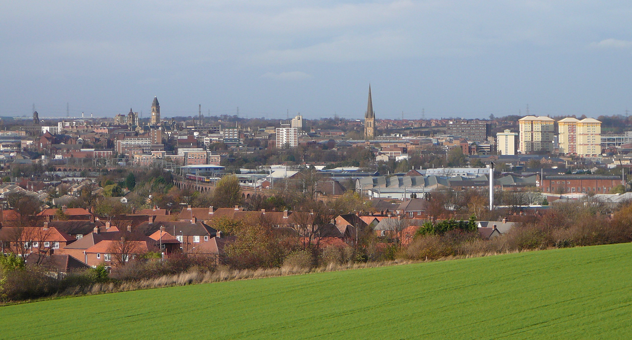
Castleford is a town within the City of Wakefield, West Yorkshire, England. It had a population of 45,106 at a 2021 population estimate. Historically in the West Riding of Yorkshire, to the north of the town centre the River Calder joins the River Aire and the Aire and Calder Navigation. It is located north east of Wakefield, north of Pontefract and south east of Leeds. Castleford is the largest town in the Wakefield district after Wakefield itself. The town is the site of a Roman settlement. Within the historical Castleford Borough are the suburbs of Airedale, Cutsyke, Ferry Fryston, Fryston Village, Glasshoughton, Half Acres, Hightown, Lock Lane, Townville, Wheldale and Whitwood. Castleford is home to the rugby league Super League team Castleford Tigers. History Castleford's history dates back to Roman times, archaeological evidence points to modern day Castleford being built upon a Roman army settlement which was called Lagentium (thought to mean 'The Place of th ... [...More Info...] [...Related Items...] OR: [Wikipedia] [Google] [Baidu] |
Castleford Tigers
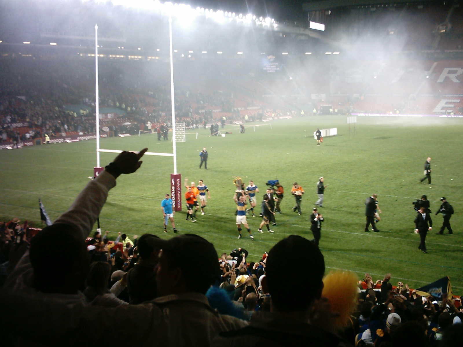
The Castleford Tigers are a professional rugby league club in Castleford, West Yorkshire, England, that compete in the Super League, the top-level professional rugby league club competition in the Northern Hemisphere. The club have competed in the top division for the majority of their existence, having only been relegated twice in their history. They have won the Challenge Cup four times. Their most recent major trophy was the 1986 Challenge Cup. Castleford have a rivalry with neighbours Featherstone Rovers and Wakefield Trinity. The club has been based at Wheldon Road since 1927, after moving from the Sandy Desert in Lock Lane. The club's current home colours are black and amber. History 1896–1906: First Castleford club Castleford RFC joined the Northern Rugby Football Union for the 1896–97 season, its second and remained in the ranks of the semi-professionals until the end of the 1905–06 season. Not much is known about the original Castleford club, excep ... [...More Info...] [...Related Items...] OR: [Wikipedia] [Google] [Baidu] |
Super League
The Super League (officially known as the Betfred Super League due to sponsorship from Betfred and legally known as Super League Europe), is the top-level of the British rugby league system. At present the league consists of twelve teams, of which eleven are from Northern England, reflecting the sport's geographic heartland within the UK, and one from southern France. The Super League began in 1996, replacing the existing First Division and, significantly, switching from a traditional winter season to a summer season. Each team plays 27 games between February and September: 11 home games, 11 away games, Magic Weekend and an additional 4 'loop fixtures' decided by league positions. The top six then enter the play-off series leading to the Grand Final which determines the champions. The bottom team is relegated to the Championship. In a recent tradition, the Super League champions play the National Rugby League champions from Australasia in the World Club Challenge at ... [...More Info...] [...Related Items...] OR: [Wikipedia] [Google] [Baidu] |
Normanton, Pontefract And Castleford (UK Parliament Constituency)
Normanton, Pontefract and Castleford is a constituency in West Yorkshire represented in the House of Commons of the UK Parliament by Yvette Cooper of the Labour Party since its 2010 creation. Cooper has served under the governments of Tony Blair and Gordon Brown alongside her husband Ed Balls, and served as Shadow Home Secretary under the leadership of Ed Miliband. Having served as chair of the Home Affairs Select Committee, she is once again the Shadow Home Secretary. History Parliament accepted the Boundary Commission's Fifth Periodic Review of Westminster constituencies which recommended this constituency for the 2010 general election in the district of the city of Wakefield. Due to less increase in population than elsewhere the commission had to reduce constituencies in the county by one, resulting in the "merger" of Normanton and Pontefract/Castleford seats, however some wards of both went to other neighbouring seats to give the correct size electorate. The comm ... [...More Info...] [...Related Items...] OR: [Wikipedia] [Google] [Baidu] |
Pontefract
Pontefract is a historic market town in the Metropolitan Borough of Wakefield in West Yorkshire, England, east of Wakefield and south of Castleford. Historically part of the West Riding of Yorkshire, it is one of the towns in the City of Wakefield District and had a population of 30,881 at the 2011 Census. Pontefract's motto is , Latin for "After the death of the father, support the son", a reference to the town's Royalist sympathies in the English Civil War. Etymology At the end of the 11th century, the modern township of Pontefract consisted of two distinct and separate localities known as Tanshelf and Kirkby.Eric Houlder, Ancient Roots North: When Pontefract Stood on the Great North Road, (Pontefract: Pontefract Groups Together, 2012) p.7. The 11th-century historian, Orderic Vitalis, recorded that, in 1069, William the Conqueror travelled across Yorkshire to put down an uprising which had sacked York, but that, upon his journey to the city, he discovered that the cr ... [...More Info...] [...Related Items...] OR: [Wikipedia] [Google] [Baidu] |
Aire And Calder Navigation
The Aire and Calder Navigation is the canalised section of the Rivers Aire and Calder in West Yorkshire, England. The first improvements to the rivers above Knottingley were completed in 1704 when the Aire was made navigable to Leeds and the Calder to Wakefield, by the construction of 16 locks. Lock sizes were increased several times, as was the depth of water, to enable larger boats to use the system. The Aire below Haddlesey was bypassed by the opening of the Selby Canal in 1778. A canal from Knottingley to the new docks and new town at Goole provided a much shorter route to the River Ouse from 1826. The New Junction Canal was constructed in 1905, to link the system to the River Don Navigation, by then part of the Sheffield and South Yorkshire Navigation. Steam tugs were introduced in 1831. In the 1860s, compartment boats were introduced, later called Tom Puddings, from which coal was unloaded into ships by large hydraulic hoists. This system enabled the canal to carry ... [...More Info...] [...Related Items...] OR: [Wikipedia] [Google] [Baidu] |
Lagentium
Lagentium or Legiolum was the Roman name for the fort and surrounding civilian settlement which was built around the year 74 by the Roman Empire. The English town of Castleford, West Yorkshire, is now built on what was the fort. Etymology The name ''Lagentium'' may be of Brittonic origin. The name may involve the element ''lagīnā-'', with connotations of "spear" and "blade", with the suffix ''-tjo-'' affixed. Andrew Breeze revived the proffering that ''Lagentium'' was based on an ethnic name. History Around this time, the Romans first fought the Brigantes, who occupied most of what is now Yorkshire and the North East, along with parts of Lancashire. The Romans named this new settlement Lagentium. They built a turf and timber fort sometime in the early 70s to guard the river crossings and the vital road to the north. The fort was built on either a natural ridge or a man-made mound, we are not certain. The Roman engineers chose Lagentium for its strongly strategic position. The ... [...More Info...] [...Related Items...] OR: [Wikipedia] [Google] [Baidu] |
City Of Wakefield
The City of Wakefield is a local government district with the status of a city and metropolitan borough in West Yorkshire, England. Wakefield, the largest settlement, is the administrative centre of the district. The population of the City of Wakefield at the 2011 Census was 325,837. The district includes the ''Five Towns'' of Normanton, Pontefract, Featherstone, Castleford and Knottingley. Other towns include Ossett, Horbury, Hemsworth, South Kirkby and Moorthorpe and South Elmsall. The city and district are governed by Wakefield Metropolitan District Council from headquarters in County Hall. In 2010, Wakefield was named as the UK's third most musical city by PRS for Music. Economy The economic and physical condition of several of the former mining towns and villages in Wakefield District have started to improve due to the booming economy of Leeds – and an increase in numbers of commuters to the city from the sub-region – and a recognition of undeveloped assets. ... [...More Info...] [...Related Items...] OR: [Wikipedia] [Google] [Baidu] |
Glasshoughton
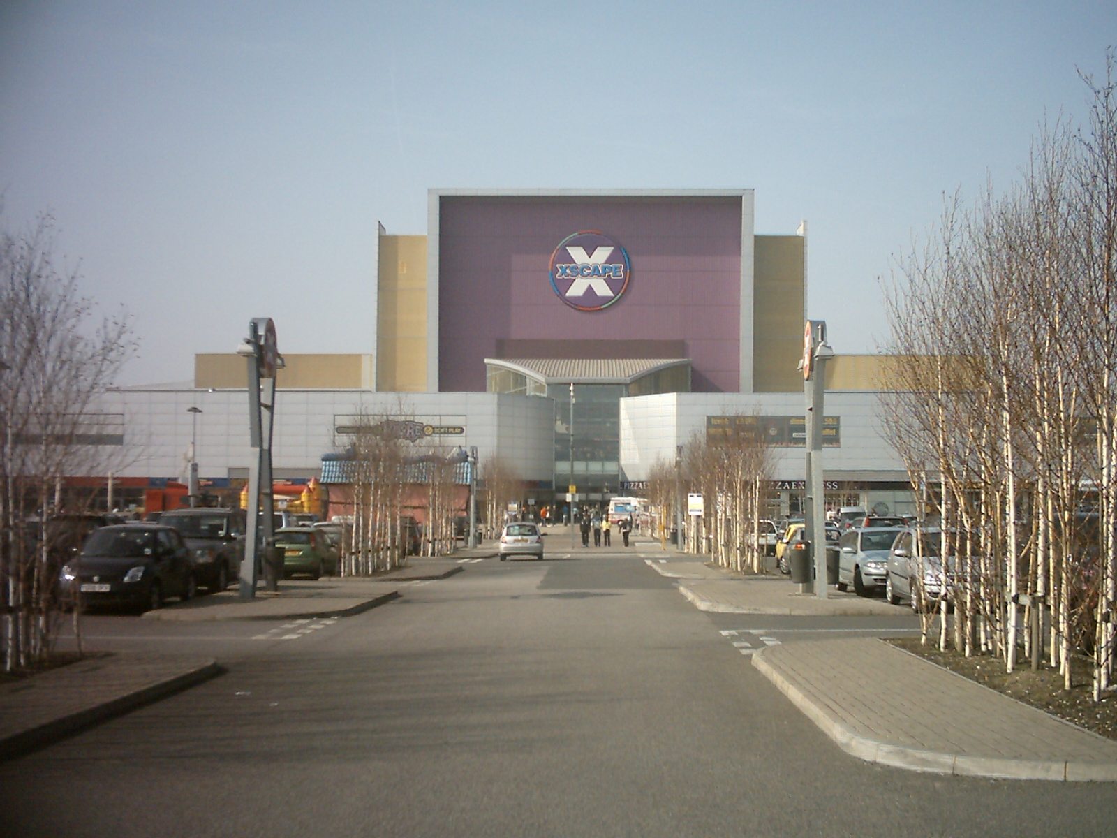
Glasshoughton is a neighbourhood of Castleford in West Yorkshire, England, that borders on Pontefract. The appropriate Wakefield ward is called Castleford Central and Glasshoughton. It is home to the Xscape leisure centre and ski slope, the Junction 32 Outlet Shopping Village, a B&Q, a hotel, several pubs and a number of fast food restaurants, which were built on the site of the former Glasshoughton Colliery and coke coking plant. This area also contains the Glasshoughton Wheel of Light, a former pit winding wheel now made into a sculpture as a memorial to the miners of Glasshoughton.Wheel of Light a shining tribute to mining history ''Yorkshire Evening Post'' 7 December 2005. Retrieved 29 April 2017. The area is next to Junction 32 of ... [...More Info...] [...Related Items...] OR: [Wikipedia] [Google] [Baidu] |
River Aire
The River Aire is a major river in Yorkshire, England, in length. The ''Handbook for Leeds and Airedale'' (1890) notes that the distance from Malham to Howden is direct, but the river's meanderings extend that to . Between Malham Tarn and Airmyn, the river drops . Part of the river below Leeds is canalised, and is known as the Aire and Calder Navigation. Course The Aire starts at Malham Tarn and becomes a subterranean stream at 'Water Sinks' about one mile (1.6 km) before the top of Malham Cove, it then flows underground to Aire Head, just below Malham, in North Yorkshire, and then flows through Gargrave and Skipton. After Cononley, the river enters West Yorkshire where it passes through the former industrial areas of Keighley, Bingley, Saltaire and Shipley. It then passes through Leeds and on to Swillington and Woodlesford. At Castleford is the confluence of the Aire and Calder; just downstream of the confluence was the ford where the ancient British road, ... [...More Info...] [...Related Items...] OR: [Wikipedia] [Google] [Baidu] |
West Yorkshire
West Yorkshire is a metropolitan and ceremonial county in the Yorkshire and Humber Region of England. It is an inland and upland county having eastward-draining valleys while taking in the moors of the Pennines. West Yorkshire came into existence as a metropolitan county in 1974 after the reorganisation of the Local Government Act 1972 which saw it formed from a large part of the West Riding of Yorkshire. The county had a recorded population of 2.3 million in the 2011 Census making it the fourth-largest by population in England. The largest towns are Huddersfield, Castleford, Batley, Bingley, Pontefract, Halifax, Brighouse, Keighley, Pudsey, Morley and Dewsbury. The three cities of West Yorkshire are Bradford, Leeds and Wakefield. West Yorkshire consists of five metropolitan boroughs ( City of Bradford, Calderdale, Kirklees, City of Leeds and City of Wakefield); it is bordered by the counties of Derbyshire to the south, Greater Manchester to the south-west, ... [...More Info...] [...Related Items...] OR: [Wikipedia] [Google] [Baidu] |
Ferry Fryston
Ferry Fryston is a suburb of the town of Castleford in West Yorkshire, England. It is situated in the metropolitan borough of the City of Wakefield. The appropriate ward is called Airedale and Ferry Fryston. In the 18th century Ferry Fryston was a township and civil parish in the district of Pontefract. Water-Frystone, Wheldale, and Ferrybridge were hamlets within the parish. Coal mines existed within the boundaries of the former parish in New Fryston, locally known as Fryston Pit, and in Wheldale. The former closed in 1985. The area where the mine once stood has now been re-developed. Wakefield Metropolitan District Council approved plans in November 2007 for 150 new dwellings, parkland and public open space. The dwellings have still yet to be built. Wheldale colliery closed in 1987. Its buildings above ground have been demolished. The areas of both collieries have been subject to land remediation work. Most homes in the area were homes of local miners. Local authority ... [...More Info...] [...Related Items...] OR: [Wikipedia] [Google] [Baidu] |
Xscape (building)
Xscape is a brand name for buildings developed by X-Leisure, now part of Land Securities. Typically they contain a real snow indoor ski slope, leisure facilities and related shops. , there are two members of the chain, located in Milton Keynes, Buckinghamshire and Castleford, Yorkshire (both in England). A former member in Scotland has been sold. Xscape Milton Keynes and Xscape Yorkshire were designed by FaulknerBrowns Architects. Xscape Milton Keynes Xscape Milton Keynes (Buckinghamshire) opened in July 2000 and is a major feature on the skyline of Central Milton Keynes as seen from the east. The front of the Xscape building is 44 metres high, making it the second tallest building in Milton Keynes after Mellish Court in Bletchley (Which is to be demolished in 2022, making Xscape the tallest building). Xscape Milton Keynes features a 170m long real-snow ski slope, a 16-screen cinema, a number of shops and restaurants, a casino and a trampoline park. An interesting point is the ... [...More Info...] [...Related Items...] OR: [Wikipedia] [Google] [Baidu] |


