|
Castle Morpeth
Castle Morpeth was a Non-metropolitan district, local government district and borough in Northumberland, England. Its administrative centre was the town of Morpeth, Northumberland, Morpeth. The district was formed on 1 April 1974 by the merger of the borough of Morpeth, Northumberland, Morpeth and Morpeth Rural District, along with part of Castle Ward Rural District. The district council was abolished as part of the 2009 structural changes to local government in England effective from 1 April 2009 with responsibilities being transferred to Northumberland County Council, a unitary authority. Settlements and parishes The district includes the settlements and parishes of (towns highlighted in bold): *Belsay *Capheaton, Cresswell, Northumberland, Cresswell *East Chevington, Ellington and Linton *Hartburn, Northumberland, Hartburn, Hebron, Northumberland, Hebron, Heddon-on-the-Wall, Hepscott *Longhirst, Longhorsley, Lynemouth *Matfen, Meldon, Northumberland, Meldon, Mitford, Nor ... [...More Info...] [...Related Items...] OR: [Wikipedia] [Google] [Baidu] |
Northumberland
Northumberland () is a county in Northern England, one of two counties in England which border with Scotland. Notable landmarks in the county include Alnwick Castle, Bamburgh Castle, Hadrian's Wall and Hexham Abbey. It is bordered by land on three sides; by the Scottish Borders region to the north, County Durham and Tyne and Wear to the south, and Cumbria to the west. The fourth side is the North Sea, with a stretch of coastline to the east. A predominantly rural county with a landscape of moorland and farmland, a large area is part of Northumberland National Park. The area has been the site of a number of historic battles with Scotland. Name The name of Northumberland is recorded as ''norð hẏmbra land'' in the Anglo-Saxon Chronicle, meaning "the land north of the Humber". The name of the kingdom of ''Northumbria'' derives from the Old English meaning "the people or province north of the Humber", as opposed to the people south of the Humber Estuary. History ... [...More Info...] [...Related Items...] OR: [Wikipedia] [Google] [Baidu] |
Castle Ward Rural District
Castle Ward was a rural district of the administrative county of Northumberland, England from 1894 to 1974, covering an area north-west of the city of Newcastle upon Tyne. It was named after the historic Castle ward of Northumberland. The council offices were located in Ponteland. In 1974, under the reforms established by the Local Government Act 1972, most of the district was merged to form part of Castle Morpeth, while the southernmost part joined the metropolitan borough of Newcastle in the new metropolitan county of Tyne & Wear Tyne and Wear () is a metropolitan county in North East England, situated around the mouths of the rivers Tyne and Wear. It was created in 1974, by the Local Government Act 1972, along with five metropolitan boroughs of Gateshead, Newcas .... Castle Ward, one of the modern day electoral wards of the City of Newcastle, takes its name from the district and shares some of its territory, such as in Dinnington. References Districts of Engl ... [...More Info...] [...Related Items...] OR: [Wikipedia] [Google] [Baidu] |
Longhirst
Longhirst is a village and civil parish in Northumberland, England, located approximately northeast of the town of Morpeth. It originally developed as an estate village serving Longhirst Hall, a Grade II* listed building built in 1824 by architect John Dobson for landowner William Lawson. The Lawson family became rich after the discovery of coal on their land, leading to the opening of Longhirst Colliery, which operated from 1868 to 1896. After use as a school and conference centre, Longhirst Hall has now been converted to private apartments. The village was formerly served by Longhirst railway station, on the Newcastle Newcastle usually refers to: *Newcastle upon Tyne, a city and metropolitan borough in Tyne and Wear, England *Newcastle-under-Lyme, a town in Staffordshire, England *Newcastle, New South Wales, a metropolitan area in Australia, named after Newcastle ... to Berwick line, from 1847 to 1951. Formerly part of the parish of Bothal since Norman times, Longhirst became ... [...More Info...] [...Related Items...] OR: [Wikipedia] [Google] [Baidu] |
Hepscott
Hepscott is a small village in the county of Northumberland, England, about south east of Morpeth, the county town. The name is Anglo-Saxon in origin and a derivation of "Shepherd's Cote". This suggests that the village, which was a hamlet prior to expansion since the 1980s, originated as the homestead of a shepherd, possibly in the early medieval period. Governance Hepscott lies within the Ulgham Division of the new county-wide unitary authority, Northumberland County Council. The County Councillor is Cllr David J. Towns (Conservative), and the village falls within the Northern Area Committee's jurisdiction. Landmarks The most historic building in Hepscott is Hepscott Hall, a three-storey, rectangular medieval pele tower. The Hall was associated with a deer park. The traces of part of the boundary wall of the deer park survive along the track to Field House Farm. Another historic building of importance is a smithy dating to the late 18th century that is a Grade II Lis ... [...More Info...] [...Related Items...] OR: [Wikipedia] [Google] [Baidu] |
Heddon-on-the-Wall
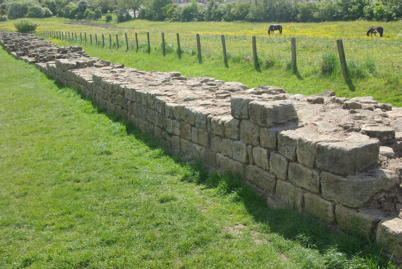
Heddon-on-the-Wall is a village in Northumberland, England, located on Hadrian's Wall. Heddon-on-the-Wall is roughly west of the centre of Newcastle upon Tyne, and just outside Throckley. The place-name 'Heddon' means 'hill where heather grew'. Etymology The place-name ' Heddon on the Wall' is first attested in the Pipe Rolls for 1175, where it appears as ''Hedun''. It appears as ''Heddun'' in 1262 and as ''Hedon super murum'' ('Heddon above the wall') in 1242. The name comes from the Old English ''hæth-dūn'', meaning 'hill where heather grew'. The name should not be confused with that of East Heddon and West Heddon, where the name means 'Hidda's pasture'. History A Roman milecastle (' Milecastle 12') was located at the site of the present-day village, under what is now Town Farm, but no traces of it are currently visible. Prior to the 1960s, Heddon-on-the-Wall was a small village with an economy based strongly on traditional industry including farming and coal mining. La ... [...More Info...] [...Related Items...] OR: [Wikipedia] [Google] [Baidu] |
Hebron, Northumberland
Hebron is a village and civil parish north of Morpeth, in the county of Northumberland, England. In 2011 the parish had a population of 422. The parish touches Longhirst, Meldon, Mitford, Morpeth, Netherwitton, Pegswood, Tritlington and West Chevington and Ulgham. Until April 2009 the parish was in Castle Morpeth district. The surname "Hebron" derives from Hebron. Landmarks There are 9 listed buildings in Hebron. Hebron has a church called St Cuthbert. History The name "Hebron" means 'The high burial-mound'. The parish included the townships of Causey Park, Cockle Park, Earsdon, Earsdon Forest, Fenrother and Tritlington. On 1 April 1955 the parishes of Benridge, Cockle Park and High and Low Highlaws High may refer to: Science and technology * Height * High (atmospheric), a high-pressure area * High (computability), a quality of a Turing degree, in computability theory * High (tectonics), in geology an area where relative tectonic uplift to ... were abolished and merg ... [...More Info...] [...Related Items...] OR: [Wikipedia] [Google] [Baidu] |
Hartburn, Northumberland
Hartburn is a village in Northumberland, in England. It is situated about to the west of Morpeth. The population at the 2011 census was 194. The place-name 'Hartburn' is first attested in Charter Rolls of 1198, where it appears as ''Herteburne''. The name means 'stag stream'. The village is on the Hart Burn river, which a couple of miles downstream joins the River Wansbeck, which flows through Morpeth and Ashington to the sea. Landmarks The Devil's Causeway passes the western edge of the village, just before its crosses the Hart river (burn). The causeway was a Roman road which started at Portgate on Hadrian's Wall, north of Corbridge, and extended northwards across Northumberland to the mouth of the River Tweed at Berwick-upon-Tweed. To the north of the village lies Hartburn Glebe, an area of woodland alongside the river Hart Burn currently in the care of the Woodland Trust. This small woodland has been described as one of the best British woods for views. A cave, k ... [...More Info...] [...Related Items...] OR: [Wikipedia] [Google] [Baidu] |
Ellington And Linton
Ellington may refer to: Places United Kingdom *Ellington, Cambridgeshire *Ellington, Northumberland * Ellington High and Low, a civil parish in North Yorkshire **High Ellington ** Low Ellington United States *Ellington Airport (Texas), Houston, Texas *Ellington, Connecticut *Ellington Township, Adams County, Illinois *Ellington Township, Hancock County, Iowa *Ellington, Missouri *Ellington, New York *Ellington Township, Michigan *Ellington Township, Dodge County, Minnesota *Ellington, Wisconsin People Given name *Ellington Ratliff, American drummer and actor *Ellington Feint, a character from Lemony Snicket's ''All the Wrong Questions'' Surname *Brian Ellington (born 1990), American baseball player *Buford Ellington (1907–1972), Governor of Tennessee from 1959 to 1963 *Christina Ellington (born 1982), Miss New York of 2004 *Douglas Ellington (1886–1960), American architect *Duke Ellington (1899–1974), American composer, pianist and bandleader *Edward Ellington ... [...More Info...] [...Related Items...] OR: [Wikipedia] [Google] [Baidu] |
East Chevington
East Chevington is a parish in Northumberland, England, and was a village until it disappeared in the 1900s. In 2001, the parish had a population of 3,192, increasing to 3,951 at the 2011 Census. History The site of the village was inhabited and the surrounding area used for agriculture at least as far back as the medieval period. Crop marks visible from the air suggest that the site may have been inhabited as far back as Roman times, however. An ordnance survey map from 1866 shows that there was a blacksmith's workshop in the village at that time. During World War II , various defences were established near the village. Chevington drift There is a memorial stone on the site of the old drift entrance. The plaque is inscribed See also *Drift mining *List of civil parishes in Northumberland *Northumberland Wildlife Trust Northumberland Wildlife Trust was established in 1971 (following a split from the ''Northumberland & Durham Trust'', established 1962) to help ... [...More Info...] [...Related Items...] OR: [Wikipedia] [Google] [Baidu] |
Cresswell, Northumberland
Cresswell is a village in Northumberland, England. It is about to the north of Ashington, on the North Sea coast. History The place-name 'Cresswell' is first attested in the Close Roll for 1234, where it appears as ''Kereswell''. It appears as ''Cressewell'' in 1242 in the Book of Fees. The name means 'stream where water cress grew'. Between 1875 and 1944, Cresswell village had a lifeboat. The lifeboat crews were successful in saving 91 lives, and the lifeboat station still stands. During the Second World War, the Royal Air Force operated two radar sites south of the village on the road to Lynemouth. Both sites have since been cleared and have no above ground evidence of previous activity. Cresswell is a popular bird watching area with Cresswell pond and bird hide nearby and the Druridge Bay Country Park less than away. The village has one ice cream shop which closes out of season, and a café on the beach just to the north of the village, open year-round. The village al ... [...More Info...] [...Related Items...] OR: [Wikipedia] [Google] [Baidu] |
Capheaton
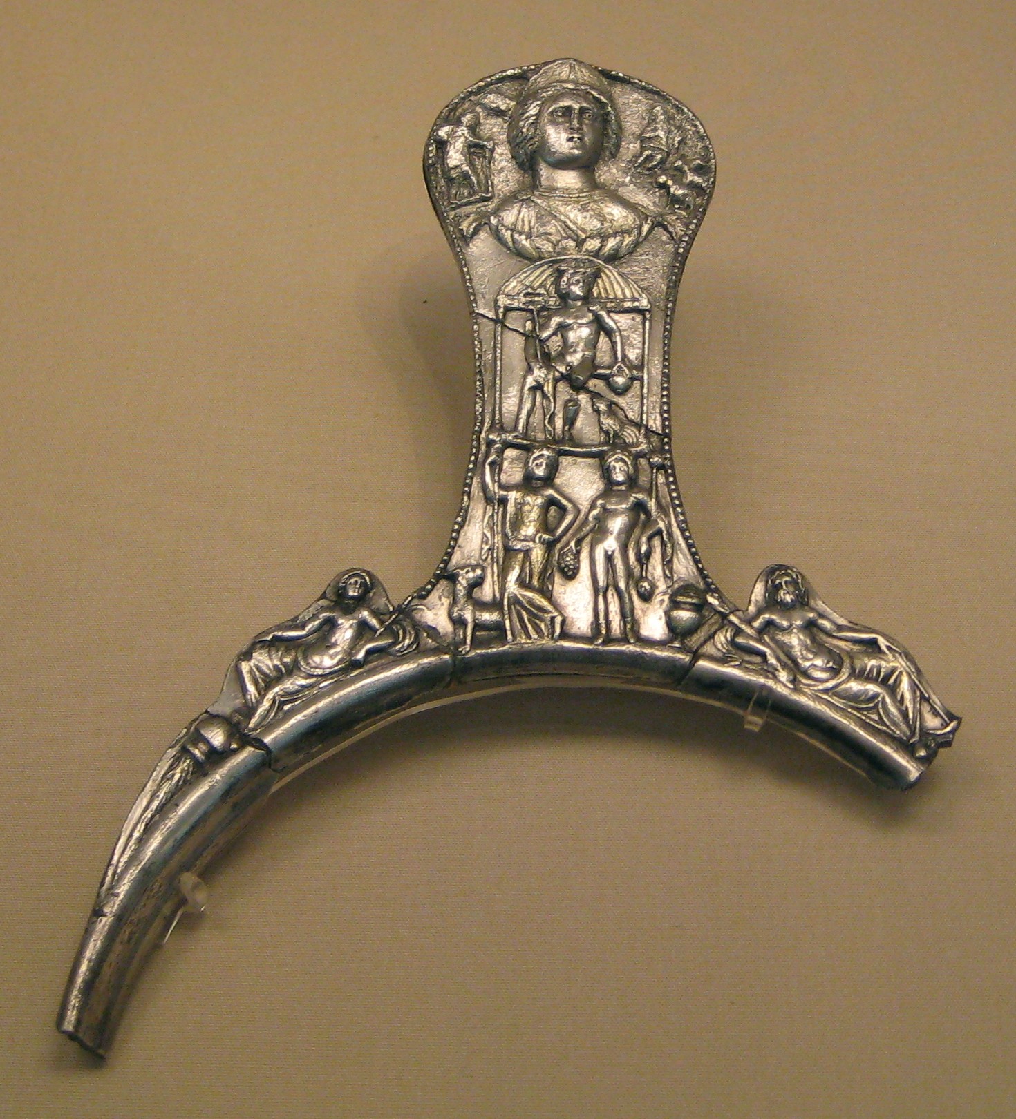
Capheaton is a village and civil parish in Northumberland, England, about to the northwest of Newcastle upon Tyne. The population at the 2001 census was 160, increasing to 175 at the 2011 Census. It was built as a planned model village in the late eighteenth century. The name Capheaton derives from ''Caput Heaton'', i.e., ''Heaton Magna'', nearby Kirkheaton being the original ''Heaton Parva''. The Capheaton archives are at the Northumberland Record Office. Governance Capheaton is in the parliamentary constituency of Berwick-upon-Tweed. Landmarks The Devil's Causeway passes the village just over to the east. The causeway is a Roman road which starts at Port Gate on Hadrian's Wall, north of Corbridge, and extends northwards across Northumberland to the mouth of the River Tweed at Berwick-upon-Tweed. A Roman-British silver treasure was found in the village in the eighteenth century. Known as the Capheaton Treasure, it is now in the British Museum. Capheaton Hall is an ... [...More Info...] [...Related Items...] OR: [Wikipedia] [Google] [Baidu] |
Belsay
Belsay is a village and civil parish in Northumberland, England. The village is about 5 miles from Ponteland on the A696, which links the village with Newcastle upon Tyne and Jedburgh. The population of the civil parish was 436 at the 2001 census, increasing to 518 at the 2011 Census. Scottish nobleman and doctor John de Strivelyn was granted the manor around 1340 by Edward III. On his death, the estate passed to his daughter Christiana, who was married to Sir John Middleton, and it has remained with the Middleton family ever since. Belsay parish includes the former parishes of Bitchfield, Black Heddon, Bolam, Bolam Vicarage, Bradford, Gallowhill, Harnham, Newham, Shortflatt, Trewick, and Wallridge. Belsay is home to Belsay Castle, a fine medieval castle, and to Belsay Hall. Landmarks Belsay Castle is a 14th-century medieval castle situated at Belsay. It is a Scheduled Ancient Monument and a Grade I listed building. The main structure, a three-storey rectangula ... [...More Info...] [...Related Items...] OR: [Wikipedia] [Google] [Baidu] |


