|
Carrick, Cornwall
Carrick ( kw, Karrek) was a local government district in Cornwall, England, United Kingdom. Its council was based in Truro. The main centres of population, industry and commerce were the city of Truro and the towns of Falmouth/ Penryn. The district was created under the Local Government Act 1972, on 1 April 1974 by the merger of the municipal boroughs of Truro, Falmouth and Penryn, and the Truro Rural District. It was named after the Carrick Roads, an inlet near Falmouth that the rivers Percuil, Penryn and Fal drain into. The district was abolished as part of the 2009 structural changes to local government in England Structural changes to local government in England were effected on 1 April 2009, whereby a number of new unitary authorities were created in parts of the country which previously operated a "two-tier" system of counties and districts. In five s ... on 1 April. Parishes Carrick comprised the following 27 parishes See also * Carrick District Counci ... [...More Info...] [...Related Items...] OR: [Wikipedia] [Google] [Baidu] |
Truro
Truro (; kw, Truru) is a City status in the United Kingdom, cathedral city and civil parishes in England, civil parish in Cornwall, England. It is Cornwall's county town, sole city and centre for administration, leisure and retail trading. Its population was 18,766 in the 2011 census. People of Truro can be called Truronians. It grew as a trade centre through its port and as a stannary town for tin mining. It became mainland Britain's southernmost city in 1876, with the founding of the Diocese of Truro. Sights include the Royal Cornwall Museum, Truro Cathedral (completed 1910), the Hall for Cornwall and Cornwall's High Court of Justice, Courts of Justice. Toponymy Truro's name may derive from the Cornish language, Cornish ''tri-veru'' meaning "three rivers", but authorities such as the ''Oxford Dictionary of English Place Names'' have doubts about the "tru" meaning "three". An expert on Cornish place-names, Oliver Padel, in ''A Popular Dictionary of Cornish Place-names'', calle ... [...More Info...] [...Related Items...] OR: [Wikipedia] [Google] [Baidu] |
Percuil River
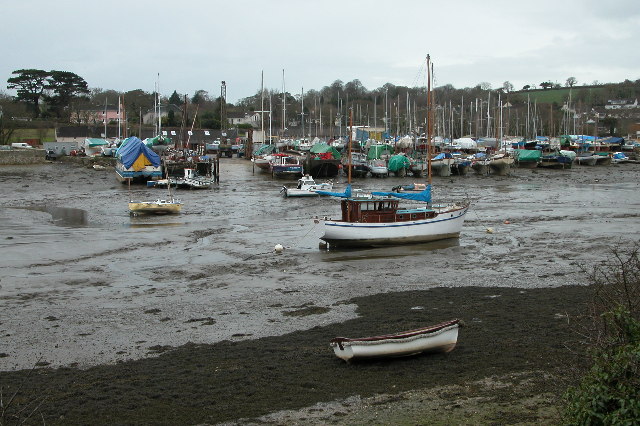
The Percuil River is an estuary and stream draining the southern part of the Roseland Peninsula of Cornwall, UK and is one of three major tidal creeks of the River Fal. The small port and holiday destination of St Mawes is on the western shore and is linked to Place Creek on the eastern shore by the Place Ferry. The ferry is used by walkers on the South West Coast Path. Geography The Percuil River is one of three major tidal creeks of the River Fal which flows into the deep tidal basin of Carrick Roads and out into Falmouth Bay. The creek is actually a ria, or drowned river valley which started to form in the Quaternary period. Sea-level rise during the Ipswichian interglacial flooded the valley, followed by the Devensian glacial, where sea-levels fell to 42 m below today's tides and the River Fal cut a deep sinuous valley into the bedrock. As the climate warmed, sea-levels rose again and the arctic tundra gave way to woodland. The sea continued to rise drowning the trees, ... [...More Info...] [...Related Items...] OR: [Wikipedia] [Google] [Baidu] |
Mylor, Cornwall
Mylor is a civil parishes in England, civil parish in Cornwall, England, United Kingdom. It is situated approximately five miles north of Falmouth, Cornwall, Falmouth.Ordnance Survey: Landranger map sheet 204 ''Truro & Falmouth'' The Churchtown, Cornwall, church town of the ecclesiastical parish is Mylor Churchtown: however, Mylor Bridge is the largest village in the parish.GENUKI website Mylor. Retrieved April 2010 Other settlements include Angarrick, Carclew, Flushing, Cornwall, Flushing and Restronguet Passage.Cornwall Council online mapping ; Retrieved May 2010 Geography Mylor is a maritime parish and is bounded by water on three sides: Restron ...[...More Info...] [...Related Items...] OR: [Wikipedia] [Google] [Baidu] |
Ladock
Ladock ( kw, Egloslajek) is a village and civil parish in Cornwall, England, United Kingdom. It is about six miles (9.5 km) north-east of Truro. Historically, Ladock was two small settlements; Bissick by the river and Ladock on the hill. Notable features include the church, the school, the village hall and the Falmouth Arms pub. At the 2011 census the total population was 4,241. The village had a station, Probus and Ladock halt, on the Cornish Main Line railway but services to the station ended in 1957. Parish church The parish church of St Ladoca has a fine west tower built of granite blocks. The north side of the church is 13th-century in date while the south aisle is 15th-century and the chancel was much altered by George Street in 1862–1864. Interesting features include the carved base of the rood screen and the font of Catacleuse stone. The feast traditionally celebrated in the parish is held on the Sunday after the first Thursday in January. Sustainable village ... [...More Info...] [...Related Items...] OR: [Wikipedia] [Google] [Baidu] |
Kenwyn
Kenwyn ( kw, Keynwynn) is a settlement and civil parish in Cornwall, England. The settlement is a suburb of the city of Truro and lies 0.5 mi (1 km) north of the city centre, within Truro parish, whereas Kenwyn parish covers an area west and north-west of the city. Kenwyn gives its name to one of three rivers that flow through the city. The civil parish includes the villages of Threemilestone and Shortlanesend, and several hamlets including Allet, Greenbottom and Idless. The population of the parish at the 2011 census was 5,800. History and toponymy It is likely that the church of Kenwyn was the mother church of Truro. The original dedication is possibly St Keyne; Keynwen is the earliest form of the name, which would be 'Keyn' and -wen' (white/blessed). By the 15th century, it was assumed to be St. Kenwyn, though no medieval records record it with the prefix 'Saint'. Subsequently, the dedication was attributed to St. Cuby. The manor of Kenwyn was held in the 12th ... [...More Info...] [...Related Items...] OR: [Wikipedia] [Google] [Baidu] |
Kea, Cornwall
Kea ( ; kw, Sen Ke) is a civil parish and village in Cornwall, England, United Kingdom. It is a '' "large straggling parish" '' GENUKI website; Kea; retrieved April 2010 in a former Mining in Cornwall, mining area south of . Kea village is situated just over one mile (1.6 km) southwest of Truro.Ordnance Survey: Landranger map sheet 204 ''Truro & Falmouth'' is situated two miles (3 km) to the east on the west bank of the [...More Info...] [...Related Items...] OR: [Wikipedia] [Google] [Baidu] |
Gwennap
Gwennap ( kw, Lannwenep (village), Pluw Wenep (parish)) is a village and civil parishes in England, civil parish in Cornwall, England. It is about five miles (8 km) southeast of Redruth. Hamlets of Burncoose, Comford, Coombe, Gwennap, Coombe, Crofthandy, Cusgarne, Fernsplatt, Frogpool, Hick's Mill, Tresamble and United Downs lie in the parish, as does Little Beside country house. In the 18th and early 19th centuries Gwennap parish was the Mining in Cornwall#Gwennap.2C Cornwall.27s .22Copper Kingdom.22, richest copper mining district in Cornwall, and was called the "richest square mile in the Old World". It is near the course of the Great County Adit which was constructed to drain mines in the area including several of the local once-famous mines such as Consolidated Mines, Poldice mine and Wheal Busy. Today it forms part of area A6i (the Gwennap Mining District) of the Cornwall and West Devon Mining Landscape World Heritage Site. It lends its name to Gwennap Pit, where Joh ... [...More Info...] [...Related Items...] OR: [Wikipedia] [Google] [Baidu] |
Gerrans
Gerrans ( kw, Gerens) is a coastal civil parish and village on the Roseland Peninsula in Cornwall, England, United Kingdom. The village adjoins Portscatho (the villages have almost merged into one but retain their identities) on the east side of the peninsula. The village is situated approximately seven miles (11 km) south-southeast of Truro. The name Gerrans derives from ''Gerent'', a 6th-century Cornish saint. The parish runs north–south along the eastern side of the Roseland peninsula. It is bounded to the south and east by the sea, to the west by St Just in Roseland parish, and to the north by Philleigh parish. The population was 933 in the 2001 census, GENUKI website: Gerrans. retrieved May 2010 reducing to 794 at the 2011 census. |
Feock, Cornwall
Feock ( ; kw, Lannfyek) is a coastal civil parish and village in Cornwall, England, United Kingdom. It is about south of Truro at the head of Carrick Roads on the River Fal. To the south, the parish is bordered by Restronguet Creek and to the east by Carrick Roads and the River Fal. To the north it is bordered by Kea parish and to the west by Perranarworthal parish. Feock parish includes the villages of Carnon Downs, Chycoose, Devoran, Goon Piper, Harcourt, Killiganoon, Penelewey, Penpol, Porthgwidden, Restronguet Point, Trevilla, and Trelissick. The electoral ward is called Feock and Kea. At the 2011 census it had a population of 4,511 whereas the civil parish including Bissom has a population of 3,708 only. The garden of the Trelissick Estate is a National Trust property. The King Harry Ferry takes cars across the Fal to Philleigh and the Roseland Peninsula. Feock lies within the Cornwall Area of Outstanding Natural Beauty (AONB). Almost a third of Cornwall has AONB d ... [...More Info...] [...Related Items...] OR: [Wikipedia] [Google] [Baidu] |
Cuby, Cornwall
Cuby ( kw, Sen Kubi) is a village and former civil parish, now in the parish of Tregony with Cuby in Cornwall, England, United Kingdom, situated approximately 7 miles (12 km) southwest of St Austell. In 2011 it had a population of 178. Cornelly parish was united with Cuby in 1934. In November 2020, the parish council voted to merge with neighbouring Tregony. Both villages are now part of the parish of 'Tregony with Cuby' that came into effect on 1 April 2021. Cuby Parish Church The church of Cuby is dedicated to Saint Cuby, a Cornish saint: since the parish church of Tregony was lost to the River Fal c. 1540 Cuby Parish Church has been in fact the parish church of Tregony also. The church was rebuilt in 1828 though some of the medieval masonry still exists on the north side and the tower (of two stages) is of the 14th century. In the south aisle is an inscribed stone of the 6th or 7th century (''Nonnita Ercilini Rigati ..ris Fili Ercilini''). The church in Norman time ... [...More Info...] [...Related Items...] OR: [Wikipedia] [Google] [Baidu] |
Chacewater
Chacewater ( kw, Dowr an Chas) is a village and civil parish in Cornwall, England, UK. It is situated approximately east of Redruth. The hamlets of Carnhot, Cox Hill, Creegbrawse, Hale Mills, Jolly's Bottom, Salem, Saveock, Scorrier, Todpool, Twelveheads and Wheal Busy are in the parish. The electoral ward is called Chacewater & Kenwyn. At the 2011 census a population of 3,870 was quoted. Village Chacewater sits in a valley between hills separating it from the villages of Threemilestone, Scorrier and St Day. Nearby is Wheal Busy, the Poldice Valley and the Coast to Coast cycle route. The village has a pub and a club, the Chacewater Literary Institute. There are also a health centre, primary school, village hall and small selection of shops. A free monthly magazine ''What's on in Chacewater'' reached its 200th issue in July 2007. It lists events and activities, such as the Football Club, a Cricket Club, a Bowling Club, the Chacewater Old Cornwall Society, the Chacewater Playe ... [...More Info...] [...Related Items...] OR: [Wikipedia] [Google] [Baidu] |


