|
Capu Tafunatu
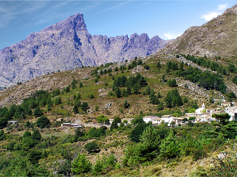
The Capu Tafunatu is a mountain in the department of Haute-Corse on the island of Corsica, France. It rises to an altitude of in the Niolo ''piève'' in the northwest of the island. Located in the Monte Cintu massif near the Paglia Orba, it rises southeast of Manso on the edge of the commune of Albertacce. Capu Tafunatu literally means "perforated head". The top of the mountain is pierced by an opening wide by , making it the largest natural arch in France. Geology Capu Tafunatu consists of alkaline rhyolite with ignimbrite facies, an igneous rock of the Monte Cinto annular volcano-plutonic complex, formed in the Permian. The formation of the "hole" is explained by tectonics. The inclined plane at the base of this cavity is an oblique fault which, intersecting the rocky blade of the summit, weakened it and caused it to collapse. In popular culture Georges-Louis Leclerc, Comte de Buffon (1707–1788), in ''Histoire et théorie de la terre'' (History and Theory of the Earth), ... [...More Info...] [...Related Items...] OR: [Wikipedia] [Google] [Baidu] |
Haute-Corse
Haute-Corse (; co, Corsica suprana , or ; en, Upper Corsica) is (as of 2022) an administrative department of France, consisting of the northern part of the island of Corsica. The corresponding departmental territorial collectivity merged with that of Corse-du-Sud on 1 January 2018, forming the single territorial collectivity of Corsica, with territorial elections coinciding with the dissolution of the separate councils. However, even though its administrative powers were ceded to the new territorial collectivity, it continues to remain an administrative department in its own right. In 2019, it had a population of 181,933.Populations légales 2019: 2B Haute-Corse INSEE History [...More Info...] [...Related Items...] OR: [Wikipedia] [Google] [Baidu] |
Monte Cinto Massif
The Monte Cinto massif is one of the main massifs in the island of Corsica, France, taking its name from the highest mountain in Corsica, Monte Cinto. It is the northernmost and highest of the four massifs that form the spine of the island. The massif is mostly in the Haute-Corse department, but the southwest of the massif is in the Corse-du-Sud department. Setting The island of Corsica essentially consists of a long chain of mountains divided into four massifs. From north to south these are the massifs of Monte Cinto, Monte Rotondo, Monte Renoso and Monte Incudine. The Monte Cinto massif is the highest at of elevation, followed by the massifs of Monte Rotondo, Monte Renoso and Monte Incudine. The main peaks are Monte Cinto, Punta Minuta, Paglia Orba, Monte Padro, Monte Traunato, Monte Corona, Capu a u Ceppu and Monte Grosso. The massif is bounded by the Forêt de Bonifatu and Forêt de Tartagine Melaja to the north, the Forêt de Pineto to the east and the Forêt de Valdu Ni ... [...More Info...] [...Related Items...] OR: [Wikipedia] [Google] [Baidu] |
Rhyolite
Rhyolite ( ) is the most silica-rich of volcanic rocks. It is generally glassy or fine-grained (aphanitic) in texture, but may be porphyritic, containing larger mineral crystals (phenocrysts) in an otherwise fine-grained groundmass. The mineral assemblage is predominantly quartz, sanidine, and plagioclase. It is the extrusive equivalent to granite. Rhyolitic magma is extremely viscous, due to its high silica content. This favors explosive eruptions over effusive eruptions, so this type of magma is more often erupted as pyroclastic rock than as lava flows. Rhyolitic ash-flow tuffs are among the most voluminous of continental igneous rock formations. Rhyolitic tuff has been extensively used for construction. Obsidian, which is rhyolitic volcanic glass, has been used for tools from prehistoric times to the present day because it can be shaped to an extremely sharp edge. Rhyolitic pumice finds use as an abrasive, in concrete, and as a soil amendment. Description Rhyolite i ... [...More Info...] [...Related Items...] OR: [Wikipedia] [Google] [Baidu] |
Corsica
Corsica ( , Upper , Southern ; it, Corsica; ; french: Corse ; lij, Còrsega; sc, Còssiga) is an island in the Mediterranean Sea and one of the 18 regions of France. It is the fourth-largest island in the Mediterranean and lies southeast of the French mainland, west of the Italian Peninsula and immediately north of the Italian island of Sardinia, which is the land mass nearest to it. A single chain of mountains makes up two-thirds of the island. , it had a population of 349,465. The island is a territorial collectivity of France. The regional capital is Ajaccio. Although the region is divided into two administrative departments, Haute-Corse and Corse-du-Sud, their respective regional and departmental territorial collectivities were merged on 1 January 2018 to form the single territorial collectivity of Corsica. As such, Corsica enjoys a greater degree of autonomy than other French regional collectivities; for example, the Corsican Assembly is permitted to exercise limit ... [...More Info...] [...Related Items...] OR: [Wikipedia] [Google] [Baidu] |
Monte Cintu Massif
The Monte Cinto massif is one of the main massifs in the island of Corsica, France, taking its name from the highest mountain in Corsica, Monte Cinto. It is the northernmost and highest of the four massifs that form the spine of the island. The massif is mostly in the Haute-Corse department, but the southwest of the massif is in the Corse-du-Sud department. Setting The island of Corsica essentially consists of a long chain of mountains divided into four massifs. From north to south these are the massifs of Monte Cinto, Monte Rotondo, Monte Renoso and Monte Incudine. The Monte Cinto massif is the highest at of elevation, followed by the massifs of Monte Rotondo, Monte Renoso and Monte Incudine. The main peaks are Monte Cinto, Punta Minuta, Paglia Orba, Monte Padro, Monte Traunato, Monte Corona, Capu a u Ceppu and Monte Grosso. The massif is bounded by the Forêt de Bonifatu and Forêt de Tartagine Melaja to the north, the Forêt de Pineto to the east and the Forêt de Valdu Nie ... [...More Info...] [...Related Items...] OR: [Wikipedia] [Google] [Baidu] |
Paglia Orba
The Paglia Orba (pronounced ) is a mountain peak in the Monte Cinto massif in Corsica. It rises to an altitude of , between the valleys of the Golo (in the Niolo) and the Cavicchia (in the Filosorma). Relatively isolated, this peak, notable for its characteristic tooth-shaped silhouette, dominates the Fango Valley and the west coast of the island. Straddling the municipalities of Albertacce and Manso, Paglia Orba is the second highest peak of the central chain and the Filosorma, behind Punta Minuta at . Geography With an altitude of , the Paglia Orba is located in the municipalities of Albertacce and Manso. It is nearly lower than Monte Cinto. The Golo, the longest river in Corsica, rises at its feet. On its slopes at an altitude of the Ruisseau Orba rises in the communal forest of Albertacce, which is a monoculture of laricio pines. Geology Unlike the other summits of the Cinto massif, which are formed mainly of volcanic rocks, the Paglia Orba is made up of ... [...More Info...] [...Related Items...] OR: [Wikipedia] [Google] [Baidu] |
Manso, Haute-Corse
Manso () is a commune in the Haute-Corse department of France on the island of Corsica. Population See also *Communes of the Haute-Corse department The following is a list of the 236 Communes of France, communes of the Haute-Corse Departments of France, department of France. The communes cooperate in the following Communes of France#Intercommunality, intercommunalities (as of 2020): References Communes of Haute-Corse Haute-Corse communes articles needing translation from French Wikipedia {{HauteCorse-geo-stub ...[...More Info...] [...Related Items...] OR: [Wikipedia] [Google] [Baidu] |
Albertacce
Albertacce (; in Corsican ''E Lupertacce'', pronounced ) is a commune in the Haute-Corse department in the Corsica region of France. Geography upright=2.4, center, Panorama of Albertacce Albertacce is a commune of ''Niolu'' a long-inaccessible micro-region where invaders were never able to conquer the mountain people, a long bowl cut from the world where there are blond Corsicans with blue eyes and fair skin and has become today the kingdom of hiking. It is located in the heart of the Regional Natural Park of Corsica. Location Albertacce is located high in the Corsican mountains some 30 km in a direct line east by north-east of Porto on the west coast and 15 km west by north-west of Corte. The road distance is very substantially longer. Access to the commune is by a single road - the D84 - which branches west from the D18 road just north of Castirla. It then follows the mountain ridge south-west to the village of Albertacce. The D84 continues south west through t ... [...More Info...] [...Related Items...] OR: [Wikipedia] [Google] [Baidu] |
Ignimbrite
Ignimbrite is a type of volcanic rock, consisting of hardened tuff. Ignimbrites form from the deposits of pyroclastic flows, which are a hot suspension of particles and gases flowing rapidly from a volcano, driven by being denser than the surrounding atmosphere. New Zealand geologist Patrick Marshall (1869-1950) coined the term ''ignimbrite'' from the Latin ''igni-'' [fire] and ''imbri-'' [rain]. Ignimbrites are made of a very poorly sorted mixture of volcanic ash (or tuff when Lithification, lithified) and pumice lapilli, commonly with scattered lithic fragments. The ash is composed of glass shards and crystal fragments. Ignimbrites may be loose and unconsolidated, or lithified (solidified) rock called lapilli-tuff. Near the volcanic source, ignimbrites often contain thick accumulations of lithic blocks, and distally, many show meter-thick accumulations of rounded cobbles of pumice. Ignimbrites may be white, grey, pink, beige, brown, or black depending on their composition and d ... [...More Info...] [...Related Items...] OR: [Wikipedia] [Google] [Baidu] |
Permian
The Permian ( ) is a geologic period and stratigraphic system which spans 47 million years from the end of the Carboniferous Period million years ago (Mya), to the beginning of the Triassic Period 251.9 Mya. It is the last period of the Paleozoic Era; the following Triassic Period belongs to the Mesozoic Era. The concept of the Permian was introduced in 1841 by geologist Sir Roderick Murchison, who named it after the region of Perm in Russia. The Permian witnessed the diversification of the two groups of amniotes, the synapsids and the sauropsids ( reptiles). The world at the time was dominated by the supercontinent Pangaea, which had formed due to the collision of Euramerica and Gondwana during the Carboniferous. Pangaea was surrounded by the superocean Panthalassa. The Carboniferous rainforest collapse left behind vast regions of desert within the continental interior. Amniotes, which could better cope with these drier conditions, rose to dominance in place of their am ... [...More Info...] [...Related Items...] OR: [Wikipedia] [Google] [Baidu] |
Georges-Louis Leclerc, Comte De Buffon
Georges-Louis Leclerc, Comte de Buffon (; 7 September 1707 – 16 April 1788) was a French naturalist, mathematician, cosmologist, and encyclopédiste. His works influenced the next two generations of naturalists, including two prominent French scientists Jean-Baptiste Lamarck and Georges Cuvier. Buffon published thirty-six quarto volumes of his ''Histoire Naturelle'' during his lifetime, with additional volumes based on his notes and further research being published in the two decades following his death. Ernst Mayr wrote that "Truly, Buffon was the father of all thought in natural history in the second half of the 18th century".Mayr, Ernst 1981. ''The Growth of Biological Thought''. Cambridge: Harvard. p 330 Credited with being one of the first naturalists to recognize ecological succession, he was later forced by the theology committee at the University of Paris to recant his theories about geological history and animal evolution because they contradicted the Biblical na ... [...More Info...] [...Related Items...] OR: [Wikipedia] [Google] [Baidu] |
Atlantis
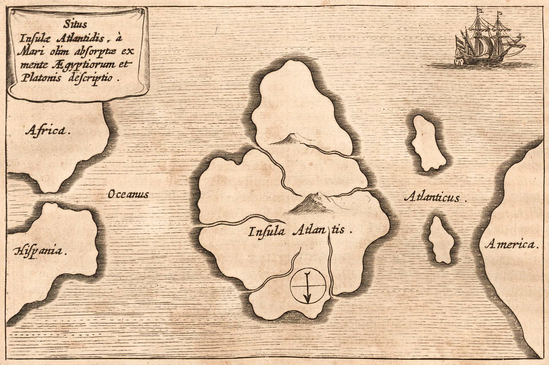
Atlantis ( grc, Ἀτλαντὶς νῆσος, , island of Atlas (mythology), Atlas) is a fictional island mentioned in an allegory on the hubris of nations in Plato's works ''Timaeus (dialogue), Timaeus'' and ''Critias (dialogue), Critias'', wherein it represents the antagonist naval power that besieges "Ancient Athens", the Counterfactual history, pseudo-historic embodiment of Plato's ideal state in ''The Republic (Plato), The Republic''. In the story, Athens repels the Atlantean attack unlike any other nation of the Ecumene, known world, supposedly bearing witness to the superiority of Plato's concept of a state. The story concludes with Atlantis falling out of favor with the deities and submerging into the Atlantic Ocean. Despite its minor importance in Plato's work, the Atlantis story has had a considerable impact on literature. The allegorical aspect of Atlantis was taken up in utopian works of several Renaissance writers, such as Francis Bacon's ''New Atlantis'' and Th ... [...More Info...] [...Related Items...] OR: [Wikipedia] [Google] [Baidu] |


