|
Cape Torokina
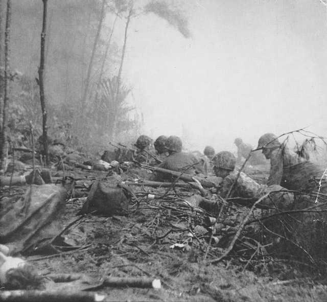
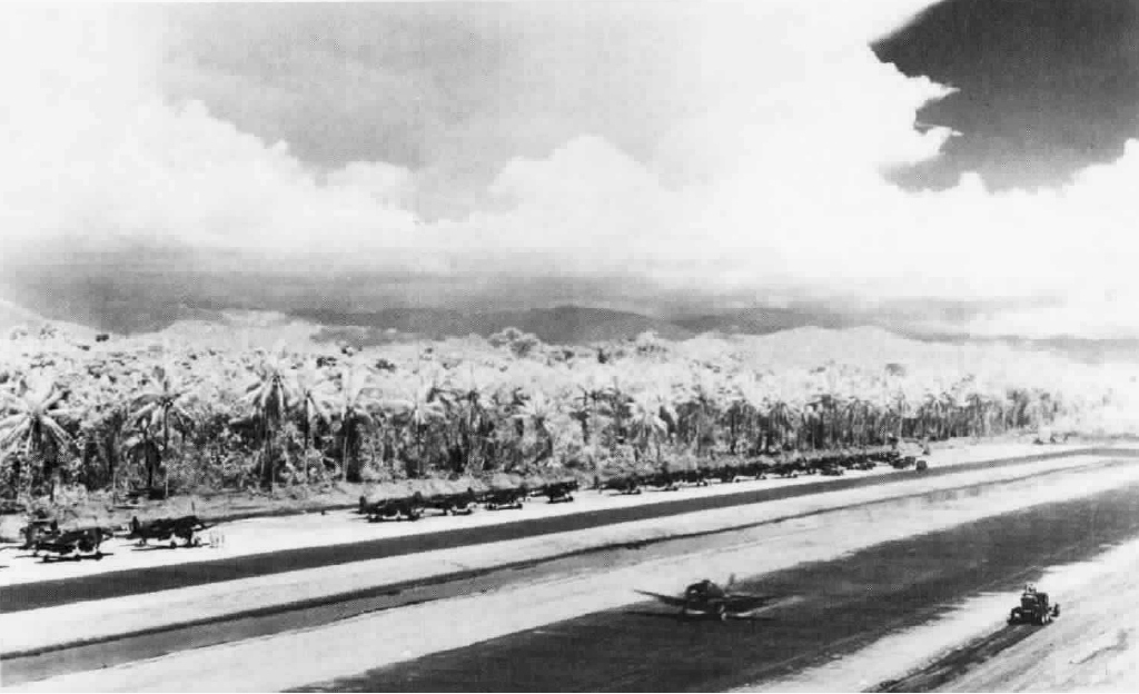
Cape Torokina is a promontory at the north end of Empress Augusta Bay, along the central part of the western coast of Bougainville, in Papua New Guinea. This cape formed the southern end of the landing zone where I Marine Amphibious Corps performed an amphibious invasion on November 1, 1943 during Operation Cherry Blossom. The small Puruata Island is just off the coast to the west of Cape Torokina. The cape and island form a beach to the north which is subject to heavy surf. The cape was relatively isolated, with a poor trail system to supply the area. A wide swamp stretched inland from the beach area, and the island was heavily forested. During the landing, the cape was the site of a Japanese 75 mm gun that inflicted heavy damage upon the landing craft. Following the landing, an airfield An aerodrome (Commonwealth English) or airdrome (American English) is a location from which aircraft flight operations take place, regardless of whether they involve air cargo, passen ... [...More Info...] [...Related Items...] OR: [Wikipedia] [Google] [Baidu] |
Promontory
A promontory is a raised mass of land that projects into a lowland or a body of water (in which case it is a peninsula). Most promontories either are formed from a hard ridge of rock that has resisted the erosive forces that have removed the softer rock to the sides of it, or are the high ground that remains between two river valleys where they form a confluence. A headland, or head, is a type of promontory. Promontories in history Located at the edge of a landmass, promontories offer a natural defense against enemies, as they are often surrounded by water and difficult to access. Many ancient and modern forts and castles have been built on promontories for this reason. One of the most famous examples of promontory forts is the Citadel of Namur in Belgium. Located at the confluence of the Meuse and Sambre rivers, the citadel has been a prime fortified location since the 10th century. The surrounding rivers act as a natural moat, making it difficult for enemies to access the fo ... [...More Info...] [...Related Items...] OR: [Wikipedia] [Google] [Baidu] |
Empress Augusta Bay
Empress Augusta Bay is a bay on the western side of the island of Bougainville Island, within the Autonomous Region of Bougainville in northeastern Papua New Guinea. It is a subsistence fishing area for the people of Bougainville. History Empress Augusta Bay is named after Augusta Viktoria of Schleswig-Holstein, wife of German Emperor William II. In November 1943 the bay was the site of the Battle of Empress Augusta Bay, between Allied and Japanese forces. During the 1970s and 1980s the bay was seriously polluted by copper tailings from the world's largest copper mine, Panguna, operated by Rio Tinto Group. This issue contributed to the formation of the secessionist Bougainville Revolutionary Army and a civil war A civil war or intrastate war is a war between organized groups within the same state (or country). The aim of one side may be to take control of the country or a region, to achieve independence for a region, or to change government polic ... on the ... [...More Info...] [...Related Items...] OR: [Wikipedia] [Google] [Baidu] |
Bougainville Island
Bougainville Island ( Tok Pisin: ''Bogenvil'') is the main island of the Autonomous Region of Bougainville, which is part of Papua New Guinea. It was previously the main landmass in the German Empire-associated North Solomons. Its land area is . The population of the whole province, including nearby islets such as the Carterets, is approximately 300,000 (2019 census). The highest point is Mount Balbi, on the main island, at . The much smaller Buka Island, , lies to the north, across the wide Buka Strait. Even though the strait is narrow, there is no bridge across it, but there is a regular ferry service between the key settlements on either side. The main airport (or airstrip) in the north is in the town of Buka. Bougainville is the largest island in the Solomon Islands archipelago. Most of the islands in this archipelago (which are primarily concentrated in the southern and eastern portions of it) are part of the politically independent Solomon Islands. Two of these is ... [...More Info...] [...Related Items...] OR: [Wikipedia] [Google] [Baidu] |
Papua New Guinea
Papua New Guinea (abbreviated PNG; , ; tpi, Papua Niugini; ho, Papua Niu Gini), officially the Independent State of Papua New Guinea ( tpi, Independen Stet bilong Papua Niugini; ho, Independen Stet bilong Papua Niu Gini), is a country in Oceania that comprises the eastern half of the island of New Guinea and its offshore islands in Melanesia (a region of the southwestern Pacific Ocean north of Australia). Its capital, located along its southeastern coast, is Port Moresby. The country is the world's third largest island country, with an area of . At the national level, after being ruled by three external powers since 1884, including nearly 60 years of Australian administration starting during World War I, Papua New Guinea established its sovereignty in 1975. It became an independent Commonwealth realm in 1975 with Elizabeth II as its queen. It also became a member of the Commonwealth of Nations in its own right. There are 839 known languages of Papua New Guinea, on ... [...More Info...] [...Related Items...] OR: [Wikipedia] [Google] [Baidu] |
Operation Cherry Blossom
The Landings at Cape Torokina (1–3 November 1943), also known as Operation Cherryblossom, took place at the beginning of the Bougainville campaign in World War II. The amphibious landings were carried out by elements of the United States Marine Corps in November 1943 on Bougainville Island in the South Pacific, as part of Allied efforts to advance towards the main Japanese base around Rabaul under Operation Cartwheel. Coming in the wake of Allied successes at Guadalcanal and in the central Solomons, the landings were intended to secure a beachhead with the purpose of establishing several bases from which to project air and naval power closer towards Rabaul, in an effort to neutralize the large Japanese force that had been established there. In the months leading up to the operation, Japanese airpower on Bougainville was degraded by Allied air strikes, while small parties of Allied reconnaissance forces landed around Bougainville and the surrounding islands to gather intelli ... [...More Info...] [...Related Items...] OR: [Wikipedia] [Google] [Baidu] |
Japan
Japan ( ja, 日本, or , and formally , ''Nihonkoku'') is an island country in East Asia. It is situated in the northwest Pacific Ocean, and is bordered on the west by the Sea of Japan, while extending from the Sea of Okhotsk in the north toward the East China Sea, Philippine Sea, and Taiwan in the south. Japan is a part of the Ring of Fire, and spans an archipelago of 6852 islands covering ; the five main islands are Hokkaido, Honshu (the "mainland"), Shikoku, Kyushu, and Okinawa. Tokyo is the nation's capital and largest city, followed by Yokohama, Osaka, Nagoya, Sapporo, Fukuoka, Kobe, and Kyoto. Japan is the eleventh most populous country in the world, as well as one of the most densely populated and urbanized. About three-fourths of the country's terrain is mountainous, concentrating its population of 123.2 million on narrow coastal plains. Japan is divided into 47 administrative prefectures and eight traditional regions. The Greater Tokyo Ar ... [...More Info...] [...Related Items...] OR: [Wikipedia] [Google] [Baidu] |
Torokina Airfield
Torokina Airfield, also known as Cape Torokina Airfield, is a former World War II airfield located at Cape Torokina, Bougainville. History World War II The 3rd Marine Division landed on Bougainville on 1 November 1943 at the start of the Bougainville Campaign, establishing a beachhead around Cape Torokina. Small detachments of the 25th, 53rd, 71st and 75th Naval Construction Battalions landed with the Marines and the 71st Battalion was tasked with establishing a by fighter airfield that would become Torokina Airfield. The airfield became operational on December 10, 1943 when VMF-216 landed with 18 F4U Corsairs. On 9 March 1944, the Japanese shelled the airfield and forced the squadrons that were based there to take off to avoid damage to their aircraft. Royal New Zealand Air Force squadrons also began operating from the airfield from January 1, 1944. Units assigned to the airfield included: *United States Navy : VC-40 operating Grumman TBF Avengers :ACORN 13 : VF(N)-75 ... [...More Info...] [...Related Items...] OR: [Wikipedia] [Google] [Baidu] |
Battle Of Bougainville
The Bougainville campaign was a series of land and naval battles of the Pacific campaign of World War II between Allied forces and the Empire of Japan, named after the island of Bougainville. It was part of Operation Cartwheel, the Allied grand strategy in the South Pacific. The campaign took place in the Northern Solomons in two phases. The first phase, in which American troops landed and held the perimeter around the beachhead at Torokina, lasted from November 1943 through November 1944. The second phase, in which primarily Australian troops went on the offensive, mopping up pockets of starving, isolated but still-determined Japanese, lasted from November 1944 until August 1945, when the last Japanese soldiers on the island surrendered. Operations during the final phase of the campaign saw the Australian forces advance north towards the Bonis Peninsula and south towards the main Japanese stronghold around Buin, although the war ended before these two enclaves were co ... [...More Info...] [...Related Items...] OR: [Wikipedia] [Google] [Baidu] |
Battle Of Empress Augusta Bay
The Battle of Empress Augusta Bay, on 1–2 November 1943 – also known as the Battle of Gazelle Bay, Operation Cherry Blossom, and in Japanese sources as the Sea Battle off Bougainville Island (ブーゲンビル島沖海戦) – was a naval battle fought near the island of Bougainville in Empress Augusta Bay. The naval battle was a result of Allied landings on nearby Bougainville in the first action in the Bougainville campaign of World War II and may also be considered as part of the Solomons and New Guinea campaigns. The battle was significant as part of a broader Allied strategy—known as Operation Cartwheel—aimed at isolating and surrounding the major Japanese base at Rabaul. The intention was to establish a beachhead on Bougainville, within which an airfield would be built. The naval battle took place at the end of the first day of the landings around Cape Torokina, as the Japanese sortied a large force from Rabaul in an effort to replicate the success they h ... [...More Info...] [...Related Items...] OR: [Wikipedia] [Google] [Baidu] |
Headlands Of Papua New Guinea
A headland, also known as a head, is a coastal landform, a point of land usually high and often with a sheer drop, that extends into a body of water. It is a type of promontory. A headland of considerable size often is called a cape.Whittow, John (1984). ''Dictionary of Physical Geography''. London: Penguin, 1984, pp. 80, 246. . Headlands are characterised by high, breaking waves, rocky shores, intense erosion, and steep sea cliff. Headlands and bays are often found on the same coastline. A bay is flanked by land on three sides, whereas a headland is flanked by water on three sides. Headlands and bays form on discordant coastlines, where bands of rock of alternating resistance run perpendicular to the coast. Bays form when weak (less resistant) rocks (such as sands and clays) are eroded, leaving bands of stronger (more resistant) rocks (such as chalk, limestone, and granite) forming a headland, or peninsula. Through the deposition of sediment within the bay and the erosion of th ... [...More Info...] [...Related Items...] OR: [Wikipedia] [Google] [Baidu] |


