|
Cape Møsting
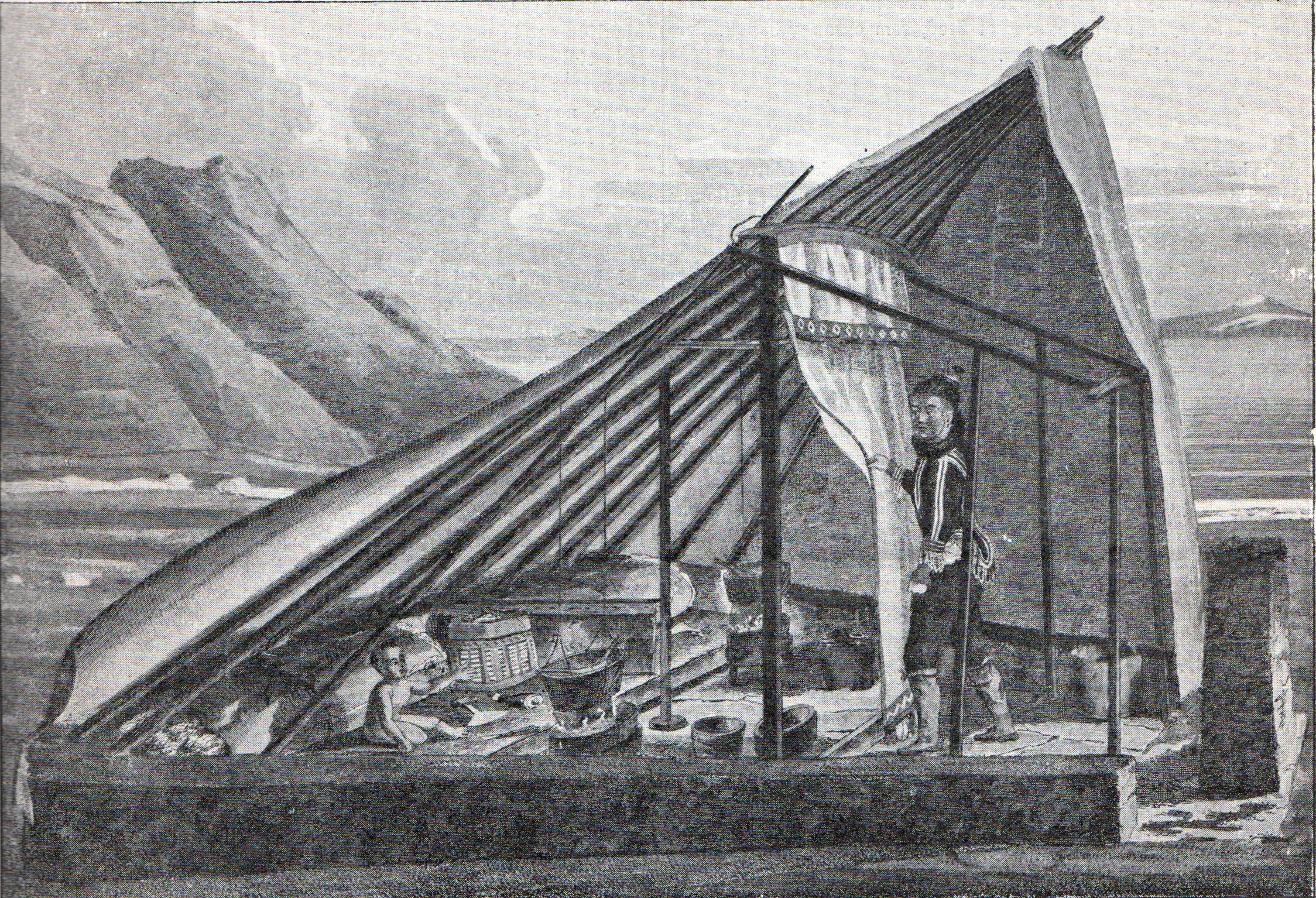
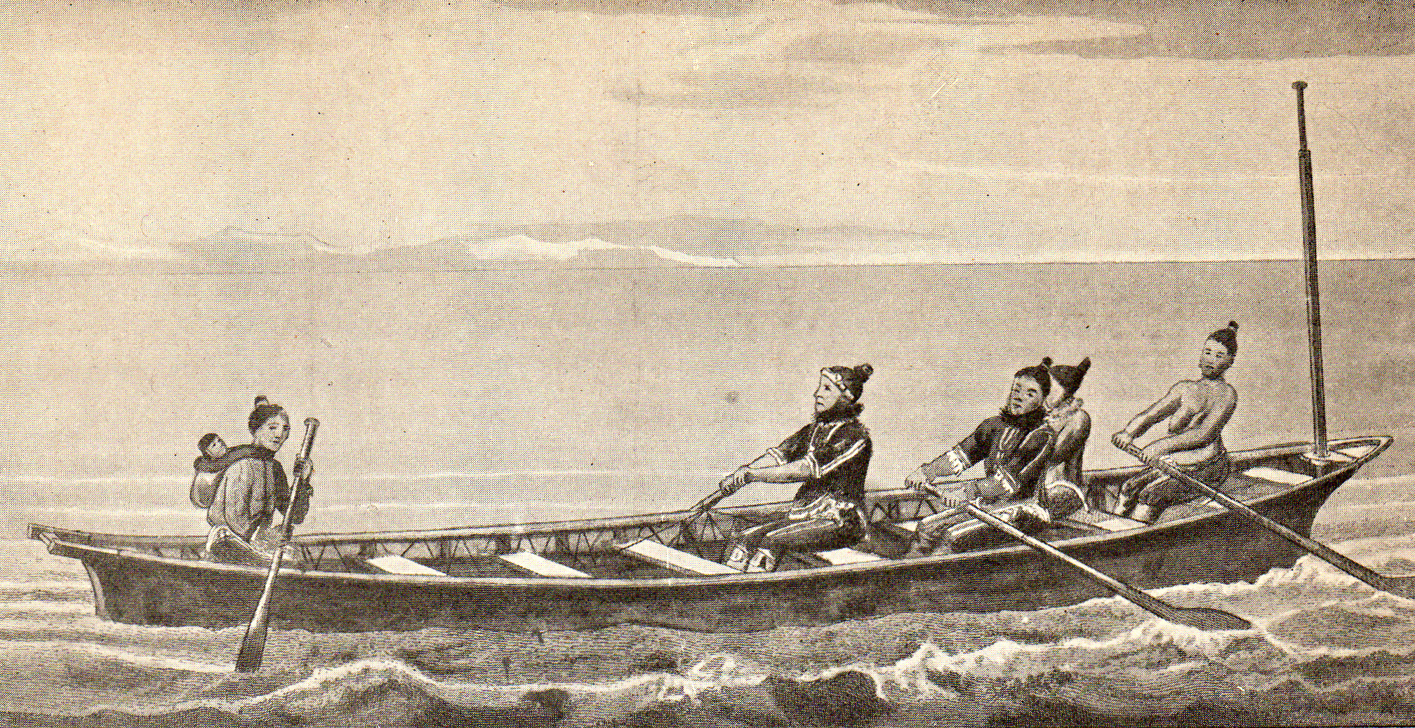
Cape Møsting ( da, Kap Møsting) is a headland in the North Atlantic Ocean, southeast Greenland, Kujalleq municipality. History Cape Møsting was named by Lieutenant Wilhelm August Graah in 1829 during his East Coast expedition. Graah took a latitude observation at the headland and named it after Johan Sigismund von Møsting. One of the umiak women rowers of Graah's party gave birth to twins at the cape. The Inuit babies died shortly after delivery and were buried in a cleft of the rocks of the two small islands off the SW side of Cape Møsting. Graah named these islands ''"Tvillingøen"'', Twin Islands, after the dead twins. Geography Cape Møsting is located at the southeastern end of Odinland. It is a steep and prominent headland on the northern side of the mouth of Bernstorff Fjord. Usually great masses of icebergs lie near the fjord entrance to the south of the cape making navigation along the shore difficult. Dangerous eddies and whirlpools form within the bank of iceber ... [...More Info...] [...Related Items...] OR: [Wikipedia] [Google] [Baidu] |
Cape (geography)
In geography, a cape is a headland or a promontory of large size extending into a body of water, usually the sea.Whittow, John (1984). ''Dictionary of Physical Geography''. London: Penguin, 1984, p. 80. . A cape usually represents a marked change in trend of the Coast, coastline, often making them important landmarks in sea navigation. This also makes them prone to natural forms of erosion, mainly tidal actions, which results in them having a relatively short geological lifespan. Capes can be formed by glaciers, volcanoes, and changes in sea level. Erosion plays a large role in each of these methods of formation. List of some well-known capes Gallery File:Cape Cornwall.jpg, Cape Cornwall, England File:Nasa photo cape fear.jpg, Satellite image of Cape Fear, North Carolina File:Cape McLear, Malawi (2499273862).jpg, Cape MacLear, Malawi File:Cape horn.png, Map depicting Cape Horn at the southernmost portion of South America File:Spain.Santander.Cabo.Mayor.jpeg, Photograph o ... [...More Info...] [...Related Items...] OR: [Wikipedia] [Google] [Baidu] |
Umiak
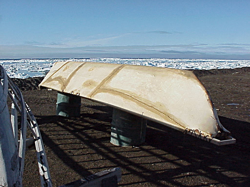
The umiak, umialak, umiaq, umiac, oomiac, oomiak, ongiuk, or anyak is a type of open skin boat, used by both Yupik and Inuit, and was originally found in all coastal areas from Siberia Siberia ( ; rus, Сибирь, r=Sibir', p=sʲɪˈbʲirʲ, a=Ru-Сибирь.ogg) is an extensive geographical region, constituting all of North Asia, from the Ural Mountains in the west to the Pacific Ocean in the east. It has been a part of ... to Greenland. First arising in Thule people, Thule times, it has traditionally been used in summer to move people and possessions to seasonal hunting grounds and for hunting whales and walrus.Umiaks at the Canadian Museum of Civilization Although the umiak was usually propelled by oars (women) or paddles (men), sails—sometimes made from seal intestines—were also used, and in the 20t ... [...More Info...] [...Related Items...] OR: [Wikipedia] [Google] [Baidu] |
Skjoldungen V2-ed
Skjoldungen ( kl, Saqqisikuik) is a large uninhabited island in the King Frederick VI Coast, southeastern Greenland. Administratively it is part of the Sermersooq municipality. The weather of the island is characterized by tundra climate. The island was named by Wilhelm August Graah (1793–1863) after ''Skjoldungen'' or ''Skioldungen'', a honorific title for the successors (Scyldings) of legendary King Skjold to the ancient Danish throne in Norse mythology. Geography Skjoldungen is a coastal island in the southeastern shores of Greenland. It is located between two fjords, the Southern Skjoldungen Fjord ( kl, Iittuarmiit), to the southwest, and the Northern Skjoldungen Fjord ( kl, Qimutuluittiip Kangertiva) to the northeast between Skjoldungen and one of the arms of the Thorland Peninsula. The Morke Sound ( kl, Pulaqqaviip Ikaasaa) is a wide sound that joins both fjords in the NW, separating the island from the mainland. The island stretches in a NE/SW direction. Its highest ... [...More Info...] [...Related Items...] OR: [Wikipedia] [Google] [Baidu] |
Tidewater Glacier
The tidewater glacier cycle is the typically centuries-long behavior of tidewater glaciers that consists of recurring periods of advance alternating with rapid retreat and punctuated by periods of stability. During portions of its cycle, a tidewater glacier is relatively insensitive to climate change. Calving rate of tidewater glaciers While climate is the main factor affecting the behavior of all glaciers, additional factors affect calving (iceberg-producing) tidewater glaciers. These glaciers terminate abruptly at the ocean interface, with large pieces of the glacier fracturing and separating, or calving, from the ice front as icebergs. Climate change causes a shift in the equilibrium line altitude (ELA) of a glacier. This is the imaginary line on a glacier, above which snow accumulates faster than it ablates, and below which, the reverse is the case. This altitude shift, in turn, prompts a retreat or advance of the terminus toward a new steady-state position. However, this ch ... [...More Info...] [...Related Items...] OR: [Wikipedia] [Google] [Baidu] |
Otte Krumpen Fjord
Otte is a surname and given name. Notable persons with that name include: Given name *Otte Brahe (1518–1571), Danish (Scanian) nobleman and statesman *Otte Krumpen (1473–1569), Marshal of Denmark from 1554 to 1567 *Otte Rømer (c.1330–1409), Norwegian nobleman, state councilor, and landowner *Otte Rud (1520–1565), Danish admiral during the Northern Seven Years' War *Otte Wallish (1903–1977), Czech-Israeli graphic designer Surname * Carl Otte (1924–2011), American politician * Carlo Otte (1908–?), German Nazi administrator * Charles Otte (born 1956), American theatre director, producer, designer and educator * Christian Otte (1943 –2005), Belgian painter * Clifford Otte (born 1933), Wisconsin politician *Dan Otte (born 1939), American behavioral ecologist * Eileen Otte (born 1922), American model agency executive *Elise Otté (1818–1903), Anglo-Danish linguist, scholar and historian *Friedrich-Wilhelm Otte (1898–1944), German Wehrmacht general *Gary Otte (1971-201 ... [...More Info...] [...Related Items...] OR: [Wikipedia] [Google] [Baidu] |
Bernstorff Fjord
Bernstorff Fjord ( da, Bernstorff Isfjord; kl, Kangertittivaq) is a fjord in King Frederick VI Coast, eastern Greenland. Administratively it is part of the Sermersooq municipality. The fjord was named after Danish statesman Andreas Peter Bernstorff. This fjord is almost always blocked by heavy ice. History One of the coastal islands, Igdluluarssuk (Sattiaatteq) at the entrance of the fjord on its southern side, had had the northernmost Inuit settlement of the southern group on the east coast in the recent past. Arctic explorer Wilhelm August Graah of the Danish Navy explored this area in 1828–30, during an expedition in search of the legendary Eastern Norse Settlement. Geography To the east the Bernstorff Fjord opens into the Irminger Sea (North Atlantic Ocean). It separates the Odinland Peninsula with its SE end, Cape Møsting to the north,''Prostar Sailing Directions 2005 Greenland and Iceland Enroute'', p. 102 from the Thorland Peninsula and Cape Moltke to the south o ... [...More Info...] [...Related Items...] OR: [Wikipedia] [Google] [Baidu] |
Odinland
Odinland ( da, Odin Land), also ''Odinsland'' in the Defense Mapping Agency Greenland Navigation charts, is a peninsula in the King Frederick VI Coast, southeastern Greenland. It is a part of the Sermersooq municipality. The peninsula is fully exposed to the influence of the Greenland Ice Sheet. In spite of the proximity of the coast and despite being located south of the Arctic Circle, an ice cap climate prevails in Odinland. History Arctic explorer Wilhelm August Graah of the Danish Navy explored this area in 1828–30, during an expedition in search of the legendary Eastern Norse Settlement and named this lonely peninsula after Odin. A large icy coastal stretch was named "Colberger Heide" by Graah, owing to its shore being lined with active glaciers and ice cliffs. This was one of the most dangerous stretches of the shore for the Southeast-Greenland Inuit that used to live hunting and fishing along the coast.Spencer Apollonio, ''Lands that Hold One Spellbound: A Story o ... [...More Info...] [...Related Items...] OR: [Wikipedia] [Google] [Baidu] |
Inuit
Inuit (; iu, ᐃᓄᐃᑦ 'the people', singular: Inuk, , dual: Inuuk, ) are a group of culturally similar indigenous peoples inhabiting the Arctic and subarctic regions of Greenland, Labrador, Quebec, Nunavut, the Northwest Territories, and Alaska. Inuit languages are part of the Eskimo–Aleut languages, also known as Inuit-Yupik-Unangan, and also as Eskaleut. Inuit Sign Language is a critically endangered language isolate used in Nunavut. Inuit live throughout most of Northern Canada in the territory of Nunavut, Nunavik in the northern third of Quebec, Nunatsiavut and NunatuKavut in Labrador, and in various parts of the Northwest Territories, particularly around the Arctic Ocean, in the Inuvialuit Settlement Region. With the exception of NunatuKavut, these areas are known, primarily by Inuit Tapiriit Kanatami, as Inuit Nunangat. In Canada, sections 25 and 35 of the Constitution Act of 1982 classify Inuit as a distinctive group of Aboriginal Canadians wh ... [...More Info...] [...Related Items...] OR: [Wikipedia] [Google] [Baidu] |
Johan Sigismund Von Møsting
Johan Sigismund von Mösting (2 November 1759 – 16 September 1843) was a Danish banker and finance minister. He was a key figure in the foundation of Bank of Denmark in 1818. His name is today also associated with Møstings Hus ("Møsting's House"), his former summer residence in Frederiksberg, Copenhagen, which is now used as an exhibition space. Early life and education Johan Sigismund von Mösting was born at Nygård on the island of Møn. His father was Frederik Christian von Møsting who was governor of the island. Johan Sigismund von Mösting studied jurisprudence at University of Copenhagen, graduating in 1782. Career 1813 became director of the Danish Reichsbank. He subsequently served as Denmark's minister of finance until 1831, president of the Chamber of Finance and Prime Minister of the Danish Kings. In 1838 he served as Director of the King's library. Cape Møsting in Greenland was named after him in 1829 by Lieutenant Wilhelm August Graah (1793–1863). Ast ... [...More Info...] [...Related Items...] OR: [Wikipedia] [Google] [Baidu] |
King Frederick VI Coast
King Frederick VI Coast ( da, Kong Frederik VI Kyst) is a major geographic division of Greenland. It comprises the coastal area of Southeastern Greenland in Sermersooq and Kujalleq municipalities fronting the Irminger Sea of the North Atlantic Ocean. It is bordered by King Christian IX Land on the north and the Greenland Ice Sheet to the west. Named after King Frederick VI of Denmark-Norway, the coast stretches for about south of the Arctic Circle. It is characterized by a succession of short fjords, steep mountains and small coastal islands. There is a narrow belt of ice-free land between the shore and the Inland ice cap, interrupted by active glaciers reaching the shore with the ice limit varying seasonally from year to year. Owing to the movement of pack ice carried by the East Greenland Current and frequent gale-force winds that sweep down from the Greenland ice cap, it is mostly very difficult to approach or navigate along the coast by ship. History This area was inhabite ... [...More Info...] [...Related Items...] OR: [Wikipedia] [Google] [Baidu] |
Wilhelm August Graah
Wilhelm August Graah (1793–1863) was a Danish naval officer and Arctic explorer. Graah had mapped areas of West Greenland when he, in 1828–30, was sent by King Frederick VI of Denmark on an expedition to the unmapped eastern coast with the purpose to search for the lost Eastern Norse Settlement. Expedition The expedition set out from Copenhagen in the brig ''Hvalfisken'', but - once arrived in Greenland - used umiaks able to navigate in the waters between the coast and the sea ice of southeastern Greenland. In 1829, the expedition reached Dannebrog Island (65° 18' N), where it was stopped by ice. They wintered at Nugarlik (63° 22' N) and returned to the settlements on the west coast of Greenland in 1830. Two naturalists participated - the geologist Christian Pingel and the botanist Jens Vahl. Graah published an account of the exploration. Graah named the southeastern coast of Greenland King Frederick VI Coast and mapped about 550 km of formerly uncharted territory. ... [...More Info...] [...Related Items...] OR: [Wikipedia] [Google] [Baidu] |
Municipalities Of Greenland
Greenland is divided into five municipalities Avannaata, Kujalleq, Qeqertalik, Qeqqata, and SermersooqStatistics Greenland''Greenland in Figures, 2014''/ref> as well as the large Northeast Greenland National Park which is unincorporated. The Thule Air Base is administered by the United States Air Force and operates as an unincorporated enclave surrounded by territory of Avannaata. Municipalities History Greenland was originally divided between the two colonies of North Greenland with its capital at Qeqertarsuaq (formerly Godhavn) and South Greenland with its capital at Nuuk (formerly Godthaab). These were directed by inspectors until 1924, when the officials were promoted to governors. The colonies were united in 1940 and the administration centralized at Godthaab. In 1953 a new Danish constitution promoted Greenland to full membership in the Danish state with all of its inhabitants given Danish citizenship. Divisions and national park For statistical and some regula ... [...More Info...] [...Related Items...] OR: [Wikipedia] [Google] [Baidu] |


