|
Cape Lookout (Oregon)
Cape Lookout is a sharp rocky promontory along the Pacific Ocean coast of northwestern Oregon in the United States. It is located in southwestern Tillamook County, approximately southwest of Tillamook, just south of Netarts Bay. The promontory extends perpendicular to the coast, and is approximately wide at its base, tapering as it extends outward from the coast. Cape Lookout State Park is located on the north side of the promontory, which is part of the Siuslaw National Forest. Cape Lookout Road travels past the base of the cape. Cape Lookout is a member of Tillamook's Three Capes Scenic Drive. The Cape Lookout Trail is a popular hiking trail, extending through Sitka spruce forest to the tip of the promontory. The cliff-top hiking trail offers views of Cape Kiwanda and Cascade Head to the south as well as Cape Meares, Three Arch Rocks, and Neahkahnie Mountain to the north. Migrating whales can also be seen, generally from December through June, as they pass the end of ... [...More Info...] [...Related Items...] OR: [Wikipedia] [Google] [Baidu] |
Cascade Head
Cascade Head is a headland and UNESCO biosphere reserve and United States Forest Service Experimental Forest. It is situated southwest of Portland, Oregon on the Oregon Coast between Lincoln City and Neskowin. Cascade Head Preserve is a Nature Conservancy Selected Site. The Nature Conservancy In the early 1960s, volunteers organized an effort to protect Cascade Head from development. By 1966 they had raised funds and purchased the property, and then turned it over to The Nature Conservancy. Because of its ecological significance, Cascade Head Preserve and surrounding national forest and other lands won recognition in 1980 as a National Scenic Research Area and a United Nations Biosphere Reserve. Conservancy researchers are testing methods of maintaining and restoring grassland habitat for the Oregon silverspot butterfly, including prescribed fire. Conservancy ecologists also monitor the populations of rare plants throughout the year. In spring and summer, teams of volunt ... [...More Info...] [...Related Items...] OR: [Wikipedia] [Google] [Baidu] |
Camp Meriwether (Oregon)
Camp Meriwether is a 790-acre Scouts BSA summer camp founded in 1926 and located south of Cape Lookout near Cloverdale, Oregon, along the Oregon Coast. Camp Meriwether is the largest of the Cascade Pacific Council's four resident camps in Oregon. During World War II, the camp was closed for two years and served as a US Army outpost until 1943. Since 2015, there has been controversy over the intended development of a golf course over 200 acres of coastal land. Early years The land upon which Camp Meriwether sits was purchased in 1926 by Scout Executive George "Chief Obie" Obertueffer of the Portland Area Council. Following a fire and the destruction of the lodge at Camp Chinidere, near Wahtum Lake on Mt. Hood, the council began to look for a new property. Oberteuffer was able to persuade the council to purchase the land from the Chamberlain family for $19,000 (when the operating budget for the council was $26,000). The camp was named for Meriwether Lewis, of the Lewis and Clark ... [...More Info...] [...Related Items...] OR: [Wikipedia] [Google] [Baidu] |
B-17 Flying Fortress
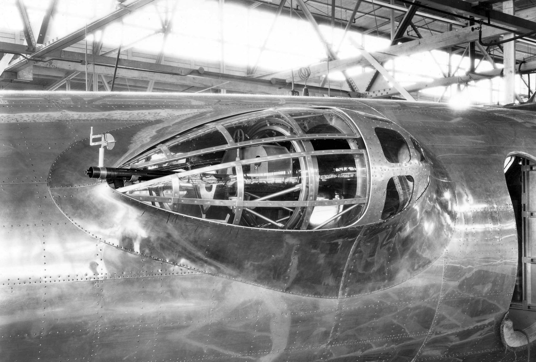
The Boeing B-17 Flying Fortress is a four-engined heavy bomber developed in the 1930s for the United States Army Air Corps (USAAC). Relatively fast and high-flying for a bomber of its era, the B-17 was used primarily in the European Theater of Operations, United States Army, European Theater of Operations and dropped more bombs than any other aircraft during World War II. It is the List of most-produced aircraft, third-most produced bomber of all time, behind the four-engined Consolidated B-24 Liberator and the multirole, twin-engined Junkers Ju 88. It was also employed as a transport, antisubmarine aircraft, drone controller, and search-and-rescue aircraft. In a USAAC competition, Boeing, Boeing's prototype Model 299/XB-17 outperformed two other entries but crashed, losing the initial 200-bomber contract to the Douglas B-18 Bolo. Still, the Air Corps ordered 13 more B-17s for further evaluation, then introduced it into service in 1938. The B-17 evolved through numerous Boei ... [...More Info...] [...Related Items...] OR: [Wikipedia] [Google] [Baidu] |
World War II
World War II or the Second World War, often abbreviated as WWII or WW2, was a world war that lasted from 1939 to 1945. It involved the vast majority of the world's countries—including all of the great powers—forming two opposing military alliances: the Allies and the Axis powers. World War II was a total war that directly involved more than 100 million personnel from more than 30 countries. The major participants in the war threw their entire economic, industrial, and scientific capabilities behind the war effort, blurring the distinction between civilian and military resources. Aircraft played a major role in the conflict, enabling the strategic bombing of population centres and deploying the only two nuclear weapons ever used in war. World War II was by far the deadliest conflict in human history; it resulted in 70 to 85 million fatalities, mostly among civilians. Tens of millions died due to genocides (including the Holocaust), starvation, ma ... [...More Info...] [...Related Items...] OR: [Wikipedia] [Google] [Baidu] |
Nootka Island
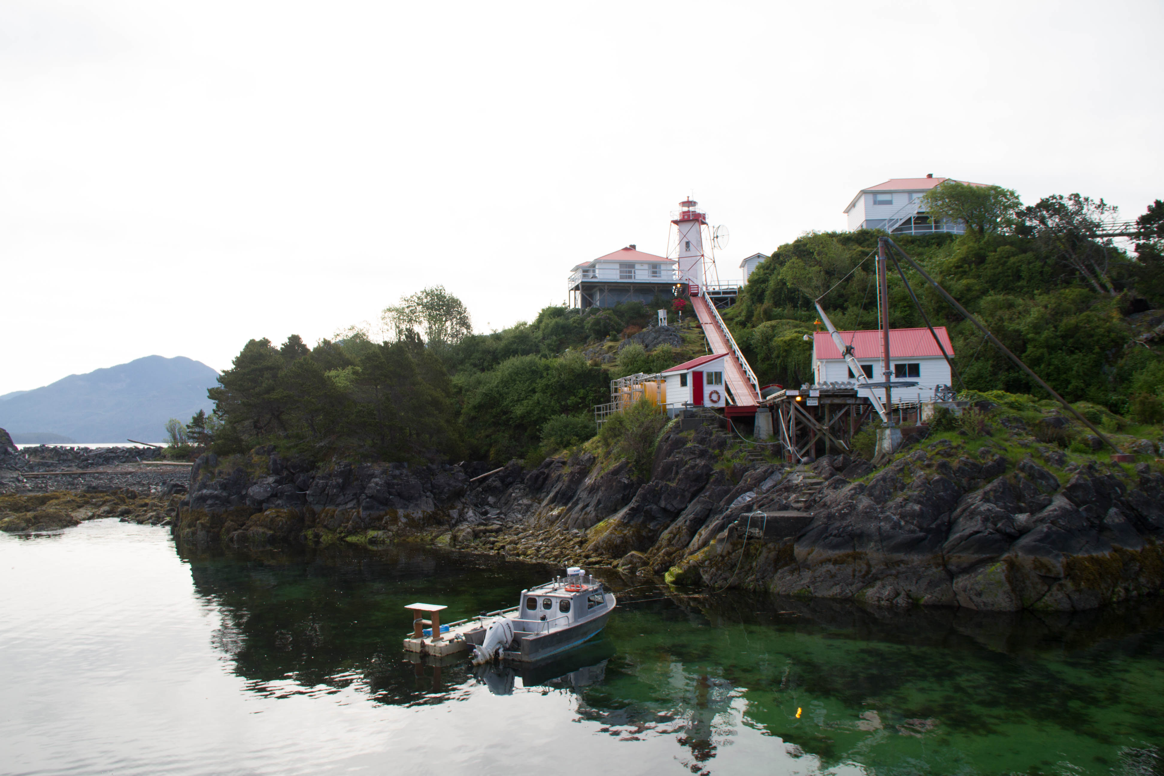
Nootka Island (french: île Nootka) is an island adjacent to Vancouver Island in British Columbia, Canada. It is in area. It is separated from Vancouver Island by Nootka Sound and its side-inlets, and is located within Electoral Area A of the Strathcona Regional District. Europeans named the island after a Nuu-chah-nulth language word meaning "go around, go around". They likely thought the natives were referring to the island itself. The Spanish and later English applied the word to the island and the sound, thinking they were naming both after the people. In the 1980s, the First Nations peoples in the region created the collective autonym of ''Nuu-chah-nulth'', a term that means "along the outside (of Vancouver Island)". An older term for this group of peoples was "Aht", which means "people" in their language and is a component in all the names of their subgroups, and of some locations (e.g. Yuquot, Mowachaht, Kyuquot, Opitsaht etc.). Climate See also *Nootka Crisis *N ... [...More Info...] [...Related Items...] OR: [Wikipedia] [Google] [Baidu] |
John Meares
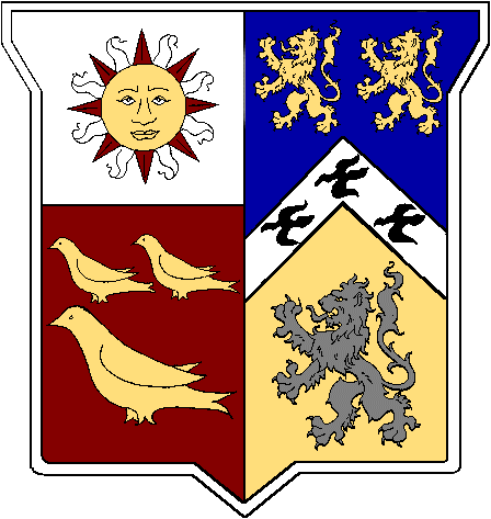
John Meares (c. 1756 – 1809) was an English navigator, explorer, and maritime fur trader, best known for his role in the Nootka Crisis, which brought Britain and Spain to the brink of war. Career Meares' father was Charles Meares, "formerly an attorney of great eminence, and for several years pursuivant of his Majesty's Court of Exchequer in Dublin". In 1771, Meares joined the Royal Navy as a captain's servant and was commissioned a lieutenant in 1778. In 1783 he joined the merchant service and in 1785, based in India, formed the ''Northwest America Company'' for collecting sea otter furs by trade with the indigenous peoples of the Pacific Northwest Coast and selling them in China. The East India Company held a monopoly on British trade in the Pacific and required all British traders to be licensed with the company and pay duties. Meares did not license his ships with the East India Company and instead tried to conceal the illegal activity by using the flag of Portugal. Meares r ... [...More Info...] [...Related Items...] OR: [Wikipedia] [Google] [Baidu] |
Fur Trade
The fur trade is a worldwide industry dealing in the acquisition and sale of animal fur. Since the establishment of a world fur market in the early modern period, furs of boreal, polar and cold temperate mammalian animals have been the most valued. Historically the trade stimulated the exploration and colonization of Siberia, northern North America, and the South Shetland and South Sandwich Islands. Today the importance of the fur trade has diminished; it is based on pelts produced at fur farms and regulated fur-bearer trapping, but has become controversial. Animal rights organizations oppose the fur trade, citing that animals are brutally killed and sometimes skinned alive. Fur has been replaced in some clothing by synthetic imitations, for example, as in ruffs on hoods of parkas. Continental fur trade Russian fur trade Before the European colonization of the Americas, Russia was a major supplier of fur pelts to Western Europe and parts of Asia. Its trade developed in ... [...More Info...] [...Related Items...] OR: [Wikipedia] [Google] [Baidu] |
Neahkahnie Mountain
Neahkahnie Mountain is a mountain, or headland, on the Oregon Coast, north of Manzanita in Oswald West State Park overlooking U.S. Route 101. The peak is part of the Northern Oregon Coast Range, which is part of the Oregon Coast Range. It is best known for stories of Spanish treasure said to be buried either at the foot of the mountain, or on its slopes. In earlier times, Native Americans would set fires to clear the mountain slopes so deer and elk would have tender vegetation to eat in the spring. Pioneers afterwards did the same so their cattle and sheep would have grass to graze on. Since at least 1990, however, this practice was discontinued and the slopes are heavily forested in many places. The name comes from the Tillamook language, although according to Lewis A. McArthur, an Oregonian geographic historian, the meaning of the word is controversial. ''Neah-Kah-Nie'' (other spellings, although obsolescent include "Ne-a-karney" and ''Ne-kah-ni'') is translated as "the plac ... [...More Info...] [...Related Items...] OR: [Wikipedia] [Google] [Baidu] |
Three Arch Rocks National Wildlife Refuge
Three Arch Rocks National Wildlife Refuge is a U.S. National Wildlife Refuge off the northern Oregon Coast. It is located on the central coast of Tillamook County, in the northwestern part of Oregon. It is one of six National Wildlife Refuges within the Oregon Coast National Wildlife Refuge Complex and was the first National Wildlife Refuge west of the Mississippi River. In 1970 the Refuge was designated as wilderness. It is one of the smallest wilderness areas in the United States.Three Rocks Wilderness - Wilderness.net Geography Three Arch Rocks consists of on three large and six small rocky islands located about a half mile (1 km) offshore from Oceanside. It ...[...More Info...] [...Related Items...] OR: [Wikipedia] [Google] [Baidu] |
Cape Meares
Cape Meares is a small headland on the Pacific coast in Tillamook County, Oregon, United States. The cape forms a high steep bluff on the south end of Tillamook Bay, approximately five miles (8 km) northwest of the city of Tillamook. Much of the cape is part of the Oregon Parks and Recreation Department-administered Cape Meares State Scenic Viewpoint with three miles of hiking trails, which includes Cape Meares Light and the Octopus Tree. The cape is named after John Meares, a British explorer. Geography Immediately north of the cape is the community of Cape Meares, next to Cape Meares Lake. Cape Meares beach extends north of the community of Cape Meares, along a sand spit, or peninsula, that encloses Tillamook Bay. The peninsula is alternatively known as Bayocean, after a popular upscale resort town that occupied the beach in the early 20th century, until beach erosion began to destroy the town beginning in the 1930s. Today, no significant remnant of the resort to ... [...More Info...] [...Related Items...] OR: [Wikipedia] [Google] [Baidu] |
Cape Kiwanda
Cape Kiwanda State Natural Area is a state park in Pacific City, Oregon, United States. Cape Kiwanda is on the Three Capes Scenic Route, which includes Cape Meares and Cape Lookout. Hiking to the top of Cape Kiwanda allows views of Nestucca Bay to the south and Cape Lookout to the north. A sea stack, named "Chief Kiwanda rock", is located southwest of the cape. It is one of three features along the Oregon Coast that are called "Haystack Rock", though the one in Cannon Beach is more widely known. One of the attractions, called the Duckbill, in the park was destroyed by vandals in August 2016. File: PACIFICCITY-Nov2004-MathewDodson.JPG, The cape from the beach in Pacific City, November 2004 File:CapeKiwanda-Nov2004-MathewDodson.jpg, View from the trail on Cape Kiwanda File:Kiwanda Haystack.JPG, Haystack Rock near Cape Kiwanda File:Aerial View of Cape Kiwanda State Natural Area.jpg, Aerial View of Cape Kiwanda State Natural Area See also * List of Oregon state parks * Hay ... [...More Info...] [...Related Items...] OR: [Wikipedia] [Google] [Baidu] |


