|
Cape Kormakitis
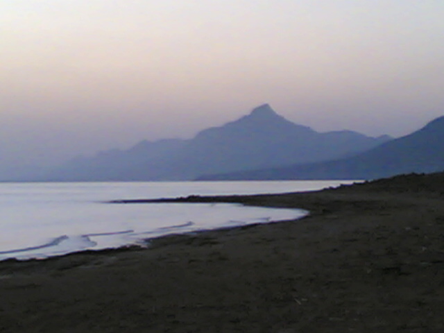
Cape Kormakitis ( el, Ακρωτήριο Κορμακίτη, ''Akrotírio Kormakíti'', tr, Koruçam Burnu), anciently known as Crommyon or Krommyon ( grc, Κρομμύων ἄκρα, Krommyon akra or Κρομμύου ἄκρα) and also Crommyacum or Krommyakon (Κρομμυακόν) is a promontory on the north-western coast of the Mediterranean island of Cyprus, located in the self-proclaimed republic of Northern Cyprus. Named after the nearby Maronite village of the same name, the cape marks the northernmost extent of Morphou Bay. The nearest coastal town to Cape Kormakitis is Kyrenia. Anciently, it was opposite to Anemurium in Cilicia on what is now the Turkish mainland. The Beşparmak Trail, a 255 km long hiking trail, starts at Cape Kormakitis, and follows the Kyrenia Mountains all the way to Cape Apostolos Andreas, the north-easternmost point on Cyprus, at the tip of the Karpaz Peninsula. References Kormakitis Kormakitis (Cypriot Arabic: ; el, Κορμακίτη ... [...More Info...] [...Related Items...] OR: [Wikipedia] [Google] [Baidu] |
Bay Near Cape Kormakitis
A bay is a recessed, coastal body of water that directly connects to a larger main body of water, such as an ocean, a lake, or another bay. A large bay is usually called a gulf, sea, sound, or bight. A cove is a small, circular bay with a narrow entrance. A fjord is an elongated bay formed by glacial action. A bay can be the estuary of a river, such as the Chesapeake Bay, an estuary of the Susquehanna River. Bays may also be nested within each other; for example, James Bay is an arm of Hudson Bay in northeastern Canada. Some large bays, such as the Bay of Bengal and Hudson Bay, have varied marine geology. The land surrounding a bay often reduces the strength of winds and blocks waves. Bays may have as wide a variety of shoreline characteristics as other shorelines. In some cases, bays have beaches, which "are usually characterized by a steep upper foreshore with a broad, flat fronting terrace".Maurice Schwartz, ''Encyclopedia of Coastal Science'' (2006), p. 129. Bays were sig ... [...More Info...] [...Related Items...] OR: [Wikipedia] [Google] [Baidu] |
Kyrenia
Kyrenia ( el, Κερύνεια ; tr, Girne ) is a city on the northern coast of Cyprus, noted for its historic harbour and castle. It is under the ''de facto'' control of Northern Cyprus. While there is evidence showing that the wider region of Kyrenia has been populated before, the city was built by the Greeks named Achaeans from the Peloponnese after the Trojan War (1300 BC). According to Greek mythology, Kyrenia was founded by the Achaeans Cepheus and Praxandrus who ended up there after the Trojan War. The heroes gave to the new city the name of their city of Kyrenia located in Achaia, Greece. As the town grew prosperous, the Romans established the foundations of its castle in the 1st century AD. Kyrenia grew in importance after the 9th century due to the safety offered by the castle, and played a pivotal role under the Lusignan rule as the city never capitulated. The castle has been most recently modified by the Venetians in the 15th century, but the city surrendered to t ... [...More Info...] [...Related Items...] OR: [Wikipedia] [Google] [Baidu] |
Karpaz Peninsula
The Karpas Peninsula ( el, Καρπασία; tr, Karpaz), also known as the Karpass, Karpaz or Karpasia, is a long, finger-like peninsula that is one of the most prominent geographical features of the island of Cyprus. Its farthest extent is Cape Apostolos Andreas, and its major population centre is the town of Rizokarpaso ( el, Ριζοκάρπασο, links=no; tr, Dipkarpaz, links=no). The peninsula ''de facto'' forms the İskele District of Northern Cyprus, while ''de jure'' it lies in the Famagusta District of the Republic of Cyprus. Geography It covers an area of 898 km2, making up 27% of the territory of Northern Cyprus. It is much less densely populated than the average of Northern Cyprus, with a population density of 26 people per km2 in 2010. The town of Trikomo (İskele), the district capital, is considered to be the "gateway" and the geographical starting point of the peninsula, along with the neighboring village of Bogazi (Boğaz). Apart from Trikomo, ... [...More Info...] [...Related Items...] OR: [Wikipedia] [Google] [Baidu] |
Cape Apostolos Andreas
Cape Apostolos Andreas ( el, Ακρωτήριο Αποστόλου Ανδρέα, "Cape Saint Andrew"; tr, Zafer Burnu, "Cape Victory") is the north-easternmost point (promontory) of the Mediterranean island of Cyprus (). It lies at the tip of the finger-like Karpass Peninsula. The Apostolos Andreas Monastery is located 5 km southwest of the promontory itself. The city of Latakia in Syria is located about to the east. Herodotus mentions it as "Keys of Cyprus", where the Phoenicians were sailing with their ships in a war between Darius I and the Ionians.Herodotus Herodotus ( ; grc, , }; BC) was an ancient Greek historian and geographer from the Greek city of Halicarnassus, part of the Persian Empire (now Bodrum, Turkey) and a later citizen of Thurii in modern Calabria ( Italy). He is known f ..., ''Histories'', 5.108in Greek and in English References Apostolos Andreas Landforms of Northern Cyprus {{Cyprus-geo-stub ... [...More Info...] [...Related Items...] OR: [Wikipedia] [Google] [Baidu] |
Kyrenia Mountains
The Kyrenia Mountains ( el, Κερύνειο Όρος; tr, Girne Dağları) is a long, narrow mountain range that runs for approximately along the northern coast of the island of Cyprus. It is primarily made of hard crystalline limestone, with some marble. Its highest peak is Mount Selvili, at . Pentadaktylos (also spelt ''Pentadactylos''; el, Πενταδάκτυλος; tr, Beşparmak) is another name for the Kyrenia Mountains, though '' Britannica'' refers to Pentadaktylos as the "western portion" of the latter, or the part west of Melounta. Pentadaktylos (''lit.'' "five-fingered") is so-named after one of its most distinguishing features, a peak that resembles five fingers. The Kyrenian mountains are named after the Kyrenian mountains in Achaia, Greece, which are well known from mythology because of the connection with one of the 12 labours of Hercules, the capture of the Kerynitis deer that lived there. This sacred deer of Artemis with golden horns and bronze legs r ... [...More Info...] [...Related Items...] OR: [Wikipedia] [Google] [Baidu] |
Beşparmak Trail
The Kyrenia Mountains ( el, Κερύνειο Όρος; tr, Girne Dağları) is a long, narrow mountain range that runs for approximately along the northern coast of the island of Cyprus. It is primarily made of hard crystalline limestone, with some marble. Its highest peak is Mount Selvili, at . Pentadaktylos (also spelt ''Pentadactylos''; el, Πενταδάκτυλος; tr, Beşparmak) is another name for the Kyrenia Mountains, though '' Britannica'' refers to Pentadaktylos as the "western portion" of the latter, or the part west of Melounta. Pentadaktylos (''lit.'' "five-fingered") is so-named after one of its most distinguishing features, a peak that resembles five fingers. The Kyrenian mountains are named after the Kyrenian mountains in Achaia, Greece, which are well known from mythology because of the connection with one of the 12 labours of Hercules, the capture of the Kerynitis deer that lived there. This sacred deer of Artemis with golden horns and bronze legs ra ... [...More Info...] [...Related Items...] OR: [Wikipedia] [Google] [Baidu] |
Cilicia
Cilicia (); el, Κιλικία, ''Kilikía''; Middle Persian: ''klkyʾy'' (''Klikiyā''); Parthian: ''kylkyʾ'' (''Kilikiyā''); tr, Kilikya). is a geographical region in southern Anatolia in Turkey, extending inland from the northeastern coasts of the Mediterranean Sea. Cilicia has a population ranging over six million, concentrated mostly at the Cilicia plain. The region includes the provinces of Mersin, Adana, Osmaniye, along with parts of Hatay and Antalya. Geography Cilicia is extended along the Mediterranean coast east from Pamphylia to the Nur Mountains, which separates it from Syria. North and east of Cilicia lie the rugged Taurus Mountains that separate it from the high central plateau of Anatolia, which are pierced by a narrow gorge called in antiquity the Cilician Gates. Ancient Cilicia was naturally divided into Cilicia Trachea and Cilicia Pedias by the Limonlu River. Salamis, the city on the east coast of Cyprus, was included in its administrative jurisdiction. T ... [...More Info...] [...Related Items...] OR: [Wikipedia] [Google] [Baidu] |
Anemurium
Anemurium ( grc, Ἀνεμούριον, Anemourion), also called Animurium, is an ancient city whose ruins, now called ''Eski Anamur'' or ''Anemuryum'', are close to the modern Turkish city of ''Anamur''. It was in the Roman province of Cilicia, later Isauria, and was situated near a high promontory (Cape Anamur) that marks the southernmost point of Asia Minor, only 64 km from Cyprus. In the Middle Ages, it was called Stallimur. History Anemurium was already in existence in the Hellenistic period. In AD 52, it was besieged by a local tribe, known as the Cietae, led by Troxobor, but Antiochus IV of Commagene broke the siege and after executing Troxobor and a few of the leading chieftains, pardoned the rest. It was under threat from a similar quarter in 382. Coins from its mint survive from the time of Antiochus IV of Commagene (38–72) to Valerian (253–259). In 260, it was captured by the Sasanians, an event that sent Anemurium into decline for many decades,University o ... [...More Info...] [...Related Items...] OR: [Wikipedia] [Google] [Baidu] |
Morphou Bay
Morphou Bay (, ''Kolpos Morfou''; ), is a part of the Mediterranean Sea, located on the north-western side of the island of Cyprus. It is named after the nearby inland town of Morphou (; ). The Morphou Bay region is home to a couple of historical sites, the ancient Greek city of Soli and the ruins known as Vouni Palace. The bay forms the westernmost seaboard of the break-away Turkish Republic of Northern Cyprus, which claims the bay as its own territorial waters. The Turkish Republic of Northern Cyprus has received diplomatic recognition only from Turkey, on which it is dependent economically, politically and militarily. The rest of the international community, including the United Nations and European Union, recognises the sovereignty of the Republic of Cyprus over the entire island, including Morphou Bay. It was here that Turkey began landing supplies and volunteers to assist the Turkish Cypriots when the intercommunal violence between the Greek and Turkish Cypriot communities ... [...More Info...] [...Related Items...] OR: [Wikipedia] [Google] [Baidu] |
Cicero
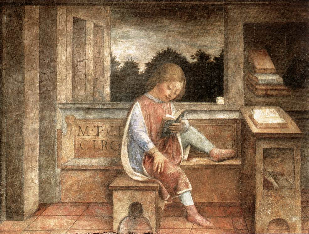
Marcus Tullius Cicero ( ; ; 3 January 106 BC – 7 December 43 BC) was a Roman statesman, lawyer, scholar, philosopher, and academic skeptic, who tried to uphold optimate principles during the political crises that led to the establishment of the Roman Empire. His extensive writings include treatises on rhetoric, philosophy and politics, and he is considered one of Rome's greatest orators and prose stylists. He came from a wealthy municipal family of the Roman equestrian order, and served as consul in 63 BC. His influence on the Latin language was immense. He wrote more than three-quarters of extant Latin literature that is known to have existed in his lifetime, and it has been said that subsequent prose was either a reaction against or a return to his style, not only in Latin but in European languages up to the 19th century. Cicero introduced into Latin the arguments of the chief schools of Hellenistic philosophy and created a Latin philosophical vocabulary ... [...More Info...] [...Related Items...] OR: [Wikipedia] [Google] [Baidu] |
Kormakitis
Kormakitis (Cypriot Arabic: ; el, Κορμακίτης, ''Kormakítis''; tr, Kormacit or ) is a small village in Cyprus. It is under the ''de facto'' control of Northern Cyprus. Kormakitis is one of four traditionally Maronite villages in Cyprus, the other three being Asomatos, Agia Marina and Karpaseia. The Maronites of Kormakitis traditionally speak their own variety of Arabic called Cypriot Maronite Arabic (CMA) in addition to Greek and recently Turkish. Cape Kormakitis is named after the village. All of the remaining Maronites villagers are elderly. The Republic of Cyprus government gives those who stayed in the north pensions of $670 a month per couple and around $430 for an individual. It also pays instructors to teach CMA, and funds week-long summer visits by young Maronites to put them in touch with their communal roots. Maronites also receive help from the United Nations. Every two weeks UN troops make the trip from Nicosia to deliver food, water, fuel and me ... [...More Info...] [...Related Items...] OR: [Wikipedia] [Google] [Baidu] |
Maronites In Cyprus
The Maronites in Cyprus, Maronite Cypriots, are an ethnoreligious group and/or members of the Maronite Catholic Archeparchy of Cyprus whose ancestors migrated from present-day Lebanon during the Middle Ages. A percentage of them traditionally speak a dialect which is a combination of Arabic, Turkish and Greek, recently recognized as a variety of Arabic known as Cypriot Arabic, in addition to Greek. People speaking this Arabic dialect originate from one village, specifically Kormakitis. As Eastern Catholics of the West Syriac Rite, they are in full communion with the Catholic Church of Rome. the Archbishop of Cyprus was Youssef Soueif, born in Chekka, Lebanon on 14 July 1962. He was ordained Archbishop on 6 December 2008 at the Basilica of Our Lady of Lebanon-Harissa by the Patriarch Cardinal Nasrallah Boutros Sfeir. The Mass of Enthronement was held at the Maronite Cathedral of Our Lady of Graces in Nicosia, Cyprus on 21 December 2008. He succeeded the Emeritus Archbish ... [...More Info...] [...Related Items...] OR: [Wikipedia] [Google] [Baidu] |


