|
Cape Islander
A Cape Islander, a style of fishing boat mostly used for lobster fishing, is an inshore motor fishing boat found across Atlantic Canada having a single keeled flat bottom at the stern and more rounded towards the bow. The Cape Island style boat is famous for its large step up to the bow. They are known for being good "sea" boats, and riding the swells well. It originated on Cape Sable Island, Nova Scotia about 1905. (Various online sources cite years 1905, 1906, and 1907.) Two families claim credit for its invention. The design is most commonly credited to Ephraim Atkinson of Clark's Harbour, Nova Scotia. The Atkinson family builders have continued building pleasure and commercial boats to this day. The other claim to the boat's design is an accomplished boat-builder from Clark's Harbour, William A. Kenney, who is said to have constructed the first Cape Islander entirely from wood in 1905. The Cape Sable and Pubnico area of South West Nova Scotia remain major centres of Cape Isl ... [...More Info...] [...Related Items...] OR: [Wikipedia] [Google] [Baidu] |
Fishing Boat
A fishing vessel is a boat or ship used to catch fish in the sea, or on a lake or river. Many different kinds of vessels are used in commercial, artisanal and recreational fishing. The total number of fishing vessels in the world in 2016 was estimated to be about 4.6 million, unchanged from 2014. The fleet in Asia was the largest, consisting of 3.5 million vessels, accounting for 75 percent of the global fleet. In Africa and North America the estimated number of vessels declined from 2014 by just over 30,000 and by nearly 5,000, respectively. For Asia, Latin America and the Caribbean and Oceania the numbers all increased, largely as a result of improvements in estimation procedures.FAO 2007 It is difficult to estimate the number of recreational fishing boats. They range in size from small dinghies to large charter cruisers, and unlike commercial fishing vessels, are often not dedicated just to fishing. Prior to the 1950s there was little standardisation of fishing boats. Desig ... [...More Info...] [...Related Items...] OR: [Wikipedia] [Google] [Baidu] |
Atlantic Canada
Atlantic Canada, also called the Atlantic provinces (french: provinces de l'Atlantique), is the region of Eastern Canada comprising the provinces located on the Atlantic coast, excluding Quebec. The four provinces are New Brunswick, Newfoundland and Labrador, Nova Scotia, and Prince Edward Island. As of 2021, the landmass of the four Atlantic provinces was approximately 488,000 km2, and had a population of over 2.4 million people. The provinces combined had an approximate GDP of $121.888 billion in 2011. The term ''Atlantic Canada'' was popularized following the admission of Newfoundland as a Canadian province in 1949. History The first premier of Newfoundland, Joey Smallwood, coined the term "Atlantic Canada" when Newfoundland joined Canada in 1949. He believed that it would have been presumptuous for Newfoundland to assume that it could include itself within the existing term "Maritime provinces," used to describe the cultural similarities shared by New Brunswick, Prince ... [...More Info...] [...Related Items...] OR: [Wikipedia] [Google] [Baidu] |
Keel
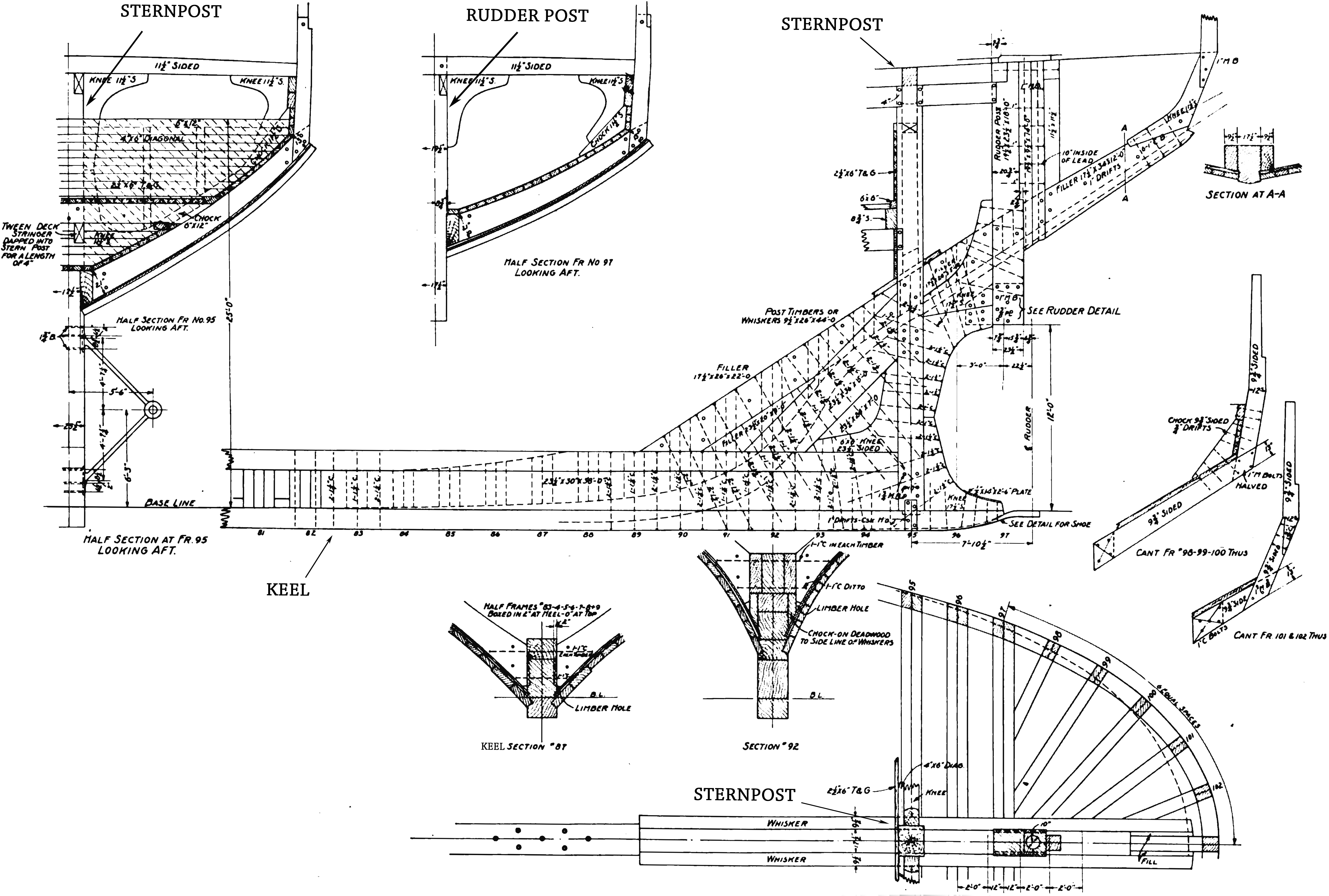
The keel is the bottom-most longitudinal structural element on a vessel. On some sailboats, it may have a hydrodynamic and counterbalancing purpose, as well. As the laying down of the keel is the initial step in the construction of a ship, in British and American shipbuilding traditions the construction is dated from this event. Etymology The word "keel" comes from Old English , Old Norse , = "ship" or "keel". It has the distinction of being regarded by some scholars as the first word in the English language recorded in writing, having been recorded by Gildas in his 6th century Latin work ''De Excidio et Conquestu Britanniae'', under the spelling ''cyulae'' (he was referring to the three ships that the Saxons first arrived in). is the Latin word for "keel" and is the origin of the term careen (to clean a keel and the hull in general, often by rolling the ship on its side). An example of this use is Careening Cove, a suburb of Sydney, Australia, where careening was carried out ... [...More Info...] [...Related Items...] OR: [Wikipedia] [Google] [Baidu] |
Stern
The stern is the back or aft-most part of a ship or boat, technically defined as the area built up over the sternpost, extending upwards from the counter rail to the taffrail. The stern lies opposite the bow, the foremost part of a ship. Originally, the term only referred to the aft port section of the ship, but eventually came to refer to the entire back of a vessel. The stern end of a ship is indicated with a white navigation light at night. Sterns on European and American wooden sailing ships began with two principal forms: the ''square'' or ''transom'' stern and the ''elliptical'', ''fantail'', or ''merchant'' stern, and were developed in that order. The hull sections of a sailing ship located before the stern were composed of a series of U-shaped rib-like frames set in a sloped or "cant" arrangement, with the last frame before the stern being called the ''fashion timber(s)'' or ''fashion piece(s)'', so called for "fashioning" the after part of the ship. This frame is d ... [...More Info...] [...Related Items...] OR: [Wikipedia] [Google] [Baidu] |
Bow (ship)
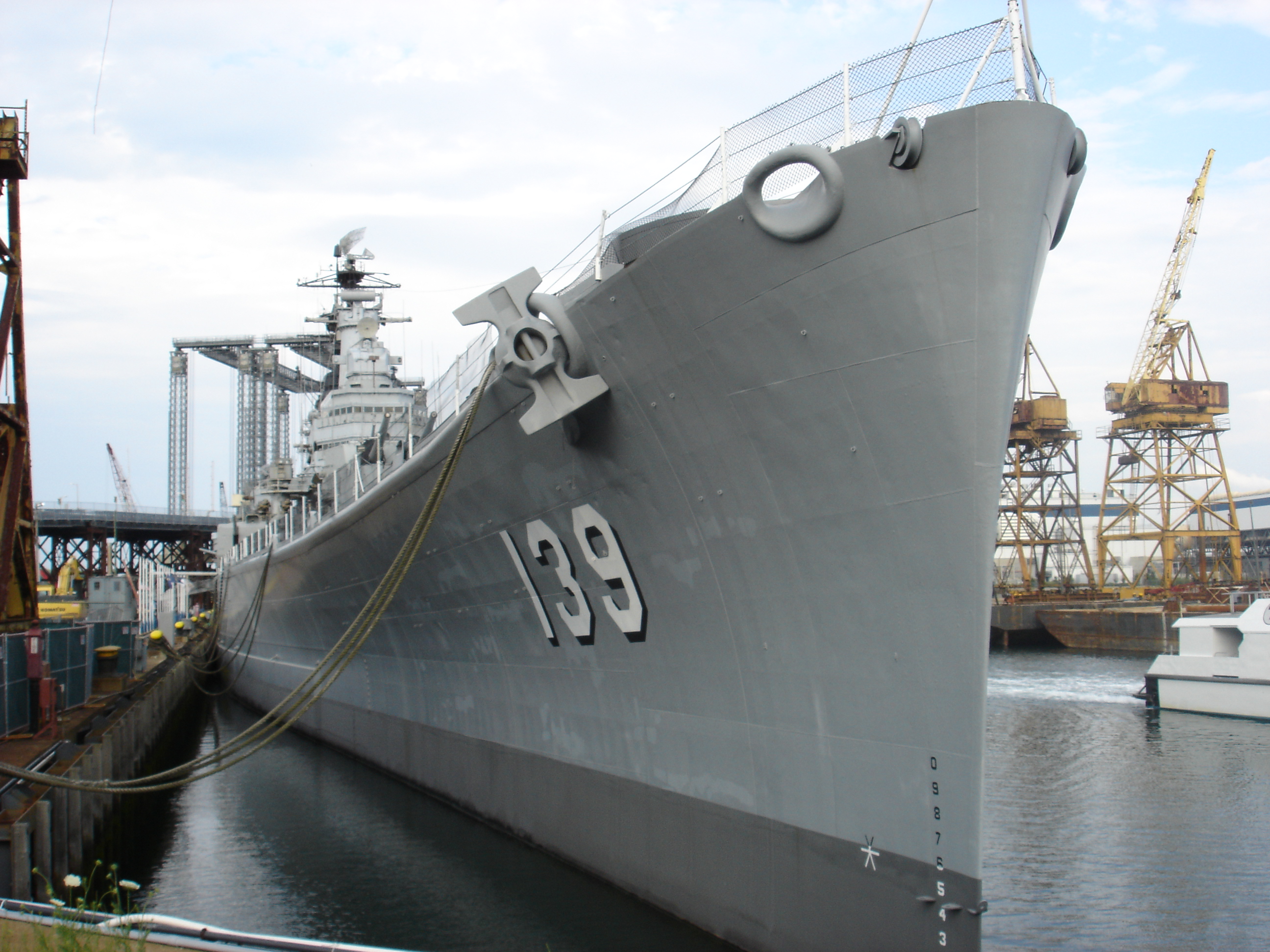
The bow () is the forward part of the hull of a ship or boat, the point that is usually most forward when the vessel is underway. The aft end of the boat is the stern. Prow may be used as a synonym for bow or it may mean the forward-most part of the bow above the waterline. Function A ship's bow should be designed to enable the hull to pass efficiently through the water. Bow shapes vary according to the speed of the boat, the seas or waterways being navigated, and the vessel's function. Where sea conditions are likely to promote pitching, it is useful if the bow provides reserve buoyancy; a flared bow (a raked stem with flared topsides) is ideal to reduce the amount of water shipped over the bow. Ideally, the bow should reduce the resistance and should be tall enough to prevent water from regularly washing over the top of it. Large commercial barges on inland waterways rarely meet big waves and may have remarkably little freeboard at the bow, whereas fast military ... [...More Info...] [...Related Items...] OR: [Wikipedia] [Google] [Baidu] |
Cape Sable Island, Nova Scotia
Cape Sable Island, locally referred to as Cape Island, is a small Canadian island at the southernmost point of the Nova Scotia peninsula. It is sometimes confused with Sable Island. Historically, the Argyle, Nova Scotia region was known as Cape Sable and encompassed a much larger area than simply the island it does today. It extended from Cape Negro (Baccaro) through Chebogue. The island is situated in Shelburne County south of Barrington Head, separated from the mainland by the narrow strait of Barrington Passage, but has been connected since 1949 by a causeway. The largest community on the island is the town of Clark's Harbour. Other communities are listed below. At the extreme southern tip is Cape Sable. History Cape Sable Island was inhabited by the Mi'kmaq who knew it as Kespoogwitk meaning "land's end". It was first charted by explorers from Portugal who named it Beusablom, meaning "Sandy Bay". French Colony Cape Sable and Cape Negro, Nova Scotia were first settle ... [...More Info...] [...Related Items...] OR: [Wikipedia] [Google] [Baidu] |
Clark's Harbour, Nova Scotia
Clark's Harbour is a town on Cape Sable Island in southwestern Nova Scotia, Canada, located in the Municipality of the District of Barrington in Shelburne County. The main industry is lobster fishing. Owing to this as well as the town's history as a fishing community, the town is noted as the birthplace of the Cape Islander fishing boat. The community is the southernmost town in the province of Nova Scotia, and thus one of the southernmost towns in Canada, being located roughly on a parallel with Bilbao, Basque Country and just north of Rome. Demographics In the 2021 Census of Population conducted by Statistics Canada, Clark's Harbour had a population of living in of its total private dwellings, a change of from its 2016 population of . With a land area of , it had a population density of in 2021. Mother tongue language (2006) Religious make-up (2001) [...More Info...] [...Related Items...] OR: [Wikipedia] [Google] [Baidu] |
David A
David (; , "beloved one") (traditional spelling), , ''Dāwūd''; grc-koi, Δαυΐδ, Dauíd; la, Davidus, David; gez , ዳዊት, ''Dawit''; xcl, Դաւիթ, ''Dawitʿ''; cu, Давíдъ, ''Davidŭ''; possibly meaning "beloved one". was, according to the Hebrew Bible, the third king of the United Kingdom of Israel. In the Books of Samuel, he is described as a young shepherd and harpist who gains fame by slaying Goliath, a champion of the Philistines, in southern Canaan. David becomes a favourite of Saul, the first king of Israel; he also forges a notably close friendship with Jonathan, a son of Saul. However, under the paranoia that David is seeking to usurp the throne, Saul attempts to kill David, forcing the latter to go into hiding and effectively operate as a fugitive for several years. After Saul and Jonathan are both killed in battle against the Philistines, a 30-year-old David is anointed king over all of Israel and Judah. Following his rise to power, David ... [...More Info...] [...Related Items...] OR: [Wikipedia] [Google] [Baidu] |
Dingwall In 2010
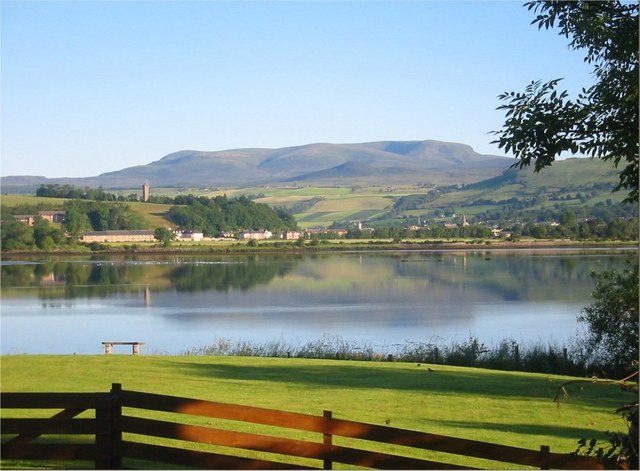
Dingwall ( sco, Dingwal, gd, Inbhir Pheofharain ) is a town and a royal burgh in the Highland (council area), Highland council area of Scotland. It has a population of 5,491. It was an east-coast harbour that now lies inland. Dingwall Castle was once the biggest castle north of Stirling. On the town's present-day outskirts lies Tulloch Castle, parts of which may date back to the 12th century. In 1411 the Battle of Dingwall is said to have taken place between the Clan Mackay and the Clan Donald. History Its name, derived from the Scandinavian (field or meeting-place of the ''thing (assembly), thing'', or local assembly; compare Tynwald, Tingwall (other), Tingwall, Thingwall in the British Isles alone, plus many others across northern Europe), preserves the Viking connections of the town; Gaels call it (), meaning "the mouth of the Peffery" or meaning "cabbage town". The site of the , and of the medieval Moothill, thought to have been established by the Vikings af ... [...More Info...] [...Related Items...] OR: [Wikipedia] [Google] [Baidu] |
Maine
Maine () is a state in the New England and Northeastern regions of the United States. It borders New Hampshire to the west, the Gulf of Maine to the southeast, and the Canadian provinces of New Brunswick and Quebec to the northeast and northwest, respectively. The largest state by total area in New England, Maine is the 12th-smallest by area, the 9th-least populous, the 13th-least densely populated, and the most rural of the 50 U.S. states. It is also the northeasternmost among the contiguous United States, the northernmost state east of the Great Lakes, the only state whose name consists of a single syllable, and the only state to border exactly one other U.S. state. Approximately half the area of Maine lies on each side of the 45th parallel north in latitude. The most populous city in Maine is Portland, while its capital is Augusta. Maine has traditionally been known for its jagged, rocky Atlantic Ocean and bayshore coastlines; smoothly contoured mountains; heavily f ... [...More Info...] [...Related Items...] OR: [Wikipedia] [Google] [Baidu] |
Northumberland Strait
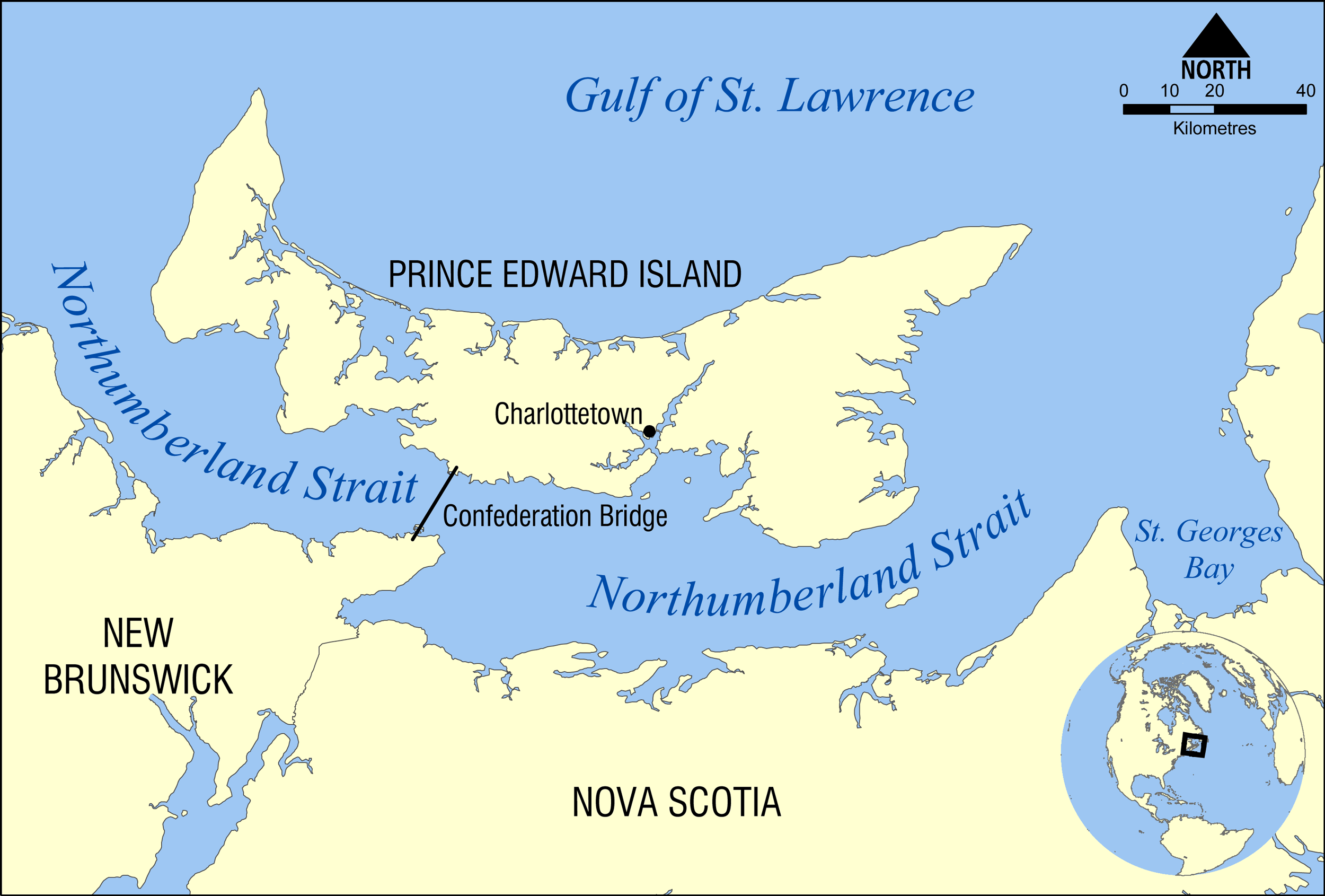
The Northumberland Strait (French: ''détroit de Northumberland'') is a strait in the southern part of the Gulf of Saint Lawrence in eastern Canada. The strait is formed by Prince Edward Island and the gulf's eastern, southern, and western shores. Boundaries The western boundary of the strait is delineated by a line running between North Cape, Prince Edward Island and Point Escuminac, New Brunswick while the eastern boundary is delineated by a line running between East Point, Prince Edward Island and Inverness, Nova Scotia. Hydrography The Northumberland Strait varies in depth between 17 and 65 metres, with the deepest waters at either end. The tidal patterns are complex; the eastern end has the usual two tides per day, with a tidal range of 1.2 to 1.8 metres, while the western end effectively has only one tide per day. The strait's shallow depths lend to warm water temperatures in summer months, with some areas reaching 25° C, or 77° F. Consequently, the strait is repo ... [...More Info...] [...Related Items...] OR: [Wikipedia] [Google] [Baidu] |


.jpg)


