|
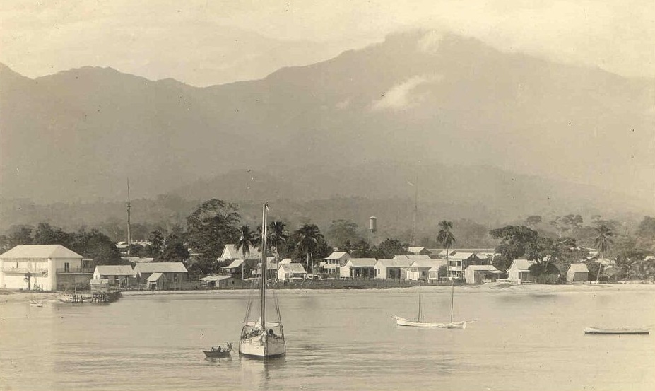
Cangrejal River
The Cangrejal River or Río Cangrejal is a river that drains several mountain tributaries and borders the rainforest of Pico Bonito National Park near La Ceiba, Honduras Honduras, officially the Republic of Honduras, is a country in Central America. The republic of Honduras is bordered to the west by Guatemala, to the southwest by El Salvador, to the southeast by Nicaragua, to the south by the Pacific Oce .... The river offers some of the best whitewater rafting opportunities in Central America. See also * List of rivers of Honduras References Rivers of Honduras {{Honduras-river-stub ... [...More Info...] [...Related Items...] OR: [Wikipedia] [Google] [Baidu] |
Honduras
Honduras, officially the Republic of Honduras, is a country in Central America. The republic of Honduras is bordered to the west by Guatemala, to the southwest by El Salvador, to the southeast by Nicaragua, to the south by the Pacific Ocean at the Gulf of Fonseca, and to the north by the Gulf of Honduras, a large inlet of the Caribbean Sea. Its capital and largest city is Tegucigalpa. Honduras was home to several important Mesoamerican cultures, most notably the Maya, before the Spanish Colonization in the sixteenth century. The Spanish introduced Catholicism and the now predominant Spanish language, along with numerous customs that have blended with the indigenous culture. Honduras became independent in 1821 and has since been a republic, although it has consistently endured much social strife and political instability, and remains one of the poorest countries in the Western Hemisphere. In 1960, the northern part of what was the Mosquito Coast was transferred from Nicara ... [...More Info...] [...Related Items...] OR: [Wikipedia] [Google] [Baidu] |
Pico Bonito National Park
Pico Bonito National Park is a national park in Honduras. It was established on January 1, 1987 and covers an area of . It has an altitude ranging between 60 and 2,480 meters. Description Pico Bonito National Park is located on the northern area of Honduras, in the mountain range called Cordillera Nombre de Dios, Pico Bonito is a mountain located in the municipality of El Porvenir, near the coastal city of La Ceiba in Honduras. World Institute for Conservation and Environment ( WICE) It is part of the . It has a su ... [...More Info...] [...Related Items...] OR: [Wikipedia] [Google] [Baidu] |
La Ceiba
La Ceiba () is a municipality, the capital of the Honduran department of Atlántida (department), Atlántida and a port city on the northern coast of Honduras in Central America. It is located on the southern edge of the Caribbean, forming part of the south eastern boundary of the Gulf of Honduras. With an estimated population of 199,080 living in approximately 170 residential areas (called ''colonias'' or ''barrios''), it is the fourth most populous and third most important city in the country. La Ceiba was officially founded on 23 August 1877. The city was named after a giant ceiba tree that grew near the old dock. The city has been officially proclaimed the "Eco-Tourism Capital of Honduras," as well as the "Entertainment Capital of Honduras". Every year, on the third or fourth Saturday of May, the city holds its La Ceiba Carnival, famous carnival to commemorate Isidore the Laborer (Spanish ''San Isidro Labrador''). During this time, the city is host to approximately 500,000 t ... [...More Info...] [...Related Items...] OR: [Wikipedia] [Google] [Baidu] |
List Of Rivers Of Honduras
Rivers in Honduras is a list of the rivers in Honduras, including those it shares with neighbours. Among the most important river in Honduras is the Ulúa, which flows through the economically important Valle de Sula. Numerous other rivers drain the interior highlands and empty north into the Caribbean Sea. The Pacific Ocean coast also receives other important rivers such as the Choluteca River, which flows through the capital, Tegucigalpa, where it wreaked havoc during the 1998 Hurricane Mitch. La Quebradona is a river located in La Ruidosa, Copán. La Comisión Permanente de Contingencias is the body which gives out alerts when rivers are in danger of overflowing. This list is arranged by drainage basin, from east to west, with respective tributaries indented under each larger stream's name. Caribbean Sea *Coco River (Segovia River) borders Nicaragua. *Cruta River *Nakunta River *Mocorón River *Warunta River * Patuca River is the largest in Honduras and the second larg ... [...More Info...] [...Related Items...] OR: [Wikipedia] [Google] [Baidu] |

