|
Campobello Di Licata
Campobello di Licata ( scn, Campubbeddu) is a ''comune'' (municipality) in the Province of Agrigento in the Italian region Sicily, located about southeast of Palermo and about east of Agrigento. Physical geography Territory Campobello di Licata is a hilly town in the province of Agrigento , located on a plateau of the Salso river valley at 316 m above sea level. The territory, which has an extension of about 80 km², borders with Ravanusa, Naro and Licata; the resident population is 9,616 inhabitants; it is 51 km from the provincial capital. Its borders are delimited to the west by the Canale torrent and to the east by the Milici torrent. Furthermore, Campobello di Licata is only 4 km from Ravanusa. History In the 11th century, the Castello di Bifar was built in Campobello di Licata. It was destroyed in the earthquake of 1693. Contemporary Age Important public works are from the end of the 19th century, mainly by the mayor Salvatore Ciotta: drinking water fountain ... [...More Info...] [...Related Items...] OR: [Wikipedia] [Google] [Baidu] |
Sicily
(man) it, Siciliana (woman) , population_note = , population_blank1_title = , population_blank1 = , demographics_type1 = Ethnicity , demographics1_footnotes = , demographics1_title1 = Sicilian , demographics1_info1 = 98% , demographics1_title2 = , demographics1_info2 = , demographics1_title3 = , demographics1_info3 = , timezone1 = CET , utc_offset1 = +1 , timezone1_DST = CEST , utc_offset1_DST = +2 , postal_code_type = , postal_code = , area_code_type = ISO 3166 code , area_code = IT-82 , blank_name_sec1 = GDP (nominal) , blank_info_sec1 = €89.2 billion (2018) , blank1_name_sec1 = GDP per capita , blank1_info_sec1 ... [...More Info...] [...Related Items...] OR: [Wikipedia] [Google] [Baidu] |
Naro
Naro ( scn, Naru ) is a ''comune'' in the province of Agrigento, on the island of Sicily, Italy. It is bounded by the comuni of Agrigento, Caltanissetta, Camastra, Campobello di Licata, Canicattì, Castrofilippo, Delia, Favara, Licata, Palma di Montechiaro, Ravanusa and Sommatino. The naturalised French composer Achille Campisiano (1837–1901) was born in this village. It is also the birthplace of Il Volo singer Piero Barone. History There was already a settlement in the area of Naro in the Roman era, of which remains such as catacombs and ruins of Roman villas have been found. It was an important fortified town during the Arab and the Norman occupation, and remained a regional centre. The medieval castle, the ruined Norman church and several baroque buildings testify to its rich history. In the Second World War World War II or the Second World War, often abbreviated as WWII or WW2, was a world war that lasted from 1939 to 1945. It involved the vast maj ... [...More Info...] [...Related Items...] OR: [Wikipedia] [Google] [Baidu] |
Royal Decree
A decree is a legal proclamation, usually issued by a head of state (such as the president of a republic or a monarch), according to certain procedures (usually established in a constitution). It has the force of law. The particular term used for this concept may vary from country to country. The ''executive orders'' made by the President of the United States, for example, are decrees (although a decree is not exactly an order). Decree by jurisdiction Belgium In Belgium, a decree is a law of a community or regional parliament, e.g. the Flemish Parliament. France The word ''décret'', literally "decree", is an old legal usage in France and is used to refer to executive orders issued by the French President or Prime Minister. Any such order must not violate the French Constitution or Civil Code, and a party has the right to request an order be annulled in the French Council of State. Orders must be ratified by Parliament before they can be modified into legislative Acts. Specia ... [...More Info...] [...Related Items...] OR: [Wikipedia] [Google] [Baidu] |
Silvio Benedetto
Silvio Benedicto Benedetto (Buenos Aires, March 21, 1938) is an Argentine painter and sculptor naturalized Italian. Biography Silvio Benedetto was born in Buenos Aires, on March 21, 1938, from a family of artists of Italian origin. His grandfather Benito Caldarella was a photographer, portraitist; his mother Adela Caldarella was a painter, ceramist and prose actress; his father Juan Valente Benedetto was an actor and journalist in Buenos Aires, where he founded the first association of journalists. Argentina from 1950 In 1956, at the age of eighteen, he won the 1st Prize at the 2nd Biennial of Pan-American Sacred Art in Buenos Aires. Between 1957 and 1961 he made several solo exhibitions, including the "Museo Provincial de Bellas Artes" (now Museo Provincial de Bellas Artes Timoteo Navarro) of Tucumán. Italy from 1961 In 1961 he moved to Italy and made some personal exhibitions in various galleries, including the "Penelope", the "Zanini", the "New Weight" in Rome, ... [...More Info...] [...Related Items...] OR: [Wikipedia] [Google] [Baidu] |
1980
Events January * January 4 – U.S. President Jimmy Carter proclaims a grain embargo against the USSR with the support of the European Commission. * January 6 – Global Positioning System time epoch begins at 00:00 UTC. * January 9 – In Saudi Arabia, 63 Islamist insurgents are beheaded for their part in the siege of the Great Mosque in Mecca in November 1979. * January 14 – Indira Gandhi returns to power as Prime Minister of India. * January 20 – At least 200 people are killed when the Corralejas Bullring collapses at Sincelejo, Colombia. * January 21 – The London Gold Fixing hits its highest price ever of $843 per troy ounce ($2,249.50 in 2020 when adjusted for inflation). * January 22 – Andrei Sakharov, Soviet scientist and human rights activist, is arrested in Moscow. * January 26 – Israel and Egypt establish diplomatic relations. * January 27 – Canadian Caper: Six United States diplomats, posing as Canadians, manage to escape from Tehran, Iran, a ... [...More Info...] [...Related Items...] OR: [Wikipedia] [Google] [Baidu] |
19th Century
The 19th (nineteenth) century began on 1 January 1801 ( MDCCCI), and ended on 31 December 1900 ( MCM). The 19th century was the ninth century of the 2nd millennium. The 19th century was characterized by vast social upheaval. Slavery was abolished in much of Europe and the Americas. The First Industrial Revolution, though it began in the late 18th century, expanding beyond its British homeland for the first time during this century, particularly remaking the economies and societies of the Low Countries, the Rhineland, Northern Italy, and the Northeastern United States. A few decades later, the Second Industrial Revolution led to ever more massive urbanization and much higher levels of productivity, profit, and prosperity, a pattern that continued into the 20th century. The Islamic gunpowder empires fell into decline and European imperialism brought much of South Asia, Southeast Asia, and almost all of Africa under colonial rule. It was also marked by the collapse of the large ... [...More Info...] [...Related Items...] OR: [Wikipedia] [Google] [Baidu] |
1693 Sicily Earthquake
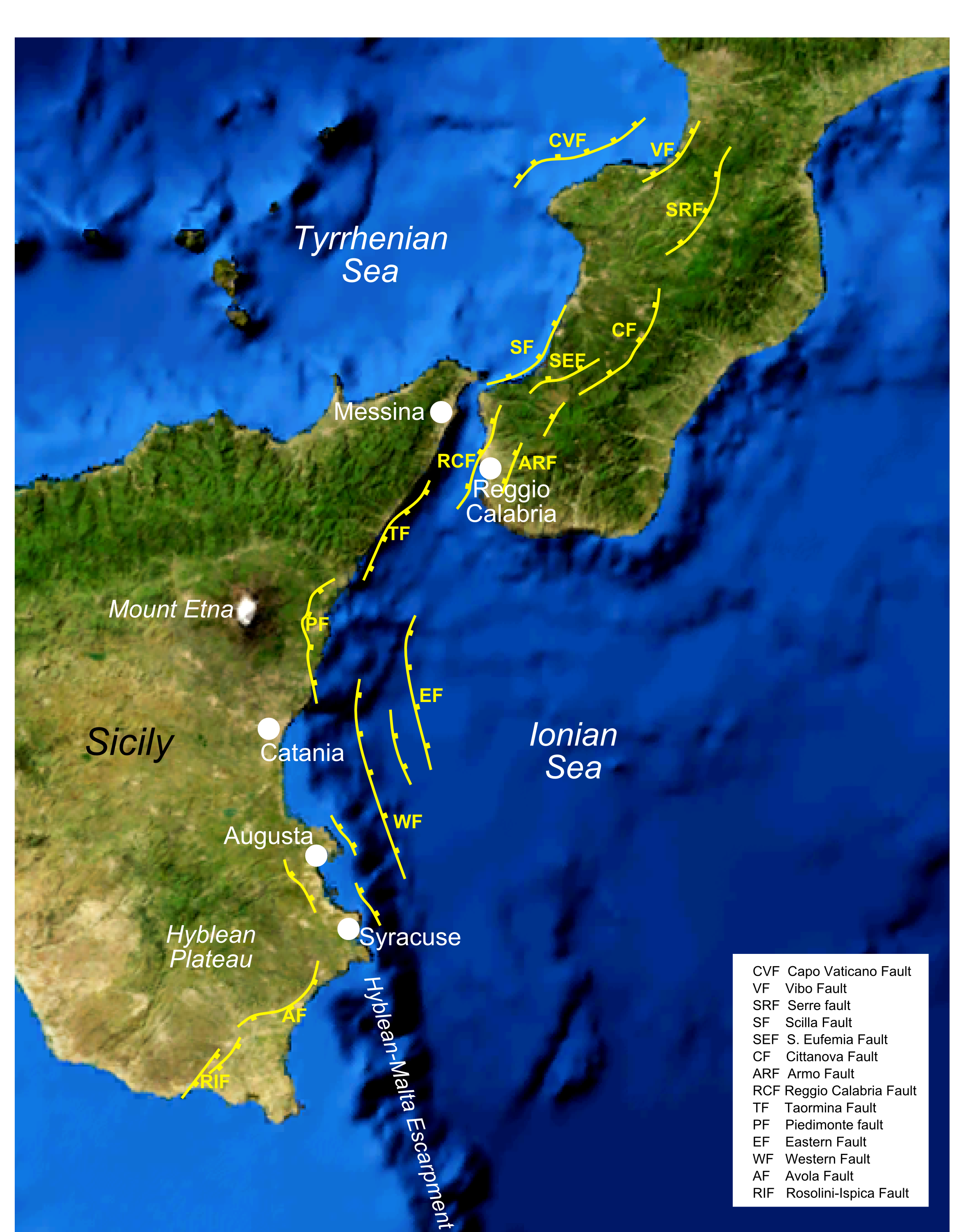
The 1693 Sicily earthquake struck parts of southern Italy near Sicily, Calabria, and Malta on January 11 at around 21:00 local time. This earthquake was preceded by a damaging foreshock on January 9. The main quake had an estimated magnitude of 7.4 on the moment magnitude scale, the most powerful in Italian recorded history, and a maximum intensity of XI (''Extreme'') on the Mercalli intensity scale, destroying at least 70 towns and cities, seriously affecting an area of and causing the death of about 60,000 people. The earthquake was followed by tsunamis that devastated the coastal villages on the Ionian Sea and in the Straits of Messina. Almost two-thirds of the entire population of Catania were killed. The epicentre of the disaster was probably close to the coast, possibly offshore, although the exact position remains unknown. The extent and degree of destruction caused by the earthquake resulted in the extensive rebuilding of the towns and cities of southeastern Sicily, partic ... [...More Info...] [...Related Items...] OR: [Wikipedia] [Google] [Baidu] |
Castello Di Bifar
The Castello di Bifar was a castle in Campobello di Licata, Sicily. It was built in around the 11th century, and was captured by the Normans in around 1086. The castle is only known from documents such as the writings of Goffredo Malaterra. The castle was destroyed in the 1693 Sicily earthquake The 1693 Sicily earthquake struck parts of southern Italy near Sicily, Calabria, and Malta on January 11 at around 21:00 local time. This earthquake was preceded by a damaging foreshock on January 9. The main quake had an estimated magnitude of 7. ..., and no remains have survived today. References {{reflist Bifar Bifar Buildings and structures in the Province of Agrigento Buildings and structures completed in the 11th century Buildings and structures demolished in the 17th century Demolished buildings and structures in Italy ... [...More Info...] [...Related Items...] OR: [Wikipedia] [Google] [Baidu] |
Licata
Licata (, ; grc, Φιντίας, whence la, Phintias or ''Plintis''), formerly also Alicata (), is a city and ''comune'' located on the south coast of Sicily, at the mouth of the Salso River (the ancient ''Himera''), about midway between Agrigento and Gela. It is a major seaport developed at the turn of the twentieth century, shipping sulphur, the refining of which has made Licata the largest European exporting centre, and asphalt, and at times shipping cheese. West of the port city there is a series of pocket beaches separated by wave-cut headlands as high as . (Amore 2002). History Ancient The settlement was frequented by the Phoenicians who traded there between the 12th and 8th centuries BC. At the end of the 7th century BC the Geloi (inhabitants of ancient Gela) built a fortified station to guard the mouth of the Salso (''Himera'') river. In the first half of 6th century BC Phalaris, tyrant of Agrigento, built a fortified outpost. The first settlement was probably ... [...More Info...] [...Related Items...] OR: [Wikipedia] [Google] [Baidu] |
Ravanusa
Ravanusa ( Sicilian: ''Rivinusa'') is a ''comune'' (municipality) in the Province of Agrigento in the Italian region Sicily, located about southeast of Palermo and about east of Agrigento. Ravanusa is near the Monte Saraceno archaeological site, an ancient Greek settlement thought to be that of the city of Kakyron. The Muslim Arab domination begins at the beginning of the 9th century, more precisely from 829, when the Muslims occupy Agrigento for the first time and lasts until July 25, 1086. With the arrivals of the Normans, Ruggero Altavilla, conquered Kerkent (Agrigento) on July 25, 1086 - said Malaterra, and he immediately began the conquest of eleven castles, including Licata, Bifar, Muclof, Naro and Remise, all familiar to the Ravanusani, as a locality. Once Ravanusa was conquered by the Normans, they introduced a new political and economic-social order in the conquered territories; feudalism, born in the 9th century, under the Carolingian Empire. The fiefs, large landhold ... [...More Info...] [...Related Items...] OR: [Wikipedia] [Google] [Baidu] |
Province Of Agrigento
The Province of Agrigento ( it, Provincia di Agrigento; scn, Pruvincia di Girgenti; officially ''Libero consorzio comunale di Agrigento'') is a province in the autonomous island region of Sicily in Italy, situated on its south-western coast. Following the suppression of the Sicilian provinces, it was replaced in 2015 by the Free municipal consortium of Agrigento. It has an area of , and a total population of 474,493. There are 43 comunes ( it, link=no, comuni) in the province. History and location It is surrounded by Province of Palermo in the north, Trapani in the west, Mediterranean Sea in the south and Caltanissetta in the east. Gela inhabitants founded the province in 6th century B.C. as Akragas. The province was destroyed by the Carthage in 406 B.C. but was later ruled by the Romans, Goths, Byzantines and Arabs. The Arabs rebuilt several parts of the province. Several ancient Doric temples were constructed during the 6th and 5th century B.C. for the purpose of worshiping He ... [...More Info...] [...Related Items...] OR: [Wikipedia] [Google] [Baidu] |
Salso
The Salso ( Sicilian: ''Salsu''), also known as the Imera Meridionale (Greek: ; Latin Himera), is a river of Sicily. It rises in the Madonie Mountains (Latin: Nebrodes Mons; Sicilian: Munti Madunìi) and, traversing the provinces of Enna and Caltanissetta, flows into the Mediterranean at the western end of the Gulf of Gela at the seaport of Licata, in the Province of Agrigento. Its small deltaic system there is dominated by marine processes rather than fluvial ones. It is a seasonal torrent, with brief but violent floods during the winter rains (from November to February), and all but dry in summer droughts. In November 1915 the iron bridge across the river's mouth collapsed during floods, and 119 people were swept away in the flood and lost.C. Amore et al., "Historical evolution of the Salso River mouth, with respect to the Licata harbour system" in Eurocoast/EUCC,''Littoral 2002'' on-line) The Salso, which is the longest river of Sicily at , has a drainage basin area of . [...More Info...] [...Related Items...] OR: [Wikipedia] [Google] [Baidu] |
.jpg)


