|
Calton, Staffordshire
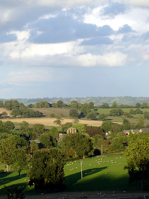
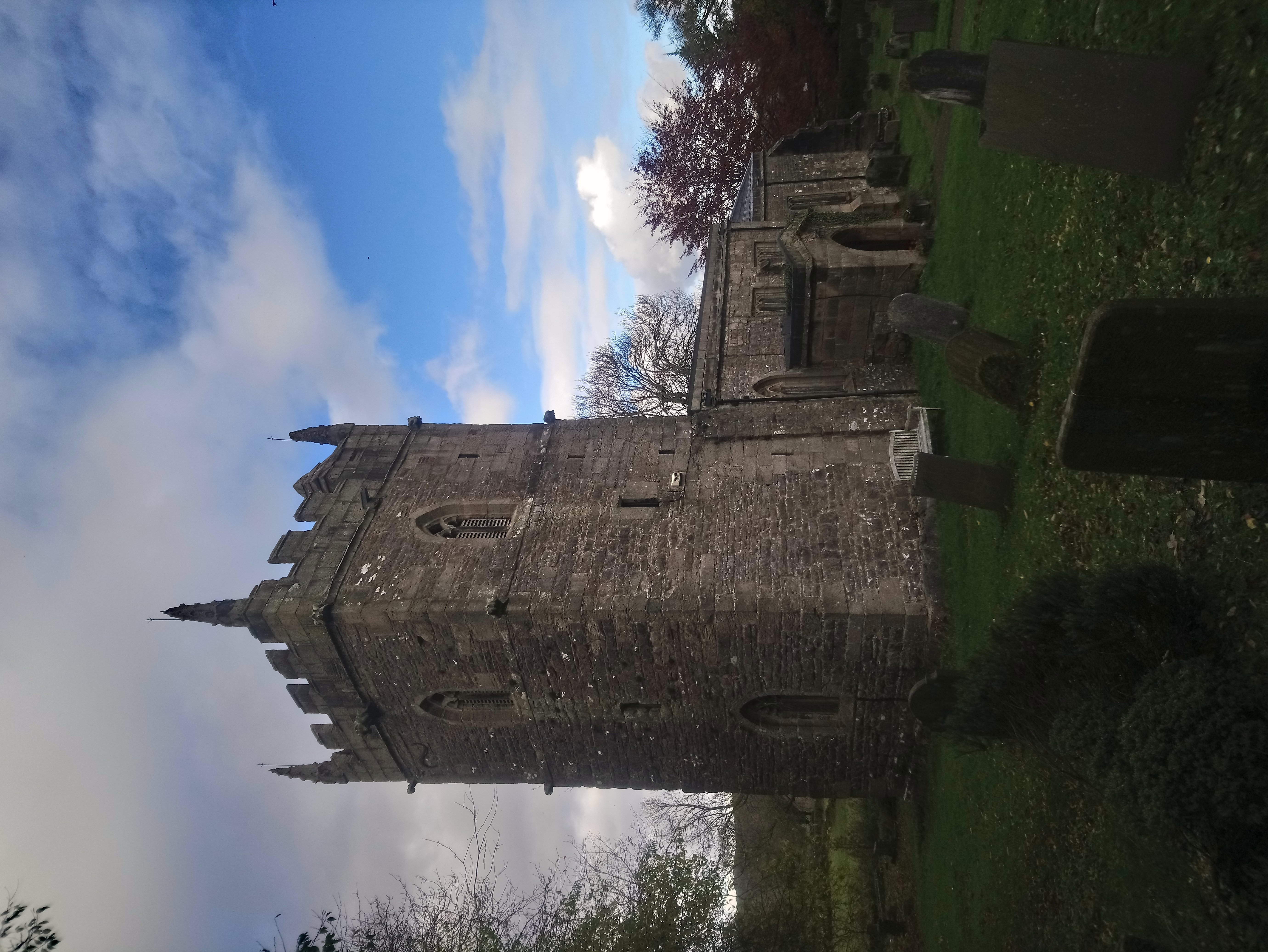
Calton is a village and a former parochial chapelry and civil parish, now in the parish of Waterhouses, in the Staffordshire Moorlands district of Staffordshire, England. In 1931 the parish had a population of 222. The chapelry contained the four parishes of Croxden, Blore, Mayfield, and Waterfall. In 1866, the four parishes became the civil parish of Calton, and on 1 April 1934 the parish was abolished to form Waterhouses. The village of Calton stands in the old parish of Mayfield, along with the chapel of St Mary. The Peak District Boundary Walk The Peak District Boundary Walk is a circular walking trail, starting and finishing at Buxton and broadly following the boundary of the Peak District, Britain's first national park. The route was developed by the Friends of the Peak District (a ... runs through the village. See also * Listed buildings in Waterhouses, Staffordshire References {{authority control Villages in Staffordshire Towns and villages of the Peak Dist ... [...More Info...] [...Related Items...] OR: [Wikipedia] [Google] [Baidu] |
Waterhouses, Staffordshire
Waterhouses is a village in the south of the Staffordshire Peak District in England. It is around 8 miles from Leek and Ashbourne, being nearly the halfway point between the two towns on the A523 road, which roughly follows the southern boundary of the Peak District National Park. Waterhouses is also a civil parish, created in 1934 when the parishes of Calton, Cauldon, Waterfall and part of Ilam were merged; previously the village of Waterhouses was on the boundary of Waterfall and Cauldon parishes. The hamlet of Winkhill is also in the parish. The population of the civil parish at the 2011 census was 1,134. Village The village of Waterhouses is on the River Hamps, a tributary of the River Manifold, and at the southern end of the track of the former Leek and Manifold Valley Light Railway (now the Manifold Way, a walk- and cycle-path), which ran to Hulme End. Nearby is the Cauldon cement plant of Lafarge Cement, and a large Tarmac limestone quarry. Waterhouses was serve ... [...More Info...] [...Related Items...] OR: [Wikipedia] [Google] [Baidu] |
Staffordshire Moorlands
Staffordshire Moorlands is a Non-metropolitan district, local government district in Staffordshire, England. Its council, Staffordshire Moorlands District Council, is based in Leek, Staffordshire, Leek and is located between the city of Stoke-on-Trent and the Peak District National Park. The 2001 census recorded the population as 94,489. Principal industries are agriculture, fashion and tourism. The area's three towns are Leek, Cheadle, Staffordshire, Cheadle and Biddulph. Visitor attractions include the National Trust for Places of Historic Interest or Natural Beauty, National Trust property Biddulph Grange, the Churnet Valley Railway, the UK's largest theme park Alton Towers Resort, and the annual Leek Arts Festival. There are also a variety of outdoor pursuits such as rock climbing (The Roaches), sailing (Rudyard Lake) and cycling (Waterhouses, Staffordshire, Waterhouses). Governance The district was formed on 1 April 1974, under the Local Government Act 1972, as a merger of ... [...More Info...] [...Related Items...] OR: [Wikipedia] [Google] [Baidu] |
Staffordshire
Staffordshire (; postal abbreviation Staffs.) is a landlocked county in the West Midlands region of England. It borders Cheshire to the northwest, Derbyshire and Leicestershire to the east, Warwickshire to the southeast, the West Midlands County and Worcestershire to the south and Shropshire to the west. The largest settlement in Staffordshire is Stoke-on-Trent, which is administered as an independent unitary authority, separately from the rest of the county. Lichfield is a cathedral city. Other major settlements include Stafford, Burton upon Trent, Cannock, Newcastle-under-Lyme, Rugeley, Leek, and Tamworth. Other towns include Stone, Cheadle, Uttoxeter, Hednesford, Brewood, Burntwood/Chasetown, Kidsgrove, Eccleshall, Biddulph and the large villages of Penkridge, Wombourne, Perton, Kinver, Codsall, Tutbury, Alrewas, Barton-under-Needwood, Shenstone, Featherstone, Essington, Stretton and Abbots Bromley. Cannock Chase AONB is within the county as well as parts of the ... [...More Info...] [...Related Items...] OR: [Wikipedia] [Google] [Baidu] |
Civil Parish
In England, a civil parish is a type of administrative parish used for local government. It is a territorial designation which is the lowest tier of local government below districts and counties, or their combined form, the unitary authority. Civil parishes can trace their origin to the ancient system of ecclesiastical parishes, which historically played a role in both secular and religious administration. Civil and religious parishes were formally differentiated in the 19th century and are now entirely separate. Civil parishes in their modern form came into being through the Local Government Act 1894, which established elected parish councils to take on the secular functions of the parish vestry. A civil parish can range in size from a sparsely populated rural area with fewer than a hundred inhabitants, to a large town with a population in the tens of thousands. This scope is similar to that of municipalities in Continental Europe, such as the communes of France. However, ... [...More Info...] [...Related Items...] OR: [Wikipedia] [Google] [Baidu] |
A Vision Of Britain Through Time
The Great Britain Historical GIS (or GBHGIS) is a spatially enabled database that documents and visualises the changing human geography of the British Isles, although is primarily focussed on the subdivisions of the United Kingdom mainly over the 200 years since the first census in 1801. The project is currently based at the University of Portsmouth, and is the provider of the website ''A Vision of Britain through Time''. NB: A "GIS" is a geographic information system, which combines map information with statistical data to produce a visual picture of the iterations or popularity of a particular set of statistics, overlaid on a map of the geographic area of interest. Original GB Historical GIS (1994–99) The first version of the GB Historical GIS was developed at Queen Mary, University of London between 1994 and 1999, although it was originally conceived simply as a mapping extension to the existing Labour Markets Database (LMDB). The system included digital boundaries for r ... [...More Info...] [...Related Items...] OR: [Wikipedia] [Google] [Baidu] |
Croxden
Croxden is a village in the county of Staffordshire, England, south of Alton and north of Uttoxeter. The population of the civil parish as taken at the 2011 census was 255. The village is the site of Croxden Abbey, founded in 1176 by the Cistercians, but now ruined. It is privately owned and in the care of English Heritage English Heritage (officially the English Heritage Trust) is a charity that manages over 400 historic monuments, buildings and places. These include prehistoric sites, medieval castles, Roman forts and country houses. The charity states that i .... See also * Listed buildings in Croxden References Villages in Staffordshire Staffordshire Moorlands {{Staffordshire-geo-stub ... [...More Info...] [...Related Items...] OR: [Wikipedia] [Google] [Baidu] |
Blore
Blore () is a small village and parish in the Staffordshire Moorlands District of England. It is on an acclivity above Dovedale, three and a half miles north west of Ashbourne, including the hamlet of Swinscoe, one mile (1.6 km) to the south and a part of the parochial chapelry of Calton. The ecclesiastical parish is Blore Ray with Okeover and the civil parish is Blore-with-Swinscoe, both with slightly different boundaries. Blore parish, exclusive of the portion of Calton, contains about and 273 souls. Swinscoe contains about . The Bassett tomb (Erected between 1618 and 1640) The village of Blore comprises Blore Hall (now owned by the Holiday Property Bond), St Bartholomew's parish church, the Old Rectory, a few other houses and several farms. The hall was first mentioned in 1331, though only one building remains substantially unaltered since 1661. The Holiday Property Bond is a life assurance bond investment in securities and assets. Its 35,000 Bondholders have excl ... [...More Info...] [...Related Items...] OR: [Wikipedia] [Google] [Baidu] |
Mayfield, Staffordshire
Mayfield is a village on the outskirts of Ashbourne in Derbyshire, about 9 miles from Uttoxeter, situated in East Staffordshire. The village is divided into Mayfield, Church Mayfield, Lower Mayfield, Upper Mayfield and Middle Mayfield. It has a population of approximately 2000. It lies on the banks of the River Dove. The Dove is the boundary between Derbyshire and Staffordshire. Mayfield is on the Staffordshire side of the border but it has an Ashbourne postal address because its nearest postal town, Ashbourne, is in Derbyshire. Derbyshire is not used by Royal Mail. History Mayfield was mentioned in the Domesday Book, in which it was called 'Mavreveldt'. The name is possibly derived from the Old English for 'open land growing with madder' or perhaps, 'assembly open land'. It was the scene of a siege during the retreat of Bonnie Prince Charlie, whose followers terrorised the local villagers forcing them to take refuge in John the Baptist's church. Several musket ball holes, re ... [...More Info...] [...Related Items...] OR: [Wikipedia] [Google] [Baidu] |
Peak District Boundary Walk
The Peak District Boundary Walk is a circular walking trail, starting and finishing at Buxton and broadly following the boundary of the Peak District, Britain's first national park. The route was developed by the Friends of the Peak District (a branch of the Campaign to Protect Rural England) and was launched on 17 June 2017. The Friends of the Peak District's founders, Gerald and Ethel Haythornthwaite, proposed the boundary of the Peak District National Park, which was subsequently established as the United Kingdom's first National Park in 1951. The route is waymarked with green markers and uses existing footpaths, tracks, quiet lanes, disused railway lines and a canal towpath. The start and finish is at the King's Head pub on Buxton Market Place, where a plaque has been installed by the Peak & Northern Footpaths Society (PNFS). The terrain covers open moorlands of the South Pennines, the limestone scenery of the Derbyshire Dales, woodlands, reservoirs and rural farming ... [...More Info...] [...Related Items...] OR: [Wikipedia] [Google] [Baidu] |
Listed Buildings In Waterhouses, Staffordshire
Waterhouses, Staffordshire, Waterhouses is a civil parish in the district of Staffordshire Moorlands, Staffordshire, England. It contains 46 Listed building#England and Wales, listed buildings that are recorded in the National Heritage List for England. Of these, three are at Grade II*, the middle of the three grades, and the others are at Grade II, the lowest grade. The parish consists of the village of Waterhouses and the surrounding area, including the settlements of Calton, Staffordshire, Calton, Cauldon, and Waterfall. The area is rural and most of the listed buildings are houses and associated structures, cottages, farmhouses and farm buildings. The other listed buildings include the ruins of a former large house, churches and items in churchyards, stocks and a pump on a village green, public houses, and a series of mileposts along the A523 road. __NOTOC__ Key Buildings References Citations Sources * * * * * * * * * * * * * * * * * * * * * * * * * ... [...More Info...] [...Related Items...] OR: [Wikipedia] [Google] [Baidu] |
Villages In Staffordshire
A village is a clustered human settlement or community, larger than a hamlet but smaller than a town (although the word is often used to describe both hamlets and smaller towns), with a population typically ranging from a few hundred to a few thousand. Though villages are often located in rural areas, the term urban village is also applied to certain urban neighborhoods. Villages are normally permanent, with fixed dwellings; however, transient villages can occur. Further, the dwellings of a village are fairly close to one another, not scattered broadly over the landscape, as a dispersed settlement. In the past, villages were a usual form of community for societies that practice subsistence agriculture, and also for some non-agricultural societies. In Great Britain, a hamlet earned the right to be called a village when it built a church. [...More Info...] [...Related Items...] OR: [Wikipedia] [Google] [Baidu] |


