|
Cadboro Bay
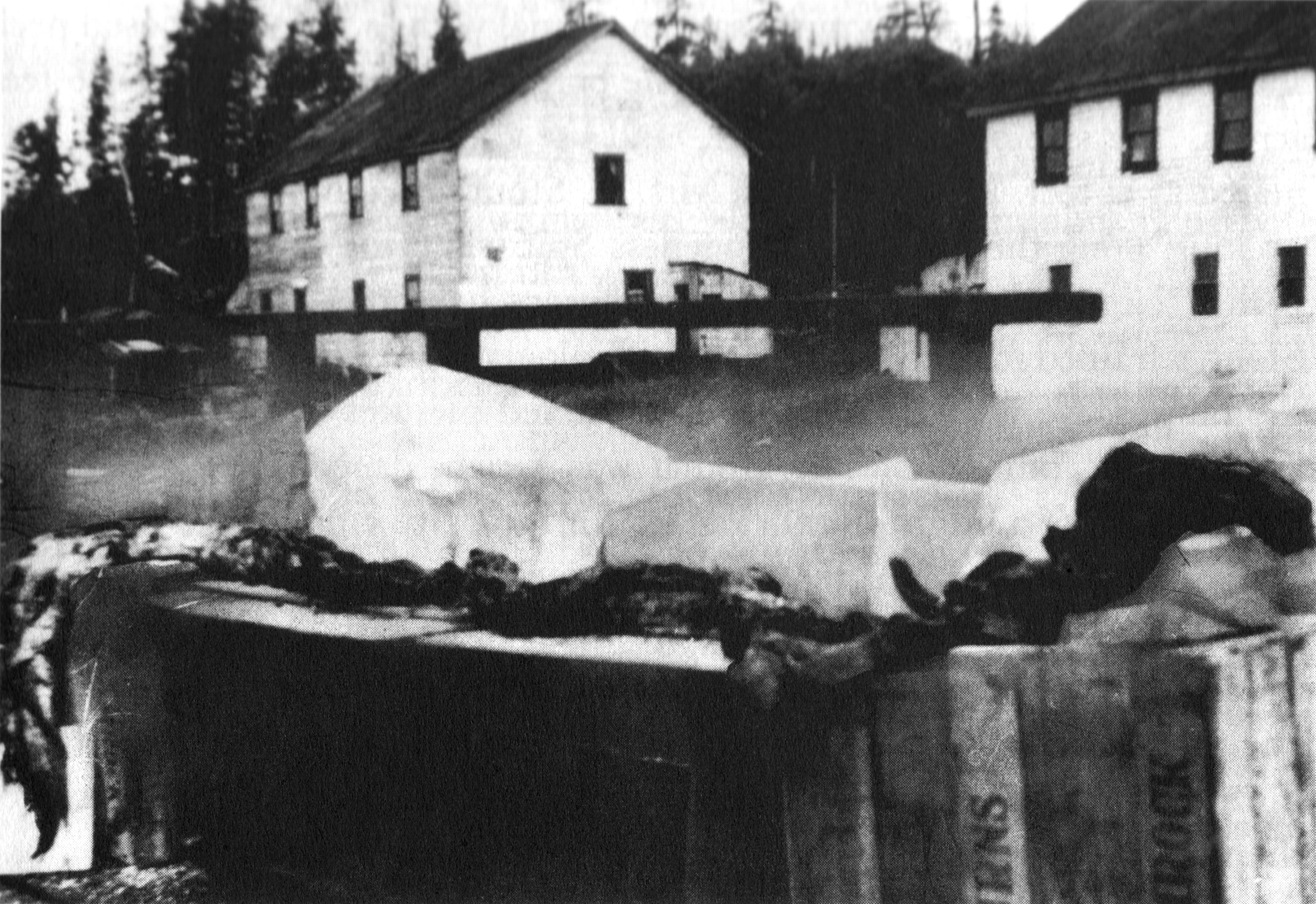
Cadboro Bay is a bay near the southern tip of Vancouver Island and its adjacent neighbourhood in the municipalities of Saanich and Oak Bay in Greater Victoria, British Columbia, Canada. Cadboro Bay was the site of Sungayka, a village of the Songhees Nation for some 8,000 years prior to the relocation of its people to Victoria's Inner Harbour in the mid 1800s. The land between Gyro Park and Telegraph Bay is included in a Douglas Treaty that is now before the courts. Cadboro Bay takes its name from the first European vessel to enter the bay, the Hudson's Bay Company schooner . During the 1862 Pacific Northwest smallpox epidemic, which started in Victoria, thousands of indigenous people living in and around Victoria were evicted by force as smallpox spread among them. Hundreds of Haida fled one native encampment and set up another on the shore of Cadboro Bay. In May 1862 the Victoria Police Commissioner Augustus Pemberton took a police force and two recently arrived gunboats, HMS ... [...More Info...] [...Related Items...] OR: [Wikipedia] [Google] [Baidu] |
Haida Gwaii
Haida Gwaii (; hai, X̱aaydag̱a Gwaay.yaay / , literally "Islands of the Haida people") is an archipelago located between off the northern Pacific coast of Canada. The islands are separated from the mainland to the east by the shallow Hecate Strait. Queen Charlotte Sound lies to the south, with Vancouver Island beyond. To the north, the disputed Dixon Entrance separates Haida Gwaii from the Alexander Archipelago in the U.S. state of Alaska. Haida Gwaii consists of two main islands: Graham Island () in the north and Moresby Island (, literally: south people island half, or "Islands of Beauty") in the south, along with approximately 400 smaller islands with a total landmass of . Other major islands include Anthony Island ( / ), Burnaby Island (), Lyell Island, Louise Island, Alder Island ( / ), and Kunghit Island. (For a fuller, but still incomplete, list see List of islands of British Columbia.) Part of the Canadian province of British Columbia, the islands were known f ... [...More Info...] [...Related Items...] OR: [Wikipedia] [Google] [Baidu] |
Cadborosaurus Willsi
''Cadborosaurus'', nicknamed Caddy by journalist Archie Wills, is a sea serpent in the folklore of regions of the Pacific Coast of North America. Its name is derived from Cadboro Bay in Greater Victoria, British Columbia, and the Greek root word "''saurus''" meaning lizard or reptile. Description ''Cadborosaurus willsi'' is said by witnesses to resemble a serpent with vertical coils or humps in tandem behind the horse-like head and long neck, with a pair of small elevating front flippers, and either a pair of hind flippers, or a pair of large webbed hind flippers fused to form a large fan-like tail region that provides forward propulsion.Bousfield, Edward L. & Leblond Paul H. (2000). ''Cadborosaurus: Survivor from the Deep''. Heritage House Publishing. Dr. Paul LeBlond, director of Earth and Ocean Sciences at UBC, and Dr. Edward Blousfield, retired chief zoologist of the Canadian Museum of Nature, state every elongated animal has been put forward as an explanation for Caddy. Thes ... [...More Info...] [...Related Items...] OR: [Wikipedia] [Google] [Baidu] |
Cryptid
Cryptids are animals that cryptozoologists believe may exist somewhere in the wild, but are not believed to exist by mainstream science. Cryptozoology is a pseudoscience, which primarily looks at anecdotal stories, and other claims rejected by the scientific community. While biologists regularly identify new species following established scientific methodology, cryptozoologists focus on entities mentioned in the folklore record and rumor. Entities that may be considered cryptids by cryptozoologists include Bigfoot, Yeti, the chupacabra, the Jersey Devil, the Loch Ness Monster, and the Mokele-mbembe. Scholars have noted that the cryptozoology subculture rejected mainstream approaches from an early date, and that adherents often express hostility to mainstream science. Scholars have studied cryptozoologists and their influence (including the pseudoscience's association with Young Earth creationism), noted parallels in cryptozoology and other pseudosciences such as ghost hunting ... [...More Info...] [...Related Items...] OR: [Wikipedia] [Google] [Baidu] |
Cadborosaurus
''Cadborosaurus'', nicknamed Caddy by journalist Archie Wills, is a sea serpent in the folklore of regions of the Pacific Coast of North America. Its name is derived from Cadboro Bay in Greater Victoria, British Columbia, and the Greek root word "''saurus''" meaning lizard or reptile. Description ''Cadborosaurus willsi'' is said by witnesses to resemble a serpent with vertical coils or humps in tandem behind the horse-like head and long neck, with a pair of small elevating front flippers, and either a pair of hind flippers, or a pair of large webbed hind flippers fused to form a large fan-like tail region that provides forward propulsion.Bousfield, Edward L. & Leblond Paul H. (2000). ''Cadborosaurus: Survivor from the Deep''. Heritage House Publishing. Dr. Paul LeBlond, director of Earth and Ocean Sciences at UBC, and Dr. Edward Blousfield, retired chief zoologist of the Canadian Museum of Nature, state every elongated animal has been put forward as an explanation for Caddy. ... [...More Info...] [...Related Items...] OR: [Wikipedia] [Google] [Baidu] |
Royal Victoria Yacht Club
The Royal Victoria Yacht Club is located along the shores of Cadboro Bay, British Columbia, Cadboro Bay in The Uplands, Greater Victoria, Uplands a neighborhood of Oak Bay, British Columbia, Oak Bay, adjacent to the city of Victoria, British Columbia, Victoria, British Columbia, Canada, and has facilities at Tseheum Harbour in Sidney, British Columbia, Sidney. History The Royal Victoria Yacht Club was formed on June 8, 1892, and moved in 1912 to its current location, at the location of the old Hudson's Bay Company cattle wharf. The Royal Victoria Yacht Club is the oldest yacht club in British Columbia. Through the years, the club has hosted a number of regattas and sailing races, including a racing program for young sailors References [...More Info...] [...Related Items...] OR: [Wikipedia] [Google] [Baidu] |
School District 61 Greater Victoria
School District 61 Greater Victoria is a school district in the Canadian province of British Columbia. This includes Victoria, the municipalities of Esquimalt, Oak Bay, View Royal, and parts of Saanich. History The earliest history of schools in Western Canada is within the boundary of the current Greater Victoria School district. The first school in the area that is present day British Columbia was established at Fort Victoria in the 1840s. A plaque to commemorate this can be found on the side of the Christmas Store on Government and Fort Street in downtown Victoria. The first public school was opened in 1853 near what is now Central Middle School. This building later became Victoria High School. When the area became part of the province of British Columbia there were already three school districts in the area: the Victoria City School District (established on June 25, 1869), the Esquimalt School District (October 22, 1870) and Craigflower School District (July 23, 1870). ... [...More Info...] [...Related Items...] OR: [Wikipedia] [Google] [Baidu] |
Ten Mile Point, British Columbia
Ten Mile Point is a neighbourhood in the District of Saanich in Victoria, British Columbia, and is the most easterly point on Vancouver Island. Ten Mile Point was so named because it was ten nautical miles () from what was at the time the headquarters of the Pacific Station of the Royal Navy (now CFB Esquimalt). Ten Mile Point is a wooded peninsula that forms one side of Cadboro Bay, the home of the Royal Victoria Yacht Club and the mythical Cadborosaurus sea monster. Cadboro Point is located on the east part of this peninsula. Prevost Hill was named after James Charles Prevost, British commissioner in the negotiations to settle the San Juan boundary dispute. Prevost Hill is the highest elevation on Ten Mile Point and is known informally in the neighbourhood as "Minnie Mountain". Prevost Hill is the location for a subdivision within Ten Mile Point called "Wedgewood Point" or "Wedgewood Estates". A small wooded island, "Flower Island", almost touches the southern shore of Ten Mile ... [...More Info...] [...Related Items...] OR: [Wikipedia] [Google] [Baidu] |
Uplands (Greater Victoria)
Uplands, Victoria (known locally as "the Uplands") is a neighbourhood located in the north east part of the District of Oak Bay, a suburb adjacent to Victoria, British Columbia, Canada, and situated between the neighbourhoods of Cadboro Bay and North Oak Bay. Uplands is a prominent example of a garden suburb designed in the early part of the 20th century. In 1907, the developers of Uplands, John A, Robert and Dawson Turner previously cattle and horse ranchers from Turner Valley Alberta and originally Scotland purchased the area for the sum of $275,000 and hired the leading landscape architect John Olmsted as the designer. Olmsted designed famous neighbourhoods and parks in North America. The Uplands of today is faithful to Olmsted's vision: an elegant neighbourhood with estate-sized lots, serpentine streets and the signature green, globed, ornate lamp posts. The houses are built to impress and the sprawling gardens are carefully manicured. For John Olmsted personally, of all h ... [...More Info...] [...Related Items...] OR: [Wikipedia] [Google] [Baidu] |
University Of Victoria
The University of Victoria (UVic or Victoria) is a public research university located in the municipalities of Oak Bay and Saanich, British Columbia, Canada. The university traces its roots to Victoria College, the first post-secondary institution established in the province of British Columbia in 1903. It was reincorporated as the University of Victoria in 1963. UVic hosts Ocean Networks Canada's deep-water seafloor research observatories VENUS and NEPTUNE, the Pacific Institute for Climate Solutions, and two Environment Canada labs: the Canadian Center for Climate Modelling and Analysis and the Water and Climate Impacts Research Centre. The Ocean Climate Building housed at the Queenswood location is dedicated solely to ocean and climate research. The Institute of Integrated Energy Systems is a leading center for research on sustainable energy solutions and alternative energy sources. The University of Victoria is also home to Canada's first and only Indigenous Law degree p ... [...More Info...] [...Related Items...] OR: [Wikipedia] [Google] [Baidu] |
Nanaimo
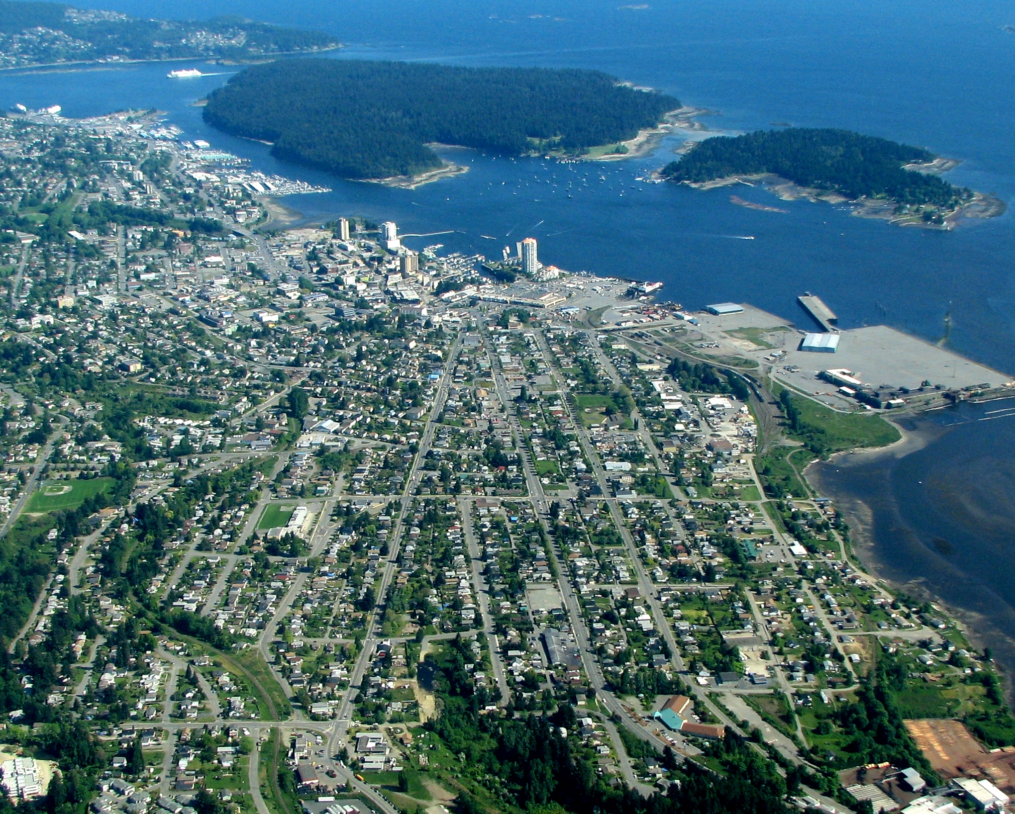
Nanaimo ( ) is a city on the east coast of Vancouver Island, in British Columbia, Canada. As of the Canada 2021 Census, 2021 census, it had a population of 99,863, and it is known as "The Harbour City." The city was previously known as the "Hub City," which was attributed to its original layout design, whose streets radiated from the shoreline like the spokes of a wagon wheel, and to its central location on Vancouver Island. Nanaimo is the headquarters of the Regional District of Nanaimo. Nanaimo is served by the coast-spanning Island Highway, the Island Rail Corridor, the BC Ferries system, and a local airport. History The Indigenous peoples of the area that is now known as Nanaimo are the Snuneymuxw. An anglicised spelling and pronunciation of that word gave the city its current name. The first Europeans known to reach Nanaimo Harbour were members of the 1791 Spanish voyage of Juan Carrasco (explorer), Juan Carrasco, under the command of Francisco de Eliza. They gave it ... [...More Info...] [...Related Items...] OR: [Wikipedia] [Google] [Baidu] |


