|
West Auckland, New Zealand
West Auckland ( mi, Te Uru o Tāmaki Makaurau) is one of the major geographical areas of Auckland, the largest city in New Zealand. Much of the area is dominated by the Waitākere Ranges, the eastern slopes of the Miocene era Waitākere volcano which was upraised from the ocean floor, and one of the largest regional parks in New Zealand. The metropolitan area of West Auckland developed on the lands between the Waitākere Ranges to the west and the upper reaches of the Waitematā Harbour to the east, in areas such as Massey, Henderson, New Lynn and Glen Eden. The area is within the rohe of Te Kawerau ā Maki, whose traditional names for the area were Hikurangi, Waitākere, and Te Wao Nui a Tiriwa, the latter of which refers to the forest of the greater Waitākere Ranges area. Most settlements and pā were centred around the west coast beaches and the Waitākere River valley. Two of the major waka portages are found in the area: the Te Tōanga Waka (the Whau River portage), an ... [...More Info...] [...Related Items...] OR: [Wikipedia] [Google] [Baidu] |
Planet Labs
Planet Labs PBC (formerly Planet Labs, Inc. and Cosmogia, Inc.) is an American public Earth imaging company based in San Francisco, California. Their goal is to image the entirety of the Earth daily to monitor changes and pinpoint trends. The company designs and manufactures Triple-CubeSat miniature satellites called Doves that are then delivered into orbit as secondary payloads on other rocket launch missions. Each ''Dove'' is equipped with a high-powered telescope and camera programmed to capture different swaths of Earth. Each ''Dove'' Earth observation satellite continuously scans Earth, sending data once it passes over a ground station, by means of a frame image sensor. The images gathered by ''Doves'', which can be accessed online and some of which is available under an open data access policy, provide up-to-date information relevant to climate monitoring, crop yield prediction, urban planning, and disaster response. With acquisition of BlackBridge in July 2015, Planet La ... [...More Info...] [...Related Items...] OR: [Wikipedia] [Google] [Baidu] |
Glen Eden, New Zealand
Glen Eden is a suburb of West Auckland, New Zealand, located at the foothills of Waitākere Ranges. Originally known as Waikumete, the suburb gained the name Glen Eden in 1921. The suburb is in the Waitākere Ward, one of the thirteen administrative areas of Auckland governed by Auckland Council. Originally part of the rohe of Te Kawerau ā Maki, the area developed into orchards during the Colonial era of New Zealand. The Glen Eden railway station opened in 1880, linking the area to central Auckland along the Western Line, and leading to the development of the Waikumete Cemetery. Suburban housing was built in the area in the 1950s and 1960s. Geography The Glen Eden area is located at the foothills of Waitākere Ranges, north of Titirangi. The Waikumete Stream flows north from Titirangi, forming a valley in the centre of the suburb. Glen Eden forms a part of the Waitematā-Waitākere foothills ecological zone. Sheltered from the Tasman Sea by the Waitākere Ranges, the are ... [...More Info...] [...Related Items...] OR: [Wikipedia] [Google] [Baidu] |
North Auckland Line
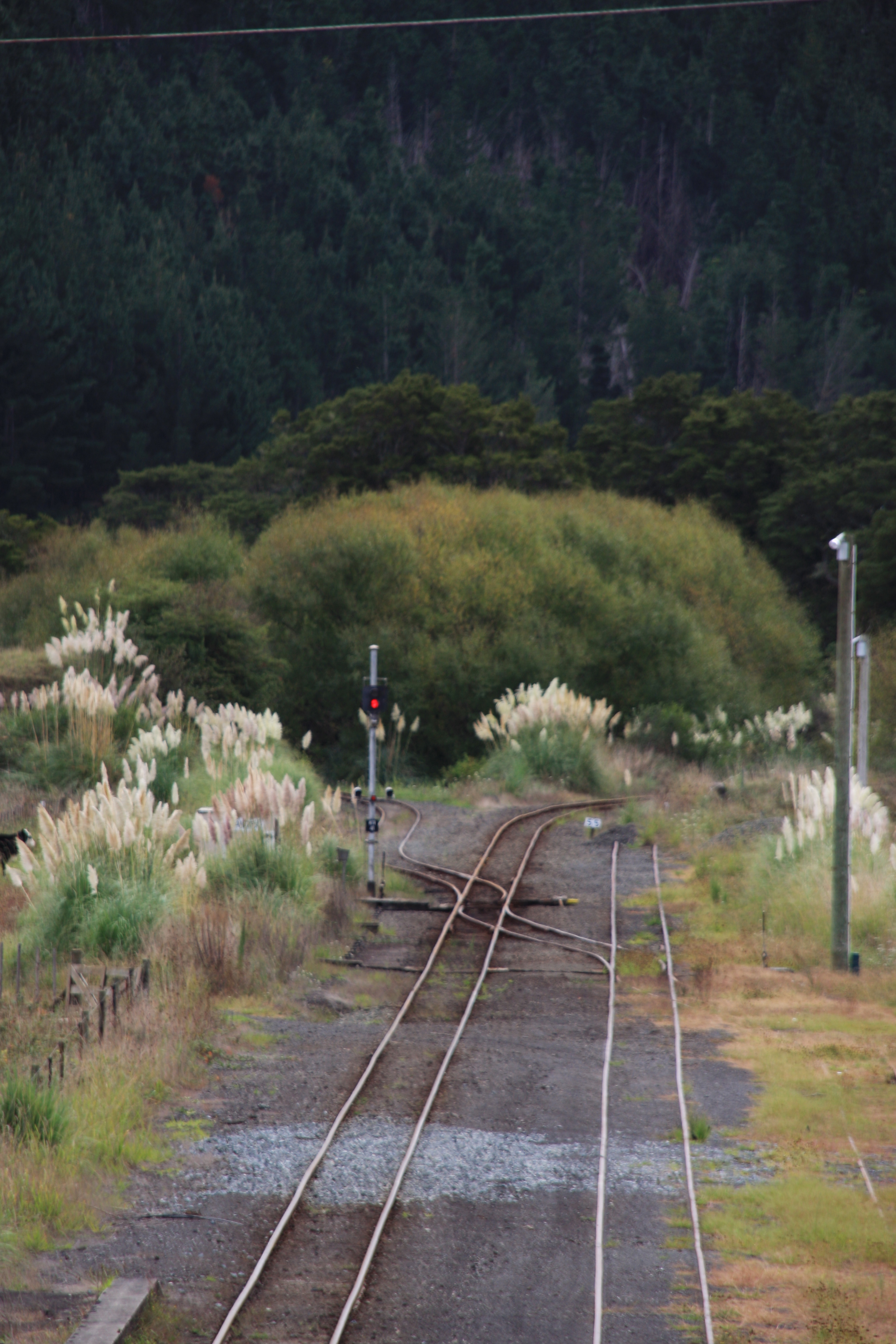
The North Auckland Line (designation NAL) is a major section of New Zealand's national rail network, and is made up of the following parts: the portion of track that runs northward from Westfield Junction to Newmarket Station; from there, westward to Waitakere; from there, northward to Otiria via Whangārei. The first section was opened in 1868 and the line was completed in 1925. The line, or sections of it, have been known at various times as the Kaipara Line, the Waikato-Kaipara Line, the Kaipara Branch and the North Auckland Main Trunk. North Auckland Line is a designation for the section of track, not a service route. The southernmost portion from Westfield Junction to Newmarket was originally built as part of the North Island Main Trunk railway, with Newmarket serving as the junction of the two lines. The North Island Main Trunk was re-routed in 1930 via the Westfield Deviation through Glen Innes and Panmure. Westfield-Newmarket was then incorporated into the North Auckl ... [...More Info...] [...Related Items...] OR: [Wikipedia] [Google] [Baidu] |
Auckland Isthmus
The Auckland isthmus, also known as the Tāmaki isthmus, is a narrow stretch of land on the North Island of New Zealand in the Auckland Region, and the location of the central suburbs of the city of Auckland, including the CBD. The isthmus is located between two rias (drowned river valleys), the Waitematā Harbour to the north, which opens to the Hauraki Gulf / Tīkapa Moana and Pacific Ocean, and the Manukau Harbour to the south, which opens to the Tasman Sea. The isthmus is the most southern section of the Northland Peninsula. The Auckland isthmus is bound on the eastern side by the Tāmaki River and by the Whau River on the west; two tidal estuaries of the Waitematā Harbour. These were used as portages by early Māori migration canoes and Tāmaki Māori to cross the isthmus (the Tāmaki River crossing known as Te Tō Waka, and the Whau River as Te Tōangawaka). Through early European settler history, canals were variously considered at either portage, however by the 191 ... [...More Info...] [...Related Items...] OR: [Wikipedia] [Google] [Baidu] |
Kauri Gum
Kauri gum is resin from kauri trees (''Agathis australis''), which historically had several important industrial uses. It can also be used to make crafts such as jewellery. Kauri forests once covered much of the North Island of New Zealand, before the arrival of people caused deforestation, causing several areas to revert to sand dunes, scrubs, and swamps. Even afterwards, ancient kauri fields continued to provide a source for the gum and the remaining forests.Hayward, pp 4–5 Kauri gum forms when resin from kauri trees leaks out through fractures or cracks in the bark, hardening with the exposure to air. Lumps commonly fall to the ground and can be covered with soil and forest litter, eventually fossilising. Other lumps form as branches forked or trees are damaged, releasing the resin.Hayward, p 2 Uses The Māori had many uses for the gum, which they called ''kapia''. Fresh gum was used as a type of chewing gum (older gum was softened by soaking and mixing with juice of ... [...More Info...] [...Related Items...] OR: [Wikipedia] [Google] [Baidu] |
Agathis Australis
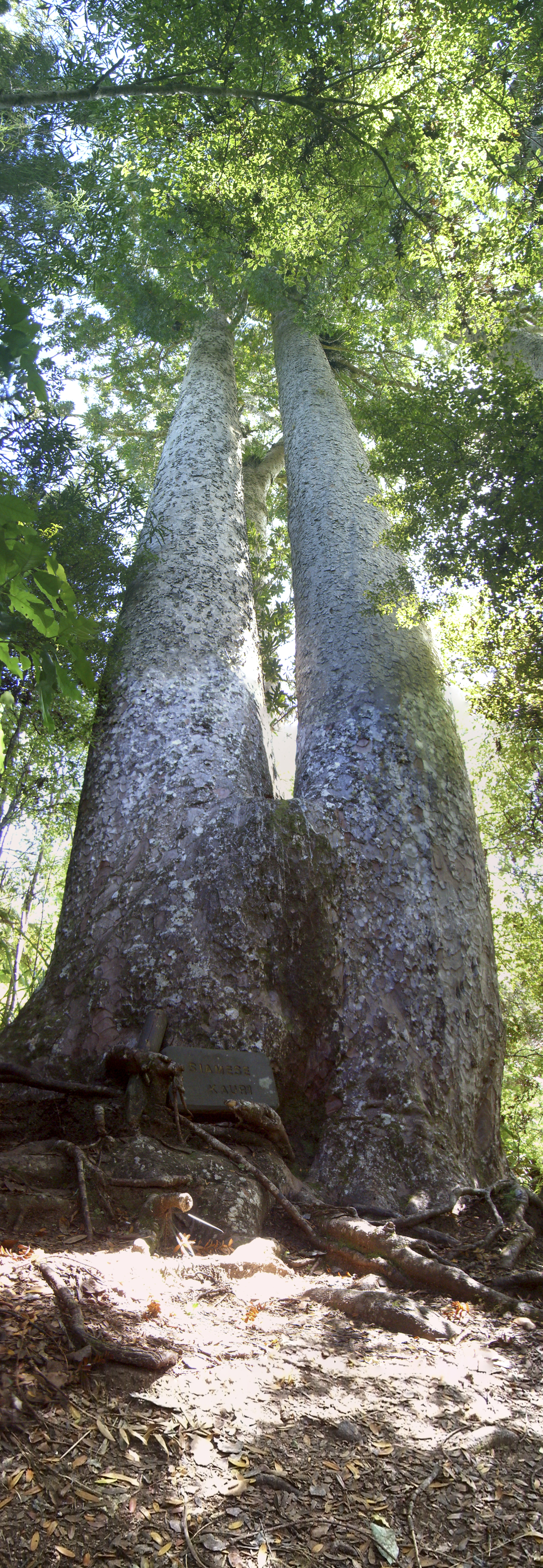
''Agathis australis'', commonly known by its Māori name kauri (), is a coniferous tree in the family ''Araucariaceae'', found north of 38°S in the northern regions of New Zealand's North Island. It is the largest (by volume) but not tallest species of tree in New Zealand, standing up to 50 m tall in the emergent layer above the forest's main canopy. The tree has smooth bark and small narrow leaves. Other common names to distinguish ''A. australis'' from other members of '' Agathis'' are southern kauri and New Zealand kauri. With its novel soil interaction and regeneration pattern it can compete with faster growing angiosperms. Because it is such a conspicuous species, forest containing kauri is generally known as kauri forest, although kauri need not be the most abundant tree. In the warmer northern climate, kauri forests have a higher species richness than those found further south. Kauri even act as a foundation species that modify the soil under their canopy to cre ... [...More Info...] [...Related Items...] OR: [Wikipedia] [Google] [Baidu] |
Kaipara Harbour
Kaipara Harbour is a large enclosed harbour estuary complex on the north western side of the North Island of New Zealand. The northern part of the harbour is administered by the Kaipara District and the southern part is administered by the Auckland Council. The local Māori tribe is Ngāti Whātua. By area, the Kaipara Harbour is one of the largest harbours in the world. It covers at high tide, with exposed as mudflats and sandflats at low tide.Heath, RA (1975) ''Stability of some New Zealand coastal inlets.'' New Zealand Journal of Marine and Freshwater Research, 9 (4):449-57. According to Māori tradition, the name Kaipara had its origins back in the 15th century when the Arawa chief, Kahumatamomoe, travelled to the Kaipara to visit his nephew at Pouto. At a feast, he was so impressed with the cooked root of the para fern, that he gave the name Kai-para to the district. ''Kaipara'' comes from the Māori meaning "food", and meaning "king fern". Geography The harbo ... [...More Info...] [...Related Items...] OR: [Wikipedia] [Google] [Baidu] |
Manukau Harbour
The Manukau Harbour is the second largest natural harbour in New Zealand by area. It is located to the southwest of the Auckland isthmus, and opens out into the Tasman Sea. Geography The harbour mouth is between the northern head ("Burnett Head" / "Ohaka Head") located at the southern end of the Waitākere Ranges and South Head at the end of the Āwhitu Peninsula reaching up from close to the mouth of the Waikato River. The mouth is only 1800 metres wide, but after a nine kilometre channel it opens up into a roughly square basin 20 kilometres in width. The harbour has a water surface area of 394 square kilometres. There is a tidal variation of up to 4 metres, a very substantial change, especially since the harbour, being silted up with almost 10 million years of sedimentation, is rather shallow itself.Manukau Ha ... [...More Info...] [...Related Items...] OR: [Wikipedia] [Google] [Baidu] |
Kumeū
Kumeū is an affluent rural town and suburb of Auckland situated 25 km north-west of the City Centre in New Zealand. State Highway 16 and the North Auckland Line pass through the town. Huapai lies to the west, Riverhead to the north, Whenuapai to the east, and Taupaki to the south. Governance Kumeū is part of the Local Government Rodney Ward of Auckland Council and is part of the Kumeu Subdivision of the Rodney Local Board. History The name Kumeū in Māori language originally referred to the north-east of Taupaki village, to the south of modern-day Kumeū. The name is associated with one of the earliest ancestors of the modern Te Kawerau ā Maki iwi, Te Kauea, who was of the early iwi Tini ō Toi (the people of Toi-te-huatahi). During the battle that preceded the peace accord, a wahine toa (woman warrior) pulled at her breast when calling her warriors to revenge an insult, giving rise to the name "Kume-ū" ("Pull Breast"). The traditional name for where the Kume� ... [...More Info...] [...Related Items...] OR: [Wikipedia] [Google] [Baidu] |
Whau River
The Whau River is an estuarial arm of the southwestern Waitemata Harbour (rather than a river) within the Auckland metropolitan area in New Zealand. It flows north for from its origin at the confluence of the Avondale Stream and Whau Stream to its mouth between the Te Atatū peninsula and the long, thin Rosebank, Auckland, Rosebank Peninsula in Avondale, Auckland, Avondale. It is at its widest and wide at its mouth. The estuary extends past the suburbs of Glendene, New Zealand, Glendene and Kelston, New Zealand, Kelston. It has one small estuarial tributary arm, the Wairau Creek in the southwest. The tide flows up the Wairau Creek as far as Sabulite Road in Kelston, and up the Rewarewa Creek to Clark Street and Wolverton Road in New Lynn, New Zealand, New Lynn. The area at the mouth of the estuary is legally protected as the Motu Manawa (Pollen Island) Marine Reserve. The Whau River is named after a native tree, the Entelea, whau (''Entelea arborescens''). Geography The g ... [...More Info...] [...Related Items...] OR: [Wikipedia] [Google] [Baidu] |
Portages Of New Zealand
Portages in New Zealand, known in Māori as Tō or Tōanga Waka, are locations where waka (canoes) could easily be transported overland. Portages were extremely important for early Māori, especially along the narrow Tāmaki isthmus of modern-day Auckland, as they served as crucial transportation and trade links between the east and west coasts. Portages can be found across New Zealand, especially in the narrow Northland and Auckland regions, and the rivers of the Waikato Region. A number of historic portages were considered for potential sites for canals during the colonial era and the early 1900s. Since the early 1990s, portage crossing events have been held on the Ōtāhuhu portage. Northland Region Mangapai portage The Mangapai portage connected the Kaipara Harbour in the west to the Whangārei Harbour in the east. The portage extended from the Wairoa River, overland through Tangiteroria to Maungakaramea, reaching the Whangārei Harbour along the Mangapai River. Bishop ... [...More Info...] [...Related Items...] OR: [Wikipedia] [Google] [Baidu] |
Waka (canoe)
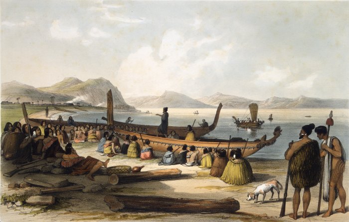
Waka () are Māori watercraft, usually canoes ranging in size from small, unornamented canoes (''waka tīwai'') used for fishing and river travel to large, decorated war canoes (''waka taua'') up to long. The earliest remains of a canoe in New Zealand were found near the Anaweka estuary in a remote part of the Tasman District and radiocarbon-dated to about 1400. The canoe was constructed in New Zealand, but was a sophisticated canoe, compatible with the style of other Polynesian voyaging canoes at that time. Since the 1970s about eight large double-hulled canoes of about 20 metres have been constructed for oceanic voyaging to other parts of the Pacific. They are made of a blend of modern and traditional materials, incorporating features from ancient Melanesia, as well as Polynesia. Waka taua (war canoes) ''Waka taua'' (in Māori, ''waka'' means "canoe" and ''taua'' means "army" or "war party") are large canoes manned by up to 80 paddlers and are up to in length. Large waka, ... [...More Info...] [...Related Items...] OR: [Wikipedia] [Google] [Baidu] |
.jpg)


.jpg)

.jpg)
