|
Stanley, County Durham
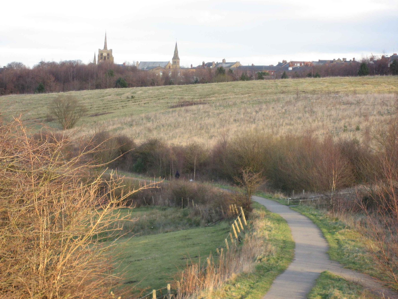
Stanley is a former colliery town and civil parish in County Durham, North East England. Centred on a hilltop between Chester-le-Street and Consett, the town lies south west of Gateshead. Stanley was formerly divided into three distinct settlements – the main town of West Stanley and the mining villages of East Stanley and South Stanley. Through a process of gradual expansion, these have become amalgamated into one town, with East and South Stanley no longer officially used as town names (although they are still recognised colloquially). The civil parish of Stanley was created in 2007 and takes in not only Stanley, but the villages of Annfield Plain, Tanfield, Craghead, Catchgate, Tantobie, Tanfield Lea, South Moor, White-le-Head, Bloemfontein, Clough Dene, Greencroft, Harelaw, Kip Hill, The Middles, New Kyo, No Place, Oxhill, Quaking Houses, Shield Row, and West Kyo. The current parish covers the vast majority of the former Stanley Urban District Council area, with the ... [...More Info...] [...Related Items...] OR: [Wikipedia] [Google] [Baidu] |
County Durham
County Durham ( ), officially simply Durham,UK General Acts 1997 c. 23Lieutenancies Act 1997 Schedule 1(3). From legislation.gov.uk, retrieved 6 April 2022. is a ceremonial county in North East England.North East Assembly �About North East England. Retrieved 30 November 2007. The ceremonial county spawned from the historic County Palatine of Durham in 1853. In 1996, the county gained part of the abolished ceremonial county of Cleveland.Lieutenancies Act 1997 . Retrieved 27 October 2014. The county town is the of |
Harelaw
Harelaw is a village in County Durham, in England England is a country that is part of the United Kingdom. It shares land borders with Wales to its west and Scotland to its north. The Irish Sea lies northwest and the Celtic Sea to the southwest. It is separated from continental Europe b .... It is situated to the north of Annfield Plain. References Villages in County Durham Stanley, County Durham {{Durham-geo-stub ... [...More Info...] [...Related Items...] OR: [Wikipedia] [Google] [Baidu] |
Old English
Old English (, ), or Anglo-Saxon, is the earliest recorded form of the English language, spoken in England and southern and eastern Scotland in the early Middle Ages. It was brought to Great Britain by Anglo-Saxon settlement of Britain, Anglo-Saxon settlers in the mid-5th century, and the first Old English literature, Old English literary works date from the mid-7th century. After the Norman conquest of 1066, English was replaced, for a time, by Anglo-Norman language, Anglo-Norman (a langues d'oïl, relative of French) as the language of the upper classes. This is regarded as marking the end of the Old English era, since during this period the English language was heavily influenced by Anglo-Norman, developing into a phase known now as Middle English in England and Early Scots in Scotland. Old English developed from a set of Anglo-Frisian languages, Anglo-Frisian or Ingvaeonic dialects originally spoken by Germanic peoples, Germanic tribes traditionally known as the Angles, Sa ... [...More Info...] [...Related Items...] OR: [Wikipedia] [Google] [Baidu] |
Roman Britain
Roman Britain was the period in classical antiquity when large parts of the island of Great Britain were under occupation by the Roman Empire. The occupation lasted from AD 43 to AD 410. During that time, the territory conquered was raised to the status of a Roman province. Julius Caesar invaded Britain in 55 and 54 BC as part of his Gallic Wars. According to Caesar, the Britons had been overrun or culturally assimilated by other Celtic tribes during the British Iron Age and had been aiding Caesar's enemies. He received tribute, installed the friendly king Mandubracius over the Trinovantes, and returned to Gaul. Planned invasions under Augustus were called off in 34, 27, and 25 BC. In 40 AD, Caligula assembled 200,000 men at the Channel on the continent, only to have them gather seashells ('' musculi'') according to Suetonius, perhaps as a symbolic gesture to proclaim Caligula's victory over the sea. Three years later, Claudius directed four legi ... [...More Info...] [...Related Items...] OR: [Wikipedia] [Google] [Baidu] |
Neolithic
The Neolithic period, or New Stone Age, is an Old World archaeological period and the final division of the Stone Age. It saw the Neolithic Revolution, a wide-ranging set of developments that appear to have arisen independently in several parts of the world. This "Neolithic package" included the introduction of farming, domestication of animals, and change from a hunter-gatherer lifestyle to one of settlement. It began about 12,000 years ago when farming appeared in the Epipalaeolithic Near East, and later in other parts of the world. The Neolithic lasted in the Near East until the transitional period of the Chalcolithic (Copper Age) from about 6,500 years ago (4500 BC), marked by the development of metallurgy, leading up to the Bronze Age and Iron Age. In other places the Neolithic followed the Mesolithic (Middle Stone Age) and then lasted until later. In Ancient Egypt, the Neolithic lasted until the Protodynastic period, 3150 BC.Karin Sowada and Peter Grave. Egypt in th ... [...More Info...] [...Related Items...] OR: [Wikipedia] [Google] [Baidu] |
Burnopfield
Burnopfield is a village in County Durham, in England. It is situated north of Stanley and Annfield Plain, close to the River Derwent and is 564 feet above sea level. There are around 4,553 inhabitants in Burnopfield. It is located 7 miles from Newcastle upon Tyne and 15 miles from Durham. Etymology The name ''Burnopfield'' probably comes from the Old English meaning "field by the valley stream", although local legend says that the village got its name after an attempted Scottish invasion of England was foiled by literally ''burning up the fields'' to stop the advancing armies. In the 19th century, Burnopfield was usually referred to as ''the Leap'', or in local dialect, as ''the Loup'', after the area of Burnopfield named ''Bryan's Leap''. History Burnopfield was the site of a leper hospital, High Friarside Hospice, which was founded in 1312, but was demolished in approximately 1450. The remains of the original chapel can still be seen today. Other historical buildings in Bur ... [...More Info...] [...Related Items...] OR: [Wikipedia] [Google] [Baidu] |
Dipton, County Durham
Dipton is a village located in County Durham, England. It is situated to the north-east of Consett, 3 miles south west of Burnopfield and a short distance to the north-west of Annfield Plain. The local village school is called Collierley Primary School. Very little housing development occurred in the 1980s, but new housing estates have been built in the village over the last 10 years, which in turn have sustained a younger generation of villagers. The Parish Church was dedicated to St John the Evangelist, but is now closed and is in the process of being converted into a house. It is close to the Pontop Pike Television Transmitter The Pontop Pike transmitting station is a facility for telecommunications and broadcasting situated on a 312-metre (1,024-ft) high hill of the same name between Stanley and Consett, County Durham, near the village of Dipton, England. The mas .... External linksUK TransmittersPontop PikeChurch [...More Info...] [...Related Items...] OR: [Wikipedia] [Google] [Baidu] |
West Kyo
West Kyo (also known locally as Old Kyo) is a small village in County Durham, England, United Kingdom. The name 'kyo' is derived from an old word for 'cow'. It is situated a very short distance to the north of Annfield Plain and to the east of Catchgate. Close by are East Kyo and to the north, Harperley. The nearest large town is Stanley. The skyline is dominated by the Pontop Pike Television Transmitter to the northwest. The main landmark of the village is the Earl Grey Inn public house, with an internal decor of wooden beams and whitewash walls. This pub is reputed to be haunted by a ghost called 'The Grey Lady', a former landlady who died in the 19th century. Another former landlord also placed five and ten pence pieces in gaps within the wooden beams during the 1990s, some of which are still being found to this day. The pub is known locally for a quiz night on Thursdays and karaoke on Saturdays. The village developed during former periods of heavy coal mining in the area du ... [...More Info...] [...Related Items...] OR: [Wikipedia] [Google] [Baidu] |
Shield Row
Shield Row is a village in County Durham, in England. It is situated immediately to the north of Stanley, County Durham, Stanley. To the north is Tanfield, Durham, Tanfield village. Pubs include: - - The Ball Alley - The Blue Bell Inn - The Board Inn - South Causey Hotel The sustrans C2C route runs through the village, crossing the roads by bridges, one of which was recently built for that purpose. The village has one primary school (shield Row primary School) External links Villages in County Durham Stanley, County Durham {{Durham-geo-stub ... [...More Info...] [...Related Items...] OR: [Wikipedia] [Google] [Baidu] |
Quaking Houses
Quaking Houses is a small village near to the town of Stanley in County Durham, in England. It may have been originally settled by Quakers, but during the Industrial Revolution it developed into a mining village with traditional terraced houses. The Quaker origin is supported by the 1873 name for a mine with two shafts at the village called Quaker House Pit. However, an alternative origin is suggested by the following; the 1865 OS Map shows a farm called Quaking House to the north at Anniefield Plain and a colliery railway line ran past this farm branching to the village mine. This colliery railway line was called the Quaking House Branch Line. A colloquial name for the village was "banana goat island" perhaps reflecting the livestock kept in the extensive allotments and grazing area around the village. Accessible by road only from the main South Moor Road, the village is dominated by one large road, with large strips of terraced housing on either side, both facing outwards. ... [...More Info...] [...Related Items...] OR: [Wikipedia] [Google] [Baidu] |
Oxhill, County Durham
Oxhill is a small village in County Durham, in England. It is located to the west of Stanley, on the bottom of the hill which leads up to New Kyo and Annfield Plain to it's east. Down the hill to the north are the C2C cycle path, East Kyo and Harperley. Oxhill contains very little: a few households, a pub called The Ox (frequented by locals and occasional cyclists from the neaby C2C cycle path taking lunch - the pub used to be known for weekend live music as well as food) and the main nursery school for the Stanley area. Opposite the ''Ox Inn'' to the south west is the former ''Oxhill Chapel''. This has now been converted to a private house. Oxhill used to be the site of a major level crossing, allowing access from the former nearby Stanhope and Tyne Railway line (this is now the basis of the eastern section of the ''C2C'' cycle path) to a shunting yard adjacent to nearby South Moor, where coal was loaded for transport to the River Tyne for export. A small pond calle ... [...More Info...] [...Related Items...] OR: [Wikipedia] [Google] [Baidu] |
No Place
No Place is a small village near the town of Stanley in County Durham, England, east of Stanley and west of Beamish. Situated to the south of the A693, it is home to an award-winning real ale pub, the Beamish Mary Inn (dating from 1897 and originally known as the Red Robin), and lies near the Beamish Mary coal pit.No Place to Go – '''', January 25, 1954 The local church is known as the "Tin Chapel".No Place finds its way into a history book '' |


