|
Seacroft
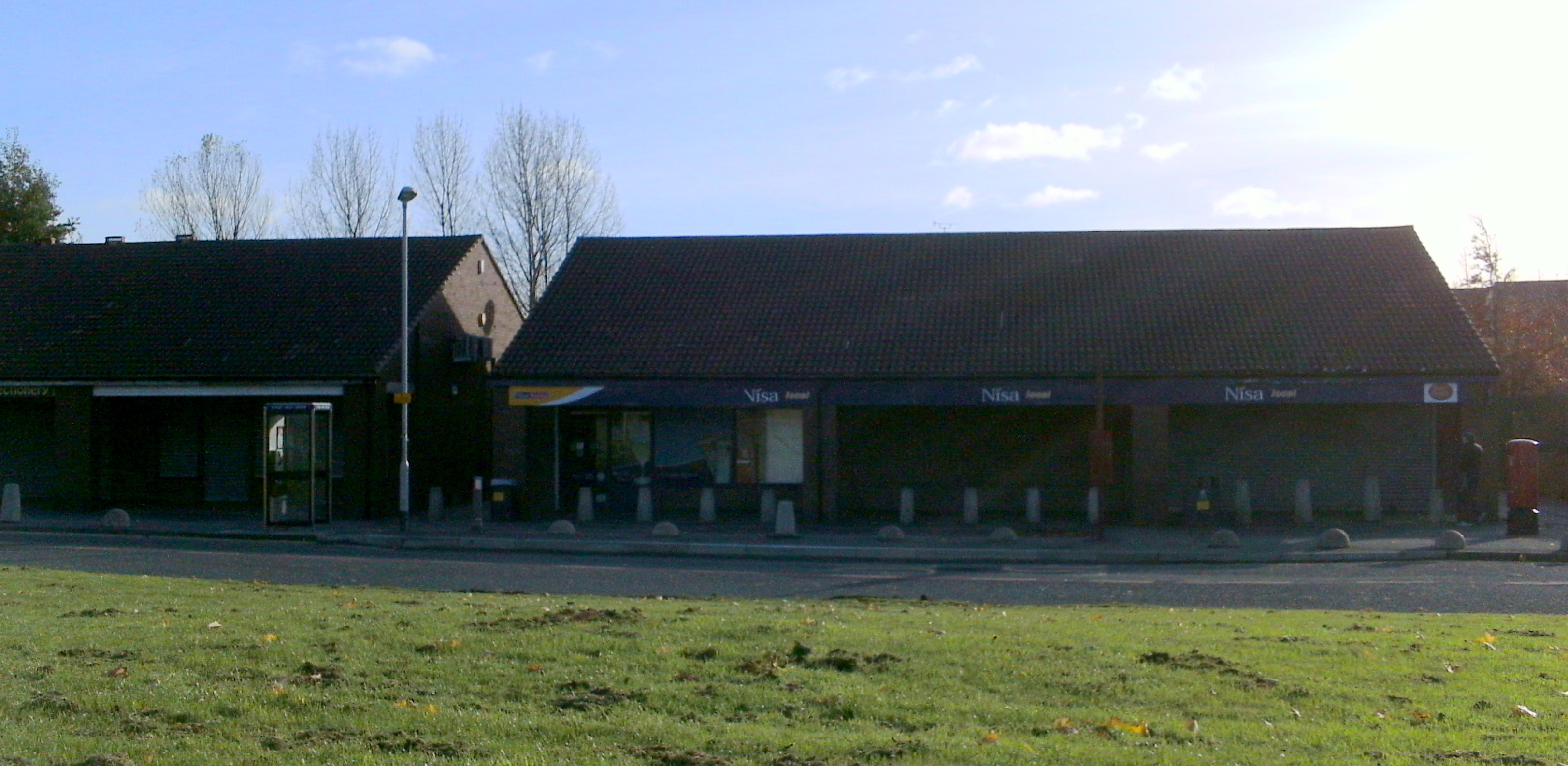
Seacroft is an outer-city suburb/township consisting mainly of council estate housing covering an extensive area of east Leeds, West Yorkshire, England. It lies in the LS14 LS postcode area, Leeds postcode area, around east of Leeds city centre. It sits in the Killingbeck and Seacroft (ward), Killingbeck & Seacroft ward of Leeds City Council and Leeds East (UK Parliament constituency), Leeds East United Kingdom Parliament constituencies, parliamentary constituency. The population of the corresponding Leeds City Ward was nearly 18,000 in 2001Office for National Statistics 2001 census for Seacroft ward 17,725 on 29 April 2001 and fell to 14,426 in 2011. The name is often used as a catch-all for Seacroft and the neighbouring areas of Whinmoor and Swarcliffe, other large east Leeds council estates which merge into each ot ... [...More Info...] [...Related Items...] OR: [Wikipedia] [Google] [Baidu] |
Seacroft Grange 11 Sep 2017
Seacroft is an outer-city suburb/township consisting mainly of council estate housing covering an extensive area of east Leeds, West Yorkshire, England. It lies in the LS14 Leeds postcode area, around east of Leeds city centre. It sits in the Killingbeck & Seacroft ward of Leeds City Council and Leeds East parliamentary constituency. The population of the corresponding Leeds City Ward was nearly 18,000 in 2001Office for National Statistics 2001 census for Seacroft ward 17,725 on 29 April 2001 and fell to 14,426 in 2011. The name is often used as a catch-all for Seacroft and the neighbouring areas of and |
Swarcliffe
Swarcliffe, originally the Swarcliffe Estate, is a district of Leeds, West Yorkshire, England. It is east of Leeds city centre, and within the LS14 and LS15 Leeds postcode area. The district falls within the Cross Gates and Whinmoor ward of the Leeds Metropolitan Council. In the 1950s, the Swarcliffe housing estate was developed, by the County Borough of Leeds, including semi detached council houses, three-storey blocks containing flats, and three brick-built, nine-storey blocks of flats. Two of these were demolished in the 1990s, and the third in 2007. A private finance initiative redevelopment of Swarcliffe began in 2006. From 1955 to 1992, the MP for Leeds East constituency, including Swarcliffe, was Denis Healey. In 2009, over 91% of the population in Swarcliffe were "hard-pressed". History The Battle of the Winwaed, between the army of the Christian king Oswiu of Bernicia and the pagan army of King Penda of Mercia, took place in 655 AD, according to Bede, altho ... [...More Info...] [...Related Items...] OR: [Wikipedia] [Google] [Baidu] |
Killingbeck And Seacroft (ward)
Killingbeck and Seacroft is an electoral ward of Leeds City Council in east Leeds, West Yorkshire, covering both of the outer city suburb areas of Killingbeck and Seacroft and the north west part of Cross Gates. Councillors since 1973 indicates seat up for re-election. indicates seat up for election following resignation or death of sitting councillor. indicates councillor defection. ''*'' indicates incumbent councillor. Elections since 2010 May 2024 May 2023 May 2022 May 2021 May 2019 May 2018 May 2016 May 2015 May 2014 May 2012 May 2011 May 2010 See also *Listed buildings in Seacroft and Killingbeck Notes References {{reflist Wards of Leeds ... [...More Info...] [...Related Items...] OR: [Wikipedia] [Google] [Baidu] |
Whinmoor
Whinmoor is a residential area of east Leeds, West Yorkshire, England. It is 5 miles (8 km) to the north-east of the city centre and adjacent to Swarcliffe and Seacroft in the LS14 Leeds postcode area. Historically, the area was within the Tadcaster Rural District until 1974. It is today situated in the Leeds City Council ward of Cross Gates and Whinmoor and Leeds East parliamentary constituency. History In November 655 AD (or perhaps in 654, according to one interpretation of the chronology), the Battle of the Winwaed took place around the Whinmoor/ Cock Beck/Swarcliffe area, with the Christian King Oswiu of Bernicia's army defeating the pagan army of King Penda of Mercia, although historians admit that few details are available. A road to the south of Whinmoor was later named Penda's Way. In addition, during the First English Civil War, the Battle of Seacroft Moor, 30 March 1643, was fought over the two moors of Winn Moor and Bramham Moor, ne ... [...More Info...] [...Related Items...] OR: [Wikipedia] [Google] [Baidu] |
Cross Gates
Cross Gates (often spelled Crossgates) is a suburb in east Leeds, West Yorkshire, England. The area sits between Seacroft and Swarcliffe to the north, Whitkirk and Colton to the south, Killingbeck to the west and Austhorpe to the south east. Manston and Pendas Fields are also generally regarded as part of Cross Gates. It serves as an important transport hub for the nearby large housing estates of Seacroft, Whinmoor and Gipton. At the 2011 census, Cross Gates had a population of 7,770, situated in the Cross Gates & Whinmoor ward of Leeds City Council with a population of 22,099. Location The suburb is to the east of Leeds city centre and lies in the LS15 Leeds postcode area. Etymology According to the English Place-Name Society, the name ''Cross Gates'' is first reliably attested in 1771 and is therefore unlikely to be an old name. (A 1457 list of the assets of one Sir John Darcey mentions a "cross gate" near Whitkirk: 'unde mete eiusdem ville oltonincipiun ... [...More Info...] [...Related Items...] OR: [Wikipedia] [Google] [Baidu] |
Leeds East (UK Parliament Constituency)
Leeds East is a Constituencies of the Parliament of the United Kingdom, constituency represented in the House of Commons of the United Kingdom, House of Commons of the Parliament of the United Kingdom, UK Parliament since 2015 by Richard Burgon of the Labour Party (UK), Labour Party. The constituency was represented by Denis Healey from 1955 to 1992. Healey served as Defence Secretary from 1964 to 1970, and Chancellor of the Exchequer from 1974 to 1979 and latterly as Deputy Leader of the Labour Party (UK), Deputy Leader of the Labour Party. Constituency profile This seat includes the areas of Leeds around York Road and Temple Newsam, including several large council estates. The seat is ethnically mixed and residents are poorer than the UK average. History The constituency was created in 1885 by the Redistribution of Seats Act 1885, and was first used in the 1885 United Kingdom general election, general election of that year. Leeds (UK Parliament constituency), Leeds had previ ... [...More Info...] [...Related Items...] OR: [Wikipedia] [Google] [Baidu] |
Council Estate
Public housing in the United Kingdom, also known as council housing or social housing, provided the majority of rented accommodation until 2011, when the number of households in private rental housing surpassed the number in social housing. Dwellings built for public housing, public or social housing use are built by or for Municipality, local authorities and known as council houses. Since the 1980s, non-profit housing associations (HA) became more important and subsequently the term "social housing" became widely used — as technically, council housing only refers to properties owned by a local authority — as this embraces both council and HA properties, though the terms are largely used interchangeably. Before 1865, housing for the poor was provided solely by the private sector. Council houses were then built on council estates — known as schemes in Scotland — where other amenities, like schools and shops, were often also provided. From the 1950s, alongside large deve ... [...More Info...] [...Related Items...] OR: [Wikipedia] [Google] [Baidu] |
Leeds
Leeds is a city in West Yorkshire, England. It is the largest settlement in Yorkshire and the administrative centre of the City of Leeds Metropolitan Borough, which is the second most populous district in the United Kingdom. It is built around the River Aire and is in the eastern foothills of the Pennines. The city was a small manorial borough in the 13th century and a market town in the 16th century. It expanded by becoming a major production and trading centre (mainly with wool) in the 17th and 18th centuries. Leeds developed as a mill town during the Industrial Revolution alongside other surrounding villages and towns in the West Riding of Yorkshire. It was also known for its flax industry, iron foundries, engineering and printing, as well as shopping, with several surviving Victorian era arcades, such as Kirkgate Market. City status was awarded in 1893, and a populous urban centre formed in the following century which absorbed surrounding villages and overtook t ... [...More Info...] [...Related Items...] OR: [Wikipedia] [Google] [Baidu] |
Leeds City Council
Leeds City Council is the local authority of the City of Leeds in West Yorkshire, England. Leeds has had a council since 1626, which has been reformed on numerous occasions. Since 1974 it has been a metropolitan borough council. It provides the majority of local government services in the city. It is the second most populous local government district in the United Kingdom with approximately 800,000 inhabitants living within its area; only Birmingham City Council has more. Since 1 April 2014, it has been a constituent council of the West Yorkshire Combined Authority. The council has been under Labour majority control since 2011. It meets at Leeds Civic Hall and has its main offices at Merrion House. History Leeds Corporation Leeds (historically often spelt Leedes) was a manor and then a town, receiving a charter from King Charles I as a 'Free Borough' in 1626 giving it powers of self-government, leading to the formation of the Leeds Corporation to administer it.Steven B ... [...More Info...] [...Related Items...] OR: [Wikipedia] [Google] [Baidu] |
Leeds City Centre
Leeds city centre is the central business district of Leeds, West Yorkshire, England. It is roughly bounded by the Leeds Inner Ring Road, Inner Ring Road to the north and the River Aire to the south and can be divided into several quarters. Areas Under the Headrow The old town is considered the retail core of Leeds, it extends south from buildings on either side of The Headrow to the River Aire. Kirkgate, Leeds, Kirkgate and Briggate are the oldest streets in Leeds, from which the city grew from. Briggate, Leeds, Briggate is home to several chain food and shopping chains, was fully pedestrianised in 1996 and connected the two previously pedestrian areas either side of it. The old town can be further subdivided into several areas: the city square; the Victorian arcades (such as the Grand Arcade (Leeds), Grand Arcade, Thornton's Arcade and the County Arcade); department stores and indoor shopping centres of The Headrow (such as The Light (Leeds), The Light and St John's Cent ... [...More Info...] [...Related Items...] OR: [Wikipedia] [Google] [Baidu] |
Prefabricated Housing
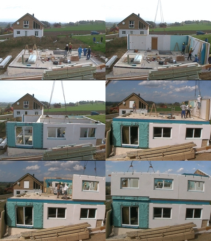
Prefabricated homes, often referred to as prefab homes or simply prefabs, are specialist dwelling types of prefabricated building, which are manufactured off-site in advance, usually in standard sections that can be easily shipped and assembled. Some current prefab home designs include architectural details inspired by postmodernism or futurist architecture. "Prefabricated" may refer to buildings built in components (e.g. panels), modules ( modular homes) or transportable sections ( manufactured homes), and may also be used to refer to mobile homes, i.e., houses on wheels. Although similar, the methods and design of the three vary widely. There are two-level home plans, as well as custom home plans. There are considerable differences in the construction types. In the U.S., mobile and manufactured houses are constructed in accordance with HUD building codes, while modular houses are constructed in accordance with the IRC (International Residential Code). *Modular homes are cre ... [...More Info...] [...Related Items...] OR: [Wikipedia] [Google] [Baidu] |


