|
Poverty Point Culture
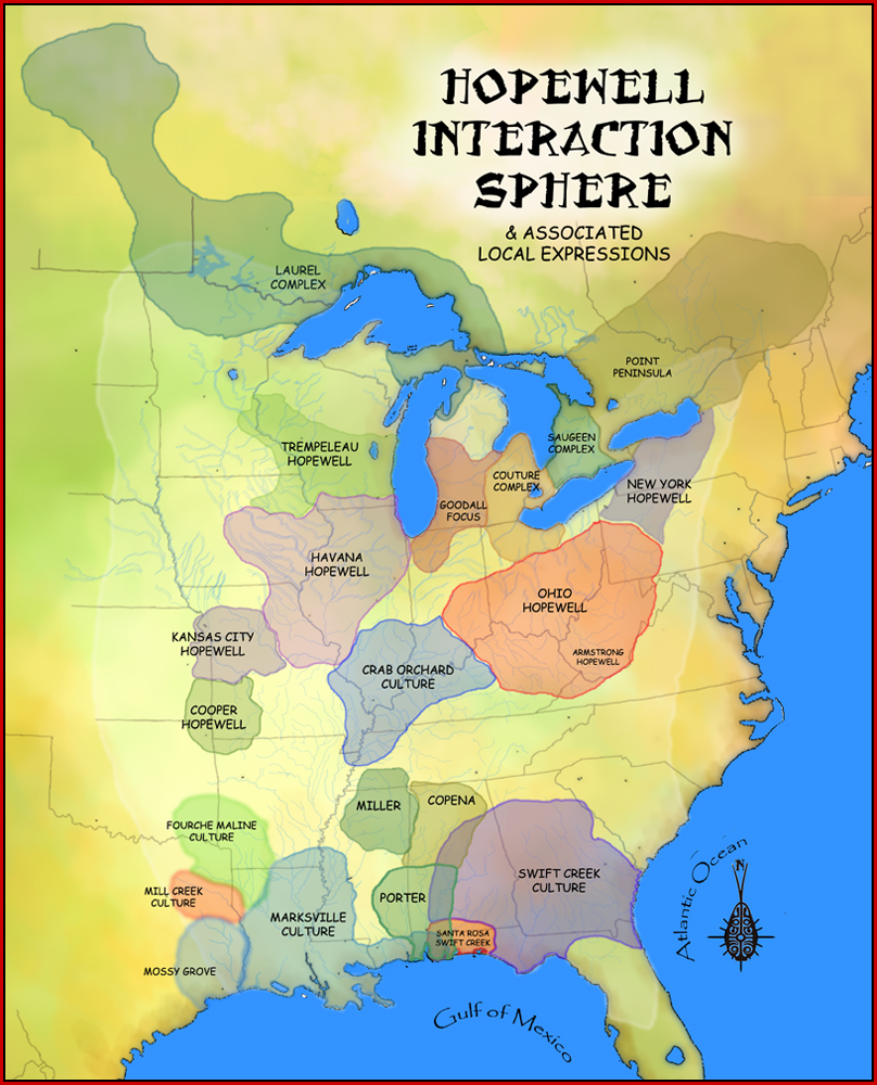
The Poverty Point culture is the archaeological culture of a prehistoric indigenous peoples who inhabited a portion of North America's lower Mississippi Valley and surrounding Gulf coast from about 1730 – 1350 BC. Archeologists have identified more than 100 sites belonging to this mound-builder culture, who also formed a large trading network throughout much of the eastern part of what is now the United States. History Preceding the Poverty Point Culture is the Watson Brake site in present-day Ouachita Parish, Louisiana, where eleven earthwork mounds were built beginning about 3500 BC. Watson Brake is one of the earliest mound complexes in the Americas. Next oldest is the Poverty Point Culture, which thrived from 1730 - 1350 BC, during the late Archaic period in North America. Evidence of this mound builder culture has been found at more than 100 sites, including the Jaketown Site near Belzoni, Mississippi. The largest and best-known site is at Poverty Point, located on ... [...More Info...] [...Related Items...] OR: [Wikipedia] [Google] [Baidu] |
Woodland Period
In the classification of :category:Archaeological cultures of North America, archaeological cultures of North America, the Woodland period of North American pre-Columbian cultures spanned a period from roughly 1000 Common Era, BCE to European contact in the eastern part of North America, with some archaeologists distinguishing the Mississippian period, from 1000 CE to European contact as a separate period. The term "Woodland Period" was introduced in the 1930s as a generic term for prehistoric, prehistoric sites falling between the Archaic period in the Americas, Archaic hunter-gatherers and the agriculturalist Mississippian cultures. The Eastern Woodlands cultural region covers what is now eastern Canada south of the Subarctic region, the Eastern United States, along to the Gulf of Mexico. This period is variously considered a developmental stage, a time period, a suite of technological adaptations or "traits", and a "family tree" of cultures related to earlier Archaic cultures. ... [...More Info...] [...Related Items...] OR: [Wikipedia] [Google] [Baidu] |
Hot Springs, Arkansas
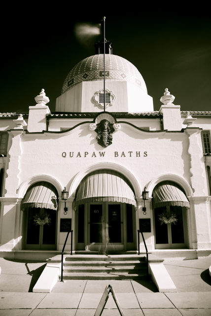
Hot Springs is a resort city in the state of Arkansas and the county seat of Garland County. The city is located in the Ouachita Mountains among the U.S. Interior Highlands, and is set among several natural hot springs for which the city is named. As of the 2020 United States Census, the city had a population of 37,930. The center of Hot Springs is the oldest federal reserve in the United States, today preserved as Hot Springs National Park. The hot spring water has been popularly believed for centuries to possess healing properties, and was a subject of legend among several Native American tribes. Following federal protection in 1832, the city developed into a successful spa town. Incorporated January 10, 1851, the city has been home to Major League Baseball spring training, illegal gambling, speakeasies and gangsters such as Al Capone, horse racing at Oaklawn Park, the Army and Navy Hospital, and 42nd President Bill Clinton. One of the largest Pentecostal denominations in ... [...More Info...] [...Related Items...] OR: [Wikipedia] [Google] [Baidu] |
Iron
Iron () is a chemical element with symbol Fe (from la, ferrum) and atomic number 26. It is a metal that belongs to the first transition series and group 8 of the periodic table. It is, by mass, the most common element on Earth, right in front of oxygen (32.1% and 30.1%, respectively), forming much of Earth's outer and inner core. It is the fourth most common element in the Earth's crust. In its metallic state, iron is rare in the Earth's crust, limited mainly to deposition by meteorites. Iron ores, by contrast, are among the most abundant in the Earth's crust, although extracting usable metal from them requires kilns or furnaces capable of reaching or higher, about higher than that required to smelt copper. Humans started to master that process in Eurasia during the 2nd millennium BCE and the use of iron tools and weapons began to displace copper alloys, in some regions, only around 1200 BCE. That event is considered the transition from the Bronze Age to the Iron A ... [...More Info...] [...Related Items...] OR: [Wikipedia] [Google] [Baidu] |
Plumb Bob
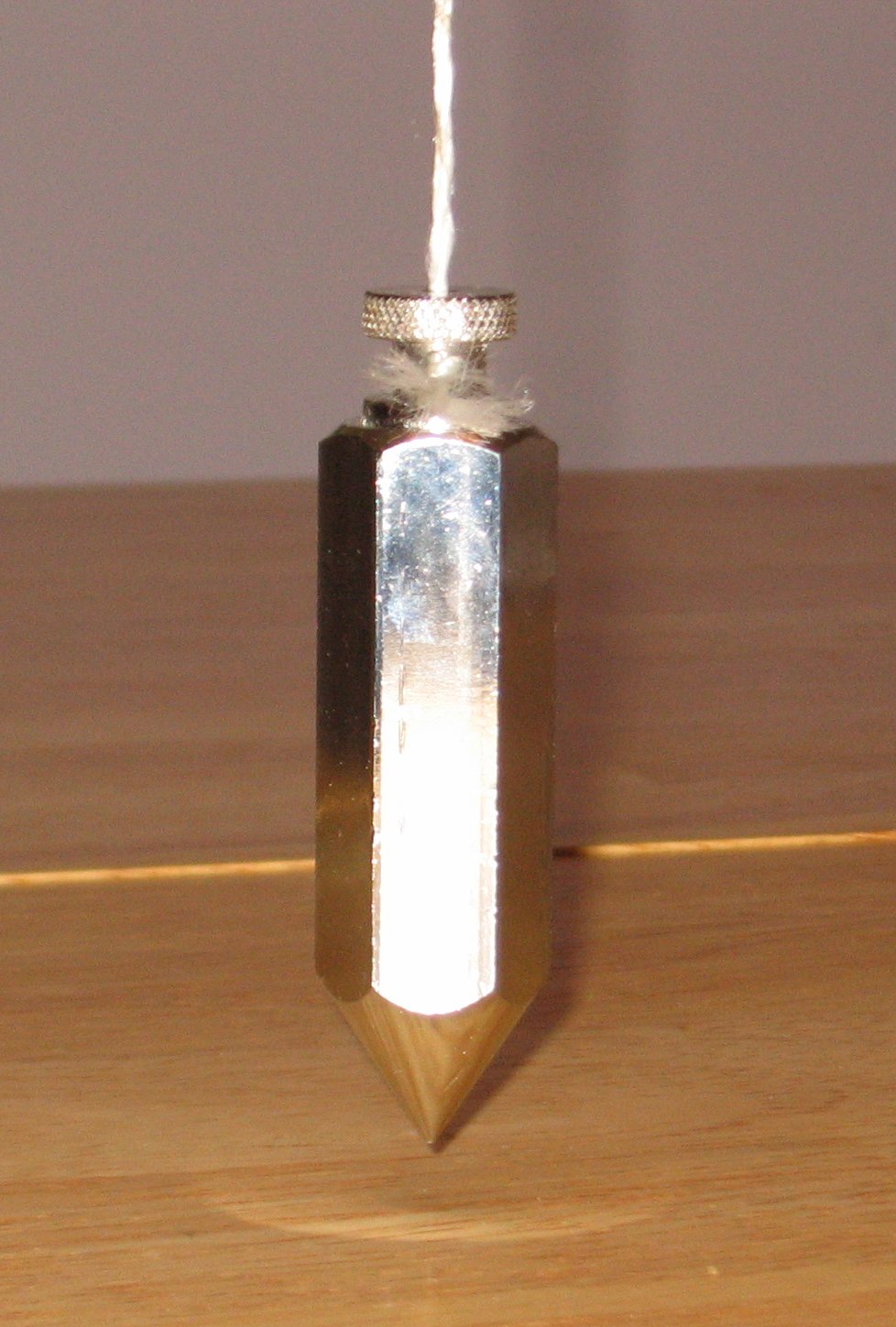
A plumb bob, plumb bob level, or plummet, is a weight, usually with a pointed tip on the bottom, suspended from a string and used as a vertical reference line, or plumb-line. It is a precursor to the spirit level and used to establish a vertical datum. It is typically made of stone, wood, or lead, but can also be made of other metals. If it is used for decoration, it may be made of bone or ivory. The instrument has been used since at least the time of ancient EgyptDenys A. Stocks. Experiments in Egyptian archaeology: stoneworking technology in ncient Egypt'. Routledge; 2003. . p. 180. to ensure that constructions are "plumb", or vertical. It is also used in surveying, to establish the nadir with respect to gravity of a point in space. It is used with a variety of instruments (including levels, theodolites, and steel tapes) to set the instrument exactly over a fixed survey marker or to transcribe positions onto the ground for placing a marker. Etymology The ''plu ... [...More Info...] [...Related Items...] OR: [Wikipedia] [Google] [Baidu] |
Flint
Flint, occasionally flintstone, is a sedimentary cryptocrystalline form of the mineral quartz, categorized as the variety of chert that occurs in chalk or marly limestone. Flint was widely used historically to make stone tools and start fires. It occurs chiefly as nodules and masses in sedimentary rocks, such as chalks and limestones.''The Flints from Portsdown Hill'' Inside the nodule, flint is usually dark grey, black, green, white or brown in colour, and often has a glassy or waxy appearance. A thin layer on the outside of the nodules is usually different in colour, typically white and rough in texture. The nodules can often be found along s and |
Loess
Loess (, ; from german: Löss ) is a clastic, predominantly silt-sized sediment that is formed by the accumulation of wind-blown dust. Ten percent of Earth's land area is covered by loess or similar deposits. Loess is a periglacial or aeolian (windborne) sediment, defined as an accumulation of 20% or less of clay and a balance of roughly equal parts sand and silt (with a typical grain size from 20 to 50 micrometers), often loosely cemented by calcium carbonate. It is usually homogeneous and highly porous and is traversed by vertical capillaries that permit the sediment to fracture and form vertical bluffs. Properties Loess is homogeneous, porous, friable, pale yellow or buff, slightly coherent, typically non- stratified and often calcareous. Loess grains are angular, with little polishing or rounding, and composed of crystals of quartz, feldspar, mica and other minerals. Loess can be described as a rich, dust-like soil. Loess deposits may become very thick, more than ... [...More Info...] [...Related Items...] OR: [Wikipedia] [Google] [Baidu] |
Gorget
A gorget , from the French ' meaning throat, was a band of linen wrapped around a woman's neck and head in the medieval period or the lower part of a simple chaperon hood. The term later described a steel or leather collar to protect the throat, a set of pieces of plate armour, or a single piece of plate armour hanging from the neck and covering the throat and chest. Later, particularly from the 18th century, the gorget became primarily ornamental, serving as a symbolic accessory on military uniforms, a use which has survived in some armies. The term may also be used for other things such as items of jewellery worn around the throat region in several societies, for example wide thin gold collars found in prehistoric Ireland dating to the Bronze Age. As part of armour In the High Middle Ages, when mail was the primary form of metal body armour used in Western Europe, the mail coif protected the neck and lower face. As more plate armour appeared to supplement mail during the 1 ... [...More Info...] [...Related Items...] OR: [Wikipedia] [Google] [Baidu] |
Atlatl
A spear-thrower, spear-throwing lever or ''atlatl'' (pronounced or ; Nahuatl ''ahtlatl'' ) is a tool that uses leverage to achieve greater velocity in dart or javelin-throwing, and includes a bearing surface which allows the user to store energy during the throw. It may consist of a shaft with a cup or a spur at the end that supports and propels the butt of the spear. It's usually about as long as the user's arm or forearm. The user holds the spear-thrower in one hand, gripping near the end farthest from the cup. The user puts the butt end of the spear, or dart, in the cup, or grabs the spur with the end of the spear. The spear is much longer than the thrower. The user holds the spear parallel to the spear-thrower and going in the other direction. The user can hold the spear, with the index and thumb, with the same hand as the thrower, with the other fingers. The user reaches back with the spear pointed at the target. Then they make an overhand throwing motion with the thrower ... [...More Info...] [...Related Items...] OR: [Wikipedia] [Google] [Baidu] |
Effigy Mound
An effigy mound is a raised pile of earth built in the shape of a stylized animal, symbol, religious figure, human, or other figure. The Effigy Moundbuilder culture is primarily associated with the years 550-1200 CE during the Late Woodland Period, although radiocarbon dating has placed the origin of certain mounds as far back as 320 BCE. Effigy mounds were constructed in many Native American cultures. Scholars believe they were primarily for religious purposes, although some also fulfilled a burial mound function. The builders of the effigy mounds are usually referred to as the Mound Builders. Over 3200 animal-shaped effigy mounds have been identified by the Wisconsin Historical Society in the upper midwest. Native North American effigy mounds have been compared to the large-scale geoglyphs such as the Nazca Lines of Peru. History Early European observations Effigy mounds are limited to the Northern and Eastern United States, and most likely the French were the first Europe ... [...More Info...] [...Related Items...] OR: [Wikipedia] [Google] [Baidu] |
Pyramid
A pyramid (from el, πυραμίς ') is a structure whose outer surfaces are triangular and converge to a single step at the top, making the shape roughly a pyramid in the geometric sense. The base of a pyramid can be trilateral, quadrilateral, or of any polygon shape. As such, a pyramid has at least three outer triangular surfaces (at least four faces including the base). The square pyramid, with a square base and four triangular outer surfaces, is a common version. A pyramid's design, with the majority of the weight closer to the ground and with the pyramidion at the apex, means that less material higher up on the pyramid will be pushing down from above. This distribution of weight allowed early civilizations to create stable monumental structures. Civilizations in many parts of the world have built pyramids. The largest pyramid by volume is the Great Pyramid of Cholula, in the Mexican state of Puebla. For thousands of years, the largest structures on Earth were pyrami ... [...More Info...] [...Related Items...] OR: [Wikipedia] [Google] [Baidu] |
Louisiana Public Broadcasting
Louisiana Public Broadcasting (LPB) is a state network of Public Broadcasting Service (PBS) member television stations serving the U.S. state of Louisiana. The stations are operated by the Louisiana Educational Television Authority, an agency created by the executive department of the Louisiana state government which holds the licenses for six of the seven PBS member stations licensed in the state. Louisiana Public Broadcasting's studio facilities and offices are located on Perkins Road in Baton Rouge. The network serves most of the state outside Greater New Orleans. That market's PBS member station, WYES-TV (channel 12), is the only PBS station in Louisiana that is not associated with LPB; a noncommercial independent station there, WLAE-TV (channel 32), is part-owned by LPB in order to provide the market with the state network's news and public affairs programming. History Louisiana became one of the first states in the Deep South with an educational television station licens ... [...More Info...] [...Related Items...] OR: [Wikipedia] [Google] [Baidu] |


.jpg)
.jpg)