|
Portlethen
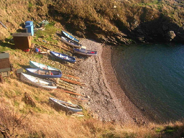
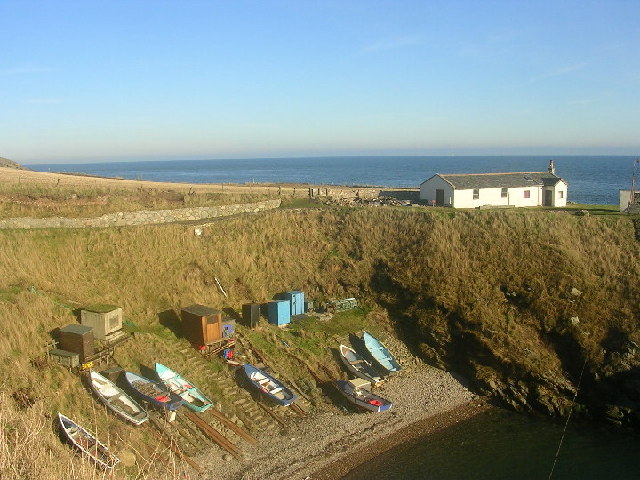
Portlethen (; gd, Port Leathain) is a town located approximately 7 miles south of Aberdeen, Scotland along the A92. The population according to the 2011 census was 7,130 making it the seventh most populous settlement within Aberdeenshire. To the east of Portlethen lie three fishing villages: Findon, Downies and Portlethen Village (now often referred to as ''Old Portlethen''). Although Portlethen has been granted official town status, it resembles a residential suburb without a clear 'town centre' or focal point. Geography Portlethen is a coastal town lying along the North Sea coast. A small island May Craig is situated off shore from Portlethen. Portlethen is located in the historic county of Kincardineshire. History Portlethen was originally a small fishing village. The harbour is located in what is now Old Portlethen, the original village on the coast about a half a mile east from Portlethen Parish Church. Portlethen lies about two kilometres east of the ancient ... [...More Info...] [...Related Items...] OR: [Wikipedia] [Google] [Baidu] |
Portlethen Village
Portlethen Village is a settlement along the North Sea coast in Aberdeenshire, Scotland. The village is also known as Old Portlethen. The skerry of Craigmaroinn is situated just off the coastline near Portlethen Village. History Portlethen Village is situated slightly to the east of the ancient Causey Mounth trackway, which road was constructed to make passable this only available medieval route from coastal points south from Stonehaven north to Aberdeen. This ancient trackway specifically connected the River Dee crossing (where the present Bridge of Dee is situated) via Portlethen Moss, Muchalls Castle and Stonehaven to the south. The route was that taken by William Keith, 7th Earl Marischal and the Marquess of Montrose when they led a Covenanter army of 9000 men in the battle of the Civil War in 1639.Watt, Archibald, ''Highways and Byways around Kincardine'', Stonehaven Heritage Society (1985) For centuries prior to the collapse of local marine fisheries in the 1900s, Po ... [...More Info...] [...Related Items...] OR: [Wikipedia] [Google] [Baidu] |
Kincardineshire
Kincardineshire, also known as the Mearns (from the Scottish Gaelic meaning "the Stewartry"), is a historic county, registration county and lieutenancy area on the coast of northeast Scotland. It is bounded by Aberdeenshire on the north and west, and by Angus on the south. The name "Kincardine" is also used in Kincardine and Mearns, a committee area of the Aberdeenshire Council, although this covers a smaller area than the county. History Anciently, the area was the Province of ''Mearns'', bordered on the north by Marr, and on the west by Angus. The name of the province simply refers to its status; the more important provinces were governed by a ''great steward'' (''Mormaer''), while the less important ones were governed by a mere ''steward'' (''Maer''). It included the burghs of Stonehaven, Banchory, Inverbervie and Laurencekirk, and other settlements included Drumoak, Muchalls, Newtonhill and Portlethen. ''Mearns'' extended to Hill of Fare north of the River Dee, but in ... [...More Info...] [...Related Items...] OR: [Wikipedia] [Google] [Baidu] |
Aberdeenshire
Aberdeenshire ( sco, Aiberdeenshire; gd, Siorrachd Obar Dheathain) is one of the 32 Subdivisions of Scotland#council areas of Scotland, council areas of Scotland. It takes its name from the County of Aberdeen which has substantially different boundaries. The Aberdeenshire Council area includes all of the area of the Counties of Scotland, historic counties of Aberdeenshire and Kincardineshire (except the area making up the City of Aberdeen), as well as part of Banffshire. The county boundaries are officially used for a few purposes, namely land registration and Lieutenancy areas of Scotland, lieutenancy. Aberdeenshire Council is headquartered at Woodhill House, in Aberdeen, making it the only Scottish council whose headquarters are located outside its jurisdiction. Aberdeen itself forms a different council area (Aberdeen City). Aberdeenshire borders onto Angus, Scotland, Angus and Perth and Kinross to the south, Highland (council area), Highland and Moray to the west and Aber ... [...More Info...] [...Related Items...] OR: [Wikipedia] [Google] [Baidu] |
Downies
Downies is a cliff-top village in Aberdeenshire, Scotland situated on Cammachmore Bay. Historically Downies was a fishing village, until much of the local North Sea fishery collapsed from overfishing; presently Downies is chiefly a residential dormitory adjunct to the city of Aberdeen. Local area history The local area of Downies was first recorded in medieval history in association with the Causey Mounth. Downies is positioned somewhat east with respect to the ancient Causey Mounth trackway, which route was constructed on high ground to render this only available medieval route from coastal points south from Stonehaven to Aberdeen. This passage specifically connected the River Dee crossing (where the present Bridge of Dee is situated) via Portlethen Moss, Muchalls Castle and Stonehaven to the south. The route was that taken by William Keith, 7th Earl Marischal and the Marquess of Montrose when they led a Covenanter army of 9000 soldiers in the first battle of the Civil Wa ... [...More Info...] [...Related Items...] OR: [Wikipedia] [Google] [Baidu] |
Findon, Aberdeenshire
Findon (Gaelic: ''Fionndan'', Scots: ''Finnan'') is a fishing village eight miles south of Aberdeen, famous for originating the smoked haddock known as Finnan haddie. The Findon moor has a number of paths through it, many of which run along the cliffs. Deer can often be seen there. Nearby features include the Portlethen Moss Nature Reserve. Historical buildings in the area include Elsick House, Gillybrands and Muchalls Castle. Geography Findon is a coastal village along the North Sea in the area historically known as Kincardineshire. Somewhat to the south of Findon is the small offshore island of May Craig. History The local area was first recorded in medieval history in association with the Causey Mounth. Findon is situated somewhat east of the ancient Causey Mounth trackway, which road was constructed on high ground to make passable this only available medieval route from coastal points south from Stonehaven to Aberdeen. This ancient passage specifically connected the Ri ... [...More Info...] [...Related Items...] OR: [Wikipedia] [Google] [Baidu] |
Causey Mounth
The Causey Mounth is an ancient drovers' road over the coastal fringe of the Grampian Mountains in Aberdeenshire, Scotland. This route was developed as the main highway between Stonehaven and Aberdeen around the 12th century AD and it continued to function as the principal route connecting these two cities until the mid 20th century, when modern highway construction of the A90 road occurred in this area. There are extant paved and usable sections of this road over part of the alignment; however, many parts of the ancient route are no more than footpaths, and in some cases the road has vanished into agricultural fields. Constructed in the Middle Ages, the Causey Mounth was created as an elevated rock causeway to span many of the boggy areas such as the Portlethen Moss. A considerable portion of the alignment of the Causey Mounth is illustrated on the UK Ordnance Survey Map, although a large fraction of the route cannot be navigated by a conventional passenger vehicle (particul ... [...More Info...] [...Related Items...] OR: [Wikipedia] [Google] [Baidu] |
Newtonhill
Newtonhill is a commuter town in Kincardineshire, Scotland. It is popular due to its location, just six miles south of Aberdeen with easy reach of Stonehaven and with views over the North Sea. History The town was originally called Skateraw. Skateraw was a fishing village, and the older part of the village(Still called Skateraw) between the railway line and the sea reflects that heritage though nearly all of the old houses have been modernised and extended. An old smoke house is still visible in Skateraw Road, though it is many years since it was in use. The village had a railway station which led to the change of name from Skateraw to Newtonhill but it was closed in 1956; the signal box was still in use until May 2019 and remnants of a platform can still be seen. A feasibility study received funding in May 2018 to study the possible reopening of the station. Newtonhill is in Kincardineshire, though local government re-organisation means that the local authority is Aberdeenshire ... [...More Info...] [...Related Items...] OR: [Wikipedia] [Google] [Baidu] |
Banchory-Devenick
Banchory-Devenick ( gd, Beannchar Dòmhnaig) is a village approximately two kilometres south of the city of Aberdeen, Scotland in the Lower Deeside area of Aberdeenshire. The village should not be confused with the historic civil parish of the same name which spanned the River Dee until 1891, its northern part lying in Aberdeenshire and its southern part in Kincardineshire. In that year the northern part became part of the neighbouring parish of Peterculter, the southern part (including the village) remaining as the parish of Banchory-Devenick. The village of Banchory-Devenick is on the B9077 road, and the ancient Causey Mounth passes directly through the village. An historic graveyard dating to 1157 AD is present at the village of Banchory-Devenick. Other historic features in the vicinity include Saint Ternan's Church, Muchalls Castle and the Lairhillock Inn. History Banchory-Devenick is located along the Causey Mounth trackway, which road was constructed on high ground to ... [...More Info...] [...Related Items...] OR: [Wikipedia] [Google] [Baidu] |
Cammachmore
Cammachmore (Gaelic ''An Camach Mòr'') is a hamlet in the coastal region near the North Sea in Aberdeenshire. It lies slightly west of the A92 road and the ancient Causey Mounth passes through the community. Historic Elsick House is situated due west of Cammachmore. Other nearby historic features include Gillybrands, Saint Ternan's Church, Muchalls Castle and the Lairhillock Inn. History Cammachmore is situated along the ancient Causey Mounth trackway, which was constructed on high ground to make this medieval route the only available, passable route from the coastal points south from Stonehaven to Aberdeen. This ancient passage specifically connected the River Dee crossing (where the present Bridge of Dee is situated) via Portlethen Moss, Muchalls Castle and Stonehaven to the south. The route was that taken by William Keith, 7th Earl Marischal and the Marquess of Montrose when they led a Covenanter army of 9000 men in the battle of the Civil War in 1639. From the industria ... [...More Info...] [...Related Items...] OR: [Wikipedia] [Google] [Baidu] |
West Aberdeenshire And Kincardine (UK Parliament Constituency)
West Aberdeenshire and Kincardine is a county constituency of the House of Commons of the Parliament of the United Kingdom of Great Britain and Northern Ireland (Westminster), which elects one Member of Parliament (MP) by the first past the post system of election. It was first used in the 1997 general election, but has undergone boundary changes since that date. There was also a Holyrood constituency of West Aberdeenshire and Kincardine, a constituency of the Scottish Parliament, created in 1999 with the same boundaries as the Westminster constituency at that time. Boundaries 1997–2005: Kincardine and Deeside District, and the Gordon District electoral divisions of Donside and South Gordon. 2005–present: The area of the Aberdeenshire Council other than those parts in the Banff and Buchan County Constituency and the Gordon County Constituency. The constituency covers a southern portion of the Aberdeenshire council area. As redefined by the Fifth Periodical Review ... [...More Info...] [...Related Items...] OR: [Wikipedia] [Google] [Baidu] |
Aberdeen South And North Kincardine (Scottish Parliament Constituency)
Aberdeen South and North Kincardine (Scottish Gaelic, Gaelic: ''Obar Dheathain a Deas agus Ceann Chàrdainn a Tuath'') is a United Kingdom constituencies, constituency of the Scottish Parliament (Scottish Parliament Building, Holyrood) covering part of the Council areas of Scotland, council areas of Aberdeen City and Aberdeenshire. It elects one Member of the Scottish Parliament, Member of the Scottish Parliament (MSP) by the first past the post method of election. It is one of ten constituencies in the North East Scotland (Scottish Parliament electoral region), North East Scotland Scottish Parliament constituencies and regions, electoral region, which elects seven additional member system (Scottish Parliament), additional members, in addition to the ten constituency MSPs, to produce a form of proportional representation for the region as a whole. The constituency was created for 2011 Scottish Parliament election, and combines most of the former Aberdeen South (Scottish Parliame ... [...More Info...] [...Related Items...] OR: [Wikipedia] [Google] [Baidu] |
James Graham, 1st Marquess Of Montrose
James Graham, 1st Marquess of Montrose (1612 – 21 May 1650) was a Scottish nobleman, poet and soldier, Lord Lieutenant, lord lieutenant and later viceroy and captain general of Scotland. Montrose initially joined the Covenanters in the Wars of the Three Kingdoms, but subsequently supported King Charles I of England, Charles I as the English Civil War developed. From 1644 to 1646, and again in 1650, he fought in the Scotland in the Wars of the Three Kingdoms, civil war in Scotland on behalf of the King. He is referred to as the Great Montrose. Following his defeat and capture at the Battle of Carbisdale, Montrose was tried by the Parliament of Scotland, Scottish Parliament and sentenced to death by hanging, followed by Decapitation, beheading and Hanged, drawn and quartered, quartering. After the Stuart Restoration, Restoration, Charles II of England, Charles II paid £802 sterling for a lavish funeral in 1661, when Montrose's reputation changed from treason, traitor or mar ... [...More Info...] [...Related Items...] OR: [Wikipedia] [Google] [Baidu] |


_by_Sir_George_Reid_-_Sir_George_Reid_-_ABDAG003965.jpg)