|
Mundesley
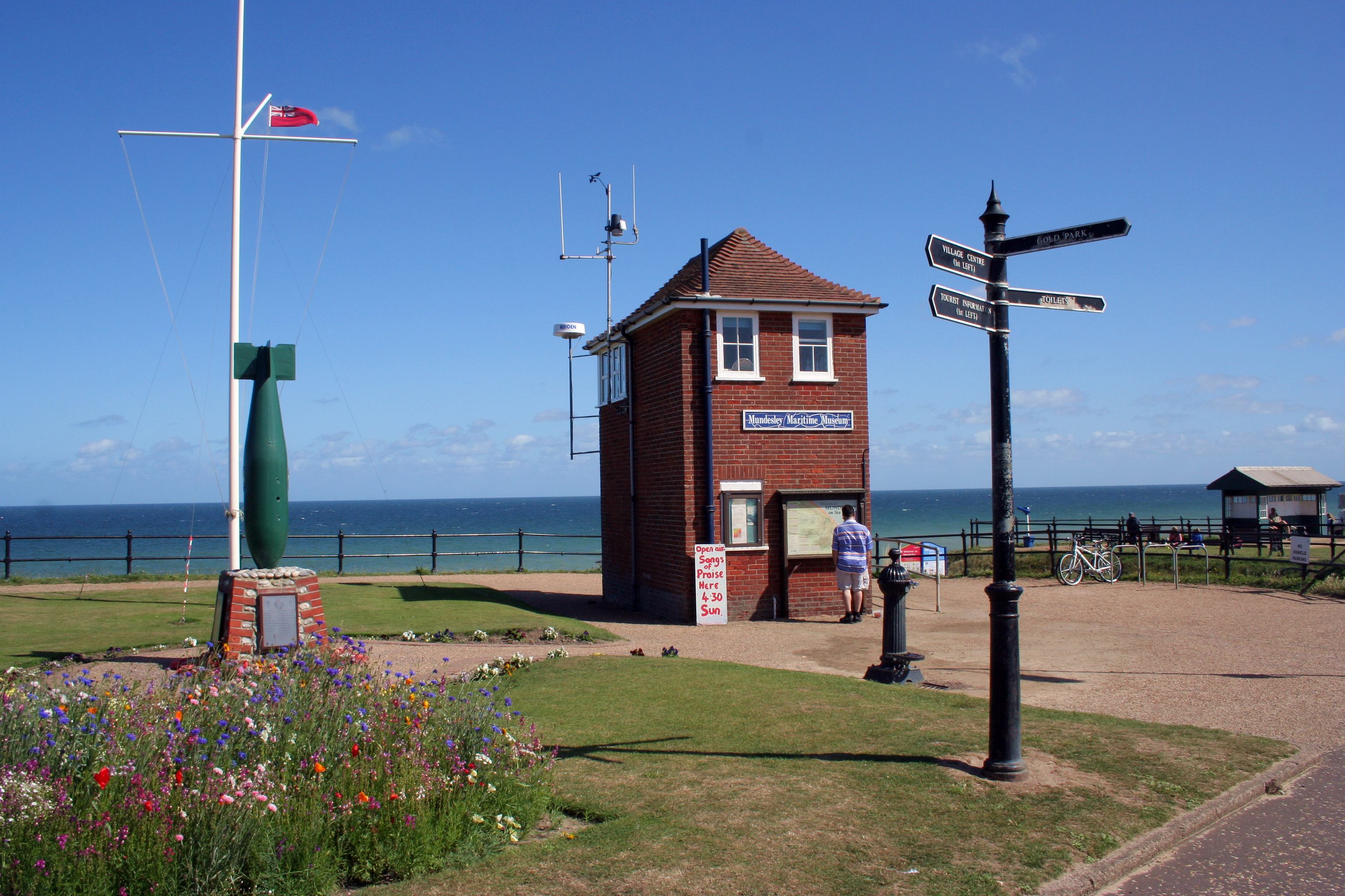
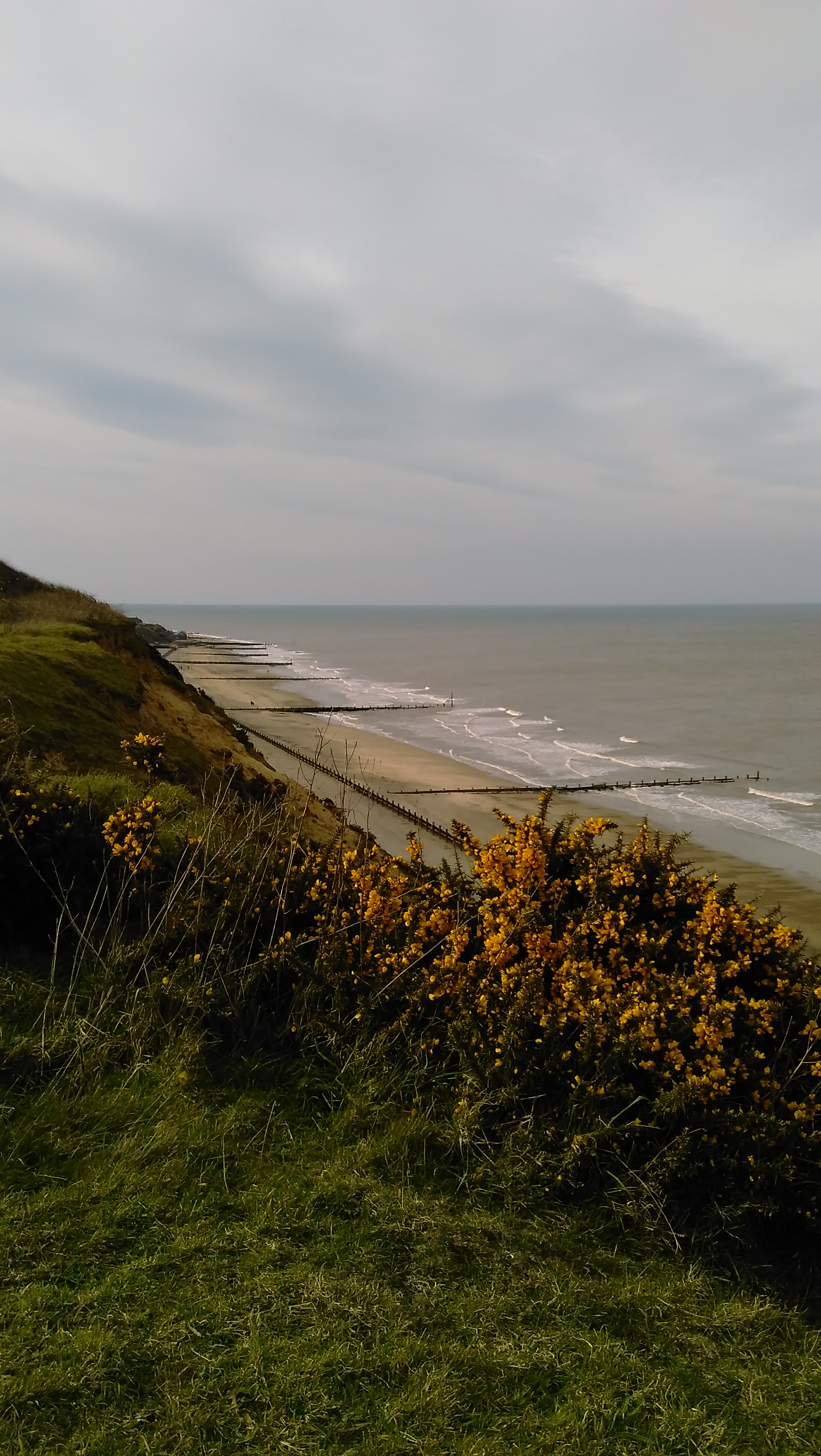
Mundesley /ˈmʌndz.li/ is a coastal village and a civil parish in the English county of Norfolk. The village is north-north east of Norwich, south east of Cromer and north east of London. The village lies north-north east of the town of North Walsham. The nearest railway station is at North Walsham, for the Bittern Line which runs between Sheringham and Norwich. The nearest airport is Norwich Airport. The village sits astride the B1159 coast road that links Cromer and Caister-on-Sea, and is at the eastern end of the B1145 a route which runs between King's Lynn and Mundesley. Mundesley is within the Norfolk Coast AONB. It has a resident population of around 2,695 (parish, 2001 census), measured at 2,758 in the 2011 Census. The River Mun or Mundesley Beck flows into the sea here. On 5 September 2022 Mundesley beach won the North Norfolk District Council Battle of the Beaches to be recognised as the top beach in North Norfolk in a close run off against West Runton beach. Hist ... [...More Info...] [...Related Items...] OR: [Wikipedia] [Google] [Baidu] |
River Mun
The River Mun or Mundesley Beck is a river in the north of the county of Norfolk, England. The source of the river can be found in the Parish of Northrepps. The river finally runs into the North Sea in the village of Mundesley. The source The source of the River Mun can be found next to Craft Lane, close to Furyhill plantation between Northrepps and the hamlet of Frogshall. It runs in a south easterly direction through a wooded valley and passes under Craft Lane close to Frogshall Farm House. From here it runs through woodland for a short distance and into a large pool called Little Broad. From Little Broad, still in woodland, the river falls over a weir and into some marshy woodland known as Osier Carr. Deep in the heart of Osier Carr Freshwater mussels (Bivalvia: Unionidae) can be found. The mussels are filter feeders, removing phytoplankton and other suspended particulate matter from the river. This removal of suspended matter from the water is often considered ecologi ... [...More Info...] [...Related Items...] OR: [Wikipedia] [Google] [Baidu] |
Mundesley Railway Station
Mundesley railway station was a former station on the Norfolk and Suffolk Joint Railway in Mundesley, Norfolk. It opened on 1 July 1898. The station was host to a LNER camping coach from 1938 to 1939. Two coaches were positioned here by Eastern Region of British Railways The Eastern Region was a region of British Railways from 1948, whose operating area could be identified from the dark blue signs and colour schemes that adorned its station and other railway buildings. Together with the North Eastern Region ( ... in 1952, then four coaches from 1953 to 1958, then ten for 1959 reducing to six coaches from 1960 to 1964, 3 coaches remained for the 1965 season despite the station having closed. On 7 April 1953 the station became the terminus of the line from North Walsham when the route to Cromer closed. In 1964 the remainder of the route was closed.Butt, R.V.J. (1995). ''The Directory of Railway Stations'', Patrick Stephens Ltd, Sparkford, , p. 165. References Externa ... [...More Info...] [...Related Items...] OR: [Wikipedia] [Google] [Baidu] |
B1159 Road
The B1159 is a road in Norfolk, England, running for about between Cromer and Caister-on-Sea, parallel to and at a short distance from the northeastern coast of Norfolk. Made famous by Norfolk's modern English folk bandAddison's Uncle Their debut single, titled B1159, gained extensive regional press coverage and they filmed a music video along the B1159 which can be viewed hereB1159 Music Video From north to south the road passes through: *Overstrand *Sidestrand * Trimingham *Mundesley * Paston * Bacton * Keswick * Walcott *Happisburgh * Whimpwell Green * Lessingham * Ingham Corner * Sea Palling * Horsey Corner * Horsey * West Somerton * East Somerton *Winterton-on-Sea *Hemsby * Dowe Hill * Scratby Sections of interest (north to south) From about halfway between Cromer and Overstrand to Mundesley, the road parallels the disused course of the Norfolk and Suffolk Joint Railway, which can be glimpsed from time to time. Between Paston and Bacton, "the road runs through acres of g ... [...More Info...] [...Related Items...] OR: [Wikipedia] [Google] [Baidu] |
B1145 Road
The B1145 runs for about through the county of Norfolk, England, between King’s Lynn and Mundesley. The road is an alternative route to the A47 road, A47 between King's Lynn and Norwich by way of the A1067 road, A1067 from Bawdeswell onwards. History This ancient route predates the Norman Conquest and remained the main east–west route through the county until the 17th century. It can be seen quiet clearly on William Faden’s map of Norfolk, which was surveyed between 1790 and 1794. This map, the first large-scale map (at one inch to the mile) of the whole county, is a record of the landscape and transport system of the county of Norfolk in late 18th century and shows that despite the Inclosure Act, Parliamentary Enclosure of the early 19th century the route has changed very little. Much of the route on the map is highlighted in a pale pink, which marks it out as an important artery of the time. Part of the roads route lies directly on the line of a Roman road between a po ... [...More Info...] [...Related Items...] OR: [Wikipedia] [Google] [Baidu] |
Harry Vardon
Henry William Vardon (9 May 1870 – 20 March 1937) was a professional golfer from Jersey. He was a member of the Great Triumvirate with John Henry Taylor and James Braid. Vardon won The Open Championship a record six times, and also won the 1900 U.S. Open. Early years Born in Grouville, Jersey, Channel Islands, Vardon, whose mother was French and father English, did not play much golf as a youngster, but showed natural talent for the sport as a young caddie in his teens. Harry and his brother Tom Vardon, younger by two years and also interested in golf, were very close. Their golf development was held back by poor family circumstances and their father was not supportive of his sons' golf interest. Tom moved from Jersey to England first, to pursue a golf career. Harry went to England in the spring of 1890, taking a job as greenkeeper at age 20, at Studley Royal Golf Club, Ripon, Yorks. A year later he became club professional at Bury Golf Club, and in 1896 the club professiona ... [...More Info...] [...Related Items...] OR: [Wikipedia] [Google] [Baidu] |
Paston, Norfolk
Paston is a village and civil parish in the English county of Norfolk. The village is north-east of North Walsham and south-east of Cromer. It is north-east of the city of Norwich. The village sits astride the coast road between Mundesley and Bacton. The nearest railway station is at North Walsham for the Bittern Line which runs between Sheringham, Cromer and Norwich. The nearest airport is Norwich International. The village gives its name to the Pastonian Stage, a British regional subdivision of the Pleistocene Epoch. The village was served by Paston & Knapton railway station on the North Walsham to Cromer section of the Norfolk and Suffolk Joint Railway from 1881 until 1964. History The manor of Paston is listed in the Domesday Book of 1086 as ''Pastuna'' from the Roman name ''Terra Pastorini'' ("Shepherds' Land"), one of the many English holdings of William de Warenne, 1st Earl of Surrey. The listing mentions the church and a mill. From about 1400 it was dominated ... [...More Info...] [...Related Items...] OR: [Wikipedia] [Google] [Baidu] |
Cromer
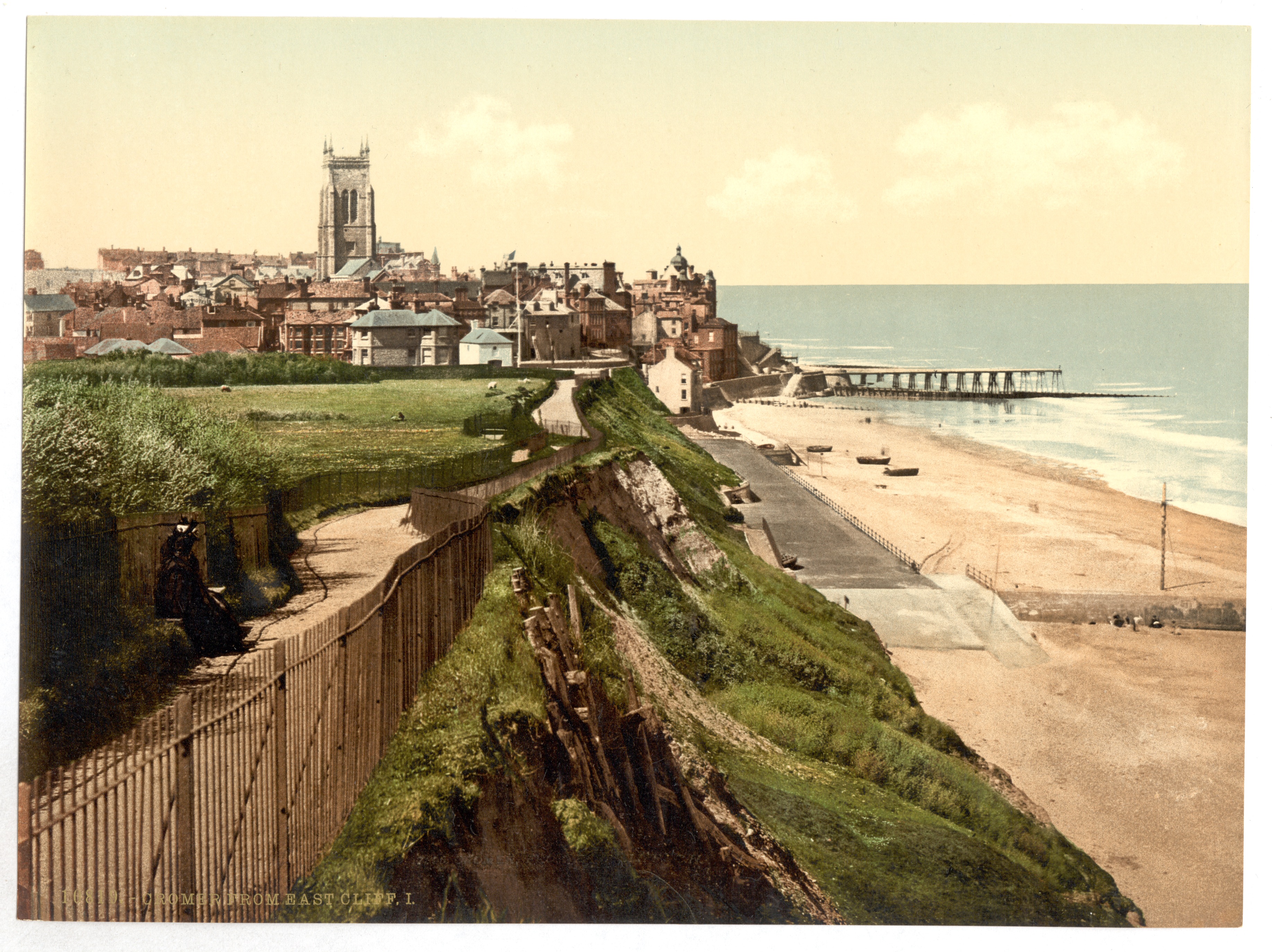
Cromer ( ) is a coastal town and civil parish on the north coast of the English county of Norfolk. It is north of Norwich, north-northeast of London and east of Sheringham on the North Sea coastline. The local government authorities are North Norfolk District Council, whose headquarters is on Holt Road in the town, and Norfolk County Council, based in Norwich. The civil parish has an area of and at the 2011 census had a population of 7,683. The town is notable as a traditional tourist resort and for the Cromer crab, which forms the major source of income for local fishermen. The motto ''Gem of the Norfolk Coast'' is highlighted on the town's road signs. History The town has given its name to the ''Cromerian Stage'' or ''Cromerian Complex'', also called the ''Cromerian'', a stage in the Pleistocene glacial history of north-western Europe. Cromer is not mentioned in the ''Domesday Book'' of 1086. The place-name 'Cromer' is first found in a will of 1262 and could mean 'C ... [...More Info...] [...Related Items...] OR: [Wikipedia] [Google] [Baidu] |
Norfolk
Norfolk () is a ceremonial and non-metropolitan county in East Anglia in England. It borders Lincolnshire to the north-west, Cambridgeshire to the west and south-west, and Suffolk to the south. Its northern and eastern boundaries are the North Sea, with The Wash to the north-west. The county town is the city of Norwich. With an area of and a population of 859,400, Norfolk is a largely rural county with a population density of 401 per square mile (155 per km2). Of the county's population, 40% live in four major built up areas: Norwich (213,000), Great Yarmouth (63,000), King's Lynn (46,000) and Thetford (25,000). The Broads is a network of rivers and lakes in the east of the county, extending south into Suffolk. The area is protected by the Broads Authority and has similar status to a national park. History The area that was to become Norfolk was settled in pre-Roman times, (there were Palaeolithic settlers as early as 950,000 years ago) with camps along the highe ... [...More Info...] [...Related Items...] OR: [Wikipedia] [Google] [Baidu] |
Bacton, Norfolk
Bacton is a village and civil parish in Norfolk, England. It is on the Norfolk coast, some south-east of Cromer, north-west of Great Yarmouth and north of Norwich. Besides the village of Bacton, the parish includes the nearby settlements of Bacton Green, Broomholm, Keswick and Pollard Street. It also includes Edingthorpe, which was added to Bacton civil parish under the County of Norfolk Review Order, 1935. The seaside village, whose name is derived from 'Bacca's farm/settlement', is located on the North Norfolk coast between Mundesley (a blue flag beach) and Walcott, Norfolk. Bacton is known for its very quiet sandy beaches offering miles of walking along the beach and cliffs. The England Coast Path passes through the village and also the Paston Way long-distance footpath linking Cromer and North Walsham. In the east of the parish can be found the ruined Cluniac Bromholm Priory. The civil parish has an area of and in the 2001 census had a population of 1,130 in 474 house ... [...More Info...] [...Related Items...] OR: [Wikipedia] [Google] [Baidu] |
William De Warenne, 1st Earl Of Surrey
William de Warenne, 1st Earl of Surrey, Lord of Lewes, Seigneur de Varennes (died 1088), was a Norman nobleman created Earl of Surrey under William II Rufus. He is among the few known from documents to have fought under William the Conqueror at the Battle of Hastings in 1066. At the time of the Domesday Survey in 1086, he held extensive lands in 13 counties, including the Rape of Lewes, a tract now divided between the ceremonial counties of East Sussex and West Sussex. Early career William was a son of Rodulf or Ralph de Warenne and Emma, and reported to have descended from a sibling of Duchess Gunnor, wife of Duke Richard I. Chronicler Robert of Torigny reported, in his additions to the ''Gesta Normannorum Ducum'' of William of Jumièges, that William de Warenne and Anglo-Norman baron Roger de Mortimer were both sons of an unnamed niece of Gunnor. Unfortunately, Robert's genealogies are somewhat confused – elsewhere he gives Roger as the son of William, and yet again makes bo ... [...More Info...] [...Related Items...] OR: [Wikipedia] [Google] [Baidu] |
Norfolk Coast AONB
The Norfolk Coast Area of Outstanding Natural Beauty is a protected landscape in Norfolk, England. It covers over 450 km2 of coastal and agricultural land from The Wash in the west through coastal marshes and cliffs to the sand dunes at Winterton in the east. It was designated AONB in 1968, under the National Parks and Access to the Countryside Act 1949. The area includes; Hunstanton, Wells-next-the-Sea, Blakeney, Sheringham, Cromer and Mundesley. The AONB boundary on the seaward side is the mean low water mark, corresponding to the limit of the planning authority of its local authority partners. The terrain behind the coast is rolling chalk land and glacial moraine, including the almost 300 foot (90m) high Cromer Ridge. Nature reserves in the area include two National Nature Reserves, Blakeney Point and the Winterton Dunes (one of the country's finest dune systems). The Heritage Coast stretch of the AONB is a Site of Special Scientific Interest, a candidate Special Ar ... [...More Info...] [...Related Items...] OR: [Wikipedia] [Google] [Baidu] |
North Norfolk
North Norfolk is a local government district in Norfolk, England. Its council is based in Cromer. The population at the 2011 Census was 101,149. History The district was formed on 1 April 1974, under the Local Government Act 1972. It was a merger of Cromer Urban District, North Walsham Urban District, Sheringham Urban District, Wells-next-the-Sea Urban District, Erpingham Rural District, Smallburgh Rural District, and Walsingham Rural District. The district was originally to be called Pastonacres, but changed its name by resolution of the council and permission of the Secretary of State for Environment before it formally came into existence on 1 April 1974. Politics Elections to the district council are held every four years, with all of the seats on the council up for election every fourth year. The council was run by a Conservative administration, the Conservative party having gained a majority of 8 seats at the 2011 elections, which they increased to 18 at the 20 ... [...More Info...] [...Related Items...] OR: [Wikipedia] [Google] [Baidu] |


